Category:Culbokie
Jump to navigation
Jump to search
human settlement in Highland, Scotland, UK  | |||||
| Upload media | |||||
| Instance of | |||||
|---|---|---|---|---|---|
| Location |
| ||||
| Area |
| ||||
 | |||||
English: Culbokie (An Cùil Bhàicidh in Gaelic) is a small village in Ross and Cromarty, Highland, Scotland, located on the north side of the Black Isle. The village is 3.5 miles north-east of Dingwall and about 12 miles north of Inverness. There is one school, a shop/post office, a public house (the Culbokie Inn) and Findon Hall. According to the census of 2001, the population was 866.
Media in category "Culbokie"
The following 78 files are in this category, out of 78 total.
-
 Church at Urquhart old burial ground - geograph.org.uk - 207679.jpg 640 × 480; 84 KB
-
 Culbokie area - geograph.org.uk - 11749.jpg 576 × 432; 38 KB
-
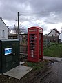 Culbokie Phone Box (geograph 4886782).jpg 480 × 640; 64 KB
-

-
 Farmhouse and steading at Crasky - geograph.org.uk - 284844.jpg 640 × 425; 126 KB
-
 Farmland - geograph.org.uk - 11747.jpg 576 × 432; 41 KB
-
 Fields, trees and heather - geograph.org.uk - 34016.jpg 640 × 480; 141 KB
-
 Gate and field by Knockbain - geograph.org.uk - 663688.jpg 640 × 422; 78 KB
-
 Hard times by Loch Culbokie (geograph 4385844).jpg 1,400 × 1,050; 558 KB
-
 Highland, UK - panoramio (100).jpg 4,000 × 3,000; 3.65 MB
-
 Highland, UK - panoramio (103).jpg 4,000 × 3,000; 3.82 MB
-
 Holy Wood - geograph.org.uk - 207854.jpg 640 × 480; 136 KB
-
 Junction off Munlochy to Culbokie road - geograph.org.uk - 284808.jpg 640 × 425; 109 KB
-
 Looking down toward the Moray Firth - geograph.org.uk - 11784.jpg 576 × 432; 44 KB
-
 Moorland - geograph.org.uk - 11788.jpg 576 × 432; 51 KB
-
 Near Braefindon - geograph.org.uk - 284800.jpg 640 × 425; 135 KB
-
-
 Old croft house in Green leonachs - geograph.org.uk - 284816.jpg 640 × 425; 153 KB
-
 Open air Church - geograph.org.uk - 11745.jpg 432 × 576; 81 KB
-
 Pile of logs - geograph.org.uk - 104220.jpg 640 × 480; 130 KB
-
 Road junction near Crasky - geograph.org.uk - 284848.jpg 640 × 425; 122 KB
-
 Silage in, Craskie - geograph.org.uk - 207835.jpg 640 × 480; 95 KB
-
 Sunset over the Cromarty Firth - geograph.org.uk - 34020.jpg 640 × 480; 78 KB
-
 The A9163 and A9169 junction. - geograph.org.uk - 207318.jpg 640 × 427; 94 KB
-

-
 Young plantation in Wester Culbo Wood - geograph.org.uk - 352503.jpg 640 × 480; 48 KB
-
 Balloan Farm - geograph.org.uk - 207670.jpg 640 × 480; 86 KB
-
 Balnabeen Holdings - geograph.org.uk - 207700.jpg 640 × 480; 98 KB
-
 Barley stubble on the Black Isle - geograph.org.uk - 284797.jpg 425 × 640; 100 KB
-
 Black Isle cycle trail - geograph.org.uk - 104217.jpg 640 × 480; 135 KB
-
 Bog of Findon - geograph.org.uk - 617136.jpg 640 × 480; 66 KB
-
 Bogbuie Wood - geograph.org.uk - 207840.jpg 640 × 480; 133 KB
-
 Broomton House - geograph.org.uk - 284794.jpg 640 × 425; 135 KB
-
 Bruichglas - geograph.org.uk - 9665.jpg 640 × 480; 110 KB
-
 Carn Mòr - geograph.org.uk - 207833.jpg 640 × 480; 120 KB
-
 Children's Playground - geograph.org.uk - 11752.jpg 576 × 432; 74 KB
-
 Communication Mast - geograph.org.uk - 11782.jpg 323 × 640; 55 KB
-
 Countryside near Inverness - geograph.org.uk - 11779.jpg 576 × 432; 47 KB
-

-
 Culbokie - geograph.org.uk - 527220.jpg 640 × 427; 45 KB
-
 Culbokie Inn - geograph.org.uk - 171222.jpg 640 × 480; 62 KB
-

-
 Deserted croft house at Badrain - geograph.org.uk - 617359.jpg 640 × 480; 53 KB
-
 Dunvournie Farm - geograph.org.uk - 171212.jpg 640 × 480; 80 KB
-
 Easter Oakwood - geograph.org.uk - 207698.jpg 640 × 480; 77 KB
-
 Evening geese, Cromarty Firth - geograph.org.uk - 603101.jpg 640 × 481; 34 KB
-
 Farm road - geograph.org.uk - 663707.jpg 640 × 426; 59 KB
-
 Farmland near Culbokie - geograph.org.uk - 284788.jpg 640 × 425; 154 KB
-
 Farmland near Kinbeachie - geograph.org.uk - 353424.jpg 640 × 480; 64 KB
-
 Field and view across Cromarty Firth - geograph.org.uk - 596947.jpg 640 × 480; 77 KB
-

-
 Forest track - geograph.org.uk - 663714.jpg 640 × 426; 98 KB
-
 Forest track - geograph.org.uk - 663723.jpg 640 × 426; 96 KB
-
 Kinbeachie Farm to the right. - geograph.org.uk - 207324.jpg 640 × 427; 92 KB
-
 Leaving Black isle - geograph.org.uk - 545770.jpg 640 × 480; 69 KB
-
 Lochside - geograph.org.uk - 284831.jpg 640 × 425; 155 KB
-

-

-

-
 Meikle Findon farm - geograph.org.uk - 284791.jpg 640 × 425; 116 KB
-
 Misty view of the Cromarty bridge - geograph.org.uk - 603093.jpg 640 × 481; 38 KB
-
 Mount Eagle - geograph.org.uk - 32675.jpg 640 × 405; 66 KB
-
 Muddy forest track - geograph.org.uk - 663703.jpg 640 × 426; 73 KB
-
 Oakwood - geograph.org.uk - 207697.jpg 640 × 480; 73 KB
-
 Outdoor Preaching at Ferintosh Burn - geograph.org.uk - 626876.jpg 640 × 436; 126 KB
-
 Road Junction - geograph.org.uk - 171215.jpg 640 × 480; 48 KB
-
 Road to Culbo House - geograph.org.uk - 617289.jpg 640 × 480; 82 KB
-

-
 Scottish Sunset - geograph.org.uk - 34821.jpg 640 × 480; 142 KB
-

-
 Tenagairn trig - geograph.org.uk - 207824.jpg 640 × 480; 101 KB
-
 The Ellan Vannin turn off. - geograph.org.uk - 207339.jpg 640 × 427; 94 KB
-

-
 The northeastern end of Toberchurn wood. - geograph.org.uk - 207331.jpg 640 × 427; 122 KB
-
 The Paddocks, a house on the Black Isle - geograph.org.uk - 284824.jpg 640 × 425; 133 KB
-
 The road to Alnessferry. - geograph.org.uk - 207428.jpg 640 × 427; 103 KB
-
 Urquhart new burial ground - geograph.org.uk - 207687.jpg 640 × 480; 117 KB
-
 View of Dingwall - geograph.org.uk - 11746.jpg 576 × 432; 49 KB


.jpg)


.jpg)
.jpg)
.jpg)


