Category:Cuckney
Jump to navigation
Jump to search
village and former civil parish in Nottinghamshire, UK  | |||||
| Upload media | |||||
| Instance of |
| ||||
|---|---|---|---|---|---|
| Location |
| ||||
 | |||||
Subcategories
This category has the following 12 subcategories, out of 12 total.
1
- 1-5, School Lane, Cuckney (7 F)
3
- 3-10, Creswell Road, Cuckney (7 F)
C
- St Mary's church, Cuckney (72 F)
- Cuckney Castle (12 F)
- Cuckney House (11 F)
- Cuckney School (8 F)
D
- Dam, Cuckney Mill (19 F)
G
- The Greendale Oak Inn, Cuckney (36 F)
T
Media in category "Cuckney"
The following 98 files are in this category, out of 98 total.
-
 3-10, Creswell Road, Cuckney (8).jpg 2,752 × 4,034; 2.23 MB
-
 A60 from A632 at Cuckney - geograph.org.uk - 3529983.jpg 539 × 321; 75 KB
-
 A60 in Cuckney - geograph.org.uk - 2044018.jpg 640 × 480; 54 KB
-
 A60 junction from A632 at Cuckney - geograph.org.uk - 3013081.jpg 640 × 374; 55 KB
-
 A60 south of Cuckney - geograph.org.uk - 99390.jpg 640 × 423; 124 KB
-
 A632 leaving Cuckney - geograph.org.uk - 2044022.jpg 640 × 480; 40 KB
-
 A632 near Cuckney - geograph.org.uk - 2044023.jpg 640 × 480; 36 KB
-
 A632 near Cuckney - geograph.org.uk - 2044025.jpg 640 × 480; 43 KB
-
 Approaching Cuckney on Norton lane - geograph.org.uk - 3013058.jpg 640 × 456; 81 KB
-
 Approaching Cuckney on the A60 - geograph.org.uk - 2044016.jpg 640 × 480; 48 KB
-
 Baker's Row, Cuckney.jpg 1,024 × 768; 142 KB
-
 Bluebell carpet - geograph.org.uk - 418764.jpg 640 × 480; 123 KB
-
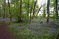 Bluebell Wood - geograph.org.uk - 169439.jpg 640 × 425; 130 KB
-
 Broomhill Lane Sewage Works - geograph.org.uk - 98664.jpg 640 × 423; 66 KB
-
 Bus shelter - geograph.org.uk - 724546.jpg 640 × 402; 90 KB
-
 Communications mast next to A616 - geograph.org.uk - 722550.jpg 480 × 640; 98 KB
-
 Cuckney - Baker Lane - geograph.org.uk - 1045771.jpg 640 × 480; 133 KB
-
 Cuckney - Creswell Road (A616) - geograph.org.uk - 1045779.jpg 640 × 480; 64 KB
-
 Cuckney - Ten Row - geograph.org.uk - 614971.jpg 640 × 480; 72 KB
-
 Cuckney and the Greendale Oak - geograph.org.uk - 3013061.jpg 640 × 429; 52 KB
-
 Cuckney Church of England Primary School - geograph.org.uk - 4733881.jpg 2,048 × 1,536; 885 KB
-
 Cuckney Dam - geograph.org.uk - 1045763.jpg 640 × 480; 104 KB
-
 Cuckney Dam and an ivy tree - geograph.org.uk - 4733855.jpg 2,048 × 1,536; 794 KB
-
 Cuckney Dam Marshland - geograph.org.uk - 1045767.jpg 640 × 480; 116 KB
-
 Cuckney Post Office - geograph.org.uk - 473649.jpg 640 × 480; 115 KB
-
 Cuckney Village Stores - geograph.org.uk - 2750387.jpg 640 × 427; 87 KB
-
 Entering Cuckney on A616 - geograph.org.uk - 3454976.jpg 3,137 × 1,839; 2.53 MB
-
 Evening sky in Cuckney - geograph.org.uk - 3737215.jpg 1,920 × 1,280; 235 KB
-
 Farmland south of Cuckney - geograph.org.uk - 99399.jpg 640 × 423; 81 KB
-
 Hazel Gap Farm - geograph.org.uk - 304888.jpg 640 × 480; 60 KB
-
 Leaving Cuckney - geograph.org.uk - 3893533.jpg 640 × 480; 43 KB
-
 Looking towards Cuckney Cricket Club - geograph.org.uk - 645126.jpg 640 × 480; 68 KB
-
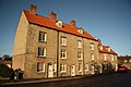 Maltkiln Row - geograph.org.uk - 2750402.jpg 640 × 427; 81 KB
-
 Maltkiln Row, 5, 6 and 7, Creswell Road, Cuckney (1).jpg 2,516 × 4,097; 1.85 MB
-
 Maltkiln Row, 5, 6 and 7, Creswell Road, Cuckney (2).jpg 3,036 × 4,048; 3.92 MB
-
 Maltkiln Row, 5, 6 and 7, Creswell Road, Cuckney (3).jpg 1,990 × 3,049; 1,003 KB
-
 Maltkiln Row, 5, 6 and 7, Creswell Road, Cuckney (4).jpg 2,193 × 3,721; 1.65 MB
-
 Maltkiln Row, 5, 6 and 7, Creswell Road, Cuckney (5).jpg 3,445 × 3,051; 2.08 MB
-
 Maltkiln Row, 8 and 9, Creswell Road, Cuckney (3).jpg 2,936 × 4,048; 2.09 MB
-
 Maltkiln Row, 8 and 9, Creswell Road, Cuckney (4).jpg 2,533 × 3,036; 1.47 MB
-
 Maltkiln Row, 8 and 9, Creswell Road, Cuckney (5).jpg 3,036 × 4,048; 2.89 MB
-
 Maltkiln Row, 8 and 9, Creswell Road, Cuckney (6).jpg 3,666 × 3,028; 1.73 MB
-
 Metz Lodge, Warsop Hill - geograph.org.uk - 1170057.jpg 640 × 480; 103 KB
-
 Mirror and mill pond at Cuckney, Notts - geograph.org.uk - 1924045.jpg 2,448 × 1,836; 2.78 MB
-
 Norton Lane, Cuckney - geograph.org.uk - 3891342.jpg 640 × 480; 66 KB
-
 Norton village - geograph.org.uk - 563731.jpg 640 × 480; 61 KB
-
 Parkers Row, Creswell Road, Cuckney (1).jpg 4,048 × 3,036; 3.99 MB
-
 Parkers Row, Creswell Road, Cuckney (2).jpg 3,724 × 3,028; 2.15 MB
-
 Parkers Row, Creswell Road, Cuckney (3).jpg 4,048 × 3,036; 2.26 MB
-
 Parkers Row, Creswell Road, Cuckney (4).jpg 4,048 × 3,036; 3.61 MB
-
 Parkers Row, Creswell Road, Cuckney (5).jpg 2,790 × 4,006; 1.96 MB
-
 River Poulter - geograph.org.uk - 122901.jpg 640 × 480; 99 KB
-
 River Poulter, Near Cuckney - geograph.org.uk - 3891332.jpg 640 × 480; 113 KB
-
 Roadsigns on Cottage Lane in Cuckney - geograph.org.uk - 2044020.jpg 640 × 480; 53 KB
-
 Sandy Lane - geograph.org.uk - 168997.jpg 480 × 640; 156 KB
-
 School Cottages, Cuckney - geograph.org.uk - 4733947.jpg 2,048 × 1,398; 709 KB
-
 Site of motte and bailey, Cuckney churchyard - geograph.org.uk - 4733952.jpg 2,007 × 1,479; 880 KB
-
 Storage yard and footy pitch - geograph.org.uk - 722562.jpg 640 × 480; 99 KB
-
 The Greendale Oak Inn - geograph.org.uk - 2750408.jpg 640 × 427; 67 KB
-
 The Greendale Oak, Cuckney - geograph.org.uk - 1168923.jpg 640 × 480; 66 KB
-
 The Greendale Oak, Cuckney - geograph.org.uk - 2935512.jpg 1,024 × 679; 161 KB
-
 The Ulvers, Budby Road, Cuckney (2).jpg 3,824 × 3,036; 2.11 MB
-
 The Ulvers, Budby Road, Cuckney (7).jpg 3,919 × 3,035; 2.64 MB
-
 The Vicarage, Norton Lane, Cuckney (2).jpg 3,702 × 3,037; 2.49 MB
-
 Village pub in Cuckney, Notts - geograph.org.uk - 1924055.jpg 2,608 × 1,952; 1.13 MB
-
 Warsop Church - geograph.org.uk - 12885.jpg 640 × 425; 67 KB
-
 Weak bridge on Old Mill Lane - geograph.org.uk - 713877.jpg 640 × 480; 87 KB
-
 A632 View - geograph.org.uk - 645132.jpg 640 × 480; 80 KB
-
 Access Road to Quarry - geograph.org.uk - 210899.jpg 400 × 300; 168 KB
-
 Cuckney - mill pond sluice railings - geograph.org.uk - 614967.jpg 640 × 480; 113 KB
-
 Cuckney Dam - geograph.org.uk - 99355.jpg 640 × 423; 63 KB
-
 Cuckney Hay Wood - geograph.org.uk - 210898.jpg 300 × 400; 50 KB
-
 Cuckney Hill - geograph.org.uk - 96045.jpg 640 × 423; 103 KB
-
 Danger mud on the road - geograph.org.uk - 713868.jpg 640 × 358; 57 KB
-
 Entering the Village of Norton - geograph.org.uk - 672505.jpg 640 × 480; 59 KB
-

-
 Farmland near Cuckney - geograph.org.uk - 302944.jpg 640 × 480; 98 KB
-
 Footpath across field of kale - geograph.org.uk - 98672.jpg 640 × 423; 85 KB
-
 Footpath over Bunkers Hill - geograph.org.uk - 763164.jpg 640 × 480; 107 KB
-
 Gate and lilac tree - geograph.org.uk - 169433.jpg 425 × 640; 120 KB
-
 Goff's Restaurant, Langwith - geograph.org.uk - 100012.jpg 640 × 423; 111 KB
-
 Hagg Hill in Welbeck Park - geograph.org.uk - 556045.jpg 640 × 480; 94 KB
-
 Lane to Park House Farm - geograph.org.uk - 645120.jpg 640 × 480; 63 KB
-
 Layby View of A632 - geograph.org.uk - 672666.jpg 640 × 480; 72 KB
-
 Layby View of Langwith Mill House - geograph.org.uk - 672653.jpg 640 × 480; 80 KB
-
 Manor Road, Old Church Warsop - geograph.org.uk - 13558.jpg 640 × 425; 67 KB
-
 New Cottages, Cuckney - geograph.org.uk - 99370.jpg 640 × 423; 133 KB
-
 Oil Seed Rape field - geograph.org.uk - 169445.jpg 640 × 425; 102 KB
-
 Old Chestnut - geograph.org.uk - 210902.jpg 300 × 400; 54 KB
-
 Old Mill Pond - geograph.org.uk - 563710.jpg 640 × 480; 131 KB
-
 Path through the bluebells - geograph.org.uk - 418750.jpg 480 × 640; 110 KB
-
 Railway Bridge, off Sandy Lane, Warsop - geograph.org.uk - 13561.jpg 425 × 640; 79 KB
-
 Rape seed plants - geograph.org.uk - 169450.jpg 640 × 425; 110 KB
-
 Stone Bridge, Warsop - geograph.org.uk - 12893.jpg 640 × 425; 117 KB
-
 Tumulus near Cuckney - geograph.org.uk - 302946.jpg 640 × 480; 38 KB
-
 Unused gate - geograph.org.uk - 252326.jpg 640 × 433; 128 KB
-
 Warsop Mill - geograph.org.uk - 12657.jpg 640 × 425; 87 KB
-
 Woodland near Cuckney Hill - geograph.org.uk - 252322.jpg 425 × 640; 130 KB
.jpg)


_-_geograph.org.uk_-_1045779.jpg)


.jpg)
.jpg)
.jpg)
.jpg)
.jpg)
.jpg)
.jpg)
.jpg)
.jpg)


.jpg)
.jpg)
.jpg)
.jpg)
.jpg)


.jpg)
.jpg)
.jpg)


