Category:Cruden Bay
Jump to navigation
Jump to search
English: Cruden Bay is a small village in Scotland, on the north coast of the Bay of Cruden in Aberdeenshire, 26 miles North of Aberdeen.
Norsk bokmål: Cruden Bay er en landsby i Skottland, på nordkysten til Bay of Cruden i Aberdeenshire, 26 miles Nord for Aberdeen.
village in Aberdeenshire, Scotland, UK  | |||||
| Upload media | |||||
| Instance of | |||||
|---|---|---|---|---|---|
| Location |
| ||||
| Population |
| ||||
| Area |
| ||||
 | |||||
Subcategories
This category has the following 6 subcategories, out of 6 total.
Media in category "Cruden Bay"
The following 43 files are in this category, out of 43 total.
-
 2008 Cruden Bay (4000267565).jpg 2,272 × 1,704; 694 KB
-
 2008 Cruden Bay (4000269385).jpg 2,272 × 1,704; 942 KB
-
 2008 Cruden Bay (4000280911).jpg 2,272 × 1,704; 1.1 MB
-
 2008 Cruden Bay (4001030970).jpg 1,704 × 2,272; 831 KB
-
 2008 Cruden Bay (4001038502).jpg 2,272 × 1,704; 1.68 MB
-
 Boddam branch.png 1,314 × 1,039; 69 KB
-
 Cruden Bay Brickworks, steam engine - geograph.org.uk - 1739138.jpg 640 × 420; 61 KB
-
 Cruden bay.jpg 703 × 728; 147 KB
-
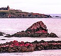
 Dunbuy - geograph.org.uk - 145373.jpg 640 × 426; 136 KB
-
 Dunbuy - geograph.org.uk - 261387.jpg 640 × 459; 59 KB
-
 Flowers 2008 Cruden Bay (4000266883).jpg 1,704 × 2,272; 793 KB
-
 Flowers 2008 Cruden Bay (4001030022).jpg 2,272 × 1,704; 1.03 MB
-
 Harbour St. - Cruden Bay, Scotland, UK - Ca. May 7, 1989.jpg 5,000 × 7,500; 19.05 MB
-
 Kittiwakes on the breeding cliffs - geograph.org.uk - 259391.jpg 480 × 640; 131 KB
-
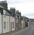
 Main Street, Cruden Bay - geograph.org.uk - 96769.jpg 640 × 480; 109 KB
-
 North end of Cruden Bay - geograph.org.uk - 2542028.jpg 640 × 417; 422 KB
-
 North Haven Cliffs - geograph.org.uk - 145381.jpg 640 × 418; 102 KB
-
 Old Erroll Schoolhouse, Cruden Bay - geograph.org.uk - 422527.jpg 640 × 480; 99 KB
-
 Port Erroll from the Beach - geograph.org.uk - 248772.jpg 640 × 481; 67 KB
-

-
 Robie's Haven headland - geograph.org.uk - 111580.jpg 640 × 422; 85 KB
-
 Skerry with birds - geograph.org.uk - 259396.jpg 640 × 480; 92 KB
-
 SlainsCastleCrudenBay.jpg 2,711 × 2,486; 1.04 MB
-
 St James's Church, Cruden Bay - geograph.org.uk - 423166.jpg 640 × 480; 58 KB
-
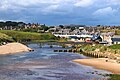 View of Cruden Bay from the estuary..jpg 5,184 × 3,456; 1.64 MB
-
 View towards St James's Church - geograph.org.uk - 423168.jpg 640 × 480; 36 KB
-

-

-
 Bus Shelter at South Teuchan - geograph.org.uk - 434106.jpg 640 × 480; 103 KB
-
 Cliff and skerry with birds - geograph.org.uk - 259401.jpg 640 × 432; 74 KB
-
 Cliff Scenery North of Cruden Bay - geograph.org.uk - 175906.jpg 640 × 480; 136 KB
-
 Cliffs stretching north - geograph.org.uk - 259399.jpg 505 × 640; 91 KB
-
 Colliehill Farm - geograph.org.uk - 359607.jpg 640 × 480; 136 KB
-
 Cruden Bay Brickworks - geograph.org.uk - 478351.jpg 423 × 640; 55 KB
-
 Field at Wellsforest Farm - geograph.org.uk - 434092.jpg 640 × 480; 65 KB
-
 Hay Farm, near Cruden Bay - geograph.org.uk - 422529.jpg 640 × 480; 77 KB
-
 Middle Teuchan - geograph.org.uk - 434791.jpg 640 × 480; 88 KB
-
 Military Transmitter Station - geograph.org.uk - 434097.jpg 640 × 480; 90 KB
-
 North Haven, Bullers o'Buchan - geograph.org.uk - 259405.jpg 480 × 640; 109 KB
-
 North Teuchan Croft - geograph.org.uk - 434792.jpg 640 × 480; 75 KB
-
 View from Colliehill - geograph.org.uk - 359610.jpg 640 × 480; 114 KB
-

-
 WW2 pillbox, Cruden Bay beach - geograph.org.uk - 383947.jpg 640 × 480; 535 KB
.jpg)
.jpg)
.jpg)
.jpg)
.jpg)


.jpg)
.jpg)


