Category:Croxton Kerrial
Jump to navigation
Jump to search
English: Croxton Kerrial (pronounced "crow-sun kerry-ul") is a small village, civil parish and electoral ward within the Melton borough of Leicestershire, England. It is northeast of Melton Mowbray.
village and civil parish in Leicestershire, United Kingdom  | |||||
| Upload media | |||||
| Instance of | |||||
|---|---|---|---|---|---|
| Location | Melton, Leicestershire, East Midlands, England | ||||
| Population |
| ||||
| Said to be the same as | Croxton Kerrial (Wikimedia duplicated page, civil parish) | ||||
 | |||||
Subcategories
This category has the following 5 subcategories, out of 5 total.
Media in category "Croxton Kerrial"
The following 200 files are in this category, out of 446 total.
(previous page) (next page)-

-
 36 Main Street, Branston - geograph.org.uk - 5181821.jpg 1,280 × 960; 372 KB
-
 A bend in Croxton Lane - geograph.org.uk - 3610511.jpg 640 × 480; 74 KB
-
 A lane along Cooper's Plantation - geograph.org.uk - 3496921.jpg 1,504 × 2,256; 2.34 MB
-
 A Seaman's grave - geograph.org.uk - 5985584.jpg 6,032 × 4,014; 6.98 MB
-

-
 A607 near Croxton Kerrial - geograph.org.uk - 67715.jpg 640 × 480; 122 KB
-
 A607 towards Grantham - geograph.org.uk - 2966412.jpg 640 × 480; 70 KB
-
 A607 towards Grantham - geograph.org.uk - 2966417.jpg 640 × 480; 63 KB
-
 A607 towards Grantham - geograph.org.uk - 2966426.jpg 640 × 480; 63 KB
-
 A607 towards Grantham - geograph.org.uk - 2966430.jpg 640 × 480; 109 KB
-
 A607 towards Grantham - geograph.org.uk - 2966444.jpg 640 × 480; 71 KB
-
 A607 towards Grantham - geograph.org.uk - 2966459.jpg 640 × 480; 79 KB
-
 A607 towards Grantham - geograph.org.uk - 5990298.jpg 640 × 425; 39 KB
-
 A607 towards Melton Mowbray - geograph.org.uk - 5990299.jpg 640 × 490; 41 KB
-
 A607, near Croxton Kerrial - geograph.org.uk - 104599.jpg 640 × 427; 83 KB
-
 Abandoned track, Croxton Kerrial - geograph.org.uk - 30069.jpg 640 × 480; 135 KB
-
 Animal pen by Branston Road - geograph.org.uk - 5879547.jpg 640 × 456; 73 KB
-
 April showers 1 - geograph.org.uk - 2913683.jpg 640 × 427; 52 KB
-
 April showers 2 - geograph.org.uk - 2913685.jpg 640 × 427; 62 KB
-
 Autumn near Branston - geograph.org.uk - 3229360.jpg 1,024 × 768; 296 KB
-
 Autumn sown crop near Eaton Grange - geograph.org.uk - 6797000.jpg 1,024 × 768; 228 KB
-
 Awaiting harvest - geograph.org.uk - 3350129.jpg 640 × 452; 61 KB
-
 Barkestone to Branston road - geograph.org.uk - 6557822.jpg 640 × 428; 70 KB
-
 Barley field by The Drift - geograph.org.uk - 6481175.jpg 1,024 × 768; 155 KB
-
 Barn and timber pile - geograph.org.uk - 6795907.jpg 1,024 × 768; 201 KB
-
 Barn near Branston - geograph.org.uk - 6795880.jpg 1,024 × 768; 329 KB
-
 Behind the hedge near Heath Farm - geograph.org.uk - 5134639.jpg 1,024 × 768; 183 KB
-
 Belvoir Angel - geograph.org.uk - 4416805.jpg 1,024 × 683; 378 KB
-
 Belvoir Angel - geograph.org.uk - 4416826.jpg 1,024 × 683; 324 KB
-
 Belvoir Angel headstone, Branston Churchyard - geograph.org.uk - 5181807.jpg 1,280 × 960; 522 KB
-
 Belvoir Angel headstone, Branston Churchyard - geograph.org.uk - 5181811.jpg 1,280 × 960; 461 KB
-
 Belvoir Angel headstone, Branston Churchyard - geograph.org.uk - 5181812.jpg 1,280 × 960; 576 KB
-

-

-
 Belvoir Castle, aerial 2018 (1) - geograph.org.uk - 5846275.jpg 1,024 × 683; 179 KB
-
 Belvoir Estate Woodlands sign - geograph.org.uk - 3350136.jpg 640 × 281; 51 KB
-
 Belvoir road - geograph.org.uk - 3492277.jpg 2,256 × 1,504; 2.44 MB
-
 Belvoir Road - geograph.org.uk - 4040983.jpg 640 × 480; 40 KB
-
 Belvoir Road approaching cottages near High Leys Farm - geograph.org.uk - 6785446.jpg 2,656 × 1,768; 2.76 MB
-
 Belvoir Road approaching crossroads - geograph.org.uk - 4040986.jpg 640 × 480; 48 KB
-
 Belvoir Road near Terrace Hills Farm - geograph.org.uk - 2027396.jpg 1,625 × 974; 650 KB
-
 Belvoir Road passing Terrace Hills Farm - geograph.org.uk - 6785436.jpg 2,656 × 1,768; 1.87 MB
-
 Belvoir Road towards Belvoir - geograph.org.uk - 6557818.jpg 640 × 430; 41 KB
-
 Belvoir Road towards Belvoir - geograph.org.uk - 6557827.jpg 640 × 394; 41 KB
-
 Belvoir Road towards Easton - geograph.org.uk - 6557828.jpg 640 × 413; 43 KB
-
 Belvoir Road towards Eastwell - geograph.org.uk - 6557819.jpg 640 × 428; 47 KB
-
 Belvoir Road towards High Leys - geograph.org.uk - 2031142.jpg 2,728 × 1,775; 2.16 MB
-
 Belvoir Road-Wood Lane crossroads - geograph.org.uk - 6557868.jpg 640 × 482; 41 KB
-
 Bench mark, 36 Main Street, Branston - geograph.org.uk - 5181825.jpg 916 × 1,280; 384 KB
-
 Bench mark, 6 Main Street, Branston - geograph.org.uk - 5181827.jpg 1,148 × 1,280; 435 KB
-
 Bench mark, Church of St Guthlac, Branston - geograph.org.uk - 5181806.jpg 960 × 1,280; 494 KB
-
 Bench mark, The Old Forge, Croxton Kerrial - geograph.org.uk - 5194304.jpg 1,160 × 1,280; 527 KB
-
 Bench mark,St Botolph's church, Croxton Kerrial - geograph.org.uk - 5183217.jpg 1,049 × 1,280; 510 KB
-
 Benchmark on 'The Old Forge' - geograph.org.uk - 6230947.jpg 683 × 1,024; 274 KB
-
 Benchmark on St John the Baptist's Church - geograph.org.uk - 6230658.jpg 678 × 1,024; 301 KB
-
 Benchmark on ^6 Top Road - geograph.org.uk - 6230882.jpg 620 × 1,024; 163 KB
-
 Branston Lane towards Branston - geograph.org.uk - 5879550.jpg 640 × 462; 82 KB
-
 Branston Lane towards Knipton - geograph.org.uk - 3350137.jpg 640 × 479; 74 KB
-
 Branston Lane towards Knipton - geograph.org.uk - 5879554.jpg 640 × 478; 91 KB
-
 Branston Road near to Eaton Grange - geograph.org.uk - 5879548.jpg 640 × 435; 87 KB
-
 Branston Road towards Branston - geograph.org.uk - 5879549.jpg 640 × 458; 98 KB
-
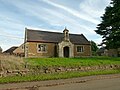
 Branston Village Hall - geograph.org.uk - 4416693.jpg 1,024 × 683; 225 KB
-
 Branston Village Hall - geograph.org.uk - 5181786.jpg 1,280 × 960; 347 KB
-
 Bridge at the foot of the hill - geograph.org.uk - 998873.jpg 640 × 427; 145 KB
-
 Bridge over the River Devon - geograph.org.uk - 3350120.jpg 640 × 421; 74 KB
-

-
 Broken oak, Mary Lane - geograph.org.uk - 6032785.jpg 3,776 × 2,520; 3.78 MB
-
 Bulls in field on west side of Saltby Road - geograph.org.uk - 6175874.jpg 1,024 × 683; 149 KB
-

-
 By Branston Lane - geograph.org.uk - 3350138.jpg 640 × 481; 72 KB
-
 Byway to Croxton Kerrial - geograph.org.uk - 6795883.jpg 1,024 × 768; 180 KB
-
 Byway to Croxton Kerrial - geograph.org.uk - 6795886.jpg 1,024 × 768; 213 KB
-
 Byway to Croxton Kerrial - geograph.org.uk - 6795893.jpg 1,024 × 768; 166 KB
-
 Byway to Croxton Kerrial - geograph.org.uk - 6795896.jpg 1,024 × 768; 276 KB
-
 Byway to Croxton Kerrial - geograph.org.uk - 6795903.jpg 1,024 × 768; 275 KB
-
 Carved poppyhead, Ss Botolph and John the Baptist church - geograph.org.uk - 5051178.jpg 4,272 × 2,848; 3.93 MB
-
 Cattlegrid on the track leading out of Croxton Park - geograph.org.uk - 6033036.jpg 3,776 × 2,520; 3.95 MB
-
 Cedar Hill - geograph.org.uk - 5981050.jpg 5,822 × 3,874; 5.63 MB
-
 Cedar Hill - geograph.org.uk - 999406.jpg 640 × 427; 113 KB
-
 Cedar Hill, near Croxton Kerrial - geograph.org.uk - 67671.jpg 640 × 480; 126 KB
-

-

-
 Chapel Lane, Croxton Kerrial - geograph.org.uk - 6032996.jpg 3,776 × 2,520; 3.96 MB
-

-

-

-

-

-

-

-

-

-

-
 Church of St Guthlac, Branston - geograph.org.uk - 5181787.jpg 1,280 × 957; 327 KB
-
 Church of St Guthlac, Branston - geograph.org.uk - 5181789.jpg 1,280 × 865; 315 KB
-
 Church of St Guthlac, Branston - geograph.org.uk - 5181791.jpg 844 × 1,280; 306 KB
-
 Church of St Guthlac, Branston - geograph.org.uk - 5181793.jpg 1,280 × 1,066; 326 KB
-
 Church of St Guthlac, Branston - geograph.org.uk - 5181794.jpg 960 × 1,280; 291 KB
-
 Church of St Guthlac, Branston - geograph.org.uk - 5181796.jpg 901 × 1,280; 294 KB
-
 Church of St Guthlac, Branston - geograph.org.uk - 5181799.jpg 1,280 × 960; 306 KB
-
 Church of St Guthlac, Branston - geograph.org.uk - 5181816.jpg 926 × 1,280; 306 KB
-
 Church of St. John the Baptist, Croxton Kerrial - geograph.org.uk - 5202580.jpg 1,024 × 768; 149 KB
-
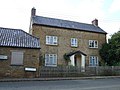
 Cottage in Branston - geograph.org.uk - 3229378.jpg 1,024 × 768; 170 KB
-
 Cottage in Branston - geograph.org.uk - 3610345.jpg 640 × 480; 81 KB
-
 Cottages in Croxton Kerrial - geograph.org.uk - 2168705.jpg 756 × 1,024; 207 KB
-
 Cottages off Main Street, Branston - geograph.org.uk - 998138.jpg 640 × 427; 99 KB
-
 Cottages on the edge of the village - geograph.org.uk - 5202600.jpg 1,024 × 768; 143 KB
-
 Cottages, Middle Street, Croxton Kerrial - geograph.org.uk - 5134624.jpg 1,024 × 768; 158 KB
-
 Cracks in field west of Croxton Lane - geograph.org.uk - 5879551.jpg 640 × 477; 136 KB
-
 Crop field and woodland - geograph.org.uk - 4040993.jpg 640 × 480; 85 KB
-
 Crop field near Branston - geograph.org.uk - 3610348.jpg 640 × 480; 100 KB
-
 Crossing of the paths - geograph.org.uk - 2051220.jpg 2,576 × 1,822; 2.04 MB
-
 Crossroads of Belvoir Road and Wood Lane - geograph.org.uk - 3492270.jpg 2,256 × 1,504; 2.34 MB
-
 Croxton Kerrial - geograph.org.uk - 5982917.jpg 6,032 × 4,014; 6.18 MB
-

-

-

-

-

-

-

-

-
-

-

-

-

-

-
 Croxton Kerrial playing field - geograph.org.uk - 1002003.jpg 640 × 427; 72 KB
-
 Croxton Kerrial Village Hall - geograph.org.uk - 5186973.jpg 1,280 × 960; 471 KB
-
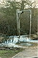 Croxton Kerrial water spout, ice feature - geograph.org.uk - 3162648.jpg 420 × 640; 120 KB
-
 Croxton Kerrial, Church Lane - 1 - geograph.org.uk - 2044168.jpg 800 × 600; 417 KB
-
 Croxton Kerrial, Church Lane - 2 - geograph.org.uk - 2044166.jpg 800 × 600; 487 KB
-
 Croxton Kerrial.jpg 477 × 325; 146 KB
-
 Croxton Lane - geograph.org.uk - 2999871.jpg 640 × 484; 84 KB
-
 Croxton Lane towards Croxton Kerrial - geograph.org.uk - 5879555.jpg 640 × 465; 58 KB
-
 Croxton Lane towards Harston - geograph.org.uk - 2999872.jpg 640 × 489; 120 KB
-
 Croxton Lane towards Knipton - geograph.org.uk - 5879556.jpg 640 × 480; 70 KB
-
 Croxton Park - geograph.org.uk - 608503.jpg 640 × 480; 102 KB
-
 Croxton Park, aerial 2020 (1) - geograph.org.uk - 6588480.jpg 533 × 800; 64 KB
-
 Croxton Park, aerial 2020 (2) - geograph.org.uk - 6588481.jpg 800 × 533; 72 KB
-
 Croxton Park, near Croxton Kerrial - geograph.org.uk - 67369.jpg 640 × 480; 150 KB
-
 Croxton-Knipton Lane - geograph.org.uk - 999411.jpg 640 × 427; 139 KB
-

-

-
 Donations brass of 1683, Croxton Kerrial Church - geograph.org.uk - 3108715.jpg 2,256 × 1,504; 2.44 MB
-
 Double manhole - geograph.org.uk - 5982927.jpg 6,032 × 4,014; 6.86 MB
-
 Down the hill - geograph.org.uk - 5982911.jpg 6,032 × 4,014; 6.72 MB
-
 Down the hill to Branston - geograph.org.uk - 3492306.jpg 1,504 × 2,256; 3.25 MB
-
 Driveway to Croxton Park - geograph.org.uk - 6797722.jpg 1,024 × 768; 121 KB
-
 Dry stone wall, Croxton Park - geograph.org.uk - 2129219.jpg 1,600 × 1,227; 454 KB
-

-
 Entrance to Highfield Farm Croxton Kerrial - geograph.org.uk - 4433704.jpg 1,024 × 768; 130 KB
-
 Entrance to Keeper's Cottage - geograph.org.uk - 3350139.jpg 640 × 557; 90 KB
-

-

-

-
 Farm track at Croxton Kerrial - geograph.org.uk - 999417.jpg 640 × 427; 117 KB
-
 Farm track near Branston - geograph.org.uk - 3229390.jpg 1,024 × 768; 144 KB
-
 Farm track near Branston - geograph.org.uk - 6795900.jpg 1,024 × 768; 170 KB
-
 Farm track near Croxton Kerrial - geograph.org.uk - 2966440.jpg 640 × 480; 74 KB
-
 Farm track near Croxton Kerrial - geograph.org.uk - 6794391.jpg 1,024 × 768; 173 KB
-
 Farm track near Harston - geograph.org.uk - 5183197.jpg 1,280 × 960; 396 KB
-
 Farm Track off Croxton Lane - geograph.org.uk - 3488225.jpg 1,504 × 2,256; 2.07 MB
-
 Farm track to Nursery Plantation - geograph.org.uk - 3229355.jpg 1,024 × 768; 253 KB
-
 Farmland above Knipton Reservoir - geograph.org.uk - 998177.jpg 640 × 427; 114 KB
-
 Farmland and Hill Top Farm - geograph.org.uk - 5240974.jpg 800 × 602; 159 KB
-
 Farmland and woodland - geograph.org.uk - 3610354.jpg 640 × 480; 73 KB
-
 Farmland in Croxton Kerrial - geograph.org.uk - 1002047.jpg 640 × 427; 102 KB
-
 Farmland near Blackwell Lodge - geograph.org.uk - 2966456.jpg 640 × 480; 88 KB
-
 Farmland near Croxson Kerrial - geograph.org.uk - 999414.jpg 640 × 427; 99 KB
-
 Farmland near Croxton Kerrial - geograph.org.uk - 2966425.jpg 640 × 435; 56 KB
-
 Farmland near Croxton Kerrial - geograph.org.uk - 2966428.jpg 640 × 480; 89 KB
-
 Farmland near Croxton Kerrial - geograph.org.uk - 2966442.jpg 640 × 480; 71 KB
-
 Farmland near Croxton Kerrial - geograph.org.uk - 2991481.jpg 640 × 427; 83 KB
-
 Farmland near Croxton Kerrial - geograph.org.uk - 2991485.jpg 640 × 427; 70 KB
-

-
 Farmland near Croxton Park - geograph.org.uk - 3016400.jpg 640 × 480; 63 KB
-

-
 Farmland towards Harston Wood - geograph.org.uk - 3610501.jpg 640 × 480; 86 KB
-
 Farmland towards Lings Covert - geograph.org.uk - 2966406.jpg 640 × 480; 106 KB
-
 Farmland, Barn Lodge Farm - geograph.org.uk - 3016394.jpg 640 × 480; 48 KB
-
 Farmland, Tipping's Lodge - geograph.org.uk - 3016388.jpg 640 × 480; 50 KB
-
 Field edge near Branston - geograph.org.uk - 6794415.jpg 1,024 × 756; 181 KB
-
 Field entrance - geograph.org.uk - 3610448.jpg 640 × 480; 98 KB
-
 Field entrance, with Geese - geograph.org.uk - 5982900.jpg 6,032 × 4,014; 8 MB
-
 Field margin - geograph.org.uk - 6492815.jpg 1,024 × 768; 188 KB
-
 Field near Terrace Hills Farm - geograph.org.uk - 1840957.jpg 640 × 480; 94 KB
-
 Field near Terrace Hills Farm - geograph.org.uk - 6577216.jpg 1,024 × 768; 240 KB
-
 Field side track - geograph.org.uk - 3350125.jpg 640 × 489; 56 KB
-

-

-
 Field west of Croxton Lane - geograph.org.uk - 5879552.jpg 640 × 514; 83 KB
-
-
 Fields above Knipton Reservoir - geograph.org.uk - 998162.jpg 640 × 427; 128 KB
-
 Fields by Croxton Lane - geograph.org.uk - 2999873.jpg 640 × 475; 73 KB
-

-
 Fish pond, fed by the headwaters of the River Devon - geograph.org.uk - 2129991.jpg 1,600 × 1,200; 571 KB
-
 Fish-ponds of the former Croxton Abbey - geograph.org.uk - 2128777.jpg 1,600 × 1,200; 294 KB


_-_geograph.org.uk_-_5846275.jpg)


_-_geograph.org.uk_-_5474581.jpg)
_-_geograph.org.uk_-_5476594.jpg)
_-_geograph.org.uk_-_5476674.jpg)
_-_geograph.org.uk_-_5476692.jpg)
_-_geograph.org.uk_-_5476707.jpg)
_-_geograph.org.uk_-_5476765.jpg)
_-_geograph.org.uk_-_5474613.jpg)
_-_geograph.org.uk_-_5474654.jpg)
_-_geograph.org.uk_-_5474673.jpg)
_-_geograph.org.uk_-_5474691.jpg)
_-_geograph.org.uk_-_5476464.jpg)
_-_geograph.org.uk_-_5476474.jpg)
_-_geograph.org.uk_-_5476555.jpg)
_-_geograph.org.uk_-_5476575.jpg)


_-_geograph.org.uk_-_6588480.jpg)
_-_geograph.org.uk_-_6588481.jpg)


