Category:Crowdecote
Jump to navigation
Jump to search
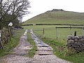
English: Crowdecote is a small village nestling on the border between Derbyshire and Staffordshire about south of Buxton. It is also thought that the name Crowdecote is a corruption of Cruda’s Cot (Cruda was a Saxon landowner) and a cot is a form of shelter. Because of its location close to the spectacular Chrome Hill, High Wheeldon and Parkhouse Hill to the north and Dovedale to the south, Crowdecote is popular with walkers and ramblers.
village in Derbyshire, England  | |||||
| Upload media | |||||
| Instance of | |||||
|---|---|---|---|---|---|
| Location | Hartington Middle Quarter, Derbyshire Dales, Derbyshire, East Midlands, England | ||||
 | |||||
Media in category "Crowdecote"
The following 36 files are in this category, out of 36 total.
-
 Access to Bridge End Farm - geograph.org.uk - 2443576.jpg 640 × 427; 290 KB
-

-
 Bridge End Farm - geograph.org.uk - 311000.jpg 640 × 480; 120 KB
-
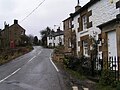
 Cottages beside the Pack Horse Inn - geograph.org.uk - 5857763.jpg 1,469 × 1,102; 536 KB
-
 Crowdecote - geograph.org.uk - 124089.jpg 640 × 398; 59 KB
-
 Crowdecote.JPG 1,280 × 960; 308 KB
-
 Crowdicote - geograph.org.uk - 1926692.jpg 3,296 × 2,472; 1.08 MB
-
 Crowdicote - geograph.org.uk - 2443572.jpg 640 × 427; 277 KB
-
 Crowdicote - geograph.org.uk - 4723343.jpg 5,060 × 3,237; 1.67 MB
-
 Crowdicote - geograph.org.uk - 4723401.jpg 4,912 × 3,370; 1.73 MB
-
 Crowdicote village scene - geograph.org.uk - 3483013.jpg 750 × 546; 122 KB
-
 Crowdicote, Derbyshire - geograph.org.uk - 2860982.jpg 4,200 × 2,800; 2.58 MB
-
 Ford at Crowdecote - geograph.org.uk - 5406008.jpg 4,032 × 3,024; 5.39 MB
-
 Hartington Middle Quarter, UK - panoramio.jpg 3,168 × 2,009; 1.02 MB
-
 Hillside towards Crowdicote - geograph.org.uk - 1568475.jpg 640 × 480; 135 KB
-
 Lane approach to Hurdlow Town - geograph.org.uk - 1230502.jpg 640 × 480; 87 KB
-
 Lane north of Crowdicote - geograph.org.uk - 3483032.jpg 750 × 485; 103 KB
-
 North out of Crowdecote - geograph.org.uk - 762855.jpg 640 × 480; 67 KB
-
 November trees above Crowdicote - geograph.org.uk - 5205090.jpg 4,916 × 3,590; 2.87 MB
-

-

-

-
 Riding out of Crowdicote - geograph.org.uk - 5857768.jpg 1,469 × 1,102; 617 KB
-
 Road to Longnor from Crowdicote (geograph 3482984).jpg 563 × 750; 112 KB
-
 Telephone box and postbox, Crowdicote - geograph.org.uk - 3482999.jpg 563 × 750; 185 KB
-
 The Pack Horse - geograph.org.uk - 5857766.jpg 1,306 × 979; 624 KB
-
 The path to Crowdicote - geograph.org.uk - 1019070.jpg 640 × 480; 65 KB
-
 The Road to Crowdicote - geograph.org.uk - 5436745.jpg 640 × 427; 101 KB
-
 Valley fields near Crowdicote - geograph.org.uk - 3483082.jpg 750 × 560; 74 KB
-

-

-
 Wall Corner, near Crowdicote - geograph.org.uk - 2443535.jpg 640 × 427; 270 KB
-
 Crowdecote - geograph.org.uk - 6732.jpg 640 × 480; 102 KB
-
 Farm at Stiff Close near Longnor - geograph.org.uk - 375114.jpg 640 × 480; 82 KB
-
 Sheen Hill - geograph.org.uk - 310940.jpg 640 × 480; 129 KB
-
 Under Whitle - geograph.org.uk - 145572.jpg 640 × 480; 117 KB


_-_geograph.org.uk_-_1714210.jpg)
_-_geograph.org.uk_-_1714220.jpg)
_-_geograph.org.uk_-_1714224.jpg)

.jpg)


