Category:Crosshands
Jump to navigation
Jump to search

A small village in East Ayrshire near the site of the old Loch Brown.
Subcategories
This category has the following 3 subcategories, out of 3 total.
Media in category "Crosshands"
The following 17 files are in this category, out of 17 total.
-
 Back road to Ramageton - geograph.org.uk - 308474.jpg 640 × 480; 130 KB
-
 Cattle cooling - geograph.org.uk - 225027.jpg 640 × 501; 124 KB
-
 Crosshands, Ayrshire - geograph.org.uk - 60988.jpg 640 × 424; 77 KB
-
 Curious cattle - geograph.org.uk - 224984.jpg 640 × 480; 71 KB
-
 Deaconhill farm road end - geograph.org.uk - 308488.jpg 640 × 480; 87 KB
-
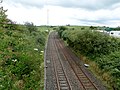
 Dismantled Railway Line - geograph.org.uk - 421193.jpg 480 × 640; 180 KB
-

-

-

-
 Garrochburn Goods Depot site, Mauchline, East Ayrshire, Scotland. Old G&SWR main line.jpg 4,606 × 3,454; 6.42 MB
-
 Gate and manger - geograph.org.uk - 225009.jpg 640 × 480; 78 KB
-

-
 Hedge and gate - geograph.org.uk - 224980.jpg 480 × 640; 66 KB
-
 House near Lawers Bridge - geograph.org.uk - 225018.jpg 640 × 480; 85 KB
-
 Killoch Burn meets the Cessnock Water - geograph.org.uk - 225016.jpg 640 × 480; 123 KB
-
 Lawersbridge Kennels - geograph.org.uk - 225013.jpg 640 × 486; 62 KB
-
 Looking down to Low Holehouse - geograph.org.uk - 225005.jpg 480 × 640; 79 KB


