Category:Cropthorne
Jump to navigation
Jump to search
village in United Kingdom  | |||||
| Upload media | |||||
| Instance of | |||||
|---|---|---|---|---|---|
| Location | Wychavon, Worcestershire, West Midlands, England | ||||
| Population |
| ||||
| Area |
| ||||
 | |||||
Subcategories
This category has the following 4 subcategories, out of 4 total.
C
- Cropthorne Mill (16 F)
- Cropthorne New Inn Section (3 F)
- Cropthorne War Memorial (3 F)
M
Media in category "Cropthorne"
The following 124 files are in this category, out of 124 total.
-
 A corner on Wychavon Way - geograph.org.uk - 2620210.jpg 640 × 480; 120 KB
-

-
 Arable land at Charlton - geograph.org.uk - 2236480.jpg 1,024 × 681; 141 KB
-
 Avon scene - geograph.org.uk - 2899088.jpg 640 × 480; 162 KB
-
 B4084 at Cropthorne - geograph.org.uk - 2079078.jpg 640 × 480; 61 KB
-
 B4084 Cropthorne Village Sign - geograph.org.uk - 4498386.jpg 640 × 399; 62 KB
-
 B4084 passes The New Inn - geograph.org.uk - 3470533.jpg 3,099 × 2,420; 879 KB
-

-
 Bell Inn, Cropthorne - geograph.org.uk - 2422165.jpg 640 × 480; 66 KB
-
 Beside the River Avon, near Fladbury - geograph.org.uk - 2033072.jpg 640 × 426; 112 KB
-

-
 Bricklehampton Road - geograph.org.uk - 4350599.jpg 800 × 450; 199 KB
-
 Bridge over small stream, Cropthorne - geograph.org.uk - 2620169.jpg 640 × 480; 145 KB
-
 Bridleway and track near Smokey Farm - geograph.org.uk - 6006286.jpg 1,024 × 683; 372 KB
-
 Bridleway and track near Smokey Farm - geograph.org.uk - 6006289.jpg 768 × 1,024; 403 KB
-

-
 Bridleway near Smokey Farm, Cropthorne - geograph.org.uk - 2620227.jpg 640 × 480; 156 KB
-

-
 Brook Lane Cropthorne - geograph.org.uk - 6170082.jpg 640 × 480; 65 KB
-

-
 Chapel - geograph.org.uk - 3142063.jpg 960 × 1,280; 296 KB
-
 Church Leys Junction Charlton - geograph.org.uk - 6170975.jpg 640 × 462; 38 KB
-
 Country road in Cropthorne - geograph.org.uk - 5143828.jpg 800 × 600; 148 KB
-
 Craycombe Turn mooring - geograph.org.uk - 6571809.jpg 640 × 480; 92 KB
-
 Cropthorne Mill - geograph.org.uk - 5673506.jpg 640 × 480; 93 KB
-
 Cropthorne Mill on R Avon, Fladbury - geograph.org.uk - 6004762.jpg 5,184 × 2,920; 5.86 MB
-
 Cropthorne viewed from the north - geograph.org.uk - 2310643.jpg 1,024 × 680; 175 KB
-
 Cropvale Farm - geograph.org.uk - 6006292.jpg 1,024 × 768; 253 KB
-
 Cropvale Farm, Cropthorne - geograph.org.uk - 640444.jpg 640 × 480; 106 KB
-

-
 Even rivers have signs - geograph.org.uk - 2899084.jpg 640 × 480; 98 KB
-
 Farm Track, Cropthorne - geograph.org.uk - 52519.jpg 425 × 640; 99 KB
-
 Farmland near Netherton - geograph.org.uk - 1975642.jpg 3,008 × 2,000; 1.51 MB
-
 Field of wheat below Haselor Hill - geograph.org.uk - 1945361.jpg 3,008 × 2,000; 1.57 MB
-
 Field shelter with rack and manger - geograph.org.uk - 2620202.jpg 640 × 480; 90 KB
-
 Fields near Cropthorne - geograph.org.uk - 1975471.jpg 3,008 × 2,000; 1.51 MB
-
 Fields near Smokey Farm - geograph.org.uk - 1975469.jpg 3,008 × 2,000; 1.54 MB
-
 Fladbury Lock - geograph.org.uk - 5673486.jpg 640 × 480; 87 KB
-
 Fladbury lock - geograph.org.uk - 6571791.jpg 640 × 480; 104 KB
-
 Fladbury lock - geograph.org.uk - 6571794.jpg 640 × 480; 98 KB
-
 Fladbury lock - geograph.org.uk - 6580084.jpg 640 × 480; 91 KB
-
 Fladbury lock - geograph.org.uk - 6580095.jpg 640 × 480; 121 KB
-
 Fladbury Lock - not quite right - geograph.org.uk - 5673493.jpg 640 × 480; 77 KB
-
 Fladbury Mill - geograph.org.uk - 5436011.jpg 2,048 × 1,152; 1.19 MB
-
 Fladbury Mill and ferry - geograph.org.uk - 5590382.jpg 1,600 × 1,200; 579 KB
-

-
 Fladbury Mill ^ weir - geograph.org.uk - 5436010.jpg 2,048 × 1,152; 981 KB
-
 Flat rollers by the track - geograph.org.uk - 2899076.jpg 640 × 480; 116 KB
-
 Flood markers, Fladbury - geograph.org.uk - 2234730.jpg 681 × 1,024; 198 KB
-
 Footpath and ploughed field - geograph.org.uk - 5143826.jpg 1,024 × 768; 326 KB
-
 Footpath leaves the lay-by, Cropthorne - geograph.org.uk - 2620160.jpg 480 × 640; 166 KB
-
 Footpath near Smokey Farm - geograph.org.uk - 6006296.jpg 768 × 1,024; 325 KB
-
 Freelands Cottage in Cropthorne - geograph.org.uk - 2279483.jpg 640 × 480; 70 KB
-

-
 Holland House (geograph 6006304).jpg 1,024 × 768; 254 KB
-
 Holland House (geograph 6804452).jpg 1,024 × 768; 234 KB
-
 Holland House (geograph 6804453).jpg 1,024 × 768; 271 KB
-
 Holland House - geograph.org.uk - 3142074.jpg 1,280 × 960; 291 KB
-
 Holland House - geograph.org.uk - 3623970.jpg 1,024 × 768; 165 KB
-
 Holland House, Cropthorne - geograph.org.uk - 850172.jpg 480 × 640; 83 KB
-
 House in Cropthorne - geograph.org.uk - 850149.jpg 640 × 480; 69 KB
-
 Jubilee Bridge - geograph.org.uk - 3313388.jpg 640 × 480; 84 KB
-
 Jubilee Bridge across the River Avon - geograph.org.uk - 5583223.jpg 1,600 × 1,200; 460 KB
-
 Jubilee Bridge Fladbury - geograph.org.uk - 6170977.jpg 640 × 480; 53 KB
-
 Jubilee Bridge over the River Avon - geograph.org.uk - 5506664.jpg 5,184 × 3,456; 6.99 MB
-

-

-

-
 Lock at Fladbury - geograph.org.uk - 2234735.jpg 1,024 × 681; 201 KB
-
 Main Street Cropthorne - geograph.org.uk - 6170080.jpg 640 × 463; 83 KB
-
 Main Street Cropthorne Village - geograph.org.uk - 6170064.jpg 640 × 480; 103 KB
-
 Main Street, Cropthorne.jpg 640 × 480; 83 KB
-
 Neigh Lane Cropthorne Village Sign - geograph.org.uk - 6170063.jpg 640 × 470; 65 KB
-
 Old Smokey Farm - geograph.org.uk - 6006293.jpg 1,024 × 768; 310 KB
-
 Ordnance Survey Cut Mark - geograph.org.uk - 6119191.jpg 1,024 × 653; 319 KB
-
 Organ in Cropthorne Church - geograph.org.uk - 2699764.jpg 424 × 640; 62 KB
-
 Path created for safety - geograph.org.uk - 2620176.jpg 640 × 480; 140 KB
-
 Patty's Farm, Cropthorne - geograph.org.uk - 850181.jpg 640 × 480; 102 KB
-
 Pershore Road looking west - geograph.org.uk - 3132870.jpg 640 × 480; 62 KB
-
 Playing fields at Cropthorne - geograph.org.uk - 850153.jpg 640 × 480; 68 KB
-
 River Avon - geograph.org.uk - 3142057.jpg 1,280 × 960; 292 KB
-
 River Avon - geograph.org.uk - 6571756.jpg 640 × 480; 67 KB
-
 River Avon - geograph.org.uk - 6572917.jpg 640 × 480; 78 KB
-
 River Avon - geograph.org.uk - 6580051.jpg 640 × 480; 61 KB
-
 River Avon and the Evesham Golf Course (2) - geograph.org.uk - 5584561.jpg 1,600 × 1,167; 273 KB
-
 River Avon near Fladbury - geograph.org.uk - 2033069.jpg 640 × 426; 123 KB
-

-
 Riverside property - geograph.org.uk - 6571761.jpg 640 × 480; 120 KB
-
 Rush hour in Cropthorne - geograph.org.uk - 4888601.jpg 640 × 480; 107 KB
-
 Smokey Lane, Cropthorne - geograph.org.uk - 852934.jpg 640 × 480; 91 KB
-

-

-

-

-
 St. Michael, Cropthorne, churchyard (e) - geograph.org.uk - 4888621.jpg 640 × 480; 110 KB
-

-

-
 Stubble field near Cropthorne - geograph.org.uk - 2236472.jpg 1,024 × 681; 236 KB
-
 Thatched cottages in Cropthorne (geograph 6804430).jpg 1,024 × 768; 215 KB
-
 Thatched timber-framed cottage (geograph 6804460).jpg 1,024 × 768; 240 KB
-
 The Bell Inn at Cropthorne - geograph.org.uk - 850188.jpg 640 × 480; 65 KB
-
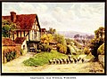 The cottages and the village life of rural England (1912) (14799559663).jpg 2,112 × 1,564; 756 KB
-
 The Manor (geograph 6804433).jpg 1,024 × 768; 290 KB
-
 Through the crop towards Fladbury - geograph.org.uk - 2899096.jpg 640 × 480; 89 KB
-
 Timber-framed cottage (geograph 6804440).jpg 1,024 × 768; 187 KB
-
 Timber-framed cottage in Cropthorne - geograph.org.uk - 850178.jpg 640 × 480; 80 KB
-
 Tomato Growing near Pershore - geograph.org.uk - 48340.jpg 640 × 480; 72 KB
-
 Track north of Jubilee Bridge - geograph.org.uk - 2236466.jpg 1,024 × 681; 221 KB
-
 View towards Pershore from Jubilee Bridge - geograph.org.uk - 5506661.jpg 5,184 × 3,456; 5.06 MB
-
 Weir at Fladbury in spate - geograph.org.uk - 2234745.jpg 1,024 × 681; 194 KB
-
 WWII bunker near Netherton - geograph.org.uk - 1975637.jpg 640 × 426; 107 KB
-
 WWII bunker near Netherton - geograph.org.uk - 6006295.jpg 1,024 × 768; 415 KB
-
 Young hedge and old hedge - geograph.org.uk - 2620189.jpg 640 × 480; 139 KB
-
 Blacksmiths Lane, Cropthorne - geograph.org.uk - 39876.jpg 640 × 480; 82 KB
-
 Cul-de-sac, Cropthorne - geograph.org.uk - 310893.jpg 640 × 388; 71 KB
-
 Fields near Wick - geograph.org.uk - 48341.jpg 640 × 480; 66 KB
-
 Haselor Hill - geograph.org.uk - 52523.jpg 640 × 480; 68 KB
-
 Hole in the road near the New Inn - geograph.org.uk - 506640.jpg 640 × 480; 77 KB
-
 Holland House, Main Street, Cropthorne - geograph.org.uk - 39878.jpg 640 × 480; 71 KB
-
 In the path of the floodwaters - geograph.org.uk - 506642.jpg 640 × 480; 141 KB
-
 Irrigation near Cropthorne - geograph.org.uk - 48339.jpg 640 × 480; 63 KB
-
 Jubilee Bridge, River Avon - geograph.org.uk - 272606.jpg 640 × 480; 145 KB
-

-
 Smokey Lane, Cropthorne - geograph.org.uk - 634143.jpg 640 × 480; 76 KB

_-_geograph.org.uk_-_2153263.jpg)


.jpg)
.jpg)
.jpg)


_-_geograph.org.uk_-_5584561.jpg)


_-_geograph.org.uk_-_4888603.jpg)
_-_geograph.org.uk_-_4888616.jpg)
_-_geograph.org.uk_-_4888617.jpg)
_-_geograph.org.uk_-_4888620.jpg)
_-_geograph.org.uk_-_4888621.jpg)
_-_geograph.org.uk_-_4888623.jpg)


.jpg)
.jpg)

_(14799559663).jpg)
.jpg)

.jpg)


