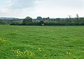
Category:Cropredy
Jump to navigation
Jump to search
village and civil parish in Cherwell district, Oxfordshire, England  | |||||
| Upload media | |||||
| Instance of | |||||
|---|---|---|---|---|---|
| Location | Cherwell, Oxfordshire, South East England, England | ||||
| Population |
| ||||
| Area |
| ||||
| official website | |||||
 | |||||
English: Cropredy is a village and civil parish on the River Cherwell, north of Banbury in Oxfordshire.
Polski: Cropredy – niewielka miejscowość w hrabstwie Oxfordshire, w Anglii, 5 mil na północ od Banbury, położona na zachodnim brzegu rzeki Cherwell.
Svenska: Cropredy är ett litet samhälle strax utanför Banbury i Oxfordshire i England. Var plats för The Battle of Cropredy Bridge i det engelska inbördeskriget 1644.
Subcategories
This category has the following 11 subcategories, out of 11 total.
B
- Brasenose Arms, Cropredy (4 F)
C
- Constone (2 F)
- Cropredy Bridge (6 F)
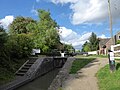
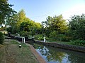
- Cropredy Lock (10 F)
- Cropredy Mill (3 F)
F
M
- Cropredy Methodist Chapel (2 F)
O
- Oxford Canal Bridge 154 (2 F)
R
- The Red Lion, Cropredy (5 F)
Media in category "Cropredy"
The following 200 files are in this category, out of 266 total.
(previous page) (next page)-
 'Arbour' at Clattercote Wharf - geograph.org.uk - 6142100.jpg 1,280 × 851; 394 KB
-
 'Jonah's Oak', memorials at Cropredy - geograph.org.uk - 1326958.jpg 640 × 464; 156 KB
-
 'Santé Bonheur' at Cropredy - geograph.org.uk - 6143026.jpg 1,280 × 851; 453 KB
-
 2016, a year on Geograph (Day 244) - geograph.org.uk - 5097630.jpg 640 × 480; 77 KB
-
 A very special field at Cropredy - geograph.org.uk - 1326968.jpg 600 × 425; 87 KB
-
 A423 northwest of Manorfields Farm - geograph.org.uk - 3124014.jpg 3,496 × 2,506; 1.21 MB
-
 Approach to Oathill Farm - geograph.org.uk - 2336626.jpg 640 × 480; 104 KB
-
 Approaching Cropredy Lock - geograph.org.uk - 5098485.jpg 640 × 480; 86 KB
-

-
 Arable landscape by the M40 - geograph.org.uk - 2686364.jpg 640 × 430; 49 KB
-

-
 Autumn tints - geograph.org.uk - 1531553.jpg 640 × 427; 89 KB
-
 Banbury Crematorium - geograph.org.uk - 343017.jpg 640 × 480; 87 KB
-
 Beam cottage, Dingle cottage and Ivy Cottage (geograph 6601108).jpg 4,032 × 3,024; 4.81 MB
-

-
 Bourton Lock on the Southern Oxford Canal - geograph.org.uk - 30568.jpg 640 × 480; 138 KB
-

-
 Bridge 148, Elkington's Bridge - geograph.org.uk - 4491766.jpg 1,024 × 814; 324 KB
-
 Bridge 149 on the Oxford Canal - geograph.org.uk - 65485.jpg 640 × 427; 94 KB
-
 Bridge 149, Varney's Lock Field Bridge - geograph.org.uk - 4491770.jpg 1,024 × 813; 236 KB
-
 Bridge 149, Varney's Lock Field Bridge - geograph.org.uk - 4500123.jpg 1,024 × 728; 240 KB
-
 Bridge 152, Cropredy Lock Bridge - geograph.org.uk - 4492257.jpg 1,024 × 768; 267 KB
-
 Bridge 153 on the Oxford Canal at Cropredy - geograph.org.uk - 1995672.jpg 1,500 × 977; 248 KB
-
 Bridge 153, Cropredy Wharf Bridge - geograph.org.uk - 4492297.jpg 1,024 × 690; 223 KB
-
 Bridge 154, Old Mill Field Bridge - geograph.org.uk - 4492519.jpg 1,024 × 768; 225 KB
-
 Bridge over Oxford Canal between Banbury and Cropredy - geograph.org.uk - 4952988.jpg 1,400 × 1,050; 1.79 MB
-
 Bridge over the canal at Cropredy - geograph.org.uk - 5098488.jpg 640 × 480; 88 KB
-
 Bridge over the Oxford Canal at Cropredy - geograph.org.uk - 1994551.jpg 1,500 × 981; 185 KB
-
 Bridge over the road to Cropredy - geograph.org.uk - 1330085.jpg 640 × 413; 89 KB
-
 Bridge. 153 crosses the Oxford Canal - geograph.org.uk - 4238270.jpg 1,600 × 1,200; 480 KB
-
 Bridleway southeast of Cropredy (1) - geograph.org.uk - 1326942.jpg 640 × 461; 126 KB
-
 Bridleway southeast of Cropredy (2) - geograph.org.uk - 1326947.jpg 640 × 466; 121 KB
-
 Broadmoor Bridge and Lock, Oxford Canal - geograph.org.uk - 4238321.jpg 1,296 × 972; 404 KB
-
 Broadmoor Bridge over the Oxford Canal - geograph.org.uk - 2947901.jpg 640 × 480; 136 KB
-
 Broadmoor Lock No 24 along the Oxford Canal - geograph.org.uk - 4491812.jpg 885 × 1,024; 322 KB
-
 Broadmoor Lock No 24 along the Oxford Canal - geograph.org.uk - 4491828.jpg 1,024 × 681; 204 KB
-
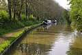
 Canal at Cropredy - geograph.org.uk - 893141.jpg 640 × 480; 141 KB
-
 Canal Bridge 153, Cropredy, Oxford Canal - geograph.org.uk - 3629305.jpg 1,066 × 800; 210 KB
-
 Canal Bridge 154, Oxford Canal - geograph.org.uk - 3627889.jpg 1,066 × 800; 379 KB
-
 Cattle southeast of Cropredy (1) - geograph.org.uk - 1326949.jpg 640 × 460; 95 KB
-
 Cattle southeast of Cropredy (2) - geograph.org.uk - 1326951.jpg 640 × 456; 129 KB
-

-
 Church Lane, Cropredy - geograph.org.uk - 4941837.jpg 4,000 × 3,000; 2.5 MB
-
 Church Lane, Cropredy - geograph.org.uk - 5480981.jpg 640 × 427; 87 KB
-
 Clattercote Reservoir - geograph.org.uk - 2627215.jpg 640 × 480; 59 KB
-
 Clattercote Reservoir - geograph.org.uk - 2627226.jpg 640 × 480; 44 KB
-
 Clattercote Wharf - geograph.org.uk - 6142062.jpg 1,280 × 851; 388 KB
-
-
 Converted butty - geograph.org.uk - 202634.jpg 640 × 480; 82 KB
-
 Cricket pitch, Cropredy - geograph.org.uk - 3690168.jpg 1,600 × 869; 203 KB
-
 Bridge over the line at Cropredy - geograph.org.uk - 1334841.jpg 640 × 427; 83 KB
-
 Pasture, Cropredy - geograph.org.uk - 662775.jpg 640 × 480; 136 KB
-
 Signpost to Precote, Cropredy - geograph.org.uk - 1332830.jpg 407 × 640; 146 KB
-
 The Cropredy to Mollington road - geograph.org.uk - 662770.jpg 640 × 480; 149 KB
-

-
 Cropredy - geograph.org.uk - 3360334.jpg 426 × 640; 49 KB
-
 Cropredy - geograph.org.uk - 82431.jpg 640 × 480; 146 KB
-
 Cropredy Bridge - geograph.org.uk - 4952992.jpg 1,400 × 1,050; 1.47 MB
-
 Cropredy Bridge battlefield - geograph.org.uk - 1995694.jpg 1,500 × 1,000; 206 KB
-
 Cropredy Bridge, Oxford Canal - geograph.org.uk - 5480973.jpg 640 × 427; 101 KB
-
 Cropredy Church from the battlefield - geograph.org.uk - 936297.jpg 640 × 480; 54 KB
-
 Cropredy Coalyard - geograph.org.uk - 2131552.jpg 640 × 480; 135 KB
-
 Cropredy Lawn - geograph.org.uk - 6213064.jpg 1,600 × 1,067; 341 KB
-
 Cropredy Lock - geograph.org.uk - 2099849.jpg 3,947 × 6,094; 4.27 MB
-
 Cropredy Lock - geograph.org.uk - 6142269.jpg 1,280 × 851; 481 KB
-
 Cropredy Lock - geograph.org.uk - 6262628.jpg 1,280 × 851; 411 KB
-
 Cropredy Lock Bridge 152 Oxford Canal - geograph.org.uk - 3292678.jpg 1,230 × 1,980; 722 KB
-
 Cropredy Lock No 25 - geograph.org.uk - 4492224.jpg 1,024 × 713; 297 KB
-
 Cropredy Lock, Oxford Canal - geograph.org.uk - 5480970.jpg 640 × 427; 102 KB
-
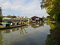
 Cropredy Marina - geograph.org.uk - 6142250.jpg 1,280 × 851; 259 KB
-
 Cropredy Marina along the Oxford Canal - geograph.org.uk - 4491894.jpg 1,024 × 668; 190 KB
-
 Cropredy Post Office - geograph.org.uk - 1954268.jpg 1,024 × 768; 170 KB
-
-
 Cropredy Road Junction - geograph.org.uk - 2627784.jpg 640 × 480; 132 KB
-
 Cropredy summer flood - geograph.org.uk - 1091304.jpg 640 × 476; 73 KB
-
 Cropredy Surgery - geograph.org.uk - 2133249.jpg 640 × 480; 66 KB
-
 Cropredy Village Hall - geograph.org.uk - 442239.jpg 640 × 451; 96 KB
-
 Cropredy village sign (2003) - geograph.org.uk - 3562751.jpg 1,846 × 2,173; 1.7 MB
-
 Cropredy village sign - geograph.org.uk - 4499874.jpg 1,024 × 845; 218 KB
-
 Cropredy village sign - geograph.org.uk - 6262646.jpg 851 × 1,280; 300 KB
-
 Cropredy Wesleyan Chapel - geograph.org.uk - 4941701.jpg 3,599 × 2,693; 1.92 MB
-
 Cropredy Wharf Bridge, Oxford Canal - geograph.org.uk - 6143035.jpg 1,280 × 851; 443 KB
-
 Cropredy Wharf Bridge, Oxford Canal - geograph.org.uk - 6262632.jpg 1,280 × 851; 470 KB
-
 Cropredy, battlefield - geograph.org.uk - 1954273.jpg 1,024 × 768; 250 KB
-
 Cropredy, by Cropredy Bridge - geograph.org.uk - 1297392.jpg 640 × 427; 349 KB
-
 Cropredy, canal - geograph.org.uk - 1954262.jpg 1,024 × 768; 139 KB
-
 Cropredy, Cropredy Wharf - geograph.org.uk - 1297389.jpg 640 × 427; 357 KB
-
 Cropredy, Oxfordshire - geograph.org.uk - 3690153.jpg 1,600 × 1,011; 253 KB
-
 Cropredy, River Cherwell - geograph.org.uk - 1954280.jpg 1,024 × 768; 229 KB
-
 Cropredy-Cup And Saucer - geograph.org.uk - 2126262.jpg 640 × 480; 85 KB
-
 Cropredy-Oxford Canal - geograph.org.uk - 2627776.jpg 640 × 480; 76 KB
-
 Cup and Saucer - geograph.org.uk - 3489727.jpg 640 × 480; 57 KB
-
 Distance (D I S) post along the Oxford Canal - geograph.org.uk - 4491759.jpg 1,024 × 768; 365 KB
-
 Elkington's Lock No 22 on the Oxford Canal - geograph.org.uk - 4491755.jpg 1,024 × 686; 239 KB
-
 Ellen and the Escapades - Cropredy.jpg 2,048 × 737; 382 KB
-
 Enterprising Narrow Boat, Oxford Canal - geograph.org.uk - 3629304.jpg 1,066 × 800; 219 KB
-
 Farmland by the M40 - geograph.org.uk - 3250955.jpg 640 × 289; 19 KB
-
 Farmland near Cropredy - geograph.org.uk - 3360332.jpg 640 × 353; 44 KB
-
 Farmland, Poplars Farm - geograph.org.uk - 3360330.jpg 640 × 430; 42 KB
-
 Field entrance southeast of Cropredy - geograph.org.uk - 1326953.jpg 640 × 519; 109 KB
-
 Fingerpost along Claydon Road - geograph.org.uk - 4500104.jpg 1,024 × 730; 303 KB
-
 Fisherman's Cottage on Appletree Lane - geograph.org.uk - 4491858.jpg 1,024 × 763; 301 KB
-

-
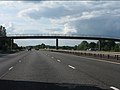
 Footbridge over the M40 - geograph.org.uk - 2461373.jpg 640 × 368; 29 KB
-

-
 Footpath through the Crop - geograph.org.uk - 3488986.jpg 640 × 480; 101 KB
-
 Forge Farm and Clattercote Wharf - geograph.org.uk - 4491744.jpg 1,024 × 654; 197 KB
-
 General shop, Cropredy - geograph.org.uk - 4577955.jpg 1,475 × 1,016; 576 KB
-
 Great Home Made Sign, Cropredy - geograph.org.uk - 3629317.jpg 1,066 × 800; 220 KB
-
-
 Jonah's Oak southeast of Cropredy - geograph.org.uk - 1326960.jpg 515 × 640; 130 KB
-
 Just North of Cropredy - geograph.org.uk - 3374887.jpg 3,872 × 2,592; 3.7 MB
-
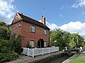 Lock keeper's cottage, Cropredy - geograph.org.uk - 5098484.jpg 640 × 480; 79 KB
-
 Lock on Oxford Canal at Cropredy - geograph.org.uk - 4398326.jpg 1,024 × 768; 202 KB
-
 Lock on the Oxford Canal at Cropredy - geograph.org.uk - 2336615.jpg 640 × 480; 98 KB
-

-

-
 M40 - footbridge - geograph.org.uk - 3250956.jpg 640 × 430; 30 KB
-
 M40 motorway - Crab Tree footbridge - geograph.org.uk - 3025524.jpg 640 × 480; 60 KB
-
 M40 northbound - geograph.org.uk - 3224341.jpg 640 × 480; 40 KB
-
 M40 south near Shotteswell - geograph.org.uk - 2829655.jpg 640 × 480; 34 KB
-

-

-
 Narrow Boat and Candle Sellers - geograph.org.uk - 3627896.jpg 1,066 × 800; 393 KB
-
 Narrow Boat and Tow Path, Oxford Canal - geograph.org.uk - 3629303.jpg 1,066 × 800; 279 KB
-
 Narrow Boats and Herb Sellers, Oxford Canal - geograph.org.uk - 3627901.jpg 1,066 × 800; 231 KB
-
 Narrow Boats, Oxford Canal - geograph.org.uk - 3627895.jpg 1,066 × 800; 358 KB
-
 Narrowboat next to Varney's Lock No 23 - geograph.org.uk - 4491780.jpg 1,024 × 768; 257 KB
-
 Narrowboats moored along the Oxford Canal - geograph.org.uk - 4491734.jpg 1,024 × 759; 262 KB
-
 Narrowboats moored along the Oxford Canal - geograph.org.uk - 4492337.jpg 1,024 × 772; 212 KB
-
 Near to Forge Farm - geograph.org.uk - 5914199.jpg 1,600 × 900; 491 KB
-
 North along Claydon Road towards Claydon - geograph.org.uk - 4500134.jpg 1,024 × 687; 244 KB
-

-

-
 Ordnance Survey Cut Mark - geograph.org.uk - 3593561.jpg 640 × 480; 140 KB
-
 Ordnance Survey Cut Mark - geograph.org.uk - 3593569.jpg 480 × 640; 130 KB
-
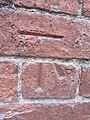 Ordnance Survey Cut Mark - geograph.org.uk - 3593582.jpg 480 × 640; 109 KB
-
 Ordnance Survey Cut Mark - geograph.org.uk - 3593594.jpg 480 × 640; 96 KB
-
 Ordnance Survey Cut Mark - geograph.org.uk - 3593611.jpg 480 × 640; 136 KB
-
 Ordnance Survey Cut Mark - geograph.org.uk - 3593616.jpg 480 × 640; 116 KB
-
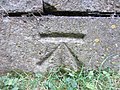 Ordnance Survey Cut Mark - geograph.org.uk - 3597209.jpg 640 × 480; 134 KB
-
 Ordnance Survey Sheet SP 44 Banbury, Published 1951.jpg 7,518 × 7,891; 4.95 MB
-
 Oxford Canal - geograph.org.uk - 125276.jpg 640 × 479; 79 KB
-
 Oxford Canal above Broadmoor Lock - geograph.org.uk - 6551615.jpg 1,280 × 851; 863 KB
-
 Oxford Canal at Cropredy - geograph.org.uk - 3629312.jpg 1,066 × 800; 232 KB
-
 Oxford Canal at Cropredy - geograph.org.uk - 3629313.jpg 1,066 × 800; 218 KB
-
 Oxford Canal at Cropredy, 1988 - geograph.org.uk - 4273655.jpg 2,394 × 1,550; 3.67 MB
-
 Oxford Canal from Cropredy Bridge - geograph.org.uk - 5480974.jpg 640 × 427; 92 KB
-
 Oxford Canal near Broadmoor Lock No 24 - geograph.org.uk - 4491801.jpg 1,024 × 654; 233 KB
-
 Oxford Canal south of Broadmoor Bridge - geograph.org.uk - 6143459.jpg 1,280 × 851; 528 KB
-
 Oxford Canal Walk - geograph.org.uk - 2679382.jpg 640 × 443; 77 KB
-
 Oxford Canal Walk - geograph.org.uk - 5192473.jpg 640 × 480; 78 KB
-
 Oxford Canal Walk - geograph.org.uk - 5192486.jpg 640 × 480; 78 KB
-
 Oxford Canal Walk - geograph.org.uk - 5192506.jpg 640 × 480; 54 KB
-
 Oxford Canal, Clattercote Wharf - geograph.org.uk - 6187071.jpg 1,024 × 742; 140 KB
-
 Oxford Canal, Cropredy - geograph.org.uk - 6142941.jpg 851 × 1,280; 378 KB
-
 Oxford Canal, Cropredy - geograph.org.uk - 6142953.jpg 1,280 × 851; 556 KB
-
 Oxford Canal, Cropredy - geograph.org.uk - 6262751.jpg 1,280 × 851; 453 KB
-
 Oxford Canal, Cropredy - geograph.org.uk - 729815.jpg 640 × 480; 96 KB
-
 Oxford Canal, Cropredy Lock Bridge Number 152 - geograph.org.uk - 6187717.jpg 1,024 × 768; 259 KB
-
 Oxford Canal, Cropredy Marina northern entrance - geograph.org.uk - 6187149.jpg 1,024 × 768; 161 KB
-
 Oxford Canal, Cropredy Marina southern entrance - geograph.org.uk - 6187155.jpg 1,024 × 768; 161 KB
-
 Oxford Canal, Elkington's Lock Number 22 - geograph.org.uk - 6187083.jpg 1,024 × 768; 190 KB
-

-

-

-
 Oxford Canal, Reach in Cropredy - geograph.org.uk - 6187723.jpg 1,024 × 768; 249 KB
-
 Oxford Canal, Reach south of Cropredy - geograph.org.uk - 6187755.jpg 1,024 × 768; 140 KB
-
 Oxford Canal, Reach south of Cropredy - geograph.org.uk - 6187783.jpg 1,024 × 768; 231 KB
-

-

-
 Oxford Canal-Broadmoor Lock - geograph.org.uk - 2627761.jpg 640 × 480; 111 KB
-
 Oxford Canal-Oathill Farm - geograph.org.uk - 2627706.jpg 640 × 480; 83 KB
-

-

-
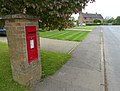 Postbox in Cropredy village - geograph.org.uk - 4499895.jpg 1,024 × 775; 241 KB
-
 Racehorse Gallop - geograph.org.uk - 3488976.jpg 640 × 480; 42 KB
-
 Railway bridge south of Cropredy - geograph.org.uk - 2947908.jpg 640 × 480; 107 KB
-
 Railway passing Cropredy - geograph.org.uk - 1474229.jpg 640 × 429; 97 KB
-
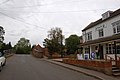
 Red Lion Street in Cropredy - geograph.org.uk - 4491995.jpg 1,024 × 656; 202 KB
-
 Red Lion Street, Cropredy, Oxfordshire - geograph.org.uk - 4398317.jpg 1,024 × 768; 186 KB
-
 Red Lion, Cropredy, late August 2016 - geograph.org.uk - 5098511.jpg 640 × 480; 66 KB
-
 River Cherwell, Cropredy - geograph.org.uk - 3629310.jpg 1,066 × 800; 271 KB
-

-

-
 Road turning for Appletree - geograph.org.uk - 2336623.jpg 640 × 480; 87 KB
-
 Rural Road - geograph.org.uk - 1531973.jpg 640 × 427; 65 KB
-
 Seat along Claydon Road in Cropredy - geograph.org.uk - 4500083.jpg 1,024 × 768; 394 KB
-
 Seat around a tree in Cropredy - geograph.org.uk - 5098521.jpg 480 × 640; 65 KB
-
 Seven Shires Way - geograph.org.uk - 2698801.jpg 640 × 480; 66 KB
-

-
 Site of the Battle of Cropredy - geograph.org.uk - 4238404.jpg 1,600 × 1,200; 726 KB
-
 Southam Road looking north - geograph.org.uk - 2836571.jpg 640 × 480; 41 KB
-
 Southern end of Cropredy High Street - geograph.org.uk - 4941860.jpg 4,000 × 3,000; 2.87 MB
-
 Sports pavilion at Cropredy - geograph.org.uk - 2336614.jpg 640 × 480; 63 KB
-
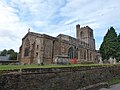
 St Mary the Virgin Church, Cropredy - geograph.org.uk - 4952997.jpg 1,400 × 1,050; 1.88 MB
-
 St Mary the Virgin parish church, Cropredy - geograph.org.uk - 4492027.jpg 1,024 × 798; 321 KB
-
 St Mary the Virgin parish church, Cropredy - geograph.org.uk - 4492193.jpg 1,024 × 716; 310 KB
-
 St Mary the Virgin, Cropredy - geograph.org.uk - 6353326.jpg 1,024 × 768; 251 KB
-


_-_geograph.org.uk_-_5097630.jpg)


_-_geograph.org.uk_-_1433041.jpg)


.jpg)


_-_geograph.org.uk_-_1326942.jpg)
_-_geograph.org.uk_-_1326947.jpg)


_-_geograph.org.uk_-_1326949.jpg)
_-_geograph.org.uk_-_1326951.jpg)


_-_geograph.org.uk_-_3562751.jpg)


_post_along_the_Oxford_Canal_-_geograph.org.uk_-_4491759.jpg)


_-_geograph.org.uk_-_3299393.jpg)
.jpg)


