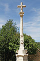
Category:Croix du village de Châtellenot
Jump to navigation
Jump to search
| Object location | | View all coordinates using: OpenStreetMap |
|---|
|
This building is classé au titre des monuments historiques de la France. It is indexed in the base Mérimée, a database of architectural heritage maintained by the French Ministry of Culture, under the reference PA00112691
|
wayside cross located in Côte-d'Or, in France  | |||||
| Upload media | |||||
| Instance of | |||||
|---|---|---|---|---|---|
| Location | Terrefondrée, canton of Recey-sur-Ource | ||||
| Street address |
| ||||
| Architectural style | |||||
| Heritage designation |
| ||||
 | |||||
Media in category "Croix du village de Châtellenot"
This category contains only the following file.
-
 Châtellenot FR21 croix IMG0083.jpg 3,456 × 5,184; 5.43 MB