Category:Croick, Strath Carron
Jump to navigation
Jump to search
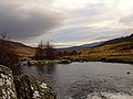
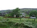
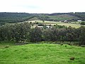
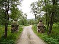
English: Croick is a small settlement in Strathcarron, within the Highland council area of Scotland. It is 15 km west of Ardgay, close to where the Black Water flows into the River Carron.
settlement in Strathcarron, Highland, Scotland, UK | |||||
| Upload media | |||||
| Instance of | |||||
|---|---|---|---|---|---|
| Location | Highland, Scottish Highlands, Scotland | ||||
 | |||||
Media in category "Croick, Strath Carron"
The following 101 files are in this category, out of 101 total.
-
 A Monument beside the River Carron - geograph.org.uk - 78360.jpg 640 × 480; 79 KB
-

-

-
 Allt nan Eun - geograph.org.uk - 792345.jpg 359 × 640; 63 KB
-
 Black Water Burn at Croick - geograph.org.uk - 301275.jpg 640 × 480; 152 KB
-
 Black Water Burn at Croick - geograph.org.uk - 301285.jpg 640 × 480; 168 KB
-
 Croick - geograph.org.uk - 797192.jpg 640 × 480; 73 KB
-
 Croick, Ross-shire - geograph-5932681.jpg 2,800 × 1,855; 2.64 MB
-
 Feur-lochan - geograph.org.uk - 768077.jpg 640 × 480; 69 KB
-

-
 Forest Farm Croick - geograph.org.uk - 724170.jpg 640 × 426; 191 KB
-
 Glen Calvie - geograph.org.uk - 19900.jpg 640 × 351; 69 KB
-
 Looking up the Srathcarron glen - geograph.org.uk - 50723.jpg 640 × 480; 107 KB
-
 Moorland above Croick - geograph.org.uk - 75110.jpg 640 × 424; 236 KB
-
 Rapidly departing adder - geograph.org.uk - 219262.jpg 640 × 510; 57 KB
-
 Strathcarron from Croick Kirk. - geograph.org.uk - 19109.jpg 640 × 419; 87 KB
-
 Strathcarron south shore road - geograph.org.uk - 504050.jpg 640 × 480; 104 KB
-
 The Bridge to Glen Calvie Lodge - geograph.org.uk - 78070.jpg 640 × 480; 104 KB
-
 The River Carron - geograph.org.uk - 441357.jpg 640 × 480; 173 KB
-
 The River Carron - geograph.org.uk - 441365.jpg 640 × 480; 150 KB
-
 The River Carron - geograph.org.uk - 78237.jpg 640 × 480; 76 KB
-
 The River Carron Water Fall - geograph.org.uk - 77853.jpg 640 × 480; 90 KB
-
 The River Carron Water Fall - geograph.org.uk - 78065.jpg 640 × 480; 93 KB
-
 The Strathcarron Road - geograph.org.uk - 441309.jpg 640 × 480; 195 KB
-
 Whale Cottage - geograph.org.uk - 43334.jpg 640 × 480; 100 KB
-
 'Mystery Box', Crom Loch - geograph.org.uk - 877945.jpg 640 × 360; 74 KB
-
 Achadh nan Damh - geograph.org.uk - 216809.jpg 640 × 480; 117 KB
-
 Alladale - geograph.org.uk - 216826.jpg 640 × 480; 54 KB
-
 Alladale Lodge - geograph.org.uk - 216822.jpg 640 × 480; 129 KB
-
 Alladale Lodge - geograph.org.uk - 770491.jpg 640 × 480; 88 KB
-
 Alladale River - geograph.org.uk - 219054.jpg 640 × 480; 76 KB
-
 Allt a' Chlaginn - geograph.org.uk - 217692.jpg 640 × 480; 91 KB
-
 Allt Mòr - geograph.org.uk - 777851.jpg 640 × 449; 246 KB
-
 Allt nan Eun - geograph.org.uk - 792192.jpg 640 × 480; 90 KB
-
 Allt nan Eun - geograph.org.uk - 792239.jpg 640 × 480; 87 KB
-
 Allt Riabhach - geograph.org.uk - 216829.jpg 640 × 480; 127 KB
-
 Allt Riabhach - geograph.org.uk - 217470.jpg 640 × 480; 92 KB
-
 An Old Peat Bank on Mell nan Eun - geograph.org.uk - 80732.jpg 640 × 480; 69 KB
-
 Ben Wyvis from Carn Salachaidh - geograph.org.uk - 792446.jpg 640 × 480; 83 KB
-
 Beside the Carron - geograph.org.uk - 797214.jpg 640 × 480; 147 KB
-
 Birches, Strathcarron - geograph.org.uk - 797607.jpg 640 × 480; 70 KB
-
 Black Water Burn at Croick - geograph.org.uk - 301267.jpg 640 × 480; 169 KB
-
 Blàr nan Con - geograph.org.uk - 216696.jpg 640 × 480; 106 KB
-
 Blàr nan Con - geograph.org.uk - 216703.jpg 640 × 480; 99 KB
-
 Boat at Loch Chuinneag - geograph.org.uk - 642239.jpg 640 × 480; 76 KB
-
 Bridge - geograph.org.uk - 43631.jpg 640 × 480; 116 KB
-
 Bridge over Garbh Allt - geograph.org.uk - 663404.jpg 640 × 426; 293 KB
-
 Bridge over the Salachie Burn - geograph.org.uk - 448593.jpg 640 × 480; 152 KB
-
 Building works at Alladale - geograph.org.uk - 642367.jpg 640 × 360; 62 KB
-
 Carn Alladale - geograph.org.uk - 217474.jpg 640 × 480; 114 KB
-
 Carn Alladale - geograph.org.uk - 217476.jpg 640 × 480; 86 KB
-
 Carn Alladale - geograph.org.uk - 217499.jpg 640 × 480; 116 KB
-
 Carn Alladale - geograph.org.uk - 217503.jpg 640 × 480; 100 KB
-
 Carn Chuinneag - geograph.org.uk - 727519.jpg 640 × 480; 65 KB
-
 Carn Maire - geograph.org.uk - 642274.jpg 640 × 360; 38 KB
-
 Coire nam Fiadh - geograph.org.uk - 217505.jpg 640 × 480; 105 KB
-
 Craigs Farm - geograph.org.uk - 504040.jpg 640 × 480; 104 KB
-
 Càrn Mòr - geograph.org.uk - 777831.jpg 640 × 409; 185 KB
-
 Easan nan Toll Dubha - geograph.org.uk - 216814.jpg 480 × 640; 168 KB
-
 Eastern slopes of Carn Alladale. - geograph.org.uk - 217472.jpg 640 × 480; 99 KB
-

-
 Forest marsh - geograph.org.uk - 216815.jpg 480 × 640; 135 KB
-
 Forest, Strathcarron - geograph.org.uk - 216705.jpg 640 × 480; 135 KB
-
 Gate on the Gleann Mòr road - geograph.org.uk - 504008.jpg 640 × 480; 112 KB
-
 Gate, Alladale - geograph.org.uk - 216824.jpg 640 × 480; 141 KB
-
-
 Glaschoill - geograph.org.uk - 301301.jpg 640 × 480; 170 KB
-
 Glaschoill - geograph.org.uk - 301316.jpg 640 × 480; 152 KB
-
 Gleann Mor - geograph.org.uk - 33462.jpg 640 × 416; 60 KB
-
 Gleann Mòr - geograph.org.uk - 503997.jpg 640 × 480; 98 KB
-
 Glen Alladale - geograph.org.uk - 217473.jpg 640 × 480; 75 KB
-
 Glen Alladale - geograph.org.uk - 219055.jpg 640 × 480; 89 KB
-
 Glen Alladale - geograph.org.uk - 32896.jpg 640 × 366; 44 KB
-

-

-
 Looking towards Diebidale - geograph.org.uk - 448600.jpg 640 × 480; 130 KB
-
 Meall nam Fuaran - geograph.org.uk - 217696.jpg 640 × 480; 77 KB
-
 Meall nan Eun - geograph.org.uk - 80733.jpg 640 × 480; 109 KB
-
 Old tree, Glen Alladale - geograph.org.uk - 219060.jpg 640 × 480; 108 KB
-
 Pig enclosure, Glen Alladale - geograph.org.uk - 217770.jpg 640 × 480; 70 KB
-
 Pine wood regeneration,Glen Alladale - geograph.org.uk - 32895.jpg 640 × 375; 55 KB
-
 River Carron - geograph.org.uk - 43327.jpg 640 × 480; 123 KB
-
 River Carron - geograph.org.uk - 43332.jpg 640 × 480; 142 KB
-
 River Carron - geograph.org.uk - 50731.jpg 640 × 480; 139 KB
-
 River Carron - geograph.org.uk - 50742.jpg 640 × 480; 153 KB
-
 River Carron view - geograph.org.uk - 50712.jpg 640 × 480; 106 KB
-
 Ruins of Croft at Garvalt - geograph.org.uk - 663400.jpg 640 × 426; 238 KB
-
 Ruins of Croft Garvalt - geograph.org.uk - 663396.jpg 640 × 411; 213 KB
-
 Scots pine woods, Carn Alladale - geograph.org.uk - 219258.jpg 640 × 480; 110 KB
-
 Sgodachail in Srathcarron - geograph.org.uk - 50748.jpg 640 × 480; 113 KB
-
 Sheepfolds - geograph.org.uk - 504020.jpg 640 × 480; 68 KB
-
 Sika Stags - geograph.org.uk - 301331.jpg 640 × 444; 148 KB
-

-
 Sròn Gun Aran - geograph.org.uk - 219049.jpg 480 × 640; 74 KB
-
 Strath Cuileannach - geograph.org.uk - 129106.jpg 544 × 388; 28 KB
-
 Strath Cuileannach - geograph.org.uk - 301323.jpg 640 × 480; 172 KB
-

-
 The River Carron - geograph.org.uk - 629648.jpg 800 × 600; 338 KB
-
 Tor na Cloiche Glaise - geograph.org.uk - 50718.jpg 640 × 480; 115 KB
-
 Waterfall, Alladale River - geograph.org.uk - 56454.jpg 640 × 479; 151 KB
-
 Welcome to Jurassic Park - geograph.org.uk - 216817.jpg 640 × 480; 149 KB


