Category:Crib Goch
Jump to navigation
Jump to search
mountain (923m) in Gwynedd  Crib Goch | |||||
| Upload media | |||||
| Instance of | |||||
|---|---|---|---|---|---|
| Part of | |||||
| Located in protected area | |||||
| Location | Gwynedd, Wales | ||||
| Mountain range | |||||
| Topographic prominence |
| ||||
| Elevation above sea level |
| ||||
| Parent peak | |||||
 | |||||
Subcategories
This category has the following 2 subcategories, out of 2 total.
C
- Crib Goch from the East (91 F)
S
- Snowdon from Crib Goch (49 F)
Media in category "Crib Goch"
The following 191 files are in this category, out of 191 total.
-
 1123 12 Snowdonia Llwybr-y-Mwynwyr.jpg 1,280 × 960; 293 KB
-
 A hint of the challenge of Crib Goch - geograph.org.uk - 488540.jpg 640 × 480; 45 KB
-

-

-
 A view of Crib Goch from the Pyg track - geograph.org.uk - 770636.jpg 480 × 640; 213 KB
-

-

-

-

-

-

-

-

-
-
 A welcome sight - geograph.org.uk - 275260.jpg 480 × 640; 140 KB
-
 A wider section of Crib Goch - geograph.org.uk - 3018580.jpg 3,968 × 2,976; 2.8 MB
-
 A Winter's Morning - Flickr - Petersrockypics.jpg 1,920 × 1,280; 1.29 MB
-
 Approaching the first pinnacle on Crib Goch - geograph.org.uk - 6434899.jpg 1,600 × 1,067; 744 KB
-
 Approaching the pinnacles of Grib Goch - geograph.org.uk - 6432987.jpg 1,600 × 1,086; 535 KB
-

-
 Bwlch Coch - geograph.org.uk - 841171.jpg 480 × 640; 158 KB
-

-

-
 Cairn on Crib Goch - geograph.org.uk - 4167726.jpg 4,000 × 3,000; 3.79 MB
-

-
 Climbing up Crib Goch - geograph.org.uk - 3018555.jpg 3,968 × 2,976; 2.77 MB
-
 Crib Goch - 20 Aug 2007.JPG 3,648 × 2,736; 3.09 MB
-
 Crib Goch - geograph.org.uk - 1022218.jpg 640 × 480; 201 KB
-
 Crib Goch - geograph.org.uk - 1216751.jpg 640 × 480; 60 KB
-
 Crib Goch - geograph.org.uk - 126985.jpg 640 × 469; 64 KB
-
 Crib Goch - geograph.org.uk - 3290136.jpg 640 × 480; 141 KB
-
 Crib Goch - geograph.org.uk - 3480190.jpg 640 × 480; 76 KB
-
 Crib Goch - geograph.org.uk - 353320.jpg 640 × 480; 128 KB
-
 Crib Goch - geograph.org.uk - 46824.jpg 640 × 480; 111 KB
-
 Crib Goch - geograph.org.uk - 46931.jpg 640 × 480; 86 KB
-
 Crib Goch - geograph.org.uk - 477557.jpg 480 × 640; 40 KB
-
 Crib Goch - geograph.org.uk - 885201.jpg 640 × 480; 72 KB
-
 Crib Goch - geograph.org.uk - 887482.jpg 640 × 480; 69 KB
-
 Crib Goch - geograph.org.uk - 892403.jpg 640 × 480; 46 KB
-
 Crib Goch above Llyn Llydaw - geograph.org.uk - 4281948.jpg 4,608 × 3,456; 5.41 MB
-
 Crib Goch and Crib y Ddysgl viewed from Y Glyderau - geograph.org.uk - 6674723.jpg 2,007 × 1,461; 625 KB
-

-
 Crib Goch and the Pinnacles - geograph.org.uk - 1286572.jpg 640 × 480; 80 KB
-
 Crib Goch and Yr Wyddfa - geograph.org.uk - 1243055.jpg 633 × 640; 114 KB
-
 Crib Goch beyond Llyn Llydaw - geograph.org.uk - 4281960.jpg 4,608 × 3,456; 5.19 MB
-
 Crib Goch from Bwlch y Saethau - geograph.org.uk - 4281938.jpg 4,608 × 3,456; 5.72 MB
-
 Crib Goch from Llyn Cwmffynnon - geograph.org.uk - 334090.jpg 480 × 547; 174 KB
-
 Crib Goch from near Garnedd Ugain - geograph.org.uk - 64947.jpg 640 × 480; 93 KB
-
 Crib Goch from part way up Y Lliwedd - geograph.org.uk - 4281959.jpg 4,608 × 3,456; 6.16 MB
-
 Crib Goch from Snowdon summit ridge - geograph.org.uk - 4919793.jpg 2,048 × 1,536; 547 KB
-

-
 Crib Goch from the First Pinnacle - geograph.org.uk - 64945.jpg 480 × 640; 100 KB
-
 Crib Goch from the Miners' Track - geograph.org.uk - 307393.jpg 640 × 480; 81 KB
-
 Crib Goch from the Pyg Track - geograph.org.uk - 6394346.jpg 2,304 × 1,728; 1.93 MB
-
 Crib Goch from Watkin Path - geograph.org.uk - 1449718.jpg 640 × 380; 57 KB
-
 Crib goch in north wales arp.jpg 1,575 × 2,205; 3.52 MB
-
 Crib Goch o'r Wyddfa.jpg 5,184 × 2,920; 20.02 MB
-
 Crib goch ridge arp.jpg 2,059 × 3,027; 5.81 MB
-
 Crib Goch ridge from the Pyg track - geograph.org.uk - 774310.jpg 640 × 480; 105 KB
-
 Crib Goch Ridge in cloud.jpg 3,888 × 2,592; 2.9 MB
-
 Crib Goch Ridge.jpg 3,888 × 2,592; 4.75 MB
-
 Crib Goch ridge.jpg 4,000 × 2,436; 2.12 MB
-
 Crib Goch Ridges.JPG 3,648 × 2,736; 4.4 MB
-
 Crib Goch Scrambling.jpg 557 × 768; 177 KB
-
 Crib goch with walker astride arp.jpg 2,074 × 3,039; 5.06 MB
-
 Crib Goch – zoom shot - geograph.org.uk - 4281953.jpg 4,608 × 3,456; 5.89 MB
-
 Crib Goch, first pinnacle - geograph.org.uk - 4167762.jpg 4,000 × 3,000; 3.08 MB
-

-
 Crib Goch, gap between the first and second pinnacles - geograph.org.uk - 4167774.jpg 3,000 × 4,000; 3.49 MB
-

-
 Crib Goch, Nice Weather ^ - geograph.org.uk - 477555.jpg 480 × 640; 42 KB
-
 Crib Goch, on top of the third pinnacle - geograph.org.uk - 4167794.jpg 3,554 × 2,665; 2.54 MB
-

-
 Crib Goch, second pinnacle - geograph.org.uk - 4167773.jpg 3,866 × 2,899; 3.68 MB
-
 Crib Goch, second pinnacle - geograph.org.uk - 4167778.jpg 2,919 × 3,892; 4.63 MB
-
 Crib Goch, Snowdonia - geograph.org.uk - 1204019.jpg 640 × 453; 97 KB
-
 Crib Goch, Snowdonia, Wales - August 2007.jpg 5,623 × 2,800; 5.53 MB
-

-
 Crib Goch.jpg 1,500 × 1,120; 330 KB
-
 Crib-Goch - geograph.org.uk - 1014908.jpg 433 × 640; 141 KB
-
 CribGoch01LB.jpg 1,600 × 1,200; 424 KB
-
 Cwm Dyli pipeline - geograph.org.uk - 150015.jpg 640 × 480; 97 KB
-
 David Cox (II) - Welsh Mountain Stream (c.1850).jpg 5,000 × 3,489; 3.71 MB
-
 Dolerite intrusion - geograph.org.uk - 1373107.jpg 640 × 480; 97 KB
-
 DSCN4572-crib-goch-to-snowdon crop b.jpg 1,200 × 1,200; 211 KB
-
 Edge of Crib Coch.jpg 480 × 640; 23 KB
-

-
 Glaslyn and Yr Wyddfa from Crib Goch - geograph.org.uk - 1243060.jpg 629 × 640; 99 KB
-
 Grib Goch - geograph.org.uk - 2933309.jpg 640 × 467; 67 KB
-
 Grib Goch from Cwm Uchaf - geograph.org.uk - 224428.jpg 480 × 640; 94 KB
-
 Grib Goch from Snowdon Great Gully - geograph.org.uk - 1692416.jpg 768 × 1,024; 190 KB
-
 Grib Goch's North Ridge - geograph.org.uk - 224096.jpg 480 × 640; 86 KB
-
 Heading along Crib Goch's ridge - geograph.org.uk - 4167751.jpg 4,000 × 3,000; 2.44 MB
-
 Lakeside recreational area - geograph.org.uk - 1274162.jpg 640 × 480; 55 KB
-
 Llyn Cwmffynnon and Crib Goch - geograph.org.uk - 885257.jpg 640 × 480; 80 KB
-
 Llyn Ffynnon from Crib Goch.jpg 3,788 × 2,540; 3.98 MB
-

-
 Llyn Padarn from Penllyn on a March day - geograph.org.uk - 1768452.jpg 1,024 × 769; 193 KB
-
 Look back along the Crib Goch ridge - geograph.org.uk - 3018583.jpg 3,968 × 2,976; 3.1 MB
-
 Look back at Crib Goch - geograph.org.uk - 3018609.jpg 3,968 × 2,976; 3.23 MB
-
 Looking up at Crib Goch. (14663048598).jpg 4,288 × 2,848; 14.35 MB
-
 Moraine below Cwm Uchaf - geograph.org.uk - 1373445.jpg 640 × 480; 85 KB
-
 Mossy waterfall - geograph.org.uk - 1373179.jpg 480 × 640; 93 KB
-
 Near Crib Goch's summit - geograph.org.uk - 4167756.jpg 4,000 × 3,000; 2.53 MB
-
 On Crib Goch - geograph.org.uk - 4167758.jpg 4,000 × 3,000; 3.54 MB
-
 On the climb to Crib Goch - geograph.org.uk - 4167730.jpg 3,000 × 4,000; 3.62 MB
-
 On the Crib Goch arête - geograph.org.uk - 3018569.jpg 3,968 × 2,976; 2.75 MB
-
 On the Crib Goch ridge - geograph.org.uk - 6434894.jpg 1,600 × 1,067; 639 KB
-
 On the first pinnacle of the Crib Gogh ridge - geograph.org.uk - 6433343.jpg 1,600 × 1,082; 546 KB
-
 On the pinnacle ridge of Crib Goch (Snowdon) - geograph.org.uk - 6487525.jpg 1,200 × 1,800; 406 KB
-
 Path from Garnedd Ugain to Crib Goch - geograph.org.uk - 3480196.jpg 640 × 480; 90 KB
-
 Pyg Track marker post - geograph.org.uk - 275783.jpg 480 × 640; 109 KB
-
 Pyg Trail on the East Ridge of Mount Snowdon, Wales.jpg 1,600 × 1,200; 606 KB
-
 Railway and Crib Goch, Snowdon, Wales LOC 3751624573.jpg 1,024 × 774; 293 KB
-
 Railway and Crib Goch, Snowdon, Wales-LCCN2001703550.jpg 3,636 × 2,747; 3.76 MB
-
 Resting on Crib Goch.jpg 2,304 × 1,728; 709 KB
-
 Retrospect of Crib Goch ridge from Bwlch Coch - geograph.org.uk - 3018604.jpg 3,968 × 2,976; 2.76 MB
-
 Rocky outcrop beside the first pinnacle of Crib Goch - geograph.org.uk - 4167763.jpg 4,000 × 3,000; 3.2 MB
-
 Snowdon Horseshoe from Glyder Fawr - geograph.org.uk - 1275642.jpg 640 × 480; 88 KB
-
 Snowdon Horseshoe.jpg 2,195 × 1,136; 779 KB
-
 Snowdonia banner.jpg 2,100 × 300; 438 KB
-
 Solar Glory and Brocken spectre 1.jpg 2,588 × 3,888; 2.99 MB
-
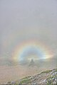
 Solar glory from Crib Goch 1.jpg 2,202 × 1,467; 579 KB
-
 Start of a route up Crib Goch - geograph.org.uk - 886398.jpg 640 × 480; 72 KB
-
 Starting off along Crib Goch's ridge - geograph.org.uk - 4167748.jpg 3,690 × 2,767; 2.43 MB
-
 Steep shoulder up Crib Goch - geograph.org.uk - 3018559.jpg 3,968 × 2,976; 2.78 MB
-
 The A4086 from the Cwmffynnon Ridge - geograph.org.uk - 244822.jpg 640 × 480; 103 KB
-

-
 The Crib Goch Ridge - geograph.org.uk - 339540.jpg 640 × 480; 59 KB
-
 The Crib of Crib Goch - geograph.org.uk - 307401.jpg 640 × 480; 45 KB
-
 The departure of the more intrepid - geograph.org.uk - 445671.jpg 640 × 480; 104 KB
-

-
 The icy Pyg Track and Crib Goch - geograph.org.uk - 1187121.jpg 640 × 480; 129 KB
-
 The lower section of the Fachwen Road - geograph.org.uk - 1757385.jpg 768 × 1,024; 295 KB
-
 The miners Track crossing Llyn Llydaw - geograph.org.uk - 64942.jpg 640 × 480; 67 KB
-
 The Miners' Path - geograph.org.uk - 590835.jpg 640 × 382; 70 KB
-
 The Pinnacles - geograph.org.uk - 1018711.jpg 640 × 480; 92 KB
-
 The Pyg track - geograph.org.uk - 748429.jpg 1,000 × 669; 411 KB
-
 The Pyg track - geograph.org.uk - 885238.jpg 640 × 480; 93 KB
-
 The Pyg Track below Crib Goch - geograph.org.uk - 278196.jpg 640 × 427; 56 KB
-
 The Pyg track. - geograph.org.uk - 885221.jpg 640 × 480; 72 KB
-

-

-
 The Sports Field at Ysgol Brynrefail - geograph.org.uk - 1724437.jpg 3,264 × 2,448; 1.87 MB
-
 The start of the Crib Goch path - geograph.org.uk - 1022228.jpg 640 × 480; 229 KB
-

-
 The top of Llanberis Pass and Crib Goch - geograph.org.uk - 1768194.jpg 768 × 1,024; 206 KB
-
 The upper car park at Pen-y-pass - geograph.org.uk - 445281.jpg 640 × 480; 93 KB
-
 The way to Crib Goch - geograph.org.uk - 1018722.jpg 640 × 480; 74 KB
-
 Towards Crib Goch - geograph.org.uk - 531701.jpg 640 × 462; 111 KB
-

-
 View across to Crib Goch from the Glyder Path - geograph.org.uk - 1768213.jpg 1,024 × 707; 241 KB
-

-
 View from Bwlch y Moch - geograph.org.uk - 1187357.jpg 640 × 480; 144 KB
-
 View from close to Pen-y-pass - geograph.org.uk - 585747.jpg 640 × 480; 96 KB
-
 View from Moel Meirch - north north west - geograph.org.uk - 1428805.jpg 640 × 427; 158 KB
-
 View from Moel Meirch - west north west - geograph.org.uk - 1428800.jpg 640 × 427; 164 KB
-
 View north northeast from Bwlch Ciliau - geograph.org.uk - 660542.jpg 800 × 600; 210 KB
-
 View towards Cnicht from Moelwyn Mawr - geograph.org.uk - 874872.jpg 640 × 415; 89 KB
-
 View towards Crib Goch - geograph.org.uk - 1071633.jpg 421 × 640; 98 KB
-
 View towards Crib Goch - geograph.org.uk - 748394.jpg 1,000 × 696; 343 KB
-

-
 View towards Garnedd Ugain and Crib Goch - geograph.org.uk - 1490189.jpg 640 × 480; 146 KB
-
 View towards the Llanberis Pass - geograph.org.uk - 460293.jpg 640 × 480; 181 KB
-
 View up to the Crib Goch ridge - geograph.org.uk - 1190056.jpg 640 × 480; 174 KB
-
 Walkers on Grib Goch - geograph.org.uk - 223868.jpg 640 × 343; 26 KB
-
 Walking up Crib Goch - geograph.org.uk - 3480186.jpg 640 × 480; 96 KB
-

-
 White rocks on Crib Goch - geograph.org.uk - 3480192.jpg 640 × 480; 86 KB
-
 Winter solstice dawn over Llanrug - geograph.org.uk - 296447.jpg 640 × 480; 39 KB
-
 Wyddfa a Crib Goch o Gilfach Ddu, Dinorwig.jpg 3,665 × 3,665; 5.45 MB
-

-

-

-

-

-

-

-

-
 Y Lliwedd - geograph.org.uk - 1468590.jpg 640 × 463; 39 KB
-
 Y Lliwedd from Crib Goch east ridge in winter.jpeg 3,648 × 2,736; 2.62 MB
-

-
 Approaching Dinorwig - geograph.org.uk - 809226.jpg 640 × 480; 73 KB
-
 Bwlch Coch from Cwm Uchaf - geograph.org.uk - 224146.jpg 640 × 480; 85 KB
-
 Copper Mine Building - geograph.org.uk - 531604.jpg 640 × 480; 156 KB
-
 Gnarled conifers amidst rocks - geograph.org.uk - 398509.jpg 640 × 480; 105 KB
-
 Grib Goch from the Pyg Track - geograph.org.uk - 262706.jpg 640 × 436; 81 KB
-
 Llyn Glas - geograph.org.uk - 591236.jpg 640 × 480; 115 KB
-

-
 Zoom shot of the pinnacles on Crib Goch - geograph.org.uk - 3018572.jpg 3,968 × 2,976; 2.82 MB
-
 The Rocky Track to Cwm Padrig - geograph.org.uk - 220993.jpg 640 × 480; 130 KB


_and_Garnedd_Ugain_(1065m)_-_geograph.org.uk_-_1017759.jpg)


_-_Welsh_Mountain_Stream_(c.1850).jpg)


.jpg)


_-_geograph.org.uk_-_6487525.jpg)


,_Gwynedd,_Cymru_(Wales)_76.jpg)
,_Gwynedd,_Cymru_(Wales)_79.jpg)
,_Gwynedd,_Cymru_(Wales)_80.jpg)
,_Gwynedd,_Cymru_(Wales)_83.jpg)
,_Gwynedd,_Cymru_(Wales)_90.jpg)
,_Gwynedd,_Cymru_(Wales)_91.jpg)


,_Gwynedd,_Cymru_(Wales)_81.jpg)
,_Gwynedd,_Cymru_(Wales)_88.jpg)