Category:Creu de terme de Bell-lloc d'Urgell
Jump to navigation
Jump to search
| Object location | | View all coordinates using: OpenStreetMap |
|---|
 | |||||
| Upload media | |||||
| Instance of | |||||
|---|---|---|---|---|---|
| Location | Bell-lloc d'Urgell, Pla d'Urgell, Province of Lleida, Catalonia | ||||
| Heritage designation | |||||
 | |||||
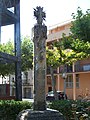
Català: Creu de terme de Bell-lloc d'Urgell (Pla d'Urgell)
This is a category about a building listed in the Catalan heritage register as Bé Cultural d'Interès Local (BCIL) under the reference IPA-14725. |
Media in category "Creu de terme de Bell-lloc d'Urgell"
The following 2 files are in this category, out of 2 total.
-
 BellocCreu01.JPG 2,736 × 3,648; 2.39 MB
-
 BellocCreu03.JPG 2,048 × 1,536; 661 KB
