Category:Creeting St Mary
Jump to navigation
Jump to search
English: Creeting St Mary is a village and civil parish in the Mid Suffolk district of Suffolk in eastern England. Sandwiched between the A14 and A140 to the north of Needham Market, the parish also includes the hamlet of Creeting Bottoms. In 2005 its population was 710. The buck of a windmill survives in the village. It was used as a dovecote after ceasing to be a windmill.
village in the United Kingdom | |||||
| Upload media | |||||
| Instance of | |||||
|---|---|---|---|---|---|
| Location | Mid Suffolk, Suffolk, East of England, England | ||||
| Population |
| ||||
 | |||||
Subcategories
This category has the following 12 subcategories, out of 12 total.
Media in category "Creeting St Mary"
The following 200 files are in this category, out of 238 total.
(previous page) (next page)-
 A14 off Coddenham Road - geograph.org.uk - 4917086.jpg 3,072 × 2,304; 1.83 MB
-
 A14 off Coddenham Road - geograph.org.uk - 4917091.jpg 3,072 × 2,304; 1.84 MB
-
 A14, North of Needham Market - geograph.org.uk - 3846043.jpg 640 × 427; 294 KB
-
 A14, westbound - geograph.org.uk - 4121048.jpg 640 × 430; 61 KB
-
 A14, westbound - geograph.org.uk - 4790901.jpg 640 × 426; 51 KB
-
 A140 junction with B1078 - geograph.org.uk - 3605799.jpg 3,648 × 2,736; 1.96 MB
-
 A140 Kettle Lane, Coddenham Green - geograph.org.uk - 4898927.jpg 2,825 × 2,117; 3.47 MB
-
 A140 Norwich Road ^ footpath - geograph.org.uk - 4918690.jpg 3,072 × 2,304; 1.78 MB
-
 A140 Norwich Road, Creeting St.Mary - geograph.org.uk - 4918015.jpg 3,072 × 2,304; 1.85 MB
-
 A140 Norwich Road, Creeting St.Mary - geograph.org.uk - 4918198.jpg 3,072 × 2,304; 1.82 MB
-
 A140 towards Beacon Hill - geograph.org.uk - 4807175.jpg 640 × 480; 47 KB
-
 A140 towards Ipswich - geograph.org.uk - 4672334.jpg 640 × 480; 57 KB
-
 A140, Creeting Bottoms - geograph.org.uk - 4250529.jpg 640 × 430; 50 KB
-
 A140, northbound - geograph.org.uk - 4250481.jpg 640 × 391; 48 KB
-
 A140, northbound - geograph.org.uk - 4250500.jpg 640 × 430; 45 KB
-
 A140, northbound - geograph.org.uk - 4250527.jpg 640 × 411; 53 KB
-
 Aggregates Trail bench - geograph.org.uk - 4066014.jpg 640 × 480; 112 KB
-
 Alder Carr Farm Shop ^ Deli sign - geograph.org.uk - 4959133.jpg 2,970 × 2,225; 2.94 MB
-
 Beacon Hill Travelodge - geograph.org.uk - 4917148.jpg 3,072 × 2,304; 1.85 MB
-
 Beacon Hill Travelodge - geograph.org.uk - 4917199.jpg 3,072 × 2,304; 1.98 MB
-
 Bifurcated boardwalk - geograph.org.uk - 1216910.jpg 640 × 480; 181 KB
-
 Birds feeding by Needham Lake - geograph.org.uk - 2188796.jpg 4,000 × 3,000; 3.68 MB
-
 Bosemere by-pass - geograph.org.uk - 2188788.jpg 4,000 × 3,000; 4.6 MB
-
 Bosmere Lock - geograph.org.uk - 4478935.jpg 2,736 × 3,648; 4.34 MB
-
 Bosmere Lock - geograph.org.uk - 4478939.jpg 3,648 × 2,736; 3.84 MB
-
 Breheny Civil Engineering sign - geograph.org.uk - 4899149.jpg 2,970 × 2,225; 3 MB
-

-

-
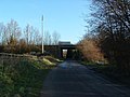
 Bridge over the A14 - geograph.org.uk - 4121050.jpg 640 × 430; 59 KB
-
 Bridge over the A14 - geograph.org.uk - 4790903.jpg 640 × 426; 51 KB
-
 Bridleway near Holt's Lane - geograph.org.uk - 6910423.jpg 6,000 × 4,000; 6.12 MB
-
 Bridleway near Holt's Lane - geograph.org.uk - 6910449.jpg 6,000 × 4,000; 6.93 MB
-
 Bridleway Sign on Coddenham Road - geograph.org.uk - 4917108.jpg 2,304 × 2,764; 3.25 MB
-
 Bridleway to Holt's Lane - geograph.org.uk - 4916727.jpg 3,072 × 2,304; 1.84 MB
-
 Bridleway towards Needham Market - geograph.org.uk - 6903910.jpg 6,000 × 4,000; 6.11 MB
-
 Bridleway towards Needham Market - geograph.org.uk - 6903911.jpg 6,000 × 4,000; 6.27 MB
-
 Creating St.Mary Village Name sign on All Saints Road - geograph.org.uk - 4918620.jpg 3,007 × 2,253; 4.59 MB
-
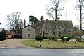 Creeting House - geograph.org.uk - 1108155.jpg 640 × 431; 95 KB
-

-
 Creeting St Mary Village Name sign - geograph.org.uk - 4511125.jpg 2,189 × 2,910; 2.75 MB
-
 Creeting St Mary Village Name sign on Flordon Road - geograph.org.uk - 4898953.jpg 2,951 × 2,210; 3.11 MB
-
 Creeting St Mary Village Name sign on St.Mary's Road - geograph.org.uk - 4959117.jpg 3,072 × 2,304; 1.92 MB
-
 Creeting St. Mary, 'Whissel's House' - geograph.org.uk - 6823707.jpg 6,982 × 4,654; 5.85 MB
-

-
 Creeting St. Mary, All Saints Road, House - geograph.org.uk - 6823713.jpg 3,483 × 2,322; 1.34 MB
-
 Creeting St. Mary, All Saints Road, House - geograph.org.uk - 6823716.jpg 3,344 × 2,230; 977 KB
-
 Creeting St. Mary, All Saints Road, Houses - geograph.org.uk - 6823719.jpg 6,469 × 4,313; 7.01 MB
-
 Creeting St.Mary Village Hall - geograph.org.uk - 1119394.jpg 3,072 × 2,304; 1.29 MB
-
 Crop field near Vale Farm - geograph.org.uk - 4807170.jpg 640 × 480; 56 KB
-
 Desirable residences - geograph.org.uk - 1748329.jpg 1,024 × 697; 412 KB
-
 Dual carriageway ends, A140 - geograph.org.uk - 4250485.jpg 640 × 390; 56 KB
-
 Earl Stonham, 'Elm Vale' - geograph.org.uk - 6823691.jpg 6,227 × 4,152; 5.51 MB
-
 Earl Stonham, Bungalow under construction - geograph.org.uk - 6823701.jpg 5,104 × 3,403; 4.64 MB
-
 Earl Stonham, Electricity transmission lines - geograph.org.uk - 6823705.jpg 7,201 × 4,801; 4.04 MB
-
 Earl Stonham, House - geograph.org.uk - 6823698.jpg 4,902 × 3,268; 3.55 MB
-
 Eastbound A14 - geograph.org.uk - 3846045.jpg 640 × 427; 264 KB
-
 Eastbound A14 - geograph.org.uk - 3846051.jpg 640 × 480; 296 KB
-
 Eastbound A14 near Creeting St Mary - geograph.org.uk - 3846041.jpg 640 × 480; 316 KB
-
 Entering Creating St.Mary on All Saints Road - geograph.org.uk - 4918621.jpg 3,033 × 2,249; 2.74 MB
-
 Entering Creeting St.Mary on Flordon Road - geograph.org.uk - 4898951.jpg 3,033 × 2,174; 3.05 MB
-
 Entering Creeting St.Mary on St.Mary's Road - geograph.org.uk - 4959113.jpg 3,072 × 2,304; 1.77 MB
-
 Entering Needham Market on the B1078 Coddenhan Road - geograph.org.uk - 4899347.jpg 2,751 × 2,064; 2.47 MB
-
 Entering the A14 - geograph.org.uk - 3664442.jpg 2,890 × 2,101; 747 KB
-
 Entrance to Alder Carr Farm - geograph.org.uk - 4959128.jpg 3,072 × 2,222; 2.4 MB
-
 Entrance to Breheny - geograph.org.uk - 4899144.jpg 3,072 × 2,304; 1.86 MB
-
 Entrance to Material Change Ltd at Watering Farm - geograph.org.uk - 4902615.jpg 3,072 × 1,981; 1.94 MB
-
 Event at Alder Carr Farm Shop - geograph.org.uk - 5434283.jpg 640 × 428; 106 KB
-
 Farm building, Creeting St Mary - geograph.org.uk - 4706822.jpg 640 × 480; 45 KB
-
 Farm building, Grange Farm - geograph.org.uk - 4666386.jpg 640 × 480; 59 KB
-
 Farm buildings near The Grange - geograph.org.uk - 4706837.jpg 640 × 480; 54 KB
-
 Farm track and public footpath towards Home Farm - geograph.org.uk - 6938836.jpg 6,000 × 4,000; 6.71 MB
-
 Farmland off Buck's Head Lane - geograph.org.uk - 4916390.jpg 3,072 × 2,304; 1.8 MB
-
 Farmland off Buck's Head Lane - geograph.org.uk - 4916411.jpg 3,072 × 2,304; 1.96 MB
-
 Farmland track - geograph.org.uk - 1748200.jpg 1,024 × 774; 507 KB
-
 Fen Alder Carr By A14 - geograph.org.uk - 303086.jpg 640 × 480; 96 KB
-
 Fen Lane - geograph.org.uk - 5432435.jpg 640 × 480; 188 KB
-
 Fen Lane ^ footpath - geograph.org.uk - 4202013.jpg 3,072 × 2,304; 1.77 MB
-
 Field entrance off Kettle Lane - geograph.org.uk - 4705194.jpg 478 × 640; 89 KB
-
 Field entrance off Sally Woods Lane - geograph.org.uk - 4666377.jpg 640 × 480; 71 KB
-
 Field off Buck's Head Lane - geograph.org.uk - 4672336.jpg 640 × 480; 42 KB
-

-
 Fields near Creeting St Mary - geograph.org.uk - 1745366.jpg 1,024 × 768; 506 KB
-
 Fields towards Creeting St Mary - geograph.org.uk - 1746837.jpg 1,024 × 768; 435 KB
-
 Fields towards Creeting St Mary - geograph.org.uk - 1749225.jpg 1,024 × 633; 374 KB
-
 Fields, Creeting St.Mary - geograph.org.uk - 4666385.jpg 640 × 480; 47 KB
-
 Footbridge over weir, River Gipping - geograph.org.uk - 5433238.jpg 640 × 480; 204 KB
-
 Footpath off Fen Lane - geograph.org.uk - 4202018.jpg 2,582 × 2,227; 2.5 MB
-
 Footpath off St.Mary's Road - geograph.org.uk - 4959135.jpg 3,072 × 2,304; 1.85 MB
-
 Footpath off the A140 Norwich Road - geograph.org.uk - 4917572.jpg 2,304 × 3,072; 2.67 MB
-
 Footpath parallel to All Saints Road - geograph.org.uk - 1746860.jpg 1,024 × 768; 510 KB
-
 Footpath sign off The Green - geograph.org.uk - 4915584.jpg 2,253 × 2,995; 4.62 MB
-
 Footpath to All Saints Road - geograph.org.uk - 4918762.jpg 3,072 × 2,304; 1.96 MB
-
 Footpath to All Saints Road - geograph.org.uk - 4918772.jpg 3,072 × 2,304; 1.78 MB
-
 Footpath to Fen Lane - geograph.org.uk - 4918764.jpg 3,072 × 2,304; 1.89 MB
-
 Footpath to Green Lane Farm - geograph.org.uk - 4914238.jpg 3,072 × 2,304; 1.87 MB
-
 Footpath to Jack's Green Road - geograph.org.uk - 4919133.jpg 3,072 × 2,304; 1.87 MB
-
 Footpath to the A140 - geograph.org.uk - 4511120.jpg 2,304 × 3,072; 2.36 MB
-
 Footpath to the A140 Norwich Road - geograph.org.uk - 4912904.jpg 3,072 × 2,304; 2.49 MB
-
 Footpath to the A140 Norwich Road - geograph.org.uk - 4915600.jpg 2,304 × 3,072; 2.71 MB
-
 Footpath to the A140 Norwich Road - geograph.org.uk - 4915613.jpg 3,072 × 2,304; 1.8 MB
-
 Footpath to the B1078 Coddenham Road - geograph.org.uk - 4899173.jpg 3,072 × 2,304; 1.88 MB
-

-
 Gauging Station off Mill Lane - geograph.org.uk - 4902586.jpg 3,072 × 2,304; 1.86 MB
-
 Gauging Station off Mill Lane - geograph.org.uk - 4902591.jpg 3,072 × 2,304; 1.83 MB
-
 Grazing north of Coddenham Road - geograph.org.uk - 4666372.jpg 640 × 480; 70 KB
-
 Grazing, Vale Farm - geograph.org.uk - 4672330.jpg 640 × 480; 48 KB
-
 Green Lane - geograph.org.uk - 4666397.jpg 640 × 480; 94 KB
-
 Green Lane, Crowfield - geograph.org.uk - 4913622.jpg 3,072 × 2,304; 2.31 MB
-
 Green Lane, Crowfield - geograph.org.uk - 4913630.jpg 2,712 × 2,052; 2.18 MB
-
 Green Lane, Crowfield - geograph.org.uk - 4913929.jpg 3,072 × 2,304; 1.71 MB
-
 Green Lane, Crowfield - geograph.org.uk - 4913935.jpg 3,072 × 2,304; 1.65 MB
-
 Hawk's Mill Lock - geograph.org.uk - 757441.jpg 427 × 614; 83 KB
-
 Hawks Mill By-Pass Weir - geograph.org.uk - 4358039.jpg 640 × 480; 393 KB
-

-

-
 Heading towards Creeting Bottoms - geograph.org.uk - 4710765.jpg 640 × 480; 73 KB
-
 Hill Farm, Coddenham Green - geograph.org.uk - 4916407.jpg 3,072 × 2,304; 1.91 MB
-
 House on the A140 - geograph.org.uk - 4666391.jpg 640 × 480; 72 KB
-
 Houses in Creeting St Mary - geograph.org.uk - 1745343.jpg 1,024 × 659; 414 KB
-
 Houses in Creeting St Mary - geograph.org.uk - 4706825.jpg 640 × 480; 66 KB
-
 Houses in Creeting St Mary - geograph.org.uk - 4706834.jpg 640 × 480; 73 KB
-
 Industrial unit, Creeting Bottoms - geograph.org.uk - 4666387.jpg 640 × 480; 71 KB
-
 Junction in Creeting Bottoms - geograph.org.uk - 6842210.jpg 1,024 × 768; 141 KB
-
 Kettle Lane (A140) - geograph.org.uk - 4705196.jpg 640 × 480; 78 KB
-
 Layby on the A14 near Needham Market - geograph.org.uk - 3846048.jpg 640 × 480; 312 KB
-
 Line of cottages at Red Houses - geograph.org.uk - 1749259.jpg 1,024 × 673; 436 KB
-
 Long line of trees by a stream - geograph.org.uk - 1748371.jpg 1,024 × 692; 448 KB
-

-

-
 Looking along Low Lane - geograph.org.uk - 1749376.jpg 1,024 × 768; 518 KB
-
 Looking up Sally Wood's Lane - geograph.org.uk - 1748279.jpg 1,024 × 671; 415 KB
-
 Low Lane - geograph.org.uk - 1435628.jpg 640 × 480; 97 KB
-
 Low Road ^ footpath - geograph.org.uk - 4918760.jpg 3,007 × 2,181; 2.61 MB
-
 Low Road ^ footpath - geograph.org.uk - 4918769.jpg 640 × 480; 71 KB
-
 Low Road, Creeting St.Mary - geograph.org.uk - 4918747.jpg 640 × 480; 99 KB
-
 Low Road, Creeting St.Mary - geograph.org.uk - 4918758.jpg 3,072 × 2,304; 1.77 MB
-
 Low Road, Creeting St.Mary - geograph.org.uk - 4918777.jpg 3,072 × 2,247; 3.9 MB
-
 Lower end of former Needham Lock - geograph.org.uk - 5433410.jpg 640 × 480; 217 KB
-
 Man made pond, Alder Carr nature reserve - geograph.org.uk - 1216911.jpg 480 × 640; 161 KB
-
 Meadow near Needham Lake - geograph.org.uk - 4064725.jpg 640 × 480; 127 KB
-

-
 Mill Lane - geograph.org.uk - 4790387.jpg 640 × 480; 73 KB
-
 Mill Lane ^ Bridge - geograph.org.uk - 4902592.jpg 3,072 × 2,304; 1.73 MB
-
 Mill Lane, Creeting St.Mary - geograph.org.uk - 4902597.jpg 3,072 × 2,304; 1.91 MB
-
 Mill Lane, Creeting St.Mary - geograph.org.uk - 4902879.jpg 3,072 × 2,304; 1.79 MB
-
 Minor Road crossing the A14 - Eastbound - geograph.org.uk - 6842200.jpg 1,024 × 768; 112 KB
-
 Minor road towards Creeting St.Mary - geograph.org.uk - 4706815.jpg 640 × 480; 54 KB
-
 National Cycle Route 51 - geograph.org.uk - 4666376.jpg 640 × 480; 54 KB
-
 National Cycle Route 51 - geograph.org.uk - 4706791.jpg 640 × 480; 79 KB
-
 National Cycle Route 51 - geograph.org.uk - 4706800.jpg 640 × 480; 58 KB
-

-
 Needham Lock, River Gipping - geograph.org.uk - 5855458.jpg 2,104 × 1,184; 474 KB
-
 Needham Market Town Name sign - geograph.org.uk - 4899351.jpg 2,771 × 2,231; 3.59 MB
-
 Newly-mown field of hay, Creeting St. Mary - geograph.org.uk - 6910513.jpg 6,000 × 4,000; 6.29 MB
-
 Newly-mown field of hay, Creeting St. Mary - geograph.org.uk - 6910533.jpg 6,000 × 4,000; 6.04 MB
-
 Northbound A140 - geograph.org.uk - 5876657.jpg 1,024 × 684; 282 KB
-
 Northbound A140 - geograph.org.uk - 5876668.jpg 1,024 × 684; 267 KB
-
 Northbound A140 - geograph.org.uk - 5876673.jpg 1,024 × 684; 306 KB
-
 Part of Creeting Hills - geograph.org.uk - 1453599.jpg 640 × 480; 88 KB
-

-
 Pasture near Red Houses, Creeting St. Mary - geograph.org.uk - 6939969.jpg 6,000 × 4,000; 5.97 MB
-
 Path across the A14 - geograph.org.uk - 4917077.jpg 3,072 × 2,287; 2.86 MB
-
 Path across the A14 - geograph.org.uk - 4917081.jpg 3,072 × 2,304; 1.78 MB
-
 Path to Creeting St Mary - geograph.org.uk - 1749216.jpg 848 × 1,024; 473 KB
-

-
 Plantation by the Gipping - geograph.org.uk - 1144705.jpg 640 × 463; 128 KB
-
 Poplar Farm, Creeting Bottom - geograph.org.uk - 6939948.jpg 5,389 × 3,593; 5.44 MB
-
 Public footpath through a field of ripening wheat - geograph.org.uk - 6938849.jpg 6,000 × 4,000; 6.17 MB
-
 Pylons - geograph.org.uk - 1435588.jpg 480 × 640; 65 KB
-
 Ransomes Roller - geograph.org.uk - 1446604.jpg 480 × 640; 121 KB
-
 Red Houses, All Saints' Road, Creeting St. Mary - geograph.org.uk - 6939962.jpg 6,000 × 4,000; 6.39 MB
-
 Ripening barley near Whitegate Cottage - geograph.org.uk - 6938843.jpg 6,000 × 4,000; 6.21 MB
-
 River Gipping - geograph.org.uk - 4066064.jpg 640 × 480; 137 KB
-
 River Gipping - geograph.org.uk - 4066078.jpg 640 × 480; 112 KB
-
 River Gipping - geograph.org.uk - 5433263.jpg 640 × 480; 160 KB
-
 River Gipping - geograph.org.uk - 5433302.jpg 640 × 480; 199 KB
-

-
 River Gipping at Hawks Mill By-pass Weir - geograph.org.uk - 5433257.jpg 640 × 480; 178 KB
-
 River Gipping towards Stowmarket - geograph.org.uk - 4064703.jpg 640 × 480; 128 KB
-
 River Gipping, Needham Market - geograph.org.uk - 5434293.jpg 640 × 480; 178 KB
-
 Road south from Creeting St. Mary - geograph.org.uk - 1108134.jpg 640 × 480; 102 KB
-
 Roadsign on Buck's Head Lane - geograph.org.uk - 4916387.jpg 3,007 × 2,253; 2.66 MB
-
 Roadsign on Buck's Head Lane - geograph.org.uk - 4918556.jpg 2,304 × 3,072; 4.24 MB
-
 Ruined farm buildings, Green Lane, Creeting St. Mary - geograph.org.uk - 6939989.jpg 5,320 × 3,547; 5.31 MB
-
 Sally Wood's Lane (track) - geograph.org.uk - 4706805.jpg 640 × 480; 80 KB
-
 Sally Wood's Lane - geograph.org.uk - 1277936.jpg 640 × 480; 47 KB
-
 Sally Wood's Lane - geograph.org.uk - 1277944.jpg 640 × 480; 80 KB
-
 Sign for The Highwayman, A140 - geograph.org.uk - 4250482.jpg 640 × 388; 36 KB
-
 Signage on A140 - geograph.org.uk - 6842207.jpg 1,024 × 768; 154 KB
-
 Signage on the A14 - Eastbound - geograph.org.uk - 6842201.jpg 1,024 × 768; 160 KB
-
 Signage on the A14 - Eastbound - geograph.org.uk - 6842204.jpg 1,024 × 768; 122 KB
-
 Site of chamber, Needham Lock - geograph.org.uk - 5433396.jpg 640 × 480; 218 KB
-
 Snowdrops by the River Gipping - geograph.org.uk - 4358000.jpg 640 × 480; 501 KB
-
 Snowy boardwalk by the Gipping - geograph.org.uk - 1144693.jpg 640 × 524; 135 KB
-
 Stalks left in harvested field - geograph.org.uk - 1422058.jpg 640 × 480; 123 KB
-

-
 Stubble field near Poplar Farm - geograph.org.uk - 4706907.jpg 640 × 480; 46 KB
-
 Stubble field near The Grange - geograph.org.uk - 4706839.jpg 640 × 480; 50 KB
-
 Stubble field off Green Lane - geograph.org.uk - 4666394.jpg 640 × 480; 54 KB
-


_-_geograph.org.uk_-_3846032.jpg)
_-_geograph.org.uk_-_3853398.jpg)


_-_geograph.org.uk_-_4705196.jpg)


_-_geograph.org.uk_-_4706805.jpg)


