Category:Crawley Down
Jump to navigation
Jump to search
English: Crawley Down is a village in in the Mid Sussex district of West Sussex, England. There are three churches, one school, and a number of social groups. It lies seven miles from Gatwick Airport and is served by two stations, one at Three Bridges and the other at East Grinstead. Crawley Down lies in the Northeast corner of West Sussex, just one mile from the border with Surrey.
human settlement in England  | |||||
| Upload media | |||||
| Instance of | |||||
|---|---|---|---|---|---|
| Location | Worth, Mid Sussex, West Sussex, South East England, England | ||||
 | |||||
Subcategories
This category has the following 4 subcategories, out of 4 total.
C
G
- Grange Road railway station (5 F)
Media in category "Crawley Down"
The following 34 files are in this category, out of 34 total.
-
 Assortiment of odd cars, Crawley Down - geograph.org.uk - 2515920.jpg 1,600 × 1,129; 769 KB
-
 Bowers Place, Crawley Down - geograph.org.uk - 1039342.jpg 640 × 426; 80 KB
-
 Bridleway near Hophurst Farm - geograph.org.uk - 225669.jpg 640 × 480; 101 KB
-
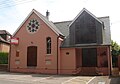 Former Crawley Down Methodist Chapel.jpg 2,000 × 1,400; 1.04 MB
-
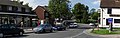
 Crawley Down Village Centre - geograph.org.uk - 1656165.jpg 640 × 428; 88 KB
-
 Crawley Down.jpg 11,903 × 3,736; 5.97 MB
-
 Dukes Head public house, Crawley Down - geograph.org.uk - 2333396.jpg 4,320 × 3,240; 4.47 MB
-
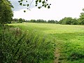 Footpath across the fields from lake - geograph.org.uk - 226173.jpg 640 × 480; 72 KB
-
 Grange Road, Crawley Down - geograph.org.uk - 824064.jpg 640 × 426; 100 KB
-
 Haven Sports Field - geograph.org.uk - 225886.jpg 640 × 480; 290 KB
-

-
 Kiln Road, Crawley Down - geograph.org.uk - 1039277.jpg 600 × 399; 237 KB
-

-
 Old railway bridge, Crawley Down - geograph.org.uk - 43996.jpg 479 × 640; 159 KB
-
 Road junction - geograph.org.uk - 225701.jpg 640 × 480; 104 KB
-
 Shops, Crawley Down - geograph.org.uk - 1608530.jpg 640 × 428; 91 KB
-
 Sussex Border Path - geograph.org.uk - 226197.jpg 640 × 480; 71 KB
-
 The B2028 at Crawley Down - geograph.org.uk - 2514864.jpg 1,600 × 1,200; 531 KB
-

-
 The Royal Oak, Crawley Down - geograph.org.uk - 2382916.jpg 1,024 × 768; 227 KB
-

-

-
 Wallage Lane from Worth Way - geograph.org.uk - 43992.jpg 640 × 479; 198 KB
-

-
 Done Fishing - geograph.org.uk - 523542.jpg 640 × 426; 122 KB
-
 Ducks on Crawley Down Pond - geograph.org.uk - 44003.jpg 640 × 479; 196 KB
-
 Footpath sign in Furnace Green - geograph.org.uk - 225687.jpg 640 × 480; 202 KB
-
 Haven Sports Field car park - geograph.org.uk - 225889.jpg 640 × 480; 252 KB
-
 Lake View Road, Furnace Green - geograph.org.uk - 225712.jpg 640 × 480; 134 KB
-
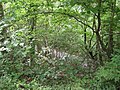
 Lakes at Fen Place - geograph.org.uk - 226181.jpg 640 × 480; 61 KB
-
 Parish Council Noticeboard - geograph.org.uk - 225692.jpg 640 × 480; 152 KB
-
 Road near Hophurst Farm - geograph.org.uk - 225673.jpg 640 × 480; 78 KB
-
 Rowfant Sunset - geograph.org.uk - 523552.jpg 640 × 426; 114 KB
-
 Rowplatt Lane - geograph.org.uk - 225676.jpg 640 × 480; 57 KB


