Category:Cranworth
Jump to navigation
Jump to search
English: Cranworth is a village in the Breckland district of mid-Norfolk, East Anglia, England in the United Kingdom.It has an area of with an estimated population of 415 as of 2007.
village and civil parish in Norfolk, UK  | |||||
| Upload media | |||||
| Instance of | |||||
|---|---|---|---|---|---|
| Location | Breckland, Norfolk, East of England, England | ||||
 | |||||
Subcategories
This category has the following 6 subcategories, out of 6 total.
L
M
S
W
Media in category "Cranworth"
The following 178 files are in this category, out of 178 total.
-

-
 44th Bomb Group memorial at Shipdham - geograph.org.uk - 4035759.jpg 430 × 640; 234 KB
-
 A flock of cranes^ - geograph.org.uk - 5561057.jpg 3,456 × 2,592; 3.83 MB
-
 Across Letton to Shipdham airfield, aerial 2015 - geograph.org.uk - 4666624.jpg 1,024 × 683; 126 KB
-

-
 An ancient path overtaken by nature - geograph.org.uk - 907273.jpg 640 × 480; 142 KB
-
 Barn conversion - geograph.org.uk - 4948486.jpg 1,600 × 1,200; 785 KB
-
 Bend in Wood Rising Road - geograph.org.uk - 5434260.jpg 640 × 480; 48 KB
-
 Beyond the winter cereal crop is Southburgh church - geograph.org.uk - 5936509.jpg 3,456 × 2,592; 3.87 MB
-
 Blue skips at Shipdham industrial estate - geograph.org.uk - 4035755.jpg 640 × 571; 106 KB
-
 Bungalow at High Common - geograph.org.uk - 4035660.jpg 640 × 479; 188 KB
-

-
 Cleared area by Home Farm - geograph.org.uk - 4948467.jpg 1,600 × 1,200; 862 KB
-
 Close up, Elizabeth II postbox, Woodrising - geograph.org.uk - 5436469.jpg 1,590 × 2,492; 791 KB
-
 Converted Methodist chapel - geograph.org.uk - 4035658.jpg 640 × 480; 172 KB
-

-
 Cranworth village hall - geograph.org.uk - 4948789.jpg 1,600 × 1,200; 766 KB
-
 Croft Farm from River Lane - geograph.org.uk - 5936542.jpg 3,456 × 2,592; 3.99 MB
-
 Direction Sign – Signpost - geograph.org.uk - 6529497.jpg 1,458 × 1,944; 1.24 MB
-
 Disused RAF building - geograph.org.uk - 4035645.jpg 640 × 480; 154 KB
-

-
 Elizabeth II postbox and telephone box, Woodrising - geograph.org.uk - 5436468.jpg 2,848 × 2,136; 1.48 MB
-
 Entering Cranworth - geograph.org.uk - 5434229.jpg 640 × 480; 116 KB
-
 Entrance to playing fields, Swathing - geograph.org.uk - 5434230.jpg 640 × 480; 84 KB
-
 Farm road - geograph.org.uk - 1348462.jpg 480 × 640; 118 KB
-

-

-
 Field by Woodrising Road - geograph.org.uk - 4948737.jpg 1,600 × 1,200; 813 KB
-
 Field edge in an evening glow - geograph.org.uk - 905842.jpg 640 × 480; 196 KB
-
 Field edge looking west - geograph.org.uk - 905839.jpg 480 × 640; 195 KB
-
 Field entrance, Woodrising - geograph.org.uk - 5434250.jpg 640 × 480; 91 KB
-
 Field margin, Swathing - geograph.org.uk - 5434233.jpg 640 × 480; 92 KB
-
 Field near Letton Hall - geograph.org.uk - 2598985.jpg 900 × 655; 254 KB
-
 Field near Letton Hall - geograph.org.uk - 4948478.jpg 1,600 × 1,200; 986 KB
-
 Flooded WW2 air raid shelter - geograph.org.uk - 4035637.jpg 480 × 640; 224 KB
-
 Footpath across High Common - geograph.org.uk - 4035620.jpg 640 × 480; 213 KB
-
 From pond to "Milking Unit" - geograph.org.uk - 905841.jpg 480 × 640; 198 KB
-

-
 Gate into a pasture - geograph.org.uk - 1348437.jpg 640 × 480; 99 KB
-
 Gated entrance - geograph.org.uk - 4035797.jpg 640 × 480; 124 KB
-

-

-
 George V postbox on High Common - geograph.org.uk - 4035650.jpg 480 × 640; 172 KB
-
 Gipsy Lane (track) - geograph.org.uk - 5434258.jpg 640 × 480; 76 KB
-
 Green by St Mary's Church, Cranworth - geograph.org.uk - 6543785.jpg 1,920 × 1,280; 1.27 MB
-
 Green near the church, Cranworth - geograph.org.uk - 5434235.jpg 640 × 480; 79 KB
-

-
 Growing by the pond - geograph.org.uk - 907285.jpg 480 × 640; 184 KB
-
 Hay meadow by High House Farm - geograph.org.uk - 4035662.jpg 640 × 480; 174 KB
-
 Heading south east from Cranworth - geograph.org.uk - 5434249.jpg 640 × 480; 96 KB
-
 Heading south east towards Cranworth - geograph.org.uk - 5434228.jpg 640 × 480; 106 KB
-
 Headquarters site at RAF Shipdham - geograph.org.uk - 4035672.jpg 640 × 480; 163 KB
-
 Headquarters site at RAF Shipdham - geograph.org.uk - 4035674.jpg 640 × 480; 139 KB
-
 Headquarters site at RAF Shipdham - geograph.org.uk - 4035677.jpg 640 × 480; 243 KB
-
 Headquarters site at RAF Shipdham - geograph.org.uk - 4035811.jpg 640 × 480; 241 KB
-

-

-

-

-

-

-

-

-

-
 High Common - geograph.org.uk - 4035626.jpg 640 × 480; 168 KB
-
 Home Farmhouse, Letton - geograph.org.uk - 6071696.jpg 3,264 × 2,448; 1.81 MB
-
 House at High Common - geograph.org.uk - 4035664.jpg 640 × 480; 157 KB
-
 Houses and telephone box, Swathing - geograph.org.uk - 5434234.jpg 640 × 480; 107 KB
-
 Houses, Woodrising - geograph.org.uk - 5434253.jpg 640 × 480; 66 KB
-
 Inside St Andrew, Southburgh (a) - geograph.org.uk - 5552334.jpg 480 × 640; 60 KB
-
 Inside St Andrew, Southburgh (b) - geograph.org.uk - 5552335.jpg 640 × 480; 64 KB
-
 Inside St Andrew, Southburgh (c) - geograph.org.uk - 5552337.jpg 640 × 480; 64 KB
-
 Inside the old control tower - geograph.org.uk - 4035732.jpg 640 × 480; 146 KB
-
 Junction in Woodrising - geograph.org.uk - 4948755.jpg 1,600 × 1,200; 572 KB
-
 Lane heading north east from Swathing - geograph.org.uk - 5434232.jpg 640 × 480; 124 KB
-
 Letton Hall - geograph.org.uk - 5434221.jpg 640 × 480; 68 KB
-
 Letton Hall and Park, aerial (2) - geograph.org.uk - 5835965.jpg 1,024 × 683; 145 KB
-

-
 Letton Hall driveway - geograph.org.uk - 2598974.jpg 900 × 665; 268 KB
-
 Letton Hall, aerial 2015 - geograph.org.uk - 4666608.jpg 1,024 × 683; 128 KB
-
 Looking North from Letton Hall gardens - geograph.org.uk - 5662001.jpg 1,024 × 683; 243 KB
-
 Looking south west on Woodrising Road - geograph.org.uk - 5434252.jpg 640 × 480; 115 KB
-

-
 Maize crop, Woodrising - geograph.org.uk - 5434255.jpg 640 × 480; 70 KB
-
 Maize crop, Woodrising - geograph.org.uk - 5434265.jpg 640 × 480; 86 KB
-
 Minor road towards Cranworth - geograph.org.uk - 5434219.jpg 640 × 480; 89 KB
-
 Minor road towards Cranworth - geograph.org.uk - 5434225.jpg 640 × 480; 82 KB
-
 Not a transformer - geograph.org.uk - 1348469.jpg 480 × 640; 133 KB
-
 Oak trees turning autumnal - geograph.org.uk - 5936423.jpg 3,456 × 2,592; 3.89 MB
-
 On the first floor of the control tower - geograph.org.uk - 4035721.jpg 480 × 640; 150 KB
-
 PACT Animal Sanctuary - geograph.org.uk - 4948770.jpg 1,600 × 1,200; 756 KB
-
 Parkland, Letton Hall - geograph.org.uk - 5434223.jpg 640 × 480; 100 KB
-
 Peeling paint in the control tower - geograph.org.uk - 4035713.jpg 640 × 480; 176 KB
-
 People for Animal Care Trust, Cranworth - geograph.org.uk - 6543784.jpg 1,848 × 1,164; 1.21 MB
-
 RAF hangar on Shipdham industrial estate - geograph.org.uk - 4035681.jpg 640 × 480; 124 KB
-

-
 Rape field - geograph.org.uk - 4948469.jpg 1,600 × 1,200; 599 KB
-
 Rape field - geograph.org.uk - 4948781.jpg 1,600 × 1,200; 793 KB
-
 Red Millett growing against the Rectory wall - geograph.org.uk - 5561075.jpg 3,456 × 2,592; 3.86 MB
-
 Remnants of the maize harvest - geograph.org.uk - 5936539.jpg 3,456 × 2,592; 3.9 MB
-
 Restricted byway along Gypsy Lane - geograph.org.uk - 5936521.jpg 3,456 × 2,592; 3.99 MB
-
 Road through Letton Green - geograph.org.uk - 4948493.jpg 1,600 × 1,200; 791 KB
-
 Road to Cranwoth - geograph.org.uk - 4948786.jpg 1,600 × 1,200; 798 KB
-
 Road to Letton Green - geograph.org.uk - 4948473.jpg 1,600 × 1,200; 666 KB
-
 Road to Letton Green - geograph.org.uk - 4948491.jpg 1,600 × 1,200; 737 KB
-
 Road to Letton Green - geograph.org.uk - 6071689.jpg 3,264 × 2,448; 1.79 MB
-
 Road to Letton Hall - geograph.org.uk - 5434218.jpg 640 × 480; 120 KB
-
 Rural lane past High Common - geograph.org.uk - 4035652.jpg 640 × 480; 218 KB
-
 Rush hour in Cranston - geograph.org.uk - 5541455.jpg 640 × 480; 68 KB
-
 Shipdham Grove - geograph.org.uk - 5434217.jpg 640 × 480; 86 KB
-
 Snapped tree off River Lane, Southburgh - geograph.org.uk - 5936518.jpg 3,456 × 2,592; 3.99 MB
-
 Southburgh church and graveyard - geograph.org.uk - 6071713.jpg 3,264 × 2,448; 1.64 MB
-

-
 St Andrew, Southburgh, churchyard (b) - geograph.org.uk - 5552327.jpg 640 × 480; 109 KB
-

-
 St Andrew, Southburgh, font - geograph.org.uk - 5552345.jpg 480 × 640; 55 KB
-
 St Andrew, Southburgh, memorial (a) - geograph.org.uk - 5552349.jpg 640 × 480; 47 KB
-
 St Andrew, Southburgh, memorial (b) - geograph.org.uk - 5552351.jpg 640 × 480; 41 KB
-
 St Andrew, Southburgh, memorial (c) - geograph.org.uk - 5552352.jpg 480 × 640; 48 KB
-
 St Andrew, Southburgh, memorial (d) - geograph.org.uk - 5552354.jpg 480 × 640; 53 KB
-

-
 St Andrew, Southburgh, pulpit - geograph.org.uk - 5552350.jpg 480 × 640; 56 KB
-

-
 St. Mary's church, Cranworth - geograph.org.uk - 3913673.jpg 640 × 480; 65 KB
-
 Stack of straw bales in the corner of a field - geograph.org.uk - 5936490.jpg 3,456 × 2,592; 3.83 MB
-
 Steps leading up the control tower - geograph.org.uk - 4035715.jpg 480 × 640; 118 KB
-

-
 Straw bales stacked beside track - geograph.org.uk - 1348466.jpg 640 × 480; 80 KB
-
 Thatched cottage opposite the church - geograph.org.uk - 5936474.jpg 3,456 × 2,592; 3.88 MB
-
 The control tower at RAF Shipdham - geograph.org.uk - 4035686.jpg 640 × 480; 138 KB
-
 The control tower at RAF Shipdham - geograph.org.uk - 4035688.jpg 640 × 480; 134 KB
-

-

-

-

-

-
 The headstone of George William Francis Graves - geograph.org.uk - 4938275.jpg 3,456 × 2,592; 3.98 MB
-
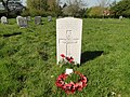
 The headstone of Pilot Officer Cromie at Cranworth - geograph.org.uk - 4815422.jpg 2,592 × 3,456; 3.26 MB
-
 The Road From Letton Green - geograph.org.uk - 293357.jpg 640 × 480; 95 KB
-
 The unkindest cut of all^ - geograph.org.uk - 5552356.jpg 640 × 480; 84 KB
-
 The view east from Oaklands Farm - geograph.org.uk - 1347472.jpg 640 × 440; 81 KB
-

-
 Traffic jam in Woodrising - geograph.org.uk - 5541471.jpg 640 × 480; 90 KB
-
 View across the control tower upper deck - geograph.org.uk - 4035746.jpg 640 × 480; 103 KB
-

-
 View northeast from Oaklands Farm - geograph.org.uk - 1347478.jpg 640 × 426; 86 KB
-
 Water Tower, Letton Hall - geograph.org.uk - 5661991.jpg 1,024 × 683; 246 KB
-
 West Lodge - geograph.org.uk - 5936448.jpg 3,456 × 2,592; 3.92 MB
-
 White Bridge Southburgh - geograph.org.uk - 5936512.jpg 3,456 × 2,592; 3.94 MB
-
 Winter cereal crop at Southburgh - geograph.org.uk - 6071712.jpg 3,264 × 2,448; 1.62 MB
-
 Winter cereal crop from the headland - geograph.org.uk - 5936493.jpg 3,456 × 2,592; 4 MB
-

-
 Wood Farm, Woodrising - geograph.org.uk - 4948760.jpg 1,600 × 1,200; 775 KB
-
 Wood Rising Road - geograph.org.uk - 5434262.jpg 640 × 480; 69 KB
-
 Wood Rising Road - geograph.org.uk - 5434266.jpg 640 × 480; 117 KB
-
 Woodland beside Wood Rising Road - geograph.org.uk - 5434261.jpg 640 × 480; 75 KB
-
 Woodland, Letton - geograph.org.uk - 5434226.jpg 640 × 480; 66 KB
-
 Woodrising Road - geograph.org.uk - 4948743.jpg 1,600 × 1,200; 972 KB
-
 Woodrising Road - geograph.org.uk - 5434251.jpg 640 × 480; 110 KB
-
 Woodrising Road through Cranworth - geograph.org.uk - 704208.jpg 640 × 480; 126 KB
-
 Woodrising Road, Cranworth - geograph.org.uk - 6544846.jpg 1,920 × 1,280; 1.04 MB
-
 Woodrising village sign - geograph.org.uk - 5936470.jpg 3,456 × 2,592; 3.9 MB
-
 Woods in Woodrising - geograph.org.uk - 6544847.jpg 1,920 × 1,280; 2.49 MB
-
 WW2 air raid shelter - geograph.org.uk - 4035634.jpg 640 × 480; 180 KB
-
 A Country Cottage - geograph.org.uk - 293305.jpg 640 × 480; 100 KB
-
 A Flint Barn - geograph.org.uk - 278456.jpg 640 × 480; 99 KB
-
 A Lane To Stebbing's Grove - geograph.org.uk - 293361.jpg 640 × 480; 93 KB
-
 New Build - geograph.org.uk - 295566.jpg 640 × 480; 114 KB
-
 Not In Daily Use - geograph.org.uk - 278448.jpg 640 × 480; 99 KB
-
 Sloping Verges - geograph.org.uk - 276663.jpg 640 × 480; 99 KB
-
 Stebbing's Grove - geograph.org.uk - 278450.jpg 640 × 480; 93 KB
-
 Straight And Narrow - geograph.org.uk - 293360.jpg 640 × 480; 101 KB
-
 The Lane From Cranworth - geograph.org.uk - 293367.jpg 640 × 480; 102 KB
-
 The Road To Hingham - geograph.org.uk - 295562.jpg 640 × 480; 92 KB
-
 The Road To Letton Green - geograph.org.uk - 293365.jpg 640 × 480; 95 KB
-
 Unlike November - geograph.org.uk - 293299.jpg 640 × 480; 103 KB
-
 Well Protected - geograph.org.uk - 293366.jpg 640 × 480; 108 KB
-
 Working And Playing Fields - geograph.org.uk - 293363.jpg 640 × 480; 80 KB


_towards_Croft_Farm_-_geograph.org.uk_-_5434256.jpg)


_-_geograph.org.uk_-_5434258.jpg)


_-_geograph.org.uk_-_5552334.jpg)
_-_geograph.org.uk_-_5552335.jpg)
_-_geograph.org.uk_-_5552337.jpg)


_-_geograph.org.uk_-_5835965.jpg)
_-_geograph.org.uk_-_5835957.jpg)


_-_geograph.org.uk_-_5552326.jpg)
_-_geograph.org.uk_-_5552327.jpg)
_-_geograph.org.uk_-_5552333.jpg)

_-_geograph.org.uk_-_5552349.jpg)
_-_geograph.org.uk_-_5552351.jpg)
_-_geograph.org.uk_-_5552352.jpg)
_-_geograph.org.uk_-_5552354.jpg)


