Category:Cramlington
Jump to navigation
Jump to search
town and civil parish in the county of Northumberland, England  | |||||
| Upload media | |||||
| Instance of | |||||
|---|---|---|---|---|---|
| Location | Northumberland, North East England, England | ||||
| Population |
| ||||
| Said to be the same as | Cramlington (Wikimedia duplicated page, civil parish) | ||||
 | |||||
Deutsch: Cramlington ist eine Stadt im Nordosten von England in dem County von Northumberland, 19 Kilometer (12 englisch miles) nördlich von Newcastle upon Tyne. Die Stadt zählt rund 40.000 Einwohner (Stand 2003) und gehört zum Distrikt Blyth Valley.
English: Cramlington is a town and civil parish in the county of Northumberland, North East England, situated north of the city of Newcastle upon Tyne. The town's name suggests a probable founding by the Danes or an Anglo-Saxon origin, the word "ton" meaning town. The population was estimated as 39,000 in 2004.
Français : Cramlington est une ville du comté de Northumberland, située à treize miles au nord de Newcastle-upon-Tyne dans la nord-est de l'Angleterre. Elle comptait 39 000 habitants en 2004. Son nom est tiré d'un mot danois, "ton", qui signifie "ville".
Italiano: Cramlington è una cittadina di 39.000 abitanti della contea del Northumberland, in Inghilterra.
Nederlands: Cramlington is een plaats in het bestuurlijke gebied Blyth Valley, in het Engelse graafschap Northumberland. De plaats telt 39.000 inwoners.
Polski: Cramlington – miasto w Wielkiej Brytanii, w Anglii, w regionie North East England, w hrabstwie Northumberland. W 2004r. miasto to zamieszkiwało 39 000 osób.
Română: Cramlington este un oraş în comitatul Northumberland, regiunea North East, Anglia. Oraşul se află în districtul Blyth Valley.
Simple English: Cramlington is a town in the county of Northumberland, in the north-east of England.
Subcategories
This category has the following 8 subcategories, out of 8 total.
Media in category "Cramlington"
The following 200 files are in this category, out of 366 total.
(previous page) (next page)-
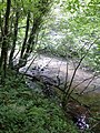 A murky River Blyth - geograph.org.uk - 5055434.jpg 900 × 1,200; 351 KB
-
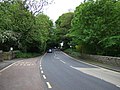
 A1068 heading north - geograph.org.uk - 3058413.jpg 640 × 480; 56 KB
-
 A1068 heading north - geograph.org.uk - 3058419.jpg 640 × 480; 65 KB
-

-

-
 A1171 towards Cramlington - geograph.org.uk - 3060708.jpg 640 × 480; 73 KB
-
 A19 heading west towards the A1 - geograph.org.uk - 2977832.jpg 640 × 371; 48 KB
-
 A19 lay-by - geograph.org.uk - 4728110.jpg 640 × 480; 44 KB
-
 A19, south of Arcott Hall - geograph.org.uk - 6374613.jpg 1,024 × 576; 166 KB
-

-
 A192 heading east - geograph.org.uk - 3058468.jpg 640 × 480; 54 KB
-
 A192 heading west towards Morpeth - geograph.org.uk - 2974579.jpg 640 × 480; 57 KB
-
 A192 towards Cramlington - geograph.org.uk - 2977887.jpg 640 × 480; 100 KB
-

-

-
 Aesica, Shotton Lane - geograph.org.uk - 6375128.jpg 1,024 × 576; 189 KB
-
 Alderley Way, Cramlington - geograph.org.uk - 5884446.jpg 2,000 × 1,333; 360 KB
-
 Aldi supermarket, Cramlington - geograph.org.uk - 5884457.jpg 2,000 × 1,333; 432 KB
-
 Arable field in Cramlington - geograph.org.uk - 4954670.jpg 2,048 × 1,536; 980 KB
-
 Arcot Pond - geograph.org.uk - 105540.jpg 640 × 480; 129 KB
-
 Arcot Pond - geograph.org.uk - 2791136.jpg 2,272 × 1,704; 2.51 MB
-
 Arcot Pond - geograph.org.uk - 2792296.jpg 1,967 × 982; 1.22 MB
-
 Avenue of trees in the cemetery - geograph.org.uk - 4728118.jpg 640 × 480; 127 KB
-
 Avery Dennison, East Nelson Park - geograph.org.uk - 6040644.jpg 1,024 × 768; 359 KB
-
 B1326 and car park, East Cramlington - geograph.org.uk - 6038574.jpg 1,024 × 768; 363 KB
-
 B1326 towards Seaton Delaval - geograph.org.uk - 3058716.jpg 640 × 480; 41 KB
-
 B1505 heading south - geograph.org.uk - 3058681.jpg 640 × 480; 81 KB
-
 B1505 heading south - geograph.org.uk - 3058692.jpg 640 × 480; 66 KB
-
 B1505 Road, Cramlington - geograph.org.uk - 2792520.jpg 1,458 × 1,886; 1.64 MB
-
 B1505 towards Annitsford - geograph.org.uk - 3058705.jpg 640 × 480; 87 KB
-
 B1505, Cramlington - geograph.org.uk - 5658422.jpg 2,000 × 1,500; 291 KB
-
 Back of Church Street, Cramlington - geograph.org.uk - 6039822.jpg 1,024 × 768; 296 KB
-
 Barbed Wire Fence - geograph.org.uk - 2791142.jpg 1,308 × 2,255; 1.88 MB
-
 Barley Meadows, East Cramlington - geograph.org.uk - 5878050.jpg 2,000 × 1,500; 351 KB
-
 Bassington Drive - geograph.org.uk - 6040616.jpg 1,024 × 768; 278 KB
-
 Bassington Industrial Estate - geograph.org.uk - 6040621.jpg 1,024 × 768; 296 KB
-
 Beaconhill Grange - geograph.org.uk - 6039839.jpg 1,024 × 768; 241 KB
-
 Bedlington and Blyth from the air - geograph.org.uk - 3209123.jpg 640 × 640; 183 KB
-
 Big boys toys at Shotton Surface Mine - geograph.org.uk - 4708378.jpg 640 × 480; 436 KB
-
 Bridge crossing the A19 - geograph.org.uk - 5612932.jpg 2,000 × 1,500; 869 KB
-
 Broken Limb - geograph.org.uk - 2790853.jpg 2,272 × 1,704; 2.11 MB
-
 Building site, Cramlington - geograph.org.uk - 6039834.jpg 1,024 × 677; 151 KB
-
 Building site, East Cramlington - geograph.org.uk - 5658400.jpg 2,000 × 1,500; 251 KB
-
 Building works, Plantation Farm - geograph.org.uk - 2473516.jpg 640 × 480; 78 KB
-
 Bungalows, Thirston Drive, Cramlington - geograph.org.uk - 5658444.jpg 2,000 × 1,500; 284 KB
-
 Bus Shelter - geograph.org.uk - 2792533.jpg 2,051 × 1,367; 1.4 MB
-
 Byway west of Cramlington - geograph.org.uk - 5612971.jpg 2,000 × 1,500; 643 KB
-
 Car park, Northumberlandia - geograph.org.uk - 5690241.jpg 640 × 480; 72 KB
-
 Chapel, Mayfield Cemetery, Cramlington - geograph.org.uk - 5658434.jpg 2,000 × 1,500; 329 KB
-
 Christmas tree, Cramlington - geograph.org.uk - 5658453.jpg 2,000 × 1,500; 358 KB
-
 Church of the Nazerene - geograph.org.uk - 6375122.jpg 1,024 × 576; 220 KB
-
 Churchyard, Cramlington - geograph.org.uk - 6039818.jpg 1,024 × 768; 441 KB
-
 Construction equipment, off the B1326, Cramlington - geograph.org.uk - 5658403.jpg 2,000 × 1,500; 212 KB
-
 Construction site entrance, East Cramlington - geograph.org.uk - 5658394.jpg 2,000 × 1,500; 233 KB
-
 Construction site, Northumberland Business Park, Cramlington - geograph.org.uk - 6515306.jpg 2,000 × 1,500; 1.94 MB
-
 Country lane - geograph.org.uk - 2113044.jpg 4,000 × 3,000; 5.29 MB
-

-
 Cramlington NE23, UK - panoramio (1).jpg 6,000 × 4,000; 11.94 MB
-
 Cramlington NE23, UK - panoramio.jpg 2,083 × 1,557; 1.68 MB
-
 Cramlington to South Beach Cycleway - geograph.org.uk - 1734494.jpg 640 × 480; 105 KB
-
 Cramlington village centre - geograph.org.uk - 5884468.jpg 2,000 × 1,333; 498 KB
-
 Cramlington Village Green - geograph.org.uk - 4961445.jpg 2,048 × 1,536; 1.02 MB
-

-
 Crosland Park - geograph.org.uk - 173180.jpg 640 × 475; 125 KB
-

-

-
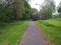
 Cycleway, Cramlington - geograph.org.uk - 1734299.jpg 640 × 480; 105 KB
-
 Cycleway, Cramlington - geograph.org.uk - 6039791.jpg 1,024 × 768; 312 KB
-
 Cycleway, Cramlington - geograph.org.uk - 6039795.jpg 1,024 × 768; 272 KB
-
 Cycleway, Cramlington - geograph.org.uk - 6039815.jpg 1,024 × 727; 246 KB
-
 Cycleway, Shankhouse - geograph.org.uk - 1734318.jpg 640 × 480; 79 KB
-
 Dam Dykes - geograph.org.uk - 1230609.jpg 640 × 480; 141 KB
-
 Dam Dykes farmhouse - geograph.org.uk - 1230571.jpg 640 × 480; 104 KB
-
 Dam Dykes gin gan - geograph.org.uk - 1230589.jpg 640 × 480; 117 KB
-
 Damdykes Crossing - geograph.org.uk - 907135.jpg 640 × 427; 96 KB
-

-

-
 Development at Damdykes - geograph.org.uk - 5612949.jpg 2,000 × 1,500; 496 KB
-
 Development site, Cramlington - geograph.org.uk - 4954688.jpg 2,048 × 1,536; 783 KB
-
 Development site, Cramlington - geograph.org.uk - 6039837.jpg 1,024 × 768; 207 KB
-
 Disused warehouse building, Dudley - geograph.org.uk - 6515300.jpg 2,000 × 1,500; 2.16 MB
-
 Dudley Business Park - geograph.org.uk - 2320441.jpg 640 × 430; 36 KB
-
 Dudley Business Park - geograph.org.uk - 2444003.jpg 640 × 339; 24 KB
-
 Dunsdale Drive, Cramlington - geograph.org.uk - 6375114.jpg 1,024 × 576; 314 KB
-
 East Cramlington Colliery Headgear site - geograph.org.uk - 6038516.jpg 1,024 × 768; 519 KB
-
 East Cramlington Local Nature Reserve - geograph.org.uk - 152880.jpg 200 × 150; 13 KB
-
 East Hartford and District Community Centre - geograph.org.uk - 6040682.jpg 1,024 × 768; 432 KB
-
 East Hartford Playground - geograph.org.uk - 6040680.jpg 1,024 × 768; 391 KB
-
 Eastfield Chase, Cramlington - geograph.org.uk - 5884450.jpg 2,000 × 1,333; 335 KB
-

-
 End of the yellow road, Plessey Hall - geograph.org.uk - 6375134.jpg 1,024 × 576; 274 KB
-
 Entering Cramlington Industrial Zone - geograph.org.uk - 4960750.jpg 2,048 × 1,536; 1.1 MB
-
 Entrance to Arcot Grange development - geograph.org.uk - 5612979.jpg 2,000 × 1,500; 561 KB
-
 Entrance to Barley Meadows development, East Cramlington - geograph.org.uk - 5878058.jpg 2,000 × 1,500; 312 KB
-
 Esher Place, Beaconhill Lea - geograph.org.uk - 6039846.jpg 1,024 × 768; 259 KB
-
 Estate road off the B1505 - geograph.org.uk - 3058677.jpg 640 × 480; 56 KB
-
 Evesham Place, Beaconhill - geograph.org.uk - 6039848.jpg 1,024 × 768; 371 KB
-
 Extension to Manor Walks, Cramlington - geograph.org.uk - 4963489.jpg 2,048 × 1,536; 811 KB
-
 Face of Northumberlandia - geograph.org.uk - 5832496.jpg 640 × 480; 302 KB
-
 Face Value - geograph.org.uk - 3990163.jpg 533 × 800; 79 KB
-
 Factory shop, Neslon Way - geograph.org.uk - 2977914.jpg 640 × 480; 55 KB
-
 Farmland and woodland, Hartford Bank - geograph.org.uk - 2977893.jpg 640 × 480; 76 KB
-
 Farmland towards Jubilee Wood - geograph.org.uk - 3058417.jpg 640 × 480; 86 KB
-

-
 Farmland, Cramlington - geograph.org.uk - 2977828.jpg 640 × 480; 40 KB
-

-

-
 Fierce Sky - geograph.org.uk - 1624909.jpg 640 × 628; 92 KB
-
 Football pitch in South Cramlington - geograph.org.uk - 2443980.jpg 640 × 430; 27 KB
-
 Football pitch, South Cramlington - geograph.org.uk - 2320435.jpg 640 × 337; 24 KB
-
 Football pitch, South Cramlington - geograph.org.uk - 2320436.jpg 640 × 395; 25 KB
-
 Footbridge over Seaton Burn - geograph.org.uk - 2792480.jpg 1,704 × 2,272; 2.02 MB
-
 Footpath at Shankhouse - geograph.org.uk - 112019.jpg 640 × 426; 157 KB
-
 Footpath behind St John the Baptist - geograph.org.uk - 2792475.jpg 883 × 1,600; 572 KB
-
 Footpath off the A1068 - geograph.org.uk - 3058429.jpg 480 × 640; 126 KB
-
 Footpath towards Northumberlandia - geograph.org.uk - 4960644.jpg 2,048 × 1,536; 840 KB
-
 Footpath, Cramlington - geograph.org.uk - 4961381.jpg 2,048 × 1,536; 1.61 MB
-
 Ford - geograph.org.uk - 281488.jpg 640 × 480; 198 KB
-
 Former United Methodist Free Church, East Cramlington - geograph.org.uk - 5878067.jpg 2,000 × 1,500; 389 KB
-

-
 Gateway - geograph.org.uk - 2791145.jpg 800 × 600; 135 KB
-
 Grass field on the edge of Cramlington - geograph.org.uk - 5612975.jpg 2,000 × 1,500; 451 KB
-
 Grassland - geograph.org.uk - 2792502.jpg 2,261 × 1,342; 1.8 MB
-
 Grazing, East Cramlington - geograph.org.uk - 3058722.jpg 640 × 480; 82 KB
-
 Green, East Hartford - geograph.org.uk - 6040685.jpg 1,024 × 768; 407 KB
-
 Harnessing the power of the wind - geograph.org.uk - 2113021.jpg 4,000 × 3,000; 2.01 MB
-
 Hartford Bridge over the River Blyth - geograph.org.uk - 3218575.jpg 3,648 × 2,736; 3.4 MB
-
 Heading through Moor Plantation - geograph.org.uk - 3623756.jpg 1,600 × 1,164; 436 KB
-
 Hetty the Harris Hawk - geograph.org.uk - 2791127.jpg 640 × 550; 143 KB
-
 Hetty the Harris Hawk - geograph.org.uk - 2791134.jpg 1,294 × 2,005; 1.56 MB
-
 Hetty the Harris Hawk - geograph.org.uk - 2791138.jpg 427 × 640; 76 KB
-
 High Pit Road, Cramlington - geograph.org.uk - 5878041.jpg 2,000 × 1,500; 404 KB
-
 Horse in field near Plessey Hall Farm - geograph.org.uk - 6303901.jpg 1,024 × 684; 172 KB
-
 Horton Burn - geograph.org.uk - 1734312.jpg 640 × 480; 103 KB
-
 Horton Dean - geograph.org.uk - 6732035.jpg 1,024 × 1,024; 445 KB
-
 Horton Drive - geograph.org.uk - 6375123.jpg 1,024 × 576; 229 KB
-
 Horton Drive, Cramlington - geograph.org.uk - 6040666.jpg 1,024 × 768; 351 KB
-
 Houses, Allensgreen, Cramlington - geograph.org.uk - 5658448.jpg 2,000 × 1,500; 315 KB
-
 Houses, Allerhope, Cramlington - geograph.org.uk - 6039799.jpg 1,024 × 768; 321 KB
-
 Houses, Grindon Close, Cramlington - geograph.org.uk - 5612992.jpg 2,000 × 1,500; 460 KB
-
 Ice - geograph.org.uk - 2792386.jpg 2,272 × 1,704; 2.07 MB
-
 Ice - geograph.org.uk - 2792397.jpg 2,220 × 1,471; 1.83 MB
-
 Illuminated Subway near Cramlington, Northumberland - geograph.org.uk - 3727787.jpg 2,592 × 1,944; 1.06 MB
-
 In memory of Old King Coal - geograph.org.uk - 152888.jpg 200 × 150; 21 KB
-

-
 Industrial building, Nelson Park East, Cramlington - geograph.org.uk - 4961359.jpg 2,048 × 1,536; 1.12 MB
-

-
 Industrial premises, Dudley - geograph.org.uk - 3568599.jpg 4,458 × 3,246; 2.21 MB
-
 Industrial units, East Cramlington - geograph.org.uk - 3058726.jpg 640 × 480; 54 KB
-

-

-

-

-
 Keep Out - geograph.org.uk - 2792435.jpg 2,130 × 1,423; 1.74 MB
-
 Lane towards Plessey Hall Farm House - geograph.org.uk - 2977903.jpg 640 × 480; 50 KB
-
 Large premises, Nelson Park Industrial Estate, Cramlington - geograph.org.uk - 4961333.jpg 2,048 × 1,536; 1,008 KB
-
 Large sheds, Nelson Park West Industrial Estate, Cramlington - geograph.org.uk - 4960761.jpg 2,048 × 1,536; 1.05 MB
-
 Level crossing, Arcot Lane, Cramlington - geograph.org.uk - 5613002.jpg 2,000 × 1,500; 440 KB
-
 Lines of dump trucks at Shotton Surface Mine - geograph.org.uk - 4960683.jpg 2,048 × 1,536; 1.02 MB
-
 Local Train - geograph.org.uk - 2792336.jpg 1,715 × 755; 982 KB
-
 Looking down her nose, Northumberlandia - geograph.org.uk - 5832488.jpg 640 × 480; 303 KB
-
 Looking east along the A19 - geograph.org.uk - 5612940.jpg 2,000 × 1,500; 340 KB
-
 Looking right up her nose - geograph.org.uk - 5832487.jpg 640 × 480; 280 KB
-
 Looking west along the A19 - geograph.org.uk - 5612937.jpg 2,000 × 1,500; 359 KB
-
 Loughrigg Avenue, Cramlington - geograph.org.uk - 6039840.jpg 1,024 × 768; 362 KB
-
 Machinery parked at Shotton Surface Mine - geograph.org.uk - 4960728.jpg 2,048 × 1,536; 1,011 KB
-
 Mayfield Cemetery, Cramlington - geograph.org.uk - 5658438.jpg 2,000 × 1,500; 328 KB
-
 Minor Road - geograph.org.uk - 2792439.jpg 1,704 × 2,272; 2.12 MB
-
 Minor road towards Arcot Hall - geograph.org.uk - 3058408.jpg 640 × 480; 67 KB
-
 Muddy Entrance - geograph.org.uk - 2792359.jpg 1,973 × 1,379; 1.71 MB
-
 Nature Reserve Inhabitant^ - geograph.org.uk - 102494.jpg 480 × 640; 115 KB
-
 Nelson Industrial Estate, Cramlington - geograph.org.uk - 3568637.jpg 2,949 × 2,022; 804 KB
-
 New houses, Cramlington - geograph.org.uk - 4954707.jpg 2,048 × 1,536; 1.1 MB
-
 New houses, Damdykes - geograph.org.uk - 5612965.jpg 2,000 × 1,500; 577 KB
-
 New housing development, Cramlington - geograph.org.uk - 4954702.jpg 2,048 × 1,536; 1.02 MB
-
 New housing estate, Cramlington Village - geograph.org.uk - 4961443.jpg 2,048 × 1,536; 1,019 KB
-

-

-

-
 Northumberlandia - geograph.org.uk - 3647895.jpg 3,000 × 2,000; 2.15 MB
-
 Northumberlandia - geograph.org.uk - 3978385.jpg 800 × 533; 111 KB
-
 Northumberlandia - geograph.org.uk - 4044902.jpg 640 × 480; 288 KB
-
 Northumberlandia - geograph.org.uk - 4044922.jpg 640 × 481; 290 KB
-
 Northumberlandia - geograph.org.uk - 5690235.jpg 640 × 480; 69 KB
-
 Northumberlandia - panoramio.jpg 2,592 × 1,936; 1.54 MB
-
 Northumberlandia from entry point to park - geograph.org.uk - 4660169.jpg 3,072 × 1,728; 1.74 MB
-

-
 Northumberlandia open day (panorama from east) - geograph.org.uk - 3120260.jpg 3,000 × 1,351; 854 KB
-
 Northumberlandia open day (panorama) - geograph.org.uk - 3120237.jpg 3,000 × 1,467; 1.44 MB
-
 Northumberlandia open day - geograph.org.uk - 3120357.jpg 1,024 × 768; 217 KB
-
 Northumberlandia's head viewed from her left breast - geograph.org.uk - 3623775.jpg 1,600 × 1,200; 308 KB
-
 Northumberlandia's left hand - geograph.org.uk - 4960730.jpg 2,048 × 1,536; 1.19 MB
-
 Northumbria Specialist Emergency Care Hospital - geograph.org.uk - 5658411.jpg 2,000 × 1,500; 217 KB
-
 Northumbria Specialist Emergency Care Hospital - geograph.org.uk - 6038580.jpg 1,024 × 768; 292 KB
-
 Obstruction on the riverside path in Hartford Wood - geograph.org.uk - 5055448.jpg 1,600 × 1,200; 406 KB
-
 Oilseed rape near Damdykes - geograph.org.uk - 6374610.jpg 1,024 × 576; 246 KB
-
 Old track through woodland - geograph.org.uk - 3058403.jpg 640 × 480; 111 KB
-

-

-


.jpg)


_-_geograph.org.uk_-_3120260.jpg)
_-_geograph.org.uk_-_3120237.jpg)


