Category:Coventry boundary markers
Jump to navigation
Jump to search
English: Boundary markers for the city of Coventry, England.
Media in category "Coventry boundary markers"
The following 77 files are in this category, out of 77 total.
-
 1928 Boundary Marker Stoneleigh Road Railway Bridge SP309746 (2332841219).jpg 1,704 × 2,272; 893 KB
-
 1928 City Boundary Allesley SP291810 (2287883581).jpg 1,704 × 2,272; 1.92 MB
-
 1928 City of Coventry Boundary Kenilworth Road SP307748 (2332843663).jpg 1,704 × 2,272; 879 KB
-
 1928 Coventry City Boundary Broad Lane SP274803 (2287892027).jpg 1,118 × 2,237; 1.16 MB
-
 1928 Coventry City Boundary Broad Lane SP274803 (2288679910).jpg 1,422 × 2,211; 1.53 MB
-
 1928 Coventry City Boundary Duggins Lane SP272779 (2287895157).jpg 1,635 × 2,180; 2.53 MB
-
 1928 Coventry City Boundary Duggins Lane SP272779 (2288687778).jpg 1,672 × 2,229; 2.68 MB
-
 1928 Coventry City Boundary Marker Allesley SP291810 (2288677914).jpg 1,640 × 2,186; 2.04 MB
-
 1928 Coventry City Boundary Windmill Hill Allesley SP291810 (2287881139).jpg 2,272 × 1,704; 1.72 MB
-
 1928 Kenilworth Road Boundary Marker SP307748 (2333672554).jpg 1,861 × 1,668; 1.96 MB
-
 1928 Parish of Stoneleigh Kenilworth Road SP307748 (2333669924).jpg 1,704 × 2,272; 883 KB
-
 1932 Bedworth Road B4113. SP351845 (2336928691).jpg 1,704 × 2,272; 2 MB
-
 1932 City of Coventry Boundary Marker Waste Lane Keresley SP317824 (2422863851).jpg 1,278 × 2,157; 1.66 MB
-
 1932 City of Coventry Boundary SP327832 (2318547672).jpg 1,346 × 2,272; 1.71 MB
-
 1932 City of Coventry London Road Toll Bar Island North Post SP364758 (2337754930).jpg 1,704 × 2,272; 1.81 MB
-
 1932 County of Warwick Parish of Keresley SP327832 (2318548704).jpg 1,190 × 2,272; 1.6 MB
-
 1932 Coventry Boundary Marker Waste Lane Keresley SP317824 (2423676520).jpg 1,704 × 2,272; 2.2 MB
-
 1932 Coventry City Boundary Marker Hawkes Mill Lane Allesley SP 303828 (2366232369).jpg 1,431 × 2,177; 2.07 MB
-
 1932 Coventry City Boundary Marker Keresley Green Road SP319824 (2301703715).jpg 2,272 × 1,704; 890 KB
-
 1932 Coventry City Boundary Marker Keresley Green SP319824 (2302496308).jpg 1,704 × 2,272; 890 KB
-
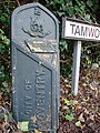
 1932 Coventry City Boundary Marker Tamworth Road Keresley SP318823 (2302493420).jpg 1,704 × 2,272; 895 KB
-
 1932 Coventry City Boundary Tamworth Road Keresley SP318823 (2301698017).jpg 1,704 × 2,272; 902 KB
-
 1932 Coventry City Boundary, Wall Hill Road, Allesley SP305829 (2270712577).jpg 1,704 × 2,272; 881 KB
-
 1932 Keresley Green Boundary Marker SP319824 (2302497202).jpg 1,704 × 2,272; 893 KB
-
 1932 London Road Marker at Toll Bar Island North Post SP364758 (2336922393).jpg 1,704 × 2,272; 1.77 MB
-
 1932 Urban District of Bedworth B4113. SP351845 (2336925469).jpg 1,278 × 2,199; 2 MB
-
 April 18th "I've found a new Boundary Marker!" SP317824 (2422866887).jpg 1,491 × 2,185; 1.6 MB
-
 B4113 Bedworth Road 1932 Boundary Marker SP351845 (2336932191).jpg 1,704 × 2,272; 2.51 MB
-
 Black Horse Road Canal Bridge Hawkesbury 1928 Boundary Marker SP358844 (2336934341).jpg 1,593 × 1,195; 1.66 MB
-
 Boundary marker, Brandon Road - geograph.org.uk - 3295651.jpg 480 × 640; 154 KB
-
 Boundary post, Toll Bar End (detail) - geograph.org.uk - 3296309.jpg 1,024 × 768; 199 KB
-
 Boundary post, Toll Bar End - geograph.org.uk - 3296305.jpg 1,024 × 768; 272 KB
-
 Brandon Road 1932 SP380781 (2427551295).jpg 1,704 × 2,272; 853 KB
-
 Brandon Road Binley 1932 SP380781 (2427549917).jpg 1,704 × 2,272; 899 KB
-
 Brandon Road Binley 1932 SP380781 (2427552809).jpg 1,704 × 2,272; 880 KB
-
 Brinklow Road 1932 SP379789 (2428361448).jpg 1,257 × 2,010; 1.6 MB
-
 Brinklow Road Binley 1932 SP379789 (2427545783).jpg 1,278 × 1,915; 1.44 MB
-
 City of Coventry Parish of Berkswell, Coventry Transport Museum (2912577677).jpg 1,704 × 2,272; 901 KB
-
 Coventry City Boundary Marker on Brandon Road, Binley - geograph.org.uk - 2125044.jpg 2,000 × 1,500; 218 KB
-
 Coventry-Bedworth boundary marker - geograph.org.uk - 4439052.jpg 1,179 × 1,985; 760 KB
-

-
 Half-buried 1928 Marker Stoneleigh Road SP309746 (2333669230).jpg 1,704 × 2,272; 897 KB
-
 Halford Lane Sadler Road Boundary 1928 SP322823 (2428338126).jpg 1,153 × 2,262; 1.41 MB
-
 Hawkes Mill Lane Allesley 1932 Boundary Marker SP 303828 (2366234501).jpg 1,425 × 2,048; 2.07 MB
-
 Hawkesbury Lane Parrotts Grove 1928 SP364841 (2427538473).jpg 1,060 × 2,115; 1.08 MB
-
 Inscription Plate Brinklow Road Binley 1932 SP379789 (2427543503).jpg 1,740 × 1,273; 1.37 MB
-
 Inscription Plate Hawkesbury Lane Parrotts Grove 1928 SP364841 (2427536683).jpg 1,704 × 1,278; 1.29 MB
-
 Inscription Plate Toll Bar South Post 1932 SP364757 (2428366668).jpg 1,135 × 851; 619 KB
-
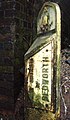
 Inscription Plate Wilsons Lane 1932 SP347845 (2428343212).jpg 1,563 × 1,595; 1.34 MB
-
 March 14th "Technicolor Elephant" SP309746 (2332817357).jpg 1,851 × 1,388; 1.45 MB
-
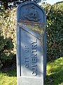
 March 8th "Coventry Boundary Marker of the Day" SP327832 (2317742367).jpg 1,391 × 2,263; 1.58 MB
-

-
-
-

-
-

-

-

-

-

-

-
-

-

-
 Parish of Baginton London Road Toll Bar Island North Post 1932 SP364758 (2337752382).jpg 1,704 × 2,272; 1.88 MB
-
 Parish of Baginton. Left. Coventry Transport Museum (2912569143).jpg 1,704 × 2,272; 896 KB
-
 Parish of Baginton. Right. Coventry Transport Museum (2913415128).jpg 1,704 × 2,272; 889 KB
-
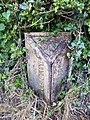
 Penny Park Lane 1932 SP327832 (2425104034).jpg 602 × 516; 191 KB
-
 Sadler Road Halford Lane Boundary 1928 SP322823 (2427527783).jpg 1,252 × 2,202; 1.69 MB
-
 Signs SP318823 (2301700725).jpg 1,933 × 1,450; 1.74 MB
-
 Stonebridge Highway Toll Bar End South Post 1932 SP364757 (2427560113).jpg 1,704 × 2,272; 1.95 MB
-

-
 Toll Bar End South Post 1932 SP364757 (2428376040).jpg 1,704 × 2,272; 2 MB
-
 Toll Bar South Post 1932 SP364757 (2427556971).jpg 1,704 × 2,272; 2.05 MB
-
 Wilsons Lane Woodshires Green 1932 SP347845 (2428344694).jpg 1,704 × 2,272; 901 KB
-
 Wilsons Lane Woodshires Green 1932 SP347845 (2428347602).jpg 1,149 × 2,270; 1.63 MB
.jpg)
.jpg)
.jpg)
.jpg)
.jpg)
.jpg)
.jpg)
.jpg)
.jpg)
.jpg)
.jpg)
.jpg)
.jpg)
.jpg)
.jpg)
.jpg)
.jpg)
.jpg)
.jpg)
.jpg)
.jpg)
.jpg)
.jpg)
.jpg)
.jpg)
.jpg)
.jpg)
.jpg)
.jpg)

_-_geograph.org.uk_-_3296309.jpg)

.jpg)
.jpg)
.jpg)
.jpg)
.jpg)


.jpg)
.jpg)
.jpg)
.jpg)
.jpg)
.jpg)
.jpg)
.jpg)
.jpg)
.jpg)
.jpg)
.jpg)
.jpg)
.jpg)
.jpg)
.jpg)
.jpg)
.jpg)
.jpg)
.jpg)
.jpg)
.jpg)
.jpg)
.jpg)
.jpg)
.jpg)
.jpg)
.jpg)
.jpg)
.jpg)
.jpg)
.jpg)
.jpg)
.jpg)
.jpg)
.jpg)
.jpg)
.jpg)