Category:County of Burgundy
Appearance
Internationalization
English: County of Burgundy
Français : Comté de Bourgogne
countship | |||||
| Upload media | |||||
| Instance of | |||||
|---|---|---|---|---|---|
| Location |
| ||||
| Capital | |||||
| Inception |
| ||||
| Dissolved, abolished or demolished date |
| ||||
 | |||||
Subcategories
This category has the following 6 subcategories, out of 6 total.
Media in category "County of Burgundy"
The following 46 files are in this category, out of 46 total.
-
La Bourgogne aux XI et XIIe siècles.svg 1,050 × 1,450; 302 KB
-
C. 1250 Holy Roman Empire (Southwestern region).jpg 1,032 × 1,129; 1.28 MB
-
C. 1350 Swiss region (Eidgenossen).jpg 979 × 579; 777 KB
-
Karte Haus Burgund 4.png 2,500 × 3,521; 1.36 MB
-
Burgundian lands.jpg 1,083 × 1,770; 457 KB
-
Biens Marguerite Autriche.png 969 × 1,380; 216 KB
-
Map Devolution-es.svg 1,314 × 1,909; 1,010 KB
-
Map Devolution.png 1,259 × 1,832; 277 KB
-
Map Devolution.svg 670 × 946; 368 KB
-
1716 Homann Map of Burgundy, France - Geographicus - Burgundiae-homan-1716.jpg 4,000 × 4,759; 4.58 MB
-
Atlas Van der Hagen-KW1049B12 045-BURGUNDIA COMITATUS. Vulgo La FRANCHECOMTÉ.jpeg 5,500 × 4,331; 3.39 MB
-
Besancon ingenomen, NG-VG-1-1012.jpg 2,500 × 1,241; 596 KB
-
Besancon opnieuw door de Fransen ingenomen, NG-VG-1-1149.jpg 2,500 × 1,241; 524 KB
-
Bourgogne in XI-XII century.png 931 × 647; 294 KB
-
Burgundian State 1364-1404.svg 5,805 × 7,573; 1,004 KB
-
C. 1250 Burgundy and Lothringen.jpg 845 × 577; 663 KB
-
C. 1350 Burgundy and Savoy.jpg 798 × 873; 880 KB
-
C. 1350 Holy Roman Empire (Southwestern region).jpg 1,069 × 1,190; 1.44 MB
-
C. 1450 Burgundy Bourbon and Savoy.jpg 1,307 × 1,040; 1.38 MB
-
C. 1450 Holy Roman Empire (Southwestern region).jpg 1,518 × 981; 1.5 MB
-
C. 1540 Burgundy.jpg 562 × 731; 459 KB
-
C. 1650 Burgundy Savoy Provence.jpg 296 × 419; 179 KB
-
Carte de la Guerre de succession au duché Bourgogne (1003-1005).png 765 × 795; 320 KB
-
Comté de Bourgogne.jpg 606 × 729; 66 KB
-
D159- N° 345. Duché de Bourgogne. - liv3-ch08.png 1,015 × 1,723; 240 KB
-
Dole ingenomen, NG-VG-1-1026.jpg 2,500 × 1,241; 593 KB
-
Duche bourgogne1477.jpg 830 × 1,123; 334 KB
-
Duché et Comté de Bourgogne au XIVe siecle-es.svg 829 × 639; 63 KB
-
Duché et Comté de Bourgogne au XIVe siecle-pt.svg 829 × 639; 63 KB
-
Duché et Comté de Bourgogne au XIVe siecle.svg 829 × 639; 53 KB
-
Franche-Comte fin XVe.jpg 1,756 × 1,984; 702 KB
-
Free County of Burgundy.png 891 × 899; 23 KB
-
Graafschap Bourgondië in tien dagen veroverd, NG-VG-1-1027.jpg 2,500 × 1,241; 593 KB
-
Graafschap Bourgondië in tien dagen veroverd, NG-VG-1-1028.jpg 2,500 × 1,241; 714 KB
-
Herzogtum Lothringen 1250.PNG 368 × 382; 138 KB
-
Herzogtum Lothringen 1400.PNG 659 × 883; 456 KB
-
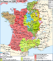
La France en 1429.svg 1,024 × 744; 2 MB
-
Lodewijk XIV geeft Spanje het graafschap Bourgondië terug, NG-VG-1-1036.jpg 2,500 × 1,241; 646 KB
-
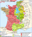
Map France 1180-br.svg 988 × 1,124; 1.9 MB
-
Map France 1180-de.svg 988 × 1,124; 1.94 MB
-
Map France 1180-es.svg 988 × 1,124; 2.1 MB
-
Map France 1180-fr.svg 988 × 1,124; 1.88 MB
-
Map France 1180-ru.svg 988 × 1,124; 1.88 MB
-
Map France 1180-uk.svg 988 × 1,124; 1.68 MB
-
Étots d'Bourgonne-15e-sièke.jpg 2,268 × 3,183; 1.52 MB


