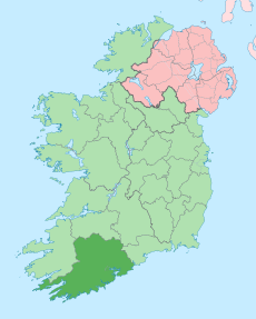
Category:County Cork
Appearance
Counties of the Republic of Ireland: Carlow · Cavan · Clare · Cork(1) · Donegal · Dún Laoghaire-Rathdown(2) · Fingal(2) · Galway(3) · Kerry · Kildare · Kilkenny · Laois · Leitrim · Limerick · Longford · Louth · Mayo · Meath · Monaghan · Offaly · Roscommon · Sligo · South Dublin(2) · Tipperary(4) · Waterford · Westmeath · Wexford · Wicklow – Separate cities: Cork(1) · Dublin(2) · Galway(3) – Former counties: Dublin(2) · South Tipperary(4) Former counties of Northern Ireland: Antrim · Armagh · Down · Fermanagh · Londonderry · Tyrone
county in Ireland | |||||
| Upload media | |||||
| Instance of | |||||
|---|---|---|---|---|---|
| Location | Munster, Ireland | ||||
| Capital | |||||
| Legislative body |
| ||||
| Executive body |
| ||||
| Official language | |||||
| Population |
| ||||
| Area |
| ||||
| official website | |||||
 | |||||
Subcategories
This category has the following 18 subcategories, out of 18 total.
Media in category "County Cork"
The following 200 files are in this category, out of 2,329 total.
(previous page) (next page)-
2 Aberdeen Angus 1 Limousin Bulls plus cows - geograph.org.uk - 3664662.jpg 3,264 × 2,448; 3.75 MB
-
500px photo (59088864).jpeg 1,000 × 707; 94 KB
-
500px photo (59088868).jpeg 1,000 × 674; 140 KB
-
A bit of a push - geograph.org.uk - 4171722.jpg 2,664 × 4,000; 2.7 MB
-
A bridge on a farm access road in Knockaneleigh - geograph.org.uk - 4860658.jpg 1,600 × 991; 269 KB
-
A bridge with hidden stream - geograph.org.uk - 6257598.jpg 1,600 × 1,200; 1.14 MB
-
A churchyard in Kill - Crosspound - geograph.org.uk - 4855610.jpg 1,024 × 768; 171 KB
-
A complicated junction - geograph.org.uk - 2917670.jpg 1,024 × 768; 219 KB
-
A confusion of tractors - geograph.org.uk - 4661890.jpg 4,000 × 2,664; 2.04 MB
-
A field for livestock - geograph.org.uk - 6257251.jpg 1,600 × 1,200; 963 KB
-
A fine hedge - geograph.org.uk - 6257397.jpg 1,600 × 1,200; 894 KB
-
A fine natural hedge - geograph.org.uk - 4193233.jpg 800 × 600; 268 KB
-
A fine row of conifers - geograph.org.uk - 6257510.jpg 1,600 × 1,200; 947 KB
-
A gentle stream valley - geograph.org.uk - 4193280.jpg 1,024 × 768; 278 KB
-
A glimpse of Bridgetown Priory - geograph.org.uk - 6415306.jpg 1,024 × 768; 302 KB
-
A glimpse of the sea - geograph.org.uk - 5481751.jpg 1,024 × 768; 196 KB
-
A helpful sign - geograph.org.uk - 6257606.jpg 1,600 × 1,200; 972 KB
-
A hidden river - geograph.org.uk - 6256727.jpg 1,600 × 1,200; 1.23 MB
-
A house in Dooneen - geograph.org.uk - 4533858.jpg 1,200 × 742; 170 KB
-
A hulk on the bank - geograph.org.uk - 6257427.jpg 1,600 × 1,200; 1 MB
-
A large pile of logs - geograph.org.uk - 6256734.jpg 1,600 × 931; 738 KB
-
A lot of slate - geograph.org.uk - 6256743.jpg 1,600 × 1,200; 1.01 MB
-
A map of the Battle - geograph.org.uk - 6257392.jpg 938 × 1,200; 544 KB
-
A messy track - geograph.org.uk - 6256731.jpg 1,600 × 1,200; 914 KB
-
A natural ha-ha - geograph.org.uk - 5163182.jpg 2,000 × 1,333; 1.2 MB
-
A potholed road - geograph.org.uk - 6257393.jpg 1,600 × 1,200; 852 KB
-
A river runs through it - geograph.org.uk - 4193176.jpg 1,024 × 768; 357 KB
-
A rural ruin - geograph.org.uk - 4168022.jpg 3,000 × 1,998; 5.92 MB
-
A satisfying view down to the sea - geograph.org.uk - 4192996.jpg 1,024 × 638; 309 KB
-
A sea of caravans - geograph.org.uk - 4775927.jpg 1,024 × 768; 164 KB
-
A small bridge - geograph.org.uk - 6257456.jpg 1,600 × 1,200; 1.06 MB
-
A standing stone - geograph.org.uk - 4860603.jpg 1,600 × 989; 187 KB
-
A stone row - geograph.org.uk - 6257232.jpg 1,600 × 1,200; 968 KB
-
A track - geograph.org.uk - 2112520.jpg 640 × 480; 164 KB
-
A twisty minor lane through farmland - geograph.org.uk - 5158066.jpg 1,464 × 2,000; 1.14 MB
-
A View Into The Green (221339963).jpeg 2,048 × 1,536; 1.06 MB
-
A view over the Tuough valley - geograph.org.uk - 4867395.jpg 1,024 × 768; 204 KB
-
A view over Togher - geograph.org.uk - 4001184.jpg 1,024 × 576; 214 KB
-
Abandoned cottage - geograph.org.uk - 4171708.jpg 4,000 × 2,664; 4.41 MB
-
Abandoned farm house - geograph.org.uk - 2809958.jpg 640 × 480; 62 KB
-
Abandoned house - geograph.org.uk - 5005601.jpg 1,024 × 768; 349 KB
-
Abandoned house at Killeenleagh - geograph.org.uk - 3767670.jpg 800 × 451; 196 KB
-
Abandoned pole and rolling distant views - geograph.org.uk - 4193129.jpg 800 × 600; 120 KB
-
Abandoned road, abandoned vehicle, Ballysimon - geograph.org.uk - 6272410.jpg 1,024 × 768; 176 KB
-
Abbey Road, Kilcrea - geograph.org.uk - 6743028.jpg 1,024 × 768; 176 KB
-
Abbey Wood - geograph.org.uk - 5822170.jpg 800 × 533; 438 KB
-
Aghern House and Castle - geograph.org.uk - 5026660.jpg 1,024 × 768; 123 KB
-
Aghern House from the bridge over the River Bride - geograph.org.uk - 5447070.jpg 1,024 × 657; 1.01 MB
-
Agricultural tank - geograph.org.uk - 4033757.jpg 1,024 × 576; 144 KB
-
All is gathered in - geograph.org.uk - 4170950.jpg 4,000 × 2,664; 3.77 MB
-
Altar wedge tomb - Altar Townland - geograph.org.uk - 2438801.jpg 640 × 480; 122 KB
-
Amber Flag.JPG 3,264 × 2,448; 1.08 MB
-
An inlet near Rinneen - geograph.org.uk - 2805683.jpg 640 × 480; 51 KB
-
An inn on the R586 - geograph.org.uk - 4465449.jpg 800 × 600; 149 KB
-
An Irish crossroads - geograph.org.uk - 4193210.jpg 800 × 600; 176 KB
-
An isolated house - geograph.org.uk - 2919132.jpg 1,024 × 768; 244 KB
-
Ancient railway gate - geograph.org.uk - 4895726.jpg 1,600 × 1,200; 524 KB
-
Angelas Shop.jpg 5,958 × 3,972; 9.72 MB
-
Animal pen by the side of the minor lane - geograph.org.uk - 5132420.jpg 2,000 × 1,333; 1.18 MB
-
Approach to the site of a former sugar factory - geograph.org.uk - 6751907.jpg 1,024 × 768; 180 KB
-
Approaching a junction - geograph.org.uk - 5165066.jpg 2,000 × 1,333; 1.16 MB
-
Approaching Courtmacsherry - geograph.org.uk - 4565193.jpg 1,024 × 768; 92 KB
-
Arable Land in West Co. Cork - geograph.org.uk - 2832890.jpg 640 × 480; 73 KB
-
Ardnahinch Bay - geograph.org.uk - 4661261.jpg 4,000 × 2,664; 4.69 MB
-
Ardrahan.jpg 5,616 × 3,744; 6.67 MB
-
Argideen River - geograph.org.uk - 4193242.jpg 1,024 × 768; 374 KB
-
Arigideen Estuary - geograph.org.uk - 6057142.jpg 1,024 × 681; 95 KB
-
Arum Lilies (Zantedeschia aethiopica) - geograph.org.uk - 457484.jpg 640 × 434; 134 KB
-
At Derryleigh crossroads - geograph.org.uk - 2917655.jpg 1,024 × 768; 316 KB
-
At the side of Lough Aderry (west) - geograph.org.uk - 594396.jpg 640 × 480; 75 KB
-
Avenue at Kilcrea Friary - geograph.org.uk - 6743036.jpg 1,024 × 768; 260 KB
-
Awbeg valley and Kilcummer Viaduct - geograph.org.uk - 6417688.jpg 1,024 × 768; 214 KB
-
Bales in a field near Aghabullogue - geograph.org.uk - 5155153.jpg 2,000 × 1,348; 1.36 MB
-
Bales on an abandoned road, Ballysimmon - geograph.org.uk - 6751902.jpg 1,024 × 768; 148 KB
-
Ballea Road - geograph.org.uk - 4170753.jpg 4,000 × 2,664; 2.8 MB
-
Ballea Road - geograph.org.uk - 4170761.jpg 4,000 × 2,664; 3.24 MB
-
Ballinadihy Bridge - geograph.org.uk - 5121687.jpg 2,000 × 1,333; 1.33 MB
-
Ballinanaghree bridge - geograph.org.uk - 4466499.jpg 1,024 × 768; 685 KB
-
Ballincollig in late 18th century and in 2024.png 3,856 × 4,979; 24.77 MB
-
Ballincollig Regional Park.jpg 4,032 × 3,024; 2.97 MB
-
Ballintubber Road near Midleton - geograph.org.uk - 5432822.jpg 1,024 × 768; 169 KB
-
Bally's Cross Roads - geograph.org.uk - 5297561.jpg 5,184 × 3,888; 5.47 MB
-
Ballybeg Priory - geograph.org.uk - 5149444.jpg 2,000 × 1,333; 1.38 MB
-
Ballyclogh Castle - geograph.org.uk - 5971138.jpg 2,086 × 1,564; 983 KB
-
Ballycraheen Bridge, Cork - geograph.org.uk - 3034712.jpg 3,648 × 2,736; 3.51 MB
-
Ballydehob Bridge - geograph.org.uk - 2375729.jpg 3,456 × 2,304; 1.44 MB
-
Ballygiblin House - geograph.org.uk - 3036095.jpg 1,024 × 689; 574 KB
-
Ballygrohan, Co. Cork, Ireland - panoramio (1).jpg 3,888 × 2,592; 1.19 MB
-
Ballyknockane Crossroads - geograph.org.uk - 6772524.jpg 1,024 × 768; 149 KB
-
Ballylinchy, Co. Cork, Ireland - panoramio.jpg 3,888 × 2,592; 1.16 MB
-
Ballynacarriga Village Square - geograph.org.uk - 3017513.jpg 1,024 × 768; 149 KB
-
Ballynacornna river inlet - geograph.org.uk - 2858101.jpg 640 × 480; 75 KB
-
Ballynaule, Co. Cork, Ireland - panoramio.jpg 6,016 × 4,000; 13.03 MB
-
Ballynoe, Co. Cork, Ireland - panoramio (1).jpg 3,888 × 2,592; 793 KB
-
Ballynoe, Co. Cork, Ireland - panoramio.jpg 3,888 × 2,592; 811 KB
-
Ballyoughtera, Co. Cork, Ireland - panoramio - georama (1).jpg 3,072 × 2,304; 3.41 MB
-
Ballyoughtera, Co. Cork, Ireland - panoramio - georama (2).jpg 3,072 × 2,304; 3.38 MB
-
Ballyoughtera, Co. Cork, Ireland - panoramio.jpg 3,072 × 2,304; 3.34 MB
-
Bank by the roadside - geograph.org.uk - 5003892.jpg 1,024 × 768; 282 KB
-
Bank of Lough Mahon at Inchera, Little Island - geograph.org.uk - 3058209.jpg 3,648 × 2,736; 1.74 MB
-
Bank of River Lee on Little Island - geograph.org.uk - 3032485.jpg 3,648 × 2,736; 2.78 MB
-
Banteer train station - geograph.org.uk - 3654532.jpg 3,288 × 1,878; 3.69 MB
-
Bantry Bay from near Sheehy Mountain - geograph.org.uk - 6603278.jpg 1,600 × 900; 154 KB
-
Bantry Coat of Arms.svg 1,200 × 1,166; 113 KB
-
Bantry Junction - geograph.org.uk - 1832927.jpg 3,456 × 2,304; 1.54 MB
-
Barn at Ballynoe - geograph.org.uk - 6750081.jpg 1,024 × 768; 178 KB
-
Bass are protected - geograph.org.uk - 2917889.jpg 1,024 × 768; 294 KB
-
Bath in a field - geograph.org.uk - 2917961.jpg 1,024 × 768; 265 KB
-
Bawn at Clonmeen North - geograph.org.uk - 6274249.jpg 1,024 × 768; 186 KB
-
Beach Mist And Horses (221538743).jpeg 2,048 × 1,536; 429 KB
-
Beach Spring - geograph.org.uk - 2770866.jpg 640 × 480; 51 KB
-
Bealick Mill - geograph.org.uk - 2733453.jpg 640 × 480; 87 KB
-
Begley's Cross Roads - geograph.org.uk - 4860707.jpg 1,024 × 767; 134 KB
-
Belgooly Flour Mill.jpg 2,984 × 3,979; 5.61 MB
-
Bellmount Lodge - geograph.org.uk - 6275081.jpg 1,024 × 768; 272 KB
-
Bellmount Lodge - geograph.org.uk - 6748627.jpg 1,024 × 768; 290 KB
-
Bend ahead - geograph.org.uk - 4186279.jpg 4,608 × 3,456; 4.95 MB
-
Bend in the road at Ringabella - geograph.org.uk - 6301791.jpg 1,024 × 768; 175 KB
-
Bird hide, the Gearagh - geograph.org.uk - 6766804.jpg 1,024 × 768; 321 KB
-
Blackwater in spate, June 2012 - geograph.org.uk - 3433982.jpg 1,600 × 1,200; 570 KB
-
Blackwater River after rain, from Roskeen Bridge - geograph.org.uk - 3434000.jpg 1,680 × 1,260; 1.87 MB
-
Blananarragaun Point - geograph.org.uk - 3094821.jpg 427 × 640; 79 KB
-
Blocked entrance to empty industrial site, Little Island - geograph.org.uk - 3058193.jpg 3,648 × 2,736; 3.11 MB
-
Boat Wreck Brown Island Ballintubbrib East - geograph.org.uk - 2940352.jpg 1,600 × 1,200; 231 KB
-
Boats and picnic table - geograph.org.uk - 6754948.jpg 1,024 × 768; 269 KB
-
Bog at Ballybane East - geograph.org.uk - 3553689.jpg 640 × 427; 233 KB
-
Boofer lady cat photo.jpg 1,536 × 2,048; 308 KB
-
Boulder Burial site (high zoom) - geograph.org.uk - 4860646.jpg 1,600 × 1,200; 409 KB
-
Boulder Burial site - geograph.org.uk - 4860634.jpg 1,600 × 1,200; 321 KB
-
Bramble flower - geograph.org.uk - 3767633.jpg 800 × 451; 203 KB
-
Brandon etc 143.JPG 1,944 × 2,592; 684 KB
-
Bricks And Garden (221897063).jpeg 2,048 × 1,536; 851 KB
-
Bridge and bench - geograph.org.uk - 6257453.jpg 1,600 × 1,200; 1.11 MB
-
Bridge east view.jpg 3,264 × 2,448; 1.91 MB
-
Bridge House - geograph.org.uk - 2007073.jpg 1,024 × 761; 510 KB
-
Bridge near Pedlar's Crossroads - geograph.org.uk - 4568548.jpg 1,024 × 768; 331 KB
-
Bridge on a small narrow country road - geograph.org.uk - 4898543.jpg 1,600 × 1,200; 499 KB
-
Bridge on the old road to Inishannon - geograph.org.uk - 4898523.jpg 1,600 × 1,203; 523 KB
-
Bridge on the R579 - geograph.org.uk - 6272266.jpg 1,024 × 768; 212 KB
-
Bridge over a tidal river - geograph.org.uk - 2918620.jpg 1,024 × 768; 247 KB
-
Bridge over the Clyda River - geograph.org.uk - 6769346.jpg 1,024 × 768; 258 KB
-
Bridge over the Gearagh River - geograph.org.uk - 6767784.jpg 1,024 × 768; 165 KB
-
Bridge over the N71 at Liberty Hill - geograph.org.uk - 5846747.jpg 800 × 533; 502 KB
-
Bridge over the River Feale - geograph.org.uk - 5021893.jpg 1,024 × 768; 224 KB
-
Bridge over the Youghal Bypass - geograph.org.uk - 6053665.jpg 800 × 533; 520 KB
-
Bridge parapet, Duhallow Way - geograph.org.uk - 6750940.jpg 1,024 × 768; 286 KB
-
Bridge with small weir - geograph.org.uk - 4865063.jpg 1,600 × 1,200; 508 KB
-
Bridgetown Priory - geograph.org.uk - 6415304.jpg 1,024 × 768; 279 KB
-
Bridgetown Priory, chancel and Lady Chapel - geograph.org.uk - 6415325.jpg 1,024 × 768; 205 KB
-
Bridgetown Priory, east end of the chancel - geograph.org.uk - 6415323.jpg 1,024 × 768; 267 KB
-
Bridgetown Priory, nave and tower house - geograph.org.uk - 6415310.jpg 1,024 × 768; 220 KB
-
Bridgetown Priory, north side of church - geograph.org.uk - 6415313.jpg 1,024 × 768; 225 KB
-
Bridgetown Priory, north-east tower - geograph.org.uk - 6415314.jpg 1,024 × 768; 186 KB
-
Bridgetown Priory, south side of the nave - geograph.org.uk - 6415329.jpg 1,024 × 768; 256 KB
-
Bridgetown Priory, the Prior's Tower - geograph.org.uk - 6415327.jpg 1,024 × 768; 249 KB
-
Bridgetown Priory, the Refectory - geograph.org.uk - 6415328.jpg 1,024 × 768; 282 KB
-
Bridgetown Priory, tower house - geograph.org.uk - 6415321.jpg 1,024 × 768; 175 KB
-
Bringing the power - geograph.org.uk - 4170886.jpg 2,664 × 4,000; 2.52 MB
-
Building at the crossroads at Toames West - geograph.org.uk - 6281293.jpg 1,024 × 768; 163 KB
-
Building site - geograph.org.uk - 2837860.jpg 640 × 480; 78 KB
-
Buildings on the skyline - geograph.org.uk - 4193225.jpg 1,024 × 768; 338 KB
-
Buingea River at Ballymichael Bridge - geograph.org.uk - 5436650.jpg 1,024 × 768; 385 KB
-
Bungalow across the valley - geograph.org.uk - 5043774.jpg 1,024 × 768; 227 KB
-
Bweeng Tavern and mobile chippy - geograph.org.uk - 6750946.jpg 1,024 × 768; 130 KB
-
Cabbage patch - geograph.org.uk - 4193090.jpg 1,024 × 768; 363 KB
-
Cairn at spot height 596 - geograph.org.uk - 1929323.jpg 3,072 × 2,304; 1.78 MB
-
Cairn on the summit of Corran - geograph.org.uk - 2922870.jpg 1,024 × 768; 383 KB
-
Calves grazing in a field - geograph.org.uk - 4001327.jpg 1,024 × 577; 198 KB
-
Camden Fort, Crosshaven - geograph.org.uk - 4243687.jpg 1,024 × 264; 71 KB
-
Camping near Lough Nagarriva (Little) - geograph.org.uk - 1913849.jpg 3,072 × 2,304; 2.03 MB
-
Canalmore - geograph.org.uk - 263727.jpg 640 × 480; 93 KB
-
Car Park off the R604 - geograph.org.uk - 5146064.jpg 2,000 × 1,333; 1.34 MB
-
Caravans by the shore - geograph.org.uk - 5482348.jpg 1,024 × 768; 369 KB
-
Carrigaline - St Mary's Church - 2024-09-30 20-36-56 001.JPG 6,000 × 4,000; 8.56 MB
-
Carrigaphooca bridge - geograph.org.uk - 5812453.jpg 1,024 × 768; 196 KB
-
Carrigfadda Cross - geograph.org.uk - 3017550.jpg 1,024 × 768; 196 KB
-
Carrigfadda Stairway - geograph.org.uk - 3017582.jpg 768 × 1,024; 354 KB
-
Castlehaven Bay, Ireland.jpg 700 × 468; 56 KB
-
Castles of Munster, Aghamarta, Cork (1) - geograph.org.uk - 6508088.jpg 1,024 × 777; 1.26 MB
-
Castles of Munster, Aghamarta, Cork (2) - geograph.org.uk - 6508093.jpg 597 × 800; 766 KB
-
Castles of Munster, Aghamarta, Cork (3) - geograph.org.uk - 6508097.jpg 600 × 800; 738 KB


