Category:Countryside in Denbighshire
Jump to navigation
Jump to search
Subcategories
This category has only the following subcategory.
G
- Green lanes in Denbighshire (15 F)
Media in category "Countryside in Denbighshire"
The following 63 files are in this category, out of 63 total.
-
 A bench and the path to Moel Famau - geograph.org.uk - 1028066.jpg 640 × 480; 63 KB
-
 Bryn Ffynnon - geograph.org.uk - 802140.jpg 640 × 480; 82 KB
-
 Countryside east of Cyffylliog - geograph.org.uk - 802148.jpg 640 × 495; 61 KB
-
 Farmland at Gwyddelwern - geograph.org.uk - 798523.jpg 640 × 480; 81 KB
-
 Footpath on Moel Eithinen - geograph.org.uk - 1587679.jpg 640 × 480; 143 KB
-
 Gwyddelwern - geograph.org.uk - 1802325.jpg 640 × 480; 75 KB
-

-
 Looking down towards Plas y Nant - geograph.org.uk - 756846.jpg 480 × 640; 83 KB
-
 Muddy farm track - geograph.org.uk - 773625.jpg 480 × 640; 84 KB
-
 Mynydd Hiraethog 578964.jpg 640 × 480; 83 KB
-
 Offa's Dyke Path - geograph.org.uk - 756842.jpg 480 × 640; 113 KB
-
 Offa's Dyke Path - geograph.org.uk - 756847.jpg 640 × 480; 81 KB
-
 Offa's Dyke Path - geograph.org.uk - 756850.jpg 480 × 640; 71 KB
-
 Offa's Dyke Path - geograph.org.uk - 772467.jpg 480 × 640; 49 KB
-
 Offa's Dyke Path - geograph.org.uk - 772592.jpg 480 × 640; 93 KB
-
 Offa's Dyke Path - geograph.org.uk - 772600.jpg 480 × 640; 70 KB
-
 Offa's Dyke Path - geograph.org.uk - 773627.jpg 455 × 640; 72 KB
-
 Offa's Dyke Path - geograph.org.uk - 773629.jpg 480 × 640; 139 KB
-
 Offa's Dyke Path leaves the Panorama Walk - geograph.org.uk - 710202.jpg 640 × 480; 105 KB
-
 Offa's Dyke Path, going South - geograph.org.uk - 772605.jpg 480 × 640; 119 KB
-
 Overview of Gwyddelwern. - geograph.org.uk - 561041.jpg 640 × 480; 63 KB
-
-
 Pentrecelyn Hall - geograph.org.uk - 773837.jpg 640 × 480; 88 KB
-
 Snowstorm on the Clwydian Hills - geograph.org.uk - 772466.jpg 640 × 480; 55 KB
-
 Storm approaching - geograph.org.uk - 772463.jpg 640 × 480; 49 KB
-
 The Moel Fferna-Deeside tramway - geograph.org.uk - 484310.jpg 640 × 480; 88 KB
-

-
 The sea at last - geograph.org.uk - 724198.jpg 639 × 436; 70 KB
-

-
 The sylvan Nant y Pandy valley - geograph.org.uk - 480708.jpg 640 × 371; 96 KB
-
 The top of the trwnc incline - geograph.org.uk - 483932.jpg 640 × 480; 132 KB
-
 Three bridges - geograph.org.uk - 538427.jpg 513 × 640; 93 KB
-
 Vale of Llangollen - geograph.org.uk - 541858.jpg 640 × 480; 137 KB
-
 Valley around Plas y Nant - geograph.org.uk - 607118.jpg 640 × 480; 124 KB
-

-
 View above Gwyddelwern - geograph.org.uk - 739195.jpg 640 × 480; 87 KB
-

-

-
 View down into the Nant y Pandy gorge - geograph.org.uk - 485350.jpg 640 × 480; 181 KB
-
 View downstream from the great loop - geograph.org.uk - 485165.jpg 640 × 480; 56 KB
-
 View from Cwm towards Trelawnyd - geograph.org.uk - 542950.jpg 640 × 480; 136 KB
-
 View of Gwyddelwern - geograph.org.uk - 739183.jpg 640 × 480; 81 KB
-

-
 View towards Fron Hen - geograph.org.uk - 1587680.jpg 640 × 480; 83 KB
-
 View towards Fron-heulog - geograph.org.uk - 1306761.jpg 640 × 480; 66 KB
-

-
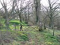
 Wall and Track at Coed y Fron. - geograph.org.uk - 566203.jpg 640 × 480; 111 KB
-
 Where the track turns to Gaerwen. - geograph.org.uk - 566412.jpg 640 × 480; 88 KB
-
 Winter grazings - geograph.org.uk - 623196.jpg 640 × 480; 70 KB
-
 Across the valley - geograph.org.uk - 654449.jpg 640 × 480; 189 KB
-
 Approaching Rhewl - geograph.org.uk - 1122698.jpg 640 × 480; 96 KB
-
 Bryn Celyn - geograph.org.uk - 102719.jpg 640 × 480; 45 KB
-
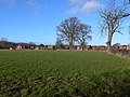
 Countryside at Gwaenynog - geograph.org.uk - 287861.jpg 640 × 325; 33 KB
-

-
 Countryside view from top St. Asaph - geograph.org.uk - 24987.jpg 640 × 480; 110 KB
-
 Edge of Llangollen at Tyn dwr - geograph.org.uk - 55106.jpg 640 × 480; 113 KB
-
 Golygfa tua'r gorllewin. View to the west - geograph.org.uk - 387937.jpg 640 × 427; 114 KB
-
 Horseshoe Pass - geograph.org.uk - 101412.jpg 640 × 480; 57 KB
-

-
 Near Bon yr On. - geograph.org.uk - 559287.jpg 640 × 480; 153 KB
-
 Old woodland - geograph.org.uk - 390072.jpg 640 × 480; 167 KB
-
 Road along the north bank of Geraint Hill - geograph.org.uk - 165661.jpg 640 × 480; 159 KB
-
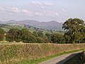
 Vale of Clwyd - geograph.org.uk - 162663.jpg 640 × 478; 92 KB


