Category:Countryside in County Galway
Jump to navigation
Jump to search
Media in category "Countryside in County Galway"
The following 76 files are in this category, out of 76 total.
-
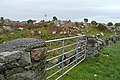
 An Bhaile Nua (Newtown) - geograph.org.uk - 1268164.jpg 640 × 426; 168 KB
-
 An Cathair - geograph.org.uk - 1270523.jpg 640 × 426; 208 KB
-
 An Cathair - geograph.org.uk - 1270527.jpg 640 × 426; 179 KB
-
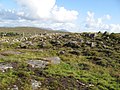
 An Chaothach (Keeagh) - geograph.org.uk - 1267526.jpg 640 × 427; 174 KB
-
 An Chaothach (Keeagh) - geograph.org.uk - 1267535.jpg 640 × 428; 167 KB
-
 An Chloch Mhór Theas (Cloghmore South) - geograph.org.uk - 1290880.jpg 640 × 428; 187 KB
-
 An Cnoc (Knock) - geograph.org.uk - 1271765.jpg 640 × 427; 202 KB
-
 An Dún (Doon) - geograph.org.uk - 1268664.jpg 640 × 426; 202 KB
-
 An Leathchartúr (Cartron) - geograph.org.uk - 1290402.jpg 640 × 427; 219 KB
-
 Approaching Gleann Trasna (Glentrasna) - geograph.org.uk - 1250145.jpg 640 × 428; 207 KB
-
 Athry, Co. Galway, Ireland - panoramio - georama.jpg 3,072 × 2,304; 3.34 MB
-
 Ballinillaun - geograph.org.uk - 1266289.jpg 640 × 426; 184 KB
-
 Ballydavid South - geograph.org.uk - 1259116.jpg 640 × 428; 228 KB
-
 Ballygarraun North - geograph.org.uk - 1259463.jpg 640 × 426; 196 KB
-
 Ballygarraun North - geograph.org.uk - 1259466.jpg 640 × 427; 184 KB
-
 Ballynasheeoge - geograph.org.uk - 1257121.jpg 640 × 425; 201 KB
-
 Both Chuanna (Bohoona) - geograph.org.uk - 1270605.jpg 640 × 426; 213 KB
-
 Both Loiscthe Uachtair (Boliske Oughter) - geograph.org.uk - 1270921.jpg 640 × 426; 196 KB
-
 Both Loiscthe Íochtair (Boliska Eighter) - geograph.org.uk - 1270568.jpg 640 × 427; 210 KB
-
 Both Loiscthe Íochtair (Boliska Eighter) - geograph.org.uk - 1270935.jpg 640 × 425; 215 KB
-
 Both Loiscthe Íochtair (Boliska Eighter) - geograph.org.uk - 1270946.jpg 640 × 426; 221 KB
-
 Bouldery hillside - geograph.org.uk - 1588819.jpg 640 × 480; 91 KB
-
 Bouldery moorland - geograph.org.uk - 1589800.jpg 640 × 480; 90 KB
-
 Burreen area - geograph.org.uk - 1329154.jpg 640 × 479; 66 KB
-

-
 Cnocán na Sliogán (Knockaunnasliggaun) - geograph.org.uk - 1267127.jpg 640 × 428; 197 KB
-
 Conamara, Ireland.jpg 2,848 × 2,136; 1,001 KB
-
 Connemara (3363960524).jpg 4,317 × 2,433; 8.24 MB
-
 Connemara - Lough Kylemore - panoramio.jpg 1,500 × 1,125; 1.41 MB
-
 Connemara - National Park - panoramio.jpg 1,500 × 1,125; 1.36 MB
-
 Connemara - panoramio (2).jpg 1,206 × 1,600; 1.7 MB
-
 Connemara - panoramio.jpg 1,500 × 1,125; 1.36 MB
-
 Connemara Panorama - panoramio.jpg 8,028 × 2,007; 3.63 MB
-
 County Clare Border - geograph.org.uk - 304559.jpg 640 × 480; 98 KB
-
 Dermot and Grania's Bed, Killevny - geograph.org.uk - 789151.jpg 640 × 480; 63 KB
-
 Eanach Bhéal Abhna - geograph.org.uk - 1289352.jpg 640 × 426; 211 KB
-
 Eanach Bhéal Abhna - geograph.org.uk - 1289354.jpg 640 × 426; 212 KB
-
 Eanach Bhéal Abhna - geograph.org.uk - 1289355.jpg 640 × 427; 214 KB
-
 Eanach Bhéal Abhna - geograph.org.uk - 1289357.jpg 640 × 426; 221 KB
-
 Eanach Bhéal Abhna - geograph.org.uk - 1289360.jpg 640 × 426; 221 KB
-
 Entering the Burren - geograph.org.uk - 304553.jpg 640 × 480; 128 KB
-
 From Connemara Loop HDR (3585050099).jpg 2,553 × 1,672; 564 KB
-
 FROM CONNEMARA NATIONAL PARK - panoramio.jpg 2,816 × 2,120; 1.45 MB
-
 Glacially smoothed outcrop - geograph.org.uk - 1588787.jpg 640 × 480; 92 KB
-
 Glennagevlagh, Co. Galway, Ireland - panoramio.jpg 3,072 × 2,304; 3.35 MB
-
 Glenummera valley - stone sheep pen - geograph.org.uk - 1293846.jpg 600 × 450; 184 KB
-
 Gort Townland - geograph.org.uk - 791760.jpg 640 × 479; 85 KB
-
 Granite outcrop - geograph.org.uk - 1588795.jpg 640 × 480; 92 KB
-
 Inishbarra Lettermore Galway Ireland.jpg 3,024 × 4,032; 2.53 MB
-
 Ireland - panoramio (1).jpg 2,560 × 1,920; 1.4 MB
-
 IRELAND - panoramio - cisko66 (1).jpg 3,264 × 830; 458 KB
-
 IRELAND - panoramio - cisko66 (2).jpg 7,635 × 2,675; 4.27 MB
-
 IRELAND - panoramio.jpg 6,079 × 1,303; 1.04 MB
-
 IRL Jan99 15 (9277967795).jpg 3,001 × 2,341; 1.03 MB
-
 IRL Jan99 18 (9277944953).jpg 3,003 × 2,369; 850 KB
-
 IRL Jan99 19 (9280730110).jpg 2,835 × 2,110; 586 KB
-
 Killeen, Co. Galway, Ireland - panoramio - georama (1).jpg 3,072 × 2,304; 3.33 MB
-
 Killeen, Co. Galway, Ireland - panoramio - georama.jpg 3,072 × 2,304; 3.46 MB
-
 Killeen, Co. Galway, Ireland - panoramio.jpg 3,072 × 2,304; 3.34 MB
-
 Leam West, Co. Galway, Ireland - panoramio - georama.jpg 3,072 × 2,304; 3.37 MB
-
 Leam West, Co. Galway, Ireland - panoramio.jpg 3,072 × 2,304; 3.38 MB
-
 Lettermore - panoramio.jpg 3,872 × 2,592; 901 KB
-
 Loch Coirib - Lough Corrib (agost 2011) - panoramio.jpg 3,072 × 1,728; 1.97 MB
-
 Poll na Míoltóg - geograph.org.uk - 1290317.jpg 640 × 427; 189 KB
-
 Páirc Naisiúnta Chonamara - Connemara National Park (agost 2011) - panoramio (6).jpg 3,072 × 2,304; 2.31 MB
-
 Rock bridge - geograph.org.uk - 1589555.jpg 640 × 480; 91 KB
-
 Rock-filled landscape - geograph.org.uk - 3629845.jpg 640 × 480; 104 KB
-
 Rough grazing - geograph.org.uk - 1461187.jpg 640 × 480; 88 KB
-
 Rough grazing - geograph.org.uk - 1589787.jpg 640 × 480; 86 KB
-
 Rough grazing - Kilbeg Townland - geograph.org.uk - 1319469.jpg 640 × 480; 68 KB
-

-
 Rough Grazing, Cloch na Ron - geograph.org.uk - 1404531.jpg 640 × 480; 136 KB
-
 Rough Grazing, Cloch na Ron - geograph.org.uk - 1404583.jpg 640 × 480; 169 KB
-
 Rough land near Cloch na Ron - geograph.org.uk - 1404364.jpg 640 × 481; 173 KB
-
 RoundstoneConnemara.JPG 4,752 × 3,168; 6.68 MB
-
 View of pastures and mountain at Bunscanniff - panoramio.jpg 4,320 × 3,240; 2.03 MB
_-_geograph.org.uk_-_1268164.jpg)


_-_geograph.org.uk_-_1267526.jpg)
_-_geograph.org.uk_-_1267535.jpg)
_-_geograph.org.uk_-_1290880.jpg)
_-_geograph.org.uk_-_1271765.jpg)
_-_geograph.org.uk_-_1268664.jpg)
_-_geograph.org.uk_-_1290402.jpg)
_-_geograph.org.uk_-_1250145.jpg)


_-_geograph.org.uk_-_1270605.jpg)
_-_geograph.org.uk_-_1270921.jpg)
_-_geograph.org.uk_-_1270568.jpg)
_-_geograph.org.uk_-_1270935.jpg)
_-_geograph.org.uk_-_1270946.jpg)


_-_geograph.org.uk_-_1296958.jpg)
_-_geograph.org.uk_-_1267127.jpg)

.jpg)


.jpg)


.jpg)


.jpg)
.jpg)
.jpg)
.jpg)
.jpg)


_-_panoramio.jpg)

_-_panoramio_(6).jpg)


.jpg)
.jpg)