Category:Countryside around Carbis Bay
Jump to navigation
Jump to search
Media in category "Countryside around Carbis Bay"
The following 22 files are in this category, out of 22 total.
-
 3 step stile. - panoramio.jpg 2,992 × 2,992; 3.66 MB
-
 Across the holiday park - geograph.org.uk - 2512266.jpg 640 × 427; 198 KB
-
 Beersheba standing stone - geograph.org.uk - 3255251.jpg 640 × 480; 50 KB
-
 Cattle at Beersheba - geograph.org.uk - 2512250.jpg 640 × 428; 197 KB
-
 Cattle at Withen - geograph.org.uk - 2513172.jpg 640 × 435; 167 KB
-
 Coast path above Carbis Bay - geograph.org.uk - 1891173.jpg 640 × 480; 94 KB
-
 Entrance, Trencrom Iron Age hill fort - geograph.org.uk - 676174.jpg 640 × 480; 67 KB
-
 Field steps ^ through. - panoramio.jpg 2,992 × 2,992; 3.65 MB
-
 Fridays Fence (Olympus Trip 35) EXPLORE - Flickr - Mr B's Photography.jpg 2,520 × 1,680; 2.31 MB
-
-
 Lodge and lane to Trevethoe Barton - geograph.org.uk - 107876.jpg 640 × 480; 184 KB
-
 One o'Clock Rock, Trencrom Hill - geograph.org.uk - 676169.jpg 640 × 480; 82 KB
-
 Sheep grazing - geograph.org.uk - 139102.jpg 640 × 480; 85 KB
-
 St Michael's Way - geograph.org.uk - 904275.jpg 640 × 424; 169 KB
-
 Standing stone on St Michael's Way - geograph.org.uk - 139099.jpg 640 × 480; 76 KB
-
 Stile ^ Gate. - panoramio.jpg 4,000 × 2,672; 4.64 MB
-
 Train approaching Carbis Bay - geograph.org.uk - 895922.jpg 640 × 424; 115 KB
-
 Trevarrack footpath. - panoramio.jpg 4,000 × 2,248; 3.81 MB
-
 Boulders in Field - geograph.org.uk - 540501.jpg 640 × 427; 117 KB
-
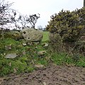
 Gate and gorse - geograph.org.uk - 139073.jpg 640 × 480; 148 KB
-
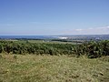
 Over the Valley - geograph.org.uk - 540500.jpg 640 × 427; 100 KB
-
 Railway Line and Coast Path - geograph.org.uk - 581210.jpg 640 × 426; 124 KB


_EXPLORE_-_Flickr_-_Mr_B%27s_Photography.jpg)


