Category:Countryside around Ashburton, Devon
Jump to navigation
Jump to search
Media in category "Countryside around Ashburton, Devon"
The following 161 files are in this category, out of 161 total.
-
 A Farm Track off Whistley Hill - geograph.org.uk - 3293313.jpg 1,024 × 768; 375 KB
-
 A track to Pitley Road - geograph.org.uk - 1930477.jpg 640 × 480; 636 KB
-
 A38 at Pridhamsleigh - geograph.org.uk - 1204068.jpg 640 × 480; 100 KB
-
 Arable field near Creek Farm - geograph.org.uk - 5580186.jpg 2,041 × 1,363; 399 KB
-
 Around Langworthy Bridge - geograph.org.uk - 5566531.jpg 2,048 × 1,536; 597 KB
-
 Ashburn valley at Priestaford - geograph.org.uk - 3739431.jpg 2,033 × 1,436; 697 KB
-
 Ashburton's Terrace Walk above Barnsey Bridge - geograph.org.uk - 4110394.jpg 1,600 × 1,200; 1.53 MB
-
 Ashburton, clump of trees - geograph.org.uk - 2724016.jpg 640 × 427; 371 KB
-
 Ashburton, clump of trees - geograph.org.uk - 2724021.jpg 640 × 427; 371 KB
-
 Ashburton, clump of trees - geograph.org.uk - 2724024.jpg 627 × 418; 373 KB
-
 Ashburton, lane to Owlacombe Cross - geograph.org.uk - 2023212.jpg 640 × 427; 498 KB
-
 Ashburton, pond by mine site - geograph.org.uk - 2023204.jpg 640 × 427; 495 KB
-
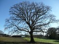
 Bare Tree - geograph.org.uk - 2892311.jpg 1,024 × 768; 284 KB
-
 Barn near Brownswell farms - geograph.org.uk - 4108607.jpg 1,600 × 1,200; 1.53 MB
-
 Barn roof, Dipwell - geograph.org.uk - 1929112.jpg 640 × 480; 406 KB
-
 Barn, Adams Hele - geograph.org.uk - 5581218.jpg 1,210 × 769; 107 KB
-
 Barns on Whistley Hill - geograph.org.uk - 5396249.jpg 3,072 × 2,048; 1.16 MB
-
 Barns, Adams Hele - geograph.org.uk - 5581226.jpg 1,975 × 1,346; 412 KB
-
 Beef cattle in pasture - geograph.org.uk - 716225.jpg 640 × 480; 102 KB
-

-
 Belt of trees near Goodstone - geograph.org.uk - 1204970.jpg 640 × 480; 102 KB
-
 Between Horsehill and Lent Hill - geograph.org.uk - 2597823.jpg 800 × 600; 420 KB
-
 Blackpool Island - geograph.org.uk - 1052948.jpg 640 × 480; 146 KB
-
 Blackpool Island - geograph.org.uk - 1354010.jpg 640 × 480; 147 KB
-
 Bridges over River Ashburn - geograph.org.uk - 1020877.jpg 640 × 427; 109 KB
-
 Buckland in the Moor, Buckland Common - geograph.org.uk - 2585431.jpg 640 × 427; 409 KB
-

-

-

-
 Cattle at spring, Halshanger - geograph.org.uk - 5566500.jpg 1,427 × 782; 138 KB
-
 Cattle near Halshanger - geograph.org.uk - 5566498.jpg 1,837 × 1,273; 265 KB
-
 Cattle on Terrace Walk - geograph.org.uk - 3654696.jpg 640 × 480; 53 KB
-
 Cattle on the edge of Ashburton, and wooded hills - geograph.org.uk - 4108545.jpg 1,600 × 1,200; 1.43 MB
-
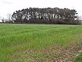
 Christmas Tree Plantation - geograph.org.uk - 2892632.jpg 1,024 × 768; 260 KB
-
 Cold East Cross - geograph.org.uk - 1031962.jpg 640 × 480; 52 KB
-
 Cold East Cross - geograph.org.uk - 4104076.jpg 640 × 480; 66 KB
-
 Coming out of the north of Woodencliff Wood - geograph.org.uk - 4108579.jpg 1,600 × 1,200; 1.9 MB
-
 Dart Country Park - geograph.org.uk - 3957057.jpg 4,000 × 2,664; 6.32 MB
-
 Dartmoor Way approaching Sigford - geograph.org.uk - 5567371.jpg 2,047 × 1,300; 249 KB
-
 Dartmoor Way approaching Sigford - geograph.org.uk - 5567396.jpg 2,048 × 1,536; 491 KB
-
 Dartmoor Way at Whiddon Wood - geograph.org.uk - 145330.jpg 640 × 480; 115 KB
-
 Dartmoor Way by Goodstone Woods - geograph.org.uk - 5567489.jpg 2,048 × 1,536; 668 KB
-
 Dartmoor Way by Goodstone Woods - geograph.org.uk - 5567507.jpg 2,048 × 1,536; 621 KB
-
 Dartmoor Way by Goodstone Woods - geograph.org.uk - 5567519.jpg 2,048 × 1,536; 697 KB
-
 Dartmoor Way crossing a small stream - geograph.org.uk - 3902100.jpg 1,152 × 1,536; 1.56 MB
-
 Dartmoor Way footpath and the River Lemon - geograph.org.uk - 3902087.jpg 1,536 × 1,152; 1.49 MB
-
 Dartmoor Way in Goodstone Woods - geograph.org.uk - 5567795.jpg 2,048 × 1,536; 635 KB
-
 Dolbeare Road - geograph.org.uk - 1932056.jpg 640 × 480; 322 KB
-
 Dolbeare Road - geograph.org.uk - 5805444.jpg 4,288 × 2,848; 1.94 MB
-
 Druid Copper Mine - geograph.org.uk - 1691055.jpg 1,024 × 683; 317 KB
-
 Electric fences forming paddocks - geograph.org.uk - 1930476.jpg 640 × 480; 533 KB
-
 Farmland by Dolbeare Road - geograph.org.uk - 5789656.jpg 4,288 × 2,848; 1.5 MB
-
 Farmland near Druid - geograph.org.uk - 5566113.jpg 2,042 × 1,319; 622 KB
-
 Farmland near Hele Cross - geograph.org.uk - 5581030.jpg 2,038 × 1,276; 335 KB
-
 Farmland near Owlacombe Cross - geograph.org.uk - 1020803.jpg 640 × 427; 68 KB
-
 Farmyard scene by Whistley Hill - geograph.org.uk - 1201696.jpg 536 × 640; 146 KB
-
 Field and Boro' Wood (geograph 6681256).jpg 4,131 × 2,159; 1.43 MB
-
 Field and shelter belt, Rushlade Common - geograph.org.uk - 5566325.jpg 2,048 × 1,536; 444 KB
-
 Field and trees near Rosemount House - geograph.org.uk - 3777186.jpg 1,920 × 1,179; 371 KB
-
 Field Barn near Hooks Plantation - geograph.org.uk - 3902061.jpg 1,536 × 1,152; 1.37 MB
-
 Field beside Chuley Hill - geograph.org.uk - 1200590.jpg 640 × 480; 92 KB
-
 Field beside Chuley Hill - geograph.org.uk - 1200774.jpg 640 × 480; 92 KB
-
 Field beside the A38 near Caton and Goodstone - geograph.org.uk - 3684698.jpg 1,536 × 1,152; 1.1 MB
-

-
 Field boundary on Welstor Common - geograph.org.uk - 1021901.jpg 427 × 640; 109 KB
-
 Field by Dolbeare Road - geograph.org.uk - 5805438.jpg 4,288 × 2,848; 1.93 MB
-
 Field gate near Rushlade - geograph.org.uk - 4108903.jpg 1,600 × 1,200; 1.52 MB
-

-
 Field near Hele - geograph.org.uk - 3776952.jpg 1,920 × 1,305; 369 KB
-
 Field near Rushlade Common - geograph.org.uk - 1228781.jpg 640 × 480; 112 KB
-
 Field with one electricity pole - geograph.org.uk - 4108615.jpg 1,600 × 1,200; 1.6 MB
-
 Fields and woodland near Rew Cross - geograph.org.uk - 4110371.jpg 1,600 × 1,200; 1.56 MB
-
 Fields near Ashburton - geograph.org.uk - 5580254.jpg 2,042 × 1,331; 479 KB
-

-
 Footbridge over the River Sig - geograph.org.uk - 2392825.jpg 1,024 × 683; 297 KB
-
 Footpath, Ashburton - geograph.org.uk - 1201735.jpg 640 × 480; 113 KB
-
 Furzeleigh Farm - geograph.org.uk - 14679.jpg 632 × 420; 61 KB
-
 Gale Road - geograph.org.uk - 1206036.jpg 480 × 640; 115 KB
-
 Granite wall near Rippon Tor - geograph.org.uk - 621960.jpg 640 × 480; 102 KB
-
 Grassland west of Creek Farm - geograph.org.uk - 1932036.jpg 640 × 480; 488 KB
-
 Grassland with nettles and thistles - geograph.org.uk - 1929124.jpg 640 × 480; 458 KB
-
 Grazing above maize - geograph.org.uk - 1932047.jpg 640 × 480; 534 KB
-
 Halsanger Common - geograph.org.uk - 1020900.jpg 640 × 427; 77 KB
-
 Halshangar Wood - geograph.org.uk - 1715184.jpg 1,024 × 683; 284 KB
-
 Halshanger Common - geograph.org.uk - 1228837.jpg 640 × 480; 126 KB
-
 Halshanger Common - geograph.org.uk - 1932774.jpg 640 × 480; 291 KB
-
 Halshanger Cross - geograph.org.uk - 1228775.jpg 640 × 477; 104 KB
-
 Holne Bridge - Dartmoor - geograph.org.uk - 34333.jpg 640 × 480; 176 KB
-
 Holne Cross, near Ashburton - geograph.org.uk - 1068040.jpg 640 × 480; 109 KB
-
 House on Whistley Hill - geograph.org.uk - 1201677.jpg 640 × 474; 81 KB
-
 Houses at Lent Hill - geograph.org.uk - 716221.jpg 640 × 480; 109 KB
-

-
 Knowles Cross, near Ashburton - geograph.org.uk - 1068608.jpg 640 × 480; 147 KB
-
 Lane at Goodstone - geograph.org.uk - 1205372.jpg 640 × 480; 120 KB
-
 Lane to Ausewell Cross - geograph.org.uk - 1229167.jpg 482 × 640; 94 KB
-
 Lane to Bowdley - geograph.org.uk - 178163.jpg 640 × 480; 103 KB
-
 Lane to Whistley Hill Cross - geograph.org.uk - 1929109.jpg 512 × 640; 405 KB
-
 Lent Hill - geograph.org.uk - 1216454.jpg 640 × 480; 89 KB
-
 Linhay Hill Quarry - geograph.org.uk - 1018123.jpg 640 × 427; 79 KB
-
 Linhay Hill Quarry - geograph.org.uk - 1018132.jpg 640 × 427; 86 KB
-
 Looking towards Bowdley - geograph.org.uk - 151049.jpg 640 × 480; 113 KB
-
 Lovers leap Holne Chase Dartmoor England.jpg 1,073 × 845; 203 KB
-
 Lovers leap, Holne Chase, Dartmoor, England-LCCN2002696634.jpg 3,690 × 2,779; 3.55 MB
-
 Lovers leap, Holne Chase, Dartmoor, England-LCCN2002696634.tif 3,690 × 2,779; 29.34 MB
-
 Minor road, north of Ashburton - geograph.org.uk - 1068069.jpg 640 × 480; 110 KB
-
 Near Goodstone Woods - geograph.org.uk - 145335.jpg 640 × 480; 145 KB
-
 Newhouse Inn ruins - Dartmoor - geograph.org.uk - 142426.jpg 640 × 425; 108 KB
-
 Nut Crackers - geograph.org.uk - 1348197.jpg 640 × 427; 101 KB
-
 Oak tree at Horsehill - geograph.org.uk - 716216.jpg 640 × 480; 130 KB
-

-
 Old gates and field walls - geograph.org.uk - 1070775.jpg 640 × 487; 92 KB
-
 Old mine chimney near Druid - geograph.org.uk - 1021921.jpg 427 × 640; 174 KB
-
 Owlacombe Cross - geograph.org.uk - 145054.jpg 640 × 480; 102 KB
-
 Owlacombe Cross - geograph.org.uk - 3264604.jpg 640 × 480; 86 KB
-
 Pines at Owlacombe Cross - geograph.org.uk - 2892620.jpg 1,024 × 768; 259 KB
-
 Place Wood from near Brownswell - geograph.org.uk - 145326.jpg 640 × 480; 109 KB
-
 Pond at Owlacombe - geograph.org.uk - 145333.jpg 640 × 480; 153 KB
-
 Pond near Owlacombe Farm - geograph.org.uk - 3264600.jpg 640 × 480; 162 KB
-
 Public footpath to Lower Mead - geograph.org.uk - 1932049.jpg 640 × 480; 515 KB
-
 Quarry near Higher Brownswell - geograph.org.uk - 952588.jpg 640 × 427; 56 KB
-
 Recently-mown meadow - geograph.org.uk - 1929105.jpg 640 × 480; 417 KB
-
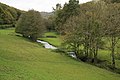 River Ashburn - geograph.org.uk - 1021934.jpg 640 × 427; 88 KB
-
 River Ashburn - geograph.org.uk - 1021948.jpg 640 × 427; 143 KB
-
 River Dart - geograph.org.uk - 2977864.jpg 640 × 480; 110 KB
-
 Road down to Langworthy Bridge - geograph.org.uk - 1715197.jpg 1,024 × 683; 229 KB
-
 Road liable to flooding - geograph.org.uk - 1018075.jpg 640 × 427; 82 KB
-
 Road near Holne Old Bridge - geograph.org.uk - 1216558.jpg 640 × 480; 156 KB
-
 Road to Nowhere - geograph.org.uk - 12415.jpg 567 × 636; 349 KB
-
 Rocks near Nutcracker Rock - geograph.org.uk - 621970.jpg 640 × 480; 83 KB
-
 Royal ferns by the Dart - geograph.org.uk - 2977944.jpg 640 × 512; 143 KB
-
 Ruined shelter on Welstor Common - geograph.org.uk - 1021875.jpg 640 × 427; 109 KB
-
 Rushlade Common - geograph.org.uk - 1228788.jpg 640 × 450; 87 KB
-
 Rushlade Common - geograph.org.uk - 1228829.jpg 640 × 480; 115 KB
-
 Sheds and fields near Chuley Hill - geograph.org.uk - 1200835.jpg 640 × 480; 84 KB
-
 Sheep grazing near Stormsdown - geograph.org.uk - 1018101.jpg 640 × 427; 54 KB
-
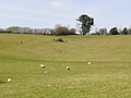
 Sheep grazing on Beacon Hill - geograph.org.uk - 1021867.jpg 640 × 427; 93 KB
-
 Sheep on Yolland Hill - Devon - geograph.org.uk - 135707.jpg 640 × 480; 146 KB
-
 Sheep Pasture - geograph.org.uk - 2892279.jpg 1,024 × 768; 202 KB
-
 Signs by Chuley Road, Ashburton - geograph.org.uk - 1081283.jpg 640 × 455; 145 KB
-
 Springtime Pasture - geograph.org.uk - 3293303.jpg 1,024 × 768; 259 KB
-

-
 Stone Stile - geograph.org.uk - 952334.jpg 640 × 427; 96 KB
-
 Stream, Ashburton - geograph.org.uk - 1200965.jpg 640 × 520; 126 KB
-
 Terrace Walk, north of Ashburton - geograph.org.uk - 952331.jpg 640 × 427; 69 KB
-
 Towards Ashburton from Pitley Cross - geograph.org.uk - 1206149.jpg 640 × 514; 113 KB
-

-
 Trees by the Dart - geograph.org.uk - 3222173.jpg 501 × 640; 124 KB
-
 View from Creek Cross - geograph.org.uk - 150983.jpg 640 × 480; 107 KB
-
 View from Rushlade Common - Dartmoor - geograph.org.uk - 142422.jpg 640 × 425; 94 KB
-
 View near Ashburton - geograph.org.uk - 132550.jpg 640 × 480; 72 KB
-
 View near Druid - geograph.org.uk - 145328.jpg 640 × 480; 104 KB
-
 Views over Dartmoor from Whiddon - geograph.org.uk - 952569.jpg 640 × 427; 70 KB
-
 Westabrook - geograph.org.uk - 145327.jpg 640 × 480; 117 KB
-
 Whiddon Woods - geograph.org.uk - 1021980.jpg 640 × 427; 73 KB
-
 Whistley Hill - geograph.org.uk - 1201710.jpg 640 × 480; 113 KB
-
 Whistley Hill - geograph.org.uk - 1201718.jpg 640 × 480; 142 KB
-
 Winter trees near Buckland Beacon - geograph.org.uk - 3258473.jpg 1,600 × 1,200; 850 KB
-
 Woodland Footpath - geograph.org.uk - 2892252.jpg 1,024 × 768; 456 KB
-
 Woodland walk by the river Ashburn - geograph.org.uk - 952340.jpg 640 × 427; 78 KB
-
 Woodland walk through Whiddon Scrubs - geograph.org.uk - 952337.jpg 640 × 427; 91 KB
-
 Woods near Ausewell Rocks - geograph.org.uk - 151057.jpg 640 × 480; 147 KB


.jpg)


