Category:Cottingley, Bradford
Jump to navigation
Jump to search
village in United Kingdom situated just outside the town of Bingley  | |||||
| Upload media | |||||
| Instance of | |||||
|---|---|---|---|---|---|
| Location | Bingley, Bradford, West Yorkshire, Yorkshire and the Humber, England | ||||
 | |||||
English: Cottingley is a village within the metropolitan borough of the City of Bradford, in West Yorkshire, England. It is situated between Shipley and Bingley. It is famous for the series of photos taken there in 1918 that purport to show fairies: see Cottingley Fairies.
Subcategories
This category has the following 7 subcategories, out of 7 total.
B
- Beckfoot Lane, Bingley (7 F)
- Bradford Road, Cottingley (1 F)
C
- Cottingley fairies (15 F)
- Cottingley Moor Road (15 F)
- Cottingley Town Hall (2 F)
S
- Stoney Ridge Road, Bradford (14 F)
Media in category "Cottingley, Bradford"
The following 36 files are in this category, out of 36 total.
-
 Bankfield Farm, Cottingley - geograph.org.uk - 1636123.jpg 640 × 480; 80 KB
-
 Bay of Biscay, Haworth Road - geograph.org.uk - 37350.jpg 640 × 480; 131 KB
-
 Bridleway - North Bank Road - geograph.org.uk - 3115407.jpg 480 × 640; 88 KB
-
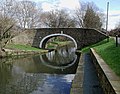
 Cottingley Bridge - geograph.org.uk - 629398.jpg 640 × 427; 153 KB
-
 Cottingley Moor in the mist - geograph.org.uk - 2711471.jpg 1,600 × 994; 325 KB
-
 Cottingley Roundabout - geograph.org.uk - 33810.jpg 640 × 480; 151 KB
-
 Dowley Gap Aqueduct - geograph.org.uk - 353210.jpg 640 × 481; 136 KB
-
 Haworth Road Library - geograph.org.uk - 642998.jpg 640 × 449; 86 KB
-
 Horses in the Snow at Cottingley(1) - geograph.org.uk - 1636142.jpg 640 × 480; 93 KB
-
 Horses in the Snow at Cottingley(2) - geograph.org.uk - 1636158.jpg 640 × 480; 92 KB
-
 Kiddi Creche - Cottingley New Road - geograph.org.uk - 642913.jpg 640 × 417; 98 KB
-

-
 Manor Farm, Cottingley - geograph.org.uk - 41709.jpg 640 × 427; 79 KB
-
 St Mary's Church, Cottingley - geograph.org.uk - 41707.jpg 640 × 427; 84 KB
-

-
 Nab Wood Crematorium - geograph.org.uk - 427977.jpg 640 × 402; 57 KB
-

-

-
 North Bank Road, Cottingley - geograph.org.uk - 3413075.jpg 2,000 × 1,425; 966 KB
-
 Parade of shops in Cottingley - geograph.org.uk - 33813.jpg 640 × 480; 137 KB
-
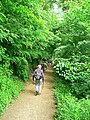 Path by the River Aire - geograph.org.uk - 1356312.jpg 450 × 600; 185 KB
-
 Ready for milking - geograph.org.uk - 1350240.jpg 640 × 480; 140 KB
-

-
 Scourer Bridge, Dowley Gap - geograph.org.uk - 41656.jpg 640 × 480; 131 KB
-
 Telephone Exchange - Leonard Street - geograph.org.uk - 581485.jpg 640 × 457; 35 KB
-

-
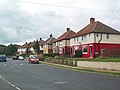
 Unity Street South - Oak Avenue - geograph.org.uk - 1119814.jpg 640 × 404; 212 KB
-
 Airedale Avenue - Cottingley - geograph.org.uk - 642923.jpg 640 × 416; 74 KB
-
 Brantwood Drive - Haworth Road - geograph.org.uk - 642993.jpg 640 × 401; 98 KB
-
 Cottingley Business Park - geograph.org.uk - 41704.jpg 567 × 378; 32 KB
-
 Cottingley Moor and North Bank Road - geograph.org.uk - 38708.jpg 640 × 480; 174 KB
-
 Dowley Gap Bridge - geograph.org.uk - 353196.jpg 640 × 500; 130 KB
-
 Dowley Gap Locks - geograph.org.uk - 353178.jpg 640 × 480; 100 KB
-
 Dowley Gap Locks - geograph.org.uk - 353186.jpg 640 × 472; 112 KB
-
 Lynfield Drive - geograph.org.uk - 37354.jpg 640 × 480; 100 KB
-
 Stockagate, Cottingley Moor - geograph.org.uk - 377205.jpg 640 × 445; 111 KB


_-_geograph.org.uk_-_1636142.jpg)
_-_geograph.org.uk_-_1636158.jpg)


