Category:Cotterstock
Jump to navigation
Jump to search
Deutsch: Cotterstock ist ein Dorf in der Grafschaft Northamptonshire in Südwest-England. Es liegt am Ufer des Flusses Nene, der in nordöstlicher Richtung nach 25 km die Stadt Peterborough durchquert und in der Bucht The Wash in die Nordsee mündet. Der nächstgelegene größere Ort ist Oundle 4 km in südwestlicher Richtung.
village and civil parish in Northamptonshire, England  | |||||
| Upload media | |||||
| Instance of | |||||
|---|---|---|---|---|---|
| Location | North Northamptonshire, Northamptonshire, East Midlands, England | ||||
 | |||||
Subcategories
This category has only the following subcategory.
A
- St Andrew's church, Cotterstock (17 F)
Media in category "Cotterstock"
The following 51 files are in this category, out of 51 total.
-
 Approaching Cotterstock - July 2014 - panoramio.jpg 4,000 × 3,000; 2.99 MB
-
 Birdwatchers at Cotterstock (geograph 3698261).jpg 800 × 506; 243 KB
-
 Boat leaving Cotterstock Lock - geograph.org.uk - 4486293.jpg 4,320 × 3,240; 5.5 MB
-
 Bridge on the southern approach to Cotterstock - geograph.org.uk - 4486250.jpg 4,320 × 3,240; 5.73 MB
-
 Cottages by Cotterstock Mill (geograph 3698622).jpg 600 × 800; 311 KB
-
 Cotterstock Cottage (geograph 2059218).jpg 640 × 480; 82 KB
-
 Cotterstock Lock - geograph.org.uk - 2682425.jpg 3,648 × 2,736; 2.13 MB
-
 Cotterstock no,1 weir - geograph.org.uk - 2682471.jpg 3,648 × 2,736; 2.24 MB
-
 Cotterstock village street - geograph.org.uk - 3698258.jpg 800 × 450; 211 KB
-
 Daniel Radcliffe in The Woman in Black.jpg 450 × 299; 140 KB
-
 Dog Daisies near to Southwick water tower - geograph.org.uk - 4560737.jpg 4,320 × 3,240; 5.37 MB
-
 Electricity sub-station at Oundle - geograph.org.uk - 647768.jpg 640 × 480; 76 KB
-
 Entering Cotterstock - geograph.org.uk - 5281037.jpg 480 × 640; 71 KB
-
 Farm track - geograph.org.uk - 3698244.jpg 800 × 450; 221 KB
-
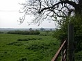
 Grass field near the church in Cotterstock - geograph.org.uk - 4486315.jpg 4,320 × 3,240; 5.97 MB
-
 Grass triangle in Cotterstock (geograph 2872739).jpg 640 × 480; 80 KB
-
 Grass triangle, Cotterstock - geograph.org.uk - 1214681.jpg 640 × 480; 87 KB
-
 Gravestones in Cotterstock - geograph.org.uk - 4486322.jpg 4,320 × 3,240; 5.92 MB
-
 Lock on The River Nene at Cotterstock - geograph.org.uk - 4486256.jpg 4,320 × 3,240; 5.33 MB
-
 Mill Race at Cotterstock - geograph.org.uk - 3698254.jpg 800 × 450; 256 KB
-
 Mounting block by Perio House (geograph 2682387).jpg 3,648 × 2,736; 2.2 MB
-
 Next to the former water mill in Cotterstock - geograph.org.uk - 4486327.jpg 4,320 × 3,240; 5.86 MB
-
 Old sluice gate near Cotterstock Mill - geograph.org.uk - 4486307.jpg 4,320 × 3,240; 5.49 MB
-
 Portage point - geograph.org.uk - 2682437.jpg 3,648 × 2,736; 2.13 MB
-
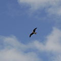 Red Kite over Cotterstock (geograph 3698266).jpg 799 × 800; 192 KB
-
 Reused sign (geograph 3698632).jpg 800 × 601; 319 KB
-
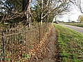 Road, path and fence in Cotterstock - geograph.org.uk - 2682414.jpg 3,648 × 2,736; 2.17 MB
-
 Sheep pasture - geograph.org.uk - 4613572.jpg 4,320 × 3,240; 5.9 MB
-
 Small tree avenue in Cotterstock village - geograph.org.uk - 2682457.jpg 3,648 × 2,736; 2.13 MB
-
 Southwick Wood and telecommunication mast - geograph.org.uk - 6332915.jpg 1,024 × 768; 205 KB
-
 Stubble field near Southwick Wood - geograph.org.uk - 6332094.jpg 1,024 × 768; 167 KB
-
 The River Nene - geograph.org.uk - 2682466.jpg 3,648 × 2,736; 2.17 MB
-
 Towards Mill Land, Cotterstock - geograph.org.uk - 5281039.jpg 480 × 640; 58 KB
-
 Trees near Cotterstock Hall - geograph.org.uk - 2682408.jpg 640 × 480; 116 KB
-
 Water tower between Glapthorn and Southwick - geograph.org.uk - 6332801.jpg 1,024 × 768; 252 KB
-
 Weir from the Nene - geograph.org.uk - 265409.jpg 640 × 480; 107 KB
-
 Where is the Kingfisher? (geograph 3698263).jpg 800 × 600; 272 KB
-
 Winding gear at Perio Mill (geograph 2682401).jpg 3,648 × 2,736; 2.1 MB
-
 A Field - geograph.org.uk - 191967.jpg 640 × 480; 83 KB
-
 A Field of Barley - geograph.org.uk - 191972.jpg 640 × 480; 98 KB
-
 Bridleway - geograph.org.uk - 191975.jpg 640 × 480; 96 KB
-
 Bridleway and Oil-seed Rape - geograph.org.uk - 191971.jpg 640 × 480; 110 KB
-

-
 Coterstock Lock River Nene - geograph.org.uk - 266701.jpg 640 × 480; 61 KB
-
 Cotterstock - geograph.org.uk - 191968.jpg 640 × 480; 94 KB
-
 Cotterstock Road towards Oundle - geograph.org.uk - 351717.jpg 640 × 480; 76 KB
-
 Field and Hedge - geograph.org.uk - 351716.jpg 640 × 480; 61 KB
-
 Fields and trees - geograph.org.uk - 351715.jpg 640 × 480; 78 KB
-
 Floods out on the Tansor Road - geograph.org.uk - 714526.jpg 640 × 480; 95 KB
-
 Near Cotterstock Lodge - geograph.org.uk - 66181.jpg 600 × 450; 72 KB
-
 Round the bend - geograph.org.uk - 351721.jpg 640 × 480; 78 KB

.jpg)


.jpg)
.jpg)


.jpg)


.jpg)


.jpg)
.jpg)


.jpg)
.jpg)


