Category:Cottam Power Station
Jump to navigation
Jump to search
one coal and one gas fired power station in Nottinghamshire, England, UK  | |||||
| Upload media | |||||
| Instance of |
| ||||
|---|---|---|---|---|---|
| Location |
| ||||
| Has part(s) |
| ||||
| Elevation above sea level |
| ||||
 | |||||
Media in category "Cottam Power Station"
The following 83 files are in this category, out of 83 total.
-
 Detail of the Partially-Demolished Cottam Power Station.jpg 2,337 × 768; 448 KB
-
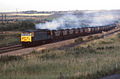 56013 , Seymour Sidings.jpg 1,500 × 985; 229 KB
-
 Across The Trent to Cottam Power Station - geograph.org.uk - 4830543.jpg 3,623 × 4,928; 4.86 MB
-
 Agriculture and Industry - geograph.org.uk - 209054.jpg 640 × 427; 54 KB
-
 Approaching Cottam power station - geograph.org.uk - 3160484.jpg 640 × 427; 188 KB
-
 Approaching Cottam power station - geograph.org.uk - 3160485.jpg 640 × 427; 187 KB
-
 Beside Cottam power station - geograph.org.uk - 531666.jpg 640 × 427; 56 KB
-
 Cooling Towers at Cottam.jpg 6,016 × 4,000; 9.79 MB
-
 Cooling Towers in the Background.jpg 6,016 × 4,000; 10.19 MB
-
 Cottam Behind Trees.jpg 5,783 × 3,845; 3.39 MB
-
Cottam blowdown.webm 27 s, 1,920 × 1,080; 8.35 MB
-
 Cottam Cooling Towers - geograph.org.uk - 1242186.jpg 640 × 426; 61 KB
-
 Cottam cooling towers - geograph.org.uk - 3504004.jpg 640 × 433; 56 KB
-
 Cottam Cooling Towers.jpg 6,016 × 4,000; 9.51 MB
-
 Cottam in Drizzle.jpg 5,863 × 3,899; 2.54 MB
-
 Cottam power station (2) - geograph.org.uk - 3040004.jpg 1,024 × 768; 148 KB
-
 Cottam Power Station - geograph.org.uk - 1364169.jpg 640 × 426; 55 KB
-
 Cottam Power Station - geograph.org.uk - 1712152.jpg 640 × 426; 44 KB
-
 Cottam power station - geograph.org.uk - 1738324.jpg 640 × 480; 102 KB
-
 Cottam Power Station - geograph.org.uk - 209096.jpg 640 × 427; 65 KB
-
 Cottam power station - geograph.org.uk - 3039979.jpg 1,024 × 768; 157 KB
-
 Cottam power station - geograph.org.uk - 3039982.jpg 1,024 × 768; 207 KB
-
 Cottam Power Station - geograph.org.uk - 3522576.jpg 640 × 429; 62 KB
-
 Cottam Power Station - geograph.org.uk - 4342158.jpg 1,024 × 768; 117 KB
-
 Cottam Power Station - geograph.org.uk - 4866584.jpg 1,024 × 682; 138 KB
-
 Cottam Power Station - geograph.org.uk - 5195627.jpg 3,776 × 2,399; 3.52 MB
-
 Cottam Power Station - geograph.org.uk - 531655.jpg 640 × 427; 61 KB
-
 Cottam Power Station - geograph.org.uk - 676945.jpg 480 × 640; 29 KB
-
 Cottam Power Station - geograph.org.uk - 777933.jpg 640 × 437; 57 KB
-
 Cottam Power Station at dusk.jpg 2,400 × 1,800; 1.61 MB
-
 Cottam Power Station at Dusk.jpg 2,400 × 1,607; 1.02 MB
-
 Cottam Power Station Boiler House 1.jpg 6,016 × 4,000; 3.18 MB
-
 Cottam Power Station Boiler House 2.jpg 6,016 × 4,000; 3.18 MB
-
 Cottam Power Station Boiler House 3.jpg 6,016 × 4,000; 3.28 MB
-
 Cottam Power Station from Broad Lane - geograph.org.uk - 209228.jpg 640 × 427; 34 KB
-
 Cottam Power Station From Grove Road.jpg 6,016 × 4,000; 8.18 MB
-
 Cottam Power Station from Grove Road.jpg 6,016 × 4,000; 8 MB
-

-
 Cottam Power Station from Torksey Castle - geograph.org.uk - 47292.jpg 640 × 480; 112 KB
-
 Cottam Power station from Torksey Ferry Road - geograph.org.uk - 3165140.jpg 4,000 × 3,000; 4.47 MB
-

-
 Cottam Power Station in 2007.jpg 640 × 480; 54 KB
-
 Cottam Power Station in the distance - geograph.org.uk - 3514680.jpg 2,256 × 1,504; 1.05 MB
-
 Cottam Power Station viewed from Tuxford.jpg 6,016 × 4,000; 8.84 MB
-
 Cottam Power Station Without the Boiler House.jpg 6,016 × 4,000; 9.17 MB
-
 Cottam Power Station, north view July 2019.jpg 4,032 × 3,024; 1.38 MB
-
 Cottam Power Station.jpg 5,781 × 3,843; 2.39 MB
-
 Cottam pylons - geograph.org.uk - 531667.jpg 640 × 427; 63 KB
-
 Cottam Sunset - geograph.org.uk - 605540.jpg 640 × 427; 40 KB
-
 Cows and cooling towers, Cottam - geograph.org.uk - 450176.jpg 480 × 640; 141 KB
-
 Disused Railway - geograph.org.uk - 92084.jpg 640 × 427; 96 KB
-
 Energy field - geograph.org.uk - 679897.jpg 640 × 459; 96 KB
-
 Fields towards Cottam Power station - geograph.org.uk - 1337126.jpg 640 × 382; 31 KB
-
 Global Warming......"Warning" (5177597159).jpg 2,780 × 2,744; 5.36 MB
-

-
 Marsh Lane - geograph.org.uk - 1330874.jpg 640 × 426; 98 KB
-
 Merry go round train detail.jpg 636 × 442; 65 KB
-
 Mickleholme Farm April 1964.jpg 4,745 × 2,944; 6.82 MB
-
 No Entay? - geograph.org.uk - 1171059.jpg 640 × 408; 42 KB
-
 North Leverton with Habblesthorpe MMB 01.jpg 3,936 × 2,172; 3.09 MB
-
 Old and new buildings - geograph.org.uk - 3158883.jpg 640 × 452; 175 KB
-
 Over grown Field gateway - geograph.org.uk - 1337093.jpg 640 × 480; 57 KB
-
 Overcoat Lane and Cottam power station - geograph.org.uk - 3040335.jpg 1,024 × 768; 149 KB
-
 Parish Boundary - geograph.org.uk - 531658.jpg 427 × 640; 55 KB
-
 Power on the Trent - geograph.org.uk - 3158893.jpg 640 × 430; 168 KB
-
 Power Stations - geograph.org.uk - 780067.jpg 640 × 480; 55 KB
-
 Pylons at Cottam power station - geograph.org.uk - 3040572.jpg 1,024 × 729; 146 KB
-
 Shortleys Road - geograph.org.uk - 1242191.jpg 640 × 426; 63 KB
-
 Shortleys Road - geograph.org.uk - 2877947.jpg 640 × 427; 69 KB
-
 Sluice at Cottam power station - geograph.org.uk - 3160489.jpg 640 × 427; 164 KB
-
 Smoke against the sky - geograph.org.uk - 483390.jpg 640 × 427; 56 KB
-
 Storm brewing - geograph.org.uk - 2009089.jpg 640 × 426; 61 KB
-
 Towards Cottam power station - geograph.org.uk - 3160472.jpg 640 × 403; 169 KB
-
 Trent flood plain - geograph.org.uk - 1718124.jpg 640 × 426; 58 KB
-
 Trent floodwaters - geograph.org.uk - 663283.jpg 640 × 427; 64 KB
-
 View from Craikbank Lane - geograph.org.uk - 531085.jpg 640 × 427; 82 KB
-
 View from Craikbank Lane - geograph.org.uk - 531090.jpg 640 × 427; 73 KB
-
 View to Cottam - geograph.org.uk - 1718128.jpg 426 × 640; 40 KB
-
 West Burton at Dusk - geograph.org.uk - 1172666.jpg 640 × 480; 38 KB
-

-
 Wood Lane, Treswell - geograph.org.uk - 545414.jpg 640 × 427; 72 KB
-
 Cottam Power Station and Double Gate - geograph.org.uk - 553908.jpg 640 × 480; 70 KB
-
 Cottam Power Station, Notts - geograph.org.uk - 90138.jpg 640 × 482; 79 KB


_-_geograph.org.uk_-_3040004.jpg)


.jpg)


