Category:Cotswold Line
Jump to navigation
Jump to search
Main Wikipedia article: Cotswold Line.
English: The railway line between Oxford, Worcester and Hereford.
railway line between Oxford and Hereford  | |||||
| Upload media | |||||
| Instance of | |||||
|---|---|---|---|---|---|
| Part of |
| ||||
| Location | South East England, England | ||||
| Owned by | |||||
| Operator | |||||
| Date of official opening |
| ||||
| Terminus | |||||
| |||||
Subcategories
This category has the following 33 subcategories, out of 33 total.
A
B
- Blockley railway station (2 F)
C
- Charlbury railway station (33 F)
- Colwall railway station (6 F)
- Combe railway station (8 F)
D
- Duke's Cut railway bridge (9 F)
E
F
- Finstock railway station (8 F)
- Fladbury railway station (2 F)
G
H
- Honeybourne railway station (45 F)
K
- Kingham railway station (20 F)
L
M
- Malvern Link railway station (37 F)
O
P
- Pershore railway station (21 F)
S
- Shipton railway station (4 F)
- Stoke Edith railway station (2 F)
- Stoulton railway station (1 F)
W
- Wolvercote Junction (7 F)
- Worcester Railway Bridge (50 F)
Media in category "Cotswold Line"
The following 32 files are in this category, out of 32 total.
-

-
 Crossing cottage - geograph.org.uk - 1232288.jpg 640 × 427; 70 KB
-
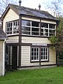 Bruern Railway Crossing Signal Box - geograph.org.uk - 1671392.jpg 1,536 × 2,048; 645 KB
-
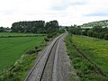
 Railway line south to Oxford - geograph.org.uk - 321088.jpg 640 × 480; 107 KB
-
 CLmap.png 604 × 379; 63 KB
-
 Cotswold Line.png 2,607 × 1,569; 2.97 MB
-
 Curving Toward Hereford - geograph.org.uk - 1349786.jpg 640 × 480; 174 KB
-
 Henwick Signal Box, Worcester - geograph.org.uk - 838702.jpg 640 × 480; 78 KB
-
 Hereford-Ledbury railway at Ashperton - geograph.org.uk - 948664.jpg 480 × 640; 118 KB
-
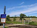 Hyatts user-worked crossing, Cotswold Line, Ascott-under-Wychwood, Oxfordshire.jpg 2,587 × 1,940; 1.4 MB
-
 Junction2.jpg 546 × 408; 162 KB
-
 Across the railway - geograph.org.uk - 1635557.jpg 640 × 480; 77 KB
-
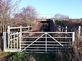
 Level crossing near Bruern Abbey - geograph.org.uk - 1031791.jpg 480 × 640; 49 KB
-
 Low bridge approaching Lyneham - geograph.org.uk - 1232195.jpg 640 × 427; 94 KB
-
 Main Line To Ledbury - geograph.org.uk - 1349751.jpg 640 × 480; 229 KB
-
 Malvern Wells loop - geograph.org.uk - 833728.jpg 640 × 480; 113 KB
-
 Railway cutting - geograph.org.uk - 406591.jpg 480 × 640; 125 KB
-
 Oxey Mead railway bridges 01.jpg 4,128 × 3,096; 8.67 MB
-
 Oxey Mead railway bridges 02.jpg 4,128 × 3,096; 4.61 MB
-
 Oxey Mead railway bridges 03.jpg 4,128 × 3,096; 7.62 MB
-
 Railway line from Godstow Road, Wolvercote 01.jpg 4,128 × 3,096; 6.42 MB
-
 Railway line from Godstow Road, Wolvercote 02.jpg 4,128 × 3,096; 6.39 MB
-
 Rushwick - site of the railway halt - geograph.org.uk - 841878.jpg 480 × 640; 106 KB
-
 The Cotswold Line at Combe - geograph.org.uk - 1950737.jpg 3,376 × 2,736; 2.32 MB
-

-

-
 The Hereford to Worcester Line - geograph.org.uk - 1293245.jpg 640 × 426; 142 KB
-
 The railway curves round Port Meadow - geograph.org.uk - 1321889.jpg 640 × 414; 78 KB
-
 The single Cotswold line - geograph.org.uk - 162695.jpg 640 × 427; 97 KB
-
 Wolvercote Junction - geograph.org.uk - 1321949.jpg 640 × 412; 88 KB
-

-
 Worcester to Hereford railway line - geograph.org.uk - 53919.jpg 426 × 640; 141 KB
.jpg)


