Category:Coton, Cambridgeshire
Jump to navigation
Jump to search
English: Coton is a small village and civil parish three miles (about 5 km) west-by-north of Cambridge in Cambridgeshire, England. It belongs to the administrative district of South Cambridgeshire. The parish covers an area of 4 km². In 2000 it had a population of 720.
Nederlands: Coton is een dorp (village en civil parish) in het Engelse graafschap Cambridgeshire. Het dorp ligt in het district South Cambridgeshire en telt 773 inwoners.
village and civil parish in Cambridgeshire, United Kingdom  | |||||
| Upload media | |||||
| Instance of | |||||
|---|---|---|---|---|---|
| Location | South Cambridgeshire, Cambridgeshire, East of England, England | ||||
| Population |
| ||||
| Said to be the same as | Coton (Wikimedia duplicated page, civil parish) | ||||
 | |||||
Subcategories
This category has the following 4 subcategories, out of 4 total.
Media in category "Coton, Cambridgeshire"
The following 200 files are in this category, out of 462 total.
(previous page) (next page)-
 50, High St - geograph.org.uk - 3861861.jpg 640 × 430; 61 KB
-
 57 High Street, Coton.jpg 640 × 426; 56 KB
-
 A cover drive at Coton - geograph.org.uk - 5891766.jpg 1,024 × 768; 971 KB
-
 A farm track in November - geograph.org.uk - 4249861.jpg 1,024 × 768; 1.26 MB
-
 A full water trough - geograph.org.uk - 1190653.jpg 640 × 470; 120 KB
-
 A January afternoon in Coton - geograph.org.uk - 4304745.jpg 1,024 × 1,024; 1.54 MB
-
 A muddy track in November - geograph.org.uk - 4249918.jpg 1,024 × 768; 950 KB
-
 A permissive path on Coton Countryside Reserve - geograph.org.uk - 6610464.jpg 1,024 × 768; 955 KB
-
 A rusty, bent farm gate - geograph.org.uk - 1219408.jpg 640 × 474; 81 KB
-
 A sprinkling of snow in October - geograph.org.uk - 3213113.jpg 1,024 × 803; 1.1 MB
-
 A wheatfield west of Cambridge - geograph.org.uk - 5844874.jpg 1,024 × 768; 932 KB
-
 A winter walk - geograph.org.uk - 5232721.jpg 1,024 × 732; 1.2 MB
-
 A1303 - geograph.org.uk - 5352972.jpg 640 × 458; 94 KB
-
 A1303 lay-by - geograph.org.uk - 5584467.jpg 640 × 480; 87 KB
-

-
 A1303 St.Neots Road, Coton - geograph.org.uk - 4766444.jpg 3,072 × 2,304; 1.72 MB
-
 A1303 St.Neots Road, Coton - geograph.org.uk - 4767310.jpg 3,072 × 2,304; 1.93 MB
-
 A1303 St.Neots Road, Coton - geograph.org.uk - 4767360.jpg 3,072 × 2,304; 1.96 MB
-
 Across the fields to Coton - geograph.org.uk - 4250333.jpg 1,024 × 682; 1.02 MB
-
 Alpacas - geograph.org.uk - 3854701.jpg 640 × 430; 90 KB
-
 Alpacas by Coton - geograph.org.uk - 4977902.jpg 1,600 × 1,200; 763 KB
-
 Anglian Water building - geograph.org.uk - 3854655.jpg 640 × 430; 90 KB
-

-
 Barn and car park, Coton Reserve - geograph.org.uk - 3846354.jpg 640 × 430; 54 KB
-
 Barn by Grantchester Road - geograph.org.uk - 6475472.jpg 1,888 × 1,230; 1.67 MB
-
 Barns off Whitwell Way, Coton - geograph.org.uk - 5611550.jpg 5,202 × 3,465; 4.94 MB
-
 Barns on The High St - geograph.org.uk - 3861914.jpg 640 × 430; 45 KB
-
 Barton Rd - geograph.org.uk - 4841279.jpg 640 × 426; 45 KB
-
 Barton Rd, A603 - geograph.org.uk - 4840898.jpg 640 × 412; 54 KB
-
 Barton rifle range - geograph.org.uk - 2748932.jpg 640 × 427; 77 KB
-
 Barton Road (A603) towards Cambridge - geograph.org.uk - 5426548.jpg 640 × 480; 79 KB
-
 Beacon at Red Meadow Hill - geograph.org.uk - 4249678.jpg 1,024 × 768; 1,024 KB
-
 Bin Brook - geograph.org.uk - 3842456.jpg 640 × 430; 106 KB
-
 Bin Brook - geograph.org.uk - 3854648.jpg 640 × 430; 106 KB
-
 Bin Brook - geograph.org.uk - 3854659.jpg 640 × 430; 121 KB
-
 Bin Brook - geograph.org.uk - 3854666.jpg 640 × 430; 101 KB
-
 Bin Brook after heavy rain - geograph.org.uk - 3331681.jpg 972 × 1,200; 1.84 MB
-
 Bin Brook and Barton Road - geograph.org.uk - 3331389.jpg 1,200 × 884; 1.71 MB
-
 Bin Brook going under Brook Lane - geograph.org.uk - 4977855.jpg 1,600 × 1,200; 1.09 MB
-
 Black and white - geograph.org.uk - 3854708.jpg 640 × 430; 100 KB
-
 Black fen Farmland - geograph.org.uk - 3444881.jpg 1,600 × 1,000; 598 KB
-
 Bridle path to Barton - geograph.org.uk - 6783510.jpg 1,024 × 732; 1,016 KB
-
 Bridleway - geograph.org.uk - 800479.jpg 640 × 480; 152 KB
-
 Bridleway from Cambridge Road, Coton - geograph.org.uk - 1071670.jpg 640 × 425; 73 KB
-
 Bridleway west of Coton - geograph.org.uk - 800495.jpg 640 × 480; 99 KB
-
 Broken bus, A1303 - geograph.org.uk - 5352964.jpg 640 × 426; 76 KB
-
 Brook Lane - geograph.org.uk - 3854647.jpg 640 × 430; 81 KB
-
 Brook Lane - geograph.org.uk - 3854776.jpg 640 × 430; 66 KB
-
 Brook Lane, Coton - geograph.org.uk - 6607154.jpg 1,920 × 1,280; 1.47 MB
-
 Butt end of Barton Road rifle range - geograph.org.uk - 2619522.jpg 3,872 × 2,592; 3.11 MB
-

-
 Cambridge City sign on the A1303 St.Neots Road - geograph.org.uk - 4767359.jpg 3,072 × 2,304; 1.93 MB
-
 Cambridge from Coton - geograph.org.uk - 3150732.jpg 1,024 × 768; 1.05 MB
-
 Cambridge Rd - geograph.org.uk - 3861875.jpg 640 × 478; 54 KB
-
 Cambridge Rd - geograph.org.uk - 5367624.jpg 640 × 426; 79 KB
-
 Cambridge Rd off Madingley Rd - geograph.org.uk - 5352946.jpg 640 × 426; 79 KB
-
 Cambridge Rd off Madingley Rd - geograph.org.uk - 5352948.jpg 640 × 489; 99 KB
-
 Cambridge Road - geograph.org.uk - 2851717.jpg 4,000 × 3,000; 4.09 MB
-
 Cambridge Road near Madingley - geograph.org.uk - 2848662.jpg 4,000 × 3,000; 4.46 MB
-
 Cambridge Road sign - geograph.org.uk - 4766451.jpg 3,072 × 2,304; 1.68 MB
-
 Cambridge Road, Coton - geograph.org.uk - 2720232.jpg 2,592 × 1,944; 1.19 MB
-
 Cambridge Road, Coton - geograph.org.uk - 4766446.jpg 3,072 × 2,304; 1.65 MB
-
 Cambridge Road, Coton - geograph.org.uk - 4766449.jpg 3,072 × 2,304; 1.77 MB
-
 Cambridge Road, Coton - geograph.org.uk - 4767308.jpg 2,963 × 2,052; 2.84 MB
-
 Cambridge Road, Coton - geograph.org.uk - 4767362.jpg 3,072 × 2,304; 2.81 MB
-

-
 Car Park, Coton Reserve - geograph.org.uk - 3846357.jpg 640 × 430; 60 KB
-
 Chapel Gate Cottage, 64 High Street, Coton.jpg 4,032 × 3,024; 6.48 MB
-
 Cherry Blossom - geograph.org.uk - 4233748.jpg 640 × 480; 118 KB
-
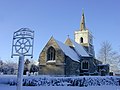
 Church and village sign - geograph.org.uk - 3854734.jpg 640 × 430; 54 KB
-
 Church of St Peter - geograph.org.uk - 3854717.jpg 640 × 430; 67 KB
-
 Church of St Peter - geograph.org.uk - 3854725.jpg 640 × 430; 59 KB
-
 Church of St Peter - geograph.org.uk - 3854731.jpg 640 × 430; 61 KB
-
 Church of St Peter - geograph.org.uk - 5367603.jpg 426 × 640; 51 KB
-
 Church of St Peter - geograph.org.uk - 5367609.jpg 426 × 640; 52 KB
-
 Church of St Peter - geograph.org.uk - 5367610.jpg 640 × 426; 80 KB
-
 Church of St Peter - geograph.org.uk - 5367611.jpg 640 × 426; 49 KB
-
 Church of St Peter - geograph.org.uk - 5367612.jpg 640 × 426; 52 KB
-
 Church of St Peter - geograph.org.uk - 5367615.jpg 426 × 640; 64 KB
-
 Church of St Peter - geograph.org.uk - 5368173.jpg 425 × 640; 65 KB
-
 Claypit Cottages, High Street, Coton.jpg 4,032 × 3,024; 3.82 MB
-
 Close to the M11 - geograph.org.uk - 3869230.jpg 640 × 430; 97 KB
-
 Cmglee Coton Countryside Reserve.jpg 4,096 × 2,048; 1,024 KB
-
 Coton - geograph.org.uk - 2748937.jpg 640 × 428; 85 KB
-
 Coton - geograph.org.uk - 3854696.jpg 640 × 430; 61 KB
-
 Coton C of E Primary School - geograph.org.uk - 5971593.jpg 1,024 × 1,024; 1.61 MB
-
 Coton Church - geograph.org.uk - 4233733.jpg 480 × 640; 49 KB
-
 Coton Church and churchyard in November - geograph.org.uk - 4745002.jpg 819 × 1,024; 1.26 MB
-
 Coton church and village sign.jpg 1,600 × 1,200; 393 KB
-
 Coton Church from Red Meadow Hill in November - geograph.org.uk - 4249694.jpg 1,024 × 768; 1.04 MB
-
 Coton Church Porch - geograph.org.uk - 3444188.jpg 1,600 × 1,000; 638 KB
-
 Coton churchyard - geograph.org.uk - 2330259.jpg 800 × 600; 505 KB
-
 Coton Countryside Reserve - geograph.org.uk - 3846337.jpg 640 × 430; 62 KB
-
 Coton Countryside Reserve - geograph.org.uk - 3846338.jpg 640 × 430; 63 KB
-
 Coton Countryside Reserve - geograph.org.uk - 3846339.jpg 640 × 392; 48 KB
-
 Coton Countryside Reserve - geograph.org.uk - 3846342.jpg 640 × 430; 81 KB
-
 Coton Countryside Reserve - geograph.org.uk - 3846355.jpg 640 × 360; 53 KB
-
 Coton Countryside Reserve - geograph.org.uk - 3861981.jpg 640 × 430; 78 KB
-
 Coton Countryside Reserve - geograph.org.uk - 3861995.jpg 640 × 430; 115 KB
-
 Coton Countryside Reserve - geograph.org.uk - 5367639.jpg 640 × 426; 75 KB
-
 Coton Countryside Reserve - geograph.org.uk - 5367642.jpg 640 × 426; 125 KB
-
 Coton Countryside Reserve - geograph.org.uk - 6438149.jpg 1,024 × 681; 208 KB
-
 Coton Countryside Reserve sign - geograph.org.uk - 3846341.jpg 430 × 640; 65 KB
-
 Coton Countryside Reserve, a Sunday walk - geograph.org.uk - 6610447.jpg 1,024 × 768; 1.14 MB
-
 Coton Cricket Ground - geograph.org.uk - 4981639.jpg 1,024 × 732; 924 KB
-
 Coton High Street - geograph.org.uk - 2330310.jpg 1,024 × 768; 830 KB
-
 Coton High Street in December - geograph.org.uk - 5232420.jpg 1,024 × 768; 1 MB
-
 Coton High Street in January - geograph.org.uk - 4304884.jpg 1,024 × 1,024; 1.49 MB
-
 Coton High Street, an extension - geograph.org.uk - 6495447.jpg 1,024 × 683; 704 KB
-
 Coton High Street.jpg 2,048 × 1,024; 255 KB
-
 Coton Orchard - geograph.org.uk - 3502025.jpg 800 × 533; 139 KB
-
 Coton Orchard sign - geograph.org.uk - 4767364.jpg 2,181 × 2,900; 2.06 MB
-
 Coton Primary School - geograph.org.uk - 3854752.jpg 640 × 430; 87 KB
-
 Coton Primary School - geograph.org.uk - 5367602.jpg 640 × 426; 67 KB
-
 Coton Primary School - geograph.org.uk - 5367606.jpg 640 × 426; 114 KB
-
 Coton Recreation Ground - geograph.org.uk - 1097930.jpg 640 × 472; 148 KB
-
 Coton Recreation Ground - geograph.org.uk - 1097933.jpg 640 × 473; 195 KB
-
 Coton recreation ground - geograph.org.uk - 38535.jpg 640 × 480; 82 KB
-
 Coton Recreation Ground - geograph.org.uk - 3861952.jpg 640 × 430; 84 KB
-
 Coton Recreation Ground - geograph.org.uk - 3861958.jpg 640 × 407; 61 KB
-
 Coton recreation ground - geograph.org.uk - 5611800.jpg 5,202 × 3,465; 4.01 MB
-
 Coton Recreation Ground - geograph.org.uk - 6442289.jpg 1,024 × 680; 189 KB
-
 Coton Rectory (geograph 3861858).jpg 640 × 380; 71 KB
-
 Coton Reserve - geograph.org.uk - 3854633.jpg 640 × 385; 47 KB
-
 Coton Reserve - geograph.org.uk - 3854637.jpg 640 × 430; 74 KB
-
 Coton The Plough.jpg 1,536 × 1,024; 256 KB
-
 Coton to Grantchester in January - geograph.org.uk - 4304415.jpg 1,024 × 732; 1,013 KB
-
 Coton to Wadlow - geograph.org.uk - 3278124.jpg 1,024 × 748; 216 KB
-
 Coton Village Hall - geograph.org.uk - 5367617.jpg 640 × 426; 57 KB
-
 Coton Village Hall - geograph.org.uk - 5516477.jpg 1,000 × 750; 134 KB
-
 Coton village pump.jpg 426 × 640; 102 KB
-
 Coton Village sign - geograph.org.uk - 5367613.jpg 426 × 640; 73 KB
-
 Coton War Memorial on 11 November 2018 - geograph.org.uk - 5971628.jpg 819 × 1,024; 1.5 MB
-
 Coton, Benny's Way - geograph.org.uk - 5845093.jpg 1,024 × 683; 638 KB
-
 Coton, Brook Lane and The Plough - geograph.org.uk - 4594313.jpg 1,024 × 1,024; 1.53 MB
-
 Coton, Cambridge Road - geograph.org.uk - 4758053.jpg 1,024 × 732; 975 KB
-
 Coton, Chapel Yard - geograph.org.uk - 5845372.jpg 819 × 1,024; 1.11 MB
-
 Coton, churchyard and High Street - geograph.org.uk - 5845103.jpg 1,024 × 682; 850 KB
-
 Coton, churchyard and primary school - geograph.org.uk - 4744908.jpg 819 × 1,024; 1.4 MB
-
 Coton, churchyard gate - geograph.org.uk - 4744903.jpg 768 × 1,024; 1.22 MB
-
 Coton, churchyard, rectory, winter light - geograph.org.uk - 4304891.jpg 800 × 800; 458 KB
-
 Coton, daffodils at St Peter's Church - geograph.org.uk - 6783269.jpg 1,024 × 768; 897 KB
-
 Coton, early spring on Cambridge Road - geograph.org.uk - 6783201.jpg 1,024 × 768; 987 KB
-
 Coton, footpath closed - geograph.org.uk - 6610435.jpg 1,024 × 683; 783 KB
-
 Coton, going for four - geograph.org.uk - 5891770.jpg 1,024 × 768; 1.08 MB
-
 Coton, Grays International - geograph.org.uk - 5845098.jpg 1,024 × 683; 916 KB
-
 Coton, green space on Silverdale Avenue - geograph.org.uk - 5844921.jpg 1,024 × 819; 1.03 MB
-
 Coton, High Street - geograph.org.uk - 2330251.jpg 800 × 600; 193 KB
-
 Coton, High Street, school and spire - geograph.org.uk - 6451548.jpg 1,024 × 683; 765 KB
-
 Coton, High Street, school and steeple - geograph.org.uk - 4304894.jpg 1,024 × 732; 1 MB
-
 Coton, houses on The Footpath - geograph.org.uk - 5845378.jpg 1,024 × 683; 792 KB
-
 Coton, memorial bench - geograph.org.uk - 3150801.jpg 1,024 × 768; 1.18 MB
-
 Coton, misty fields - geograph.org.uk - 2829566.jpg 1,024 × 755; 794 KB
-
 Coton, muddy path at midday - geograph.org.uk - 3277688.jpg 1,024 × 781; 211 KB
-
 Coton, new houses on The Footpath - geograph.org.uk - 6451569.jpg 1,024 × 683; 746 KB
-
 Coton, October sunlight - geograph.org.uk - 3213117.jpg 1,024 × 768; 1,010 KB
-
 Coton, on Whitwell Way - geograph.org.uk - 4745004.jpg 1,024 × 732; 823 KB
-
 Coton, on Whitwell Way - geograph.org.uk - 6451562.jpg 1,024 × 683; 782 KB
-
 Coton, plaster and thatch - geograph.org.uk - 2330322.jpg 800 × 600; 553 KB
-
 Coton, playground and spire - geograph.org.uk - 3278074.jpg 1,024 × 742; 227 KB
-

-
 Coton, spring foliage and St Peter's spire - geograph.org.uk - 6451540.jpg 1,024 × 1,024; 1.38 MB
-
 Coton, St Catharine's Hall - geograph.org.uk - 4304742.jpg 1,024 × 732; 1.13 MB
-
 Coton, St Peter - geograph.org.uk - 2330263.jpg 800 × 570; 130 KB
-
 Coton, St Peter - geograph.org.uk - 2330304.jpg 1,024 × 757; 675 KB
-
 Coton, St Peter - sunlit chancel - geograph.org.uk - 2330272.jpg 800 × 617; 556 KB
-
 Coton, St Peter – nave and south aisle - geograph.org.uk - 2330287.jpg 800 × 600; 524 KB
-
 Coton, St Peter – table of commandments - geograph.org.uk - 2330277.jpg 1,024 × 655; 746 KB
-
 Coton, St Peter – the font - geograph.org.uk - 2330298.jpg 800 × 600; 558 KB
-
 Coton, St Peter's Church in Christmas week - geograph.org.uk - 5232218.jpg 1,024 × 1,024; 1.22 MB
-
 Coton, Sunday-morning football - geograph.org.uk - 6609690.jpg 1,024 × 768; 856 KB
-
 Coton, the corner of Brook Lane - geograph.org.uk - 5845375.jpg 1,024 × 1,024; 1.13 MB
-
 Coton, The Footpath - geograph.org.uk - 4304933.jpg 1,024 × 732; 1.1 MB
-
 Coton, The Old School - geograph.org.uk - 6147627.jpg 1,024 × 768; 1.08 MB
-
 Coton, The Old School from the churchyard - geograph.org.uk - 5845109.jpg 1,024 × 819; 1.27 MB
-
 Coton, The Plough - geograph.org.uk - 2330327.jpg 800 × 587; 537 KB
-
 Coton, The Plough - geograph.org.uk - 6451517.jpg 1,024 × 1,024; 1.15 MB
-
 Coton, the start of Whitwell Way - geograph.org.uk - 2829557.jpg 1,024 × 768; 1.01 MB
-
 Coton, timber, tiles and roughcast - geograph.org.uk - 5232415.jpg 819 × 1,024; 1.22 MB
-
 Coton, tree, gate and sheds - geograph.org.uk - 4745009.jpg 819 × 1,024; 1.22 MB
-
 Coton, up Silverdale Avenue - geograph.org.uk - 5844919.jpg 1,024 × 731; 802 KB
-
 Coton, up St Peter's Road - geograph.org.uk - 5845090.jpg 1,024 × 683; 674 KB
-
 Coton, winter sunlight - geograph.org.uk - 4304897.jpg 1,024 × 1,024; 1.36 MB
-

-
 Coton-village-footpaths-map.JPG 1,600 × 1,200; 143 KB
-
 Cricket at Coton - geograph.org.uk - 5891774.jpg 1,024 × 683; 743 KB
-
 Cross by Brook Lane, Coton (geograph 5554940).jpg 2,592 × 3,872; 3.02 MB
-
 Dangerous daffodils - geograph.org.uk - 4977871.jpg 1,600 × 1,170; 934 KB
-
 Dovecote at Dovecote Barns, Church End, Coton.jpg 4,032 × 3,024; 6.62 MB
-
 Down from the M11 bridge - geograph.org.uk - 4250211.jpg 1,024 × 768; 1.06 MB
-
 Entering Cambridge on the A1303 St.Neots Road - geograph.org.uk - 4767356.jpg 3,072 × 2,304; 2.57 MB
-
 Entering Coton - geograph.org.uk - 4304936.jpg 1,024 × 732; 1.24 MB
-
 Entering Coton, Grantchester Road - geograph.org.uk - 3854642.jpg 640 × 430; 92 KB
-
 Entrance to American Cemetery - geograph.org.uk - 6630427.jpg 2,048 × 3,072; 1.25 MB
-
 Entrance to Coton Countryside Reserve - geograph.org.uk - 3151524.jpg 1,024 × 716; 891 KB
-
 Entrance to Coton Orchard garden centre, Coton, Cambridge - geograph.org.uk - 6687324.jpg 4,000 × 3,000; 4.54 MB
-
 Farm cottage and Whitwell Way - geograph.org.uk - 2829547.jpg 1,024 × 768; 1,016 KB
-

-
 Farm track off Grantchester Rd - geograph.org.uk - 3854638.jpg 640 × 430; 64 KB
-
 Farmland by Brook Lane - geograph.org.uk - 3854644.jpg 640 × 430; 79 KB


_towards_Cambridge_-_geograph.org.uk_-_5426548.jpg)


.jpg)


.jpg)


_off_Barton_Road_(A603)_-_geograph.org.uk_-_5426550.jpg)

