Category:Cotheridge
Jump to navigation
Jump to search
village in United Kingdom  | |||||
| Upload media | |||||
| Instance of | |||||
|---|---|---|---|---|---|
| Location | Malvern Hills, Worcestershire, West Midlands, England | ||||
| Population |
| ||||
 | |||||
Subcategories
This category has only the following subcategory.
L
- St. Leonard's church, Cotheridge (10 F)
Media in category "Cotheridge"
The following 90 files are in this category, out of 90 total.
-
 A glimpse of the Malvern Hills - geograph.org.uk - 4376053.jpg 1,600 × 1,196; 764 KB
-
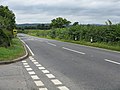 A44 at Cotheridge junction - geograph.org.uk - 903113.jpg 640 × 480; 80 KB
-
 A44 at Hilltop Farm - geograph.org.uk - 5687596.jpg 1,600 × 901; 652 KB
-
 A44 towards Worcester - geograph.org.uk - 5687582.jpg 1,600 × 901; 601 KB
-
 Ankerdine Road - geograph.org.uk - 6132296.jpg 1,024 × 768; 346 KB
-
 Ankerdine Road in Lower Broadheath - geograph.org.uk - 4376080.jpg 1,600 × 1,042; 487 KB
-
 Ankerdine Road near Maple's Cross Farm - geograph.org.uk - 4376189.jpg 1,600 × 1,021; 555 KB
-
 Bank erosion on the River Teme - geograph.org.uk - 6074827.jpg 1,600 × 1,200; 388 KB
-
 Cattle grazing near Cotheridge - geograph.org.uk - 903090.jpg 640 × 480; 77 KB
-
 Church Farm, Cotheridge - geograph.org.uk - 55354.jpg 640 × 479; 118 KB
-
 Church Farm, Cotheridge - geograph.org.uk - 5683765.jpg 1,600 × 901; 760 KB
-
 Church Farm, Cotheridge - geograph.org.uk - 6074850.jpg 1,600 × 1,149; 226 KB
-
 Church Lane - geograph.org.uk - 6407094.jpg 859 × 1,067; 297 KB
-
 Cotheridge Church - geograph.org.uk - 6074832.jpg 1,600 × 1,200; 473 KB
-
 Cotheridge pond - geograph.org.uk - 5683759.jpg 1,600 × 901; 851 KB
-
 Cotheridge Telephone Exchange - geograph.org.uk - 903096.jpg 480 × 640; 75 KB
-
 Cottages along Otherton Lane - geograph.org.uk - 4374764.jpg 1,600 × 1,287; 679 KB
-
 Countryside at Lower Broadheath - geograph.org.uk - 4376014.jpg 1,600 × 1,103; 703 KB
-
 Curious bovine at Lightwood Farm - geograph.org.uk - 6012068.jpg 1,600 × 1,200; 415 KB
-
 Entrance to Little Lightwood Farm from Lightwood Road - geograph.org.uk - 3069663.jpg 3,648 × 2,736; 3.59 MB
-
 Farmland and cottages south of the A44 - geograph.org.uk - 4374772.jpg 1,600 × 1,200; 718 KB
-
 Farmland near Maple's Cross Farm - geograph.org.uk - 1691060.jpg 640 × 426; 96 KB
-
 Farmland near Rushwick - geograph.org.uk - 6500077.jpg 1,024 × 644; 386 KB
-
 Farmland near the Lingens Farm - geograph.org.uk - 4376250.jpg 1,600 × 1,200; 597 KB
-
 Field at Cotheridge junction - geograph.org.uk - 903106.jpg 640 × 480; 73 KB
-
 Field gate for access to footpath from Ankerdine Road - geograph.org.uk - 3069648.jpg 3,648 × 2,736; 3.16 MB
-
 Field, Broadheath - geograph.org.uk - 6132313.jpg 1,024 × 768; 310 KB
-
 Fields and trees near Tinkers' Cross - geograph.org.uk - 4376368.jpg 1,600 × 1,118; 411 KB
-
 Fields south of Ankerdine Road - geograph.org.uk - 4376160.jpg 1,600 × 1,101; 506 KB
-
 Font, Cotheridge Church - geograph.org.uk - 6074837.jpg 1,200 × 1,600; 189 KB
-
 Footpath through graveyard, Cotheridge Church - geograph.org.uk - 6074845.jpg 1,600 × 1,200; 800 KB
-
 Gate along Otherton Lane - geograph.org.uk - 4374760.jpg 1,600 × 1,200; 637 KB
-
 Heading south along Lightwood Lane - geograph.org.uk - 4375888.jpg 1,600 × 1,215; 593 KB
-
 Hedge and gate along Ankerdine Road in Lower Broadheath - geograph.org.uk - 4375999.jpg 1,600 × 1,200; 763 KB
-
 Hedgerow trees - geograph.org.uk - 2341049.jpg 427 × 640; 61 KB
-
 If it ain't sunny it will be windy - geograph.org.uk - 2341174.jpg 427 × 640; 48 KB
-

-
 Junction on Ankerdine Road - geograph.org.uk - 4376298.jpg 1,600 × 984; 569 KB
-
 Karting at Moat House Farm - geograph.org.uk - 2498458.jpg 2,048 × 1,536; 2.26 MB
-
 Last vestige of Christmas - geograph.org.uk - 5687540.jpg 1,600 × 901; 728 KB
-
 Laylocks Garden Centre - geograph.org.uk - 5670735.jpg 1,600 × 901; 771 KB
-
 Laylocks Garden Centre entrance - geograph.org.uk - 5670733.jpg 1,600 × 901; 665 KB
-
 Lightwood Lane - geograph.org.uk - 5676554.jpg 1,600 × 901; 767 KB
-
 Lightwood Lane - geograph.org.uk - 903296.jpg 480 × 640; 115 KB
-
 Lightwood Lane and the A44 - geograph.org.uk - 5676564.jpg 1,600 × 901; 747 KB
-
 Lightwood Lane in Lower Broadheath - geograph.org.uk - 4375978.jpg 1,600 × 1,078; 648 KB
-
 Lightwood Lane near Cotheridge - geograph.org.uk - 4375867.jpg 1,600 × 1,267; 596 KB
-
 Lingens Cottage and Sledgemoor Coppice - geograph.org.uk - 4376388.jpg 1,600 × 1,167; 684 KB
-
 Little Lightwood Farm, Upper Broadheath - geograph.org.uk - 6074868.jpg 1,600 × 1,200; 468 KB
-
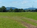
 Looking towards Malvern from Crown East (2) - geograph.org.uk - 6011987.jpg 1,600 × 1,200; 284 KB
-
 Maples Cross Farm - geograph.org.uk - 1691057.jpg 426 × 640; 105 KB
-
 Middle Lightwood Farm along Lightwood Lane - geograph.org.uk - 4375896.jpg 1,600 × 1,080; 590 KB
-
 Mount Flirt - geograph.org.uk - 1869689.jpg 640 × 480; 113 KB
-
 Mount Flirt - geograph.org.uk - 1869698.jpg 640 × 480; 101 KB
-
 Mount Flirt - geograph.org.uk - 1869719.jpg 640 × 480; 113 KB
-
 Mount Flirt - geograph.org.uk - 1869724.jpg 640 × 480; 102 KB
-
 Mount Flirt - geograph.org.uk - 1869740.jpg 640 × 480; 115 KB
-
 Old font in porch, Cotheridge Church - geograph.org.uk - 6074841.jpg 1,200 × 1,600; 294 KB
-
 Otherton Farm - geograph.org.uk - 6407097.jpg 2,891 × 1,387; 1,018 KB
-
 Otherton Farm - geograph.org.uk - 841908.jpg 640 × 480; 77 KB
-
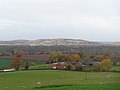 Otherton Farm with the Suckley Hills in the sun - geograph.org.uk - 6011984.jpg 1,600 × 1,200; 223 KB
-
 Otherton Lane - geograph.org.uk - 4374731.jpg 1,600 × 1,200; 599 KB
-
 Otherton Lane near Rushwick - geograph.org.uk - 6500074.jpg 1,024 × 768; 365 KB
-
 P1210793 - Flickr - gailhampshire.jpg 1,380 × 1,236; 222 KB
-
 Pasture by Broadheath - geograph.org.uk - 6132295.jpg 1,024 × 768; 416 KB
-
 Pond at Cotheridge - geograph.org.uk - 3075435.jpg 3,648 × 2,736; 3.58 MB
-

-
 Postbox along the A44 at Cotheridge - geograph.org.uk - 4374791.jpg 1,600 × 1,200; 752 KB
-
 Road from Cotheridge meeting the A44 - geograph.org.uk - 3067654.jpg 3,648 × 2,736; 2.23 MB
-

-
 Scrubland in Cotheridge - geograph.org.uk - 55323.jpg 640 × 479; 91 KB
-
 Sign along the A44 at Cotheridge - geograph.org.uk - 4374786.jpg 1,600 × 1,200; 701 KB
-
 Snowdrops on a grave at Cotheridge - geograph.org.uk - 5683749.jpg 1,600 × 1,201; 1.05 MB
-
 St. Leonard's church, Cotheridge, 1 - geograph.org.uk - 5683739.jpg 1,600 × 901; 687 KB
-
 St. Leonard's church, Cotheridge, 2 - geograph.org.uk - 5683744.jpg 1,600 × 1,200; 1,001 KB
-
 The A44 near Cotheridge - geograph.org.uk - 6153985.jpg 1,920 × 1,280; 1.74 MB
-
 The A44 near Cotheridge - geograph.org.uk - 6153993.jpg 1,920 × 1,280; 1.23 MB
-
 The River Teme - geograph.org.uk - 2341119.jpg 640 × 427; 67 KB
-
 The Teme flood plain - geograph.org.uk - 5649018.jpg 1,600 × 901; 591 KB
-
 The Teme flood plain - geograph.org.uk - 5687592.jpg 1,600 × 901; 715 KB
-
 Travellers' horses near the River Teme - geograph.org.uk - 6074820.jpg 1,600 × 1,200; 275 KB
-
 Tree in a field near Cotheridge - geograph.org.uk - 6074860.jpg 1,600 × 1,200; 461 KB
-
 Tree near Middle Lightwood Farm, Upper Broadheath - geograph.org.uk - 6074876.jpg 1,600 × 1,200; 484 KB
-
 View across the Teme Valley - geograph.org.uk - 4374713.jpg 1,600 × 1,200; 746 KB
-
 View across the Teme Valley - geograph.org.uk - 4374758.jpg 1,600 × 1,060; 396 KB
-
 Walkers in the fog, Three Choirs Way - geograph.org.uk - 6074727.jpg 1,600 × 1,200; 198 KB
-
 Wall mounted pulpit, Cotheridge Church - geograph.org.uk - 6074839.jpg 1,200 × 1,600; 191 KB
-
 Wet day at Laylocks Garden Centre - geograph.org.uk - 5997152.jpg 1,600 × 1,200; 340 KB
-
 Wet muddy field - geograph.org.uk - 5676073.jpg 1,600 × 901; 716 KB
-
 Woodland by the A44 near Cotheridge - geograph.org.uk - 6153990.jpg 1,872 × 1,204; 2.28 MB


_-_geograph.org.uk_-_6011987.jpg)


