Category:Cossington, Somerset
Jump to navigation
Jump to search
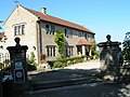
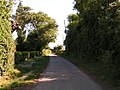
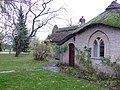
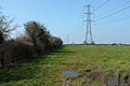
English: Cossington is a village and civil parish close to Woolavington and north of Bridgwater, in the Sedgemoor district in Somerset, England. The village lies on the north side of the Polden Hills.
village and civil parish in Somerset, United Kingdom  | |||||
| Upload media | |||||
| Instance of | |||||
|---|---|---|---|---|---|
| Location | Sedgemoor, Somerset, South West England, England | ||||
| Population |
| ||||
| Said to be the same as | Cossington (Wikimedia duplicated page, civil parish) | ||||
 | |||||
Subcategories
This category has only the following subcategory.
Media in category "Cossington, Somerset"
The following 94 files are in this category, out of 94 total.
-
 A bit of detecting - geograph.org.uk - 2913719.jpg 1,024 × 768; 277 KB
-
 A39 Bath Road - geograph.org.uk - 4868912.jpg 1,920 × 1,280; 1.05 MB
-
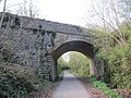
 A39 Bridge over Sustrans Cycle Route - geograph.org.uk - 1435359.jpg 640 × 480; 102 KB
-
 A39 near Cossington Park - geograph.org.uk - 4868921.jpg 1,920 × 1,280; 966 KB
-
 A39 westbound - geograph.org.uk - 3279444.jpg 640 × 480; 47 KB
-
 A39, Bath Road near Cossington - geograph.org.uk - 3801986.jpg 640 × 480; 335 KB
-
 Back of the pillbox - geograph.org.uk - 2913467.jpg 1,024 × 768; 397 KB
-
 Barn on Whitchey Drove - geograph.org.uk - 5250868.jpg 1,024 × 812; 208 KB
-
 Big Tree memorial stone, Cossington - geograph.org.uk - 4869161.jpg 1,920 × 1,280; 739 KB
-
 Bridge along the road - geograph.org.uk - 2912058.jpg 1,024 × 768; 325 KB
-
 Bridge at Bawdrip - geograph.org.uk - 2912071.jpg 1,024 × 768; 281 KB
-
 Bridge parapet by A39 - geograph.org.uk - 5475706.jpg 1,600 × 1,202; 703 KB
-
 Bridge parapet on the A39 - geograph.org.uk - 2912288.jpg 1,024 × 768; 295 KB
-
 Coming away - geograph.org.uk - 2913457.jpg 600 × 800; 159 KB
-
 Cossington - geograph.org.uk - 2165402.jpg 640 × 480; 128 KB
-
 Cossington - geograph.org.uk - 4869219.jpg 2,946 × 1,871; 1.09 MB
-
 Cossington former station geograph-3156227-by-Ben-Brooksbank.jpg 2,098 × 1,449; 2.92 MB
-
 Cossington, Corner of Brent Road. - geograph.org.uk - 1461803.jpg 640 × 480; 71 KB
-
 Cripps River at Gold Corner - geograph.org.uk - 4965102.jpg 3,061 × 1,892; 1.08 MB
-
 Crossroads near Cossington - geograph.org.uk - 4869367.jpg 3,045 × 1,879; 944 KB
-
 Cycle route 3 near Cossington - geograph.org.uk - 1978993.jpg 640 × 480; 217 KB
-
 Cycletrack on the railbed - geograph.org.uk - 2912066.jpg 1,024 × 768; 360 KB
-
 Eight Acre Drove - geograph.org.uk - 5250601.jpg 1,024 × 768; 187 KB
-
 Fairways Caravan and Camping Site. - geograph.org.uk - 191021.jpg 640 × 426; 122 KB
-
 Farm buildings at Cossington - geograph.org.uk - 1979003.jpg 640 × 480; 146 KB
-
 Farm B^B at Cossington - geograph.org.uk - 1979000.jpg 640 × 480; 153 KB
-
 Farmland near Cossington - geograph.org.uk - 4869379.jpg 3,072 × 2,048; 1.36 MB
-
 Farmland near Cossington - geograph.org.uk - 4869427.jpg 3,055 × 1,799; 1.02 MB
-
 Farmland on the Polden Hills - geograph.org.uk - 4907834.jpg 1,024 × 768; 192 KB
-
 Field and a warning about fly tipping - geograph.org.uk - 2990087.jpg 640 × 480; 145 KB
-

-

-
 Former railway line, Cossington - geograph.org.uk - 4869351.jpg 2,048 × 3,072; 2.15 MB
-

-
 Gloucestershire Old Spots from Combe Lane - geograph.org.uk - 386096.jpg 640 × 480; 175 KB
-
 Gold Corner Pumping Station - geograph.org.uk - 5250883.jpg 1,024 × 728; 176 KB
-

-
 Hole in the roof - geograph.org.uk - 2913478.jpg 1,024 × 768; 150 KB
-
 House on Manor Road - geograph.org.uk - 4909045.jpg 1,024 × 768; 179 KB
-
 House on Middle Road - geograph.org.uk - 4908342.jpg 1,024 × 768; 194 KB
-

-
-
 Last view - geograph.org.uk - 2913715.jpg 1,024 × 768; 374 KB
-
 Levels from Whitchey Drove - geograph.org.uk - 4965845.jpg 1,920 × 1,280; 670 KB
-
 Levels from Whitchey Drove - geograph.org.uk - 4966168.jpg 1,920 × 1,096; 567 KB
-
 Locks Way Cossington - geograph.org.uk - 2165424.jpg 640 × 469; 103 KB
-
 Looking east-southeast along Middle Row - geograph.org.uk - 4928928.jpg 3,264 × 2,448; 2.05 MB
-
 Manor Rd, Cossington - geograph.org.uk - 1461796.jpg 640 × 480; 96 KB
-
 Manor Road - geograph.org.uk - 4868966.jpg 1,920 × 1,280; 644 KB
-
 Manor Road, Cossington - geograph.org.uk - 4868980.jpg 1,920 × 1,217; 850 KB
-
 Manor Road, Cossington - geograph.org.uk - 4869148.jpg 1,920 × 1,222; 754 KB
-
 Manor Road, Cossington - geograph.org.uk - 4869225.jpg 1,920 × 1,280; 604 KB
-
 Mill Lane, Cossington - geograph.org.uk - 4869337.jpg 1,920 × 1,172; 556 KB
-
 Minor road north of Cossington - geograph.org.uk - 1863265.jpg 640 × 480; 83 KB
-
 Moon Cottage - geograph.org.uk - 1462365.jpg 640 × 480; 288 KB
-
 Moon Cottage - geograph.org.uk - 2165428.jpg 640 × 480; 115 KB
-
 Moon Cottage by A39 - geograph.org.uk - 5603722.jpg 1,600 × 1,200; 787 KB
-
 Moon Cottage on the A39 - geograph.org.uk - 191035.jpg 640 × 426; 141 KB
-
 Muddy field on Chilton Moor - geograph.org.uk - 5250623.jpg 1,024 × 768; 182 KB
-
 Muddy Lane at Cossington - geograph.org.uk - 2165421.jpg 640 × 480; 107 KB
-
 New houses on Middle Road - geograph.org.uk - 4909021.jpg 1,024 × 875; 177 KB
-
 Newland's Drove - geograph.org.uk - 5250624.jpg 1,024 × 768; 231 KB
-
 Off to one side - geograph.org.uk - 2913446.jpg 1,024 × 768; 271 KB
-

-

-

-
 Pillbox from the road - geograph.org.uk - 2911889.jpg 1,024 × 768; 425 KB
-
 Pillbox through the trees - geograph.org.uk - 2913442.jpg 1,024 × 768; 304 KB
-
 Polden Hills Veterinary Centre - geograph.org.uk - 4909081.jpg 1,024 × 768; 188 KB
-
 Pylons by Whitchey Drove - geograph.org.uk - 4965604.jpg 1,920 × 1,280; 659 KB
-
 Railway Bridge - geograph.org.uk - 2165419.jpg 640 × 480; 164 KB
-
 Rhyne by Whitchey Drove - geograph.org.uk - 4965634.jpg 1,920 × 2,880; 1.77 MB
-
 Ride at Cossington Grange - geograph.org.uk - 4907523.jpg 1,024 × 768; 313 KB
-

-
 Road to Cossington (Manor Road) - geograph.org.uk - 2626135.jpg 800 × 600; 406 KB
-
 Rusty Gates - geograph.org.uk - 2913722.jpg 1,024 × 768; 271 KB
-
 Site of Cossington Great Tree - geograph.org.uk - 2626140.jpg 600 × 800; 550 KB
-
 Someone else in the field - geograph.org.uk - 2913472.jpg 1,024 × 768; 404 KB
-
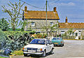
 The centre of Cossington - geograph.org.uk - 2626136.jpg 800 × 600; 543 KB
-
 The joys of motoring^ - geograph.org.uk - 5250614.jpg 1,024 × 799; 243 KB
-
 The Red Tile - geograph.org.uk - 4909015.jpg 1,024 × 878; 202 KB
-
 The School bus arrives at Cossington - geograph.org.uk - 4909033.jpg 1,024 × 768; 247 KB
-
 The side to the road - geograph.org.uk - 2913452.jpg 1,024 × 768; 340 KB
-
 Track and bridge - geograph.org.uk - 2913439.jpg 1,024 × 768; 344 KB
-

-
 Trackbed of the former S ^ D Bridgwater branch - geograph.org.uk - 4909072.jpg 1,024 × 768; 368 KB
-
 Two holes in the roof - geograph.org.uk - 2913483.jpg 1,024 × 768; 334 KB
-
 View across the pasture - geograph.org.uk - 2913720.jpg 1,024 × 768; 267 KB
-
 View from the front - geograph.org.uk - 2913714.jpg 1,024 × 768; 432 KB
-
 View from the track - geograph.org.uk - 2912068.jpg 1,024 × 768; 309 KB
-
 Water inside - geograph.org.uk - 2913475.jpg 600 × 800; 88 KB
-
 Whitchey Drove - geograph.org.uk - 4965802.jpg 1,920 × 1,280; 1,009 KB
-
 Chilton Moor - geograph.org.uk - 109560.jpg 640 × 426; 109 KB
-
 Red Tile Inn - geograph.org.uk - 109577.jpg 640 × 426; 116 KB


_-_geograph.org.uk_-_2626135.jpg)


