Category:Cosgrove, Northamptonshire
Jump to navigation
Jump to search
English: Cosgrove is a village in Northamptonshire, England about south of Northampton along the A508 road. The village Grand Union Canal passes through the middle of the village.
village in Northamptonshire, England  | |||||
| Upload media | |||||
| Instance of | |||||
|---|---|---|---|---|---|
| Location | West Northamptonshire, Northamptonshire, East Midlands, England | ||||
| Population |
| ||||
| Area |
| ||||
| Said to be the same as | Cosgrove (Wikimedia duplicated page, civil parish) | ||||
 | |||||
Subcategories
This category has the following 5 subcategories, out of 5 total.
C
- Cosgrove aqueduct (9 F)
S
- Solomon's Bridge, Cosgrove (9 F)
Media in category "Cosgrove, Northamptonshire"
The following 174 files are in this category, out of 174 total.
-
 25 Miles to Braunston - geograph.org.uk - 1388028.jpg 480 × 640; 257 KB
-
 26 Miles to Braunston - geograph.org.uk - 1388007.jpg 480 × 640; 267 KB
-
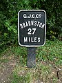 27 Miles to Braunston - geograph.org.uk - 1387979.jpg 480 × 640; 250 KB
-
 A508 approaches junction with Northampton Road - geograph.org.uk - 3913006.jpg 3,735 × 2,539; 1.27 MB
-
 A508 approaches junction with Yardley Road - geograph.org.uk - 3913015.jpg 3,666 × 2,647; 995 KB
-
 A508 south of Badgers Farm - geograph.org.uk - 3913031.jpg 3,794 × 2,575; 1,012 KB
-
 Animals grazing by the wood on Manor Farm - geograph.org.uk - 256607.jpg 640 × 480; 128 KB
-
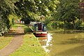
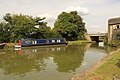
 Boat on Grand Union Canal - geograph.org.uk - 5071851.jpg 4,000 × 3,000; 3.66 MB
-
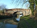
 Bridge 62 over the Grand Union - geograph.org.uk - 2953363.jpg 640 × 427; 101 KB
-
 Bridge 63 - geograph.org.uk - 1388049.jpg 640 × 480; 213 KB
-
 Bridge 63, Grand Junction Canal - geograph.org.uk - 2738809.jpg 4,000 × 3,000; 4.77 MB
-
 Bridge 63, Grand Union Canal - geograph.org.uk - 4334237.jpg 2,000 × 1,500; 449 KB
-
 Bridge 64, Grand Junction Canal - geograph.org.uk - 2738807.jpg 4,000 × 3,000; 4.84 MB
-
 Bridge 66, Grand Junction Canal - geograph.org.uk - 2870173.jpg 4,000 × 3,000; 4.59 MB
-
 Bridge 67, Grand Junction Canal - geograph.org.uk - 2870113.jpg 4,000 × 3,000; 4.8 MB
-
 Bridge over Grand Union Canal - geograph.org.uk - 5071620.jpg 5,000 × 3,333; 4.7 MB
-
 Bridge Road - geograph.org.uk - 5071839.jpg 5,000 × 3,333; 4.76 MB
-
 Broad Water from the Grand Union Canal towpath - geograph.org.uk - 5387721.jpg 5,202 × 3,465; 5.03 MB
-
 Canada Geese on the Grand Union Canal - geograph.org.uk - 4746093.jpg 800 × 552; 129 KB
-
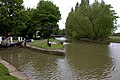 Canal junction at Cosgrove Lock - geograph.org.uk - 5387732.jpg 5,202 × 3,465; 4.17 MB
-
 Canal view, Cosgrove - geograph.org.uk - 4889835.jpg 2,048 × 1,536; 697 KB
-
 Canalside houses at Cosgrove - geograph.org.uk - 5387838.jpg 5,202 × 3,465; 3.63 MB
-

-
 Castlethorpe Wharf Bridge No 64 - geograph.org.uk - 4746071.jpg 800 × 638; 137 KB
-
 Cattle by the River Great Ouse - geograph.org.uk - 4110630.jpg 1,024 × 683; 281 KB
-
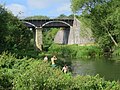
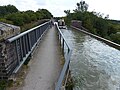
 Cosgrove Aqueduct - geograph.org.uk - 2876548.jpg 4,000 × 3,000; 4.82 MB
-
 Cosgrove aqueduct over Great Ouse River - geograph.org.uk - 5071518.jpg 4,000 × 3,000; 5.28 MB
-
 Cosgrove foot tunnel, west side. - geograph.org.uk - 5387845.jpg 5,202 × 3,465; 4.53 MB
-

-
 Cosgrove lock - geograph.org.uk - 5387725.jpg 5,202 × 3,465; 4.11 MB
-
 Cosgrove Lock 21 Grand Union Canal - geograph.org.uk - 3160387.jpg 2,070 × 1,409; 988 KB
-

-
 Cosgrove Lock No21 - geograph.org.uk - 675673.jpg 640 × 433; 78 KB
-
 Cosgrove Lock, Grand Union Canal - geograph.org.uk - 5071810.jpg 4,000 × 3,000; 3.7 MB
-
 Cosgrove Mill 1902.jpeg 876 × 585; 790 KB
-
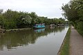
 Cosgrove moorings - geograph.org.uk - 4111895.jpg 1,024 × 683; 246 KB
-
 Cosgrove- Grand Union Canal - geograph.org.uk - 6335987.jpg 1,600 × 1,067; 583 KB
-
 Cosgrove-The Navigation Inn - geograph.org.uk - 6335996.jpg 1,600 × 931; 352 KB
-
 Cosgrove-Yardley Road - geograph.org.uk - 6335989.jpg 1,600 × 1,067; 334 KB
-

-
 Driveway to Rectory Farm - geograph.org.uk - 256583.jpg 640 × 480; 128 KB
-
 Ducks by the Grand Union Canal - geograph.org.uk - 5071644.jpg 5,000 × 3,333; 4.88 MB
-
 Ducks by the Grand Union Canal - geograph.org.uk - 5071646.jpg 5,000 × 3,333; 4.27 MB
-
 Elm Tree farm from canal towpath - geograph.org.uk - 5387900.jpg 5,202 × 3,465; 2.79 MB
-
 Entrance to Cosgrove hall, Northamptonshire - geograph-5387870.jpg 5,202 × 3,465; 4.74 MB
-
 Field hedge - geograph.org.uk - 2960932.jpg 640 × 427; 106 KB
-
 Fields with Castlethorpe in the distance - geograph.org.uk - 5387896.jpg 5,202 × 3,465; 3.9 MB
-
 Footbridge and converted mill - geograph.org.uk - 2943136.jpg 640 × 480; 137 KB
-
 Footpath towards Rectory Farm - geograph.org.uk - 2949767.jpg 640 × 428; 142 KB
-
 Grand Junction Canal, Buckingham Arm - geograph.org.uk - 2870117.jpg 4,000 × 3,000; 4.58 MB
-
 Grand Junction Canal, Buckingham Arm - geograph.org.uk - 2870155.jpg 4,000 × 3,000; 5.11 MB
-
 Grand Union at the Navigation - geograph.org.uk - 1038950.jpg 640 × 480; 47 KB
-
 Grand Union Canal - Castlethorpe - geograph.org.uk - 350401.jpg 640 × 480; 101 KB
-
 Grand Union Canal - geograph.org.uk - 4110346.jpg 1,024 × 683; 222 KB
-
 Grand Union Canal - geograph.org.uk - 4111900.jpg 1,024 × 683; 328 KB
-
 Grand Union Canal - geograph.org.uk - 4112178.jpg 1,024 × 683; 161 KB
-
 Grand Union Canal - geograph.org.uk - 5071441.jpg 5,184 × 3,456; 7.58 MB
-
 Grand Union Canal - geograph.org.uk - 5071473.jpg 5,184 × 3,456; 6.33 MB
-
 Grand Union Canal aqueduct over Great Ouse River - geograph.org.uk - 5071521.jpg 5,000 × 3,333; 5 MB
-
 Grand Union Canal aqueduct over Great Ouse River - geograph.org.uk - 5071522.jpg 5,000 × 3,333; 5.45 MB
-
 Grand Union Canal at Cosgrove (geograph 2679106).jpg 640 × 480; 82 KB
-
 Grand Union Canal at Cosgrove - geograph.org.uk - 4746101.jpg 800 × 550; 113 KB
-
 Grand Union Canal at Cosgrove - geograph.org.uk - 5071491.jpg 5,184 × 3,456; 7.69 MB
-
 Grand Union Canal at Cosgrove - geograph.org.uk - 5071503.jpg 5,184 × 3,456; 7.87 MB
-
 Grand Union Canal at Cosgrove - geograph.org.uk - 5071507.jpg 5,184 × 3,456; 7.71 MB
-
 Grand Union Canal at Cosgrove - geograph.org.uk - 5071513.jpg 5,184 × 3,456; 7.7 MB
-
 Grand Union canal at Cosgrove - geograph.org.uk - 5387836.jpg 5,202 × 3,465; 2.95 MB
-
 Grand Union Canal at Thrupp Wharf - geograph.org.uk - 2679099.jpg 640 × 480; 41 KB
-
 Grand Union Canal at Thrupp Wharf - geograph.org.uk - 4745980.jpg 800 × 538; 159 KB
-
 Grand Union canal between the aqueduct and Cosgrove - geograph.org.uk - 5387711.jpg 5,202 × 3,465; 3.61 MB
-
 Grand Union canal looking towards Castlethorpe - geograph.org.uk - 5387893.jpg 5,202 × 3,465; 3.6 MB
-
 Grand Union Canal near Cosgrove - geograph.org.uk - 5387833.jpg 5,202 × 3,465; 3.92 MB
-
 Grand Union canal north of Cosgrove - geograph.org.uk - 5387889.jpg 5,202 × 3,465; 4.12 MB
-
 Grand Union Canal north of the bridge - geograph.org.uk - 4889830.jpg 2,048 × 1,536; 665 KB
-
 Grand Union Canal towards Cosgrove - geograph.org.uk - 5071848.jpg 5,184 × 3,456; 4.76 MB
-
 Grand Union Canal towards Cosgrove - geograph.org.uk - 5071849.jpg 4,872 × 3,252; 3.61 MB
-
 Grand Union Canal Walk - geograph.org.uk - 5627937.jpg 640 × 480; 79 KB
-
 Grand Union Canal, Bridge Number 62 - geograph.org.uk - 3663324.jpg 640 × 480; 81 KB
-
 Grand Union Canal, Bridge Number 63 - geograph.org.uk - 3663333.jpg 640 × 480; 96 KB
-
 Grand Union Canal, Bridge Number 64 - geograph.org.uk - 3663336.jpg 640 × 480; 80 KB
-
 Grand Union Canal, Buckingham Arm - geograph.org.uk - 3639481.jpg 640 × 480; 91 KB
-

-

-
 Grand Union Canal, Reach in Cosgrove - geograph.org.uk - 3663421.jpg 640 × 480; 63 KB
-

-
-
 Grand Union Canal, Thrupp Wharf - geograph.org.uk - 6323749.jpg 1,280 × 851; 261 KB
-

-

-
 Grand Union near Cosgrove - geograph.org.uk - 1038956.jpg 640 × 460; 55 KB
-

-
 Horse tunnel Cosgrove.jpg 2,848 × 4,272; 2.21 MB
-
 Iron Aqueduct - geograph.org.uk - 2831331.jpg 4,000 × 2,664; 2.05 MB
-
 Iron Trunk Aqueduct - geograph.org.uk - 5071843.jpg 4,000 × 3,000; 3.23 MB
-
 Iron Trunk Aqueduct - geograph.org.uk - 5071846.jpg 5,000 × 3,333; 4.57 MB
-
 Iron Trunk Aqueduct - geograph.org.uk - 5071847.jpg 5,100 × 3,400; 4.71 MB
-
 Iron Trunk Aqueduct over Great Ouse River - geograph.org.uk - 5071524.jpg 5,000 × 3,333; 5.01 MB
-
 Isworth Farm - geograph.org.uk - 2953199.jpg 640 × 428; 81 KB
-
 Lock 21, Grand Junction Canal - Cosgrove Lock - geograph.org.uk - 2870147.jpg 4,000 × 3,000; 4.54 MB
-
 Lockkeeper's cottage - geograph.org.uk - 1575415.jpg 640 × 480; 57 KB
-
 Milestone 27 - geograph.org.uk - 4796782.jpg 800 × 600; 241 KB
-
 Moorings by the Navigation Inn - geograph.org.uk - 2953047.jpg 640 × 427; 69 KB
-
 Narrowboat at Cosgrove - geograph.org.uk - 5071656.jpg 4,000 × 3,000; 3.67 MB
-

-
 Narrowboats passing Bridge No 62 - geograph.org.uk - 4745944.jpg 800 × 576; 179 KB
-
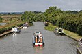
 Narrowboats, Grand Union Canal - geograph.org.uk - 5071478.jpg 5,184 × 3,456; 7.53 MB
-
 Narrowboats, Grand Union Canal - geograph.org.uk - 5071480.jpg 5,184 × 3,456; 6.85 MB
-
 Navigation Inn and bridge 64 - geograph.org.uk - 2953385.jpg 640 × 428; 73 KB
-
 Navigation Inn, Thrupps Wharf - geograph.org.uk - 5387911.jpg 5,202 × 3,022; 2.7 MB
-

-
 Old narrow boat on Grand Union Canal - geograph.org.uk - 5387716.jpg 5,202 × 3,465; 3.86 MB
-
 Ornamental bridge No 65 at Cosgrove - geograph.org.uk - 4746177.jpg 692 × 800; 198 KB
-
 Ornamental bridge No 65 at Cosgrove - geograph.org.uk - 4889828.jpg 2,048 × 1,536; 1.06 MB
-
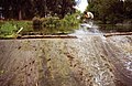
 Overflow on the Grand Union - geograph.org.uk - 2953388.jpg 640 × 427; 59 KB
-
 Path from Cosgrove towards Elm Tree farm - geograph.org.uk - 5387875.jpg 5,202 × 3,465; 4.05 MB
-
 Path to Castlethorpe Mill - geograph.org.uk - 2953347.jpg 640 × 427; 115 KB
-
 Path to the Castlethorpe road - geograph.org.uk - 2953343.jpg 640 × 427; 81 KB
-
-
 Pipeline over Grand Union Canal near Cosgrove - geograph.org.uk - 5387822.jpg 5,202 × 3,465; 3.91 MB
-
 Pony tunnel, Cosgrove - geograph.org.uk - 4889832.jpg 2,048 × 1,536; 1.1 MB
-
 Remembrance Day tribute in Cosgrove - geograph.org.uk - 6325309.jpg 851 × 1,280; 238 KB
-
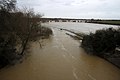
 River Great Ouse - geograph.org.uk - 4110321.jpg 1,024 × 683; 323 KB
-

-

-

-
 River Tove - geograph.org.uk - 2679094.jpg 640 × 480; 129 KB
-
 River Tove, Castlethorpe - geograph.org.uk - 6325515.jpg 1,280 × 851; 313 KB
-
 Road bridge at Thrupp Wharf - geograph.org.uk - 5387905.jpg 5,202 × 3,465; 4.03 MB
-
 Road to Castlethorpe - geograph.org.uk - 5071466.jpg 5,184 × 3,456; 7.48 MB
-
 Road to Castlethorpe - geograph.org.uk - 5387920.jpg 5,202 × 3,465; 3.6 MB
-
 Road to Castlethorpe - geograph.org.uk - 6323732.jpg 1,280 × 851; 393 KB
-
 Solomon's Bridge, Cosgrove - geograph.org.uk - 5387881.jpg 5,202 × 3,465; 3.73 MB
-
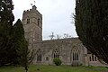 St Peter and St Paul church, Cosgrove - geograph.org.uk - 5387859.jpg 5,202 × 3,465; 4.3 MB
-
 St Peter and St Paul churchyard, Cosgrove - geograph.org.uk - 5387865.jpg 5,202 × 3,465; 4.02 MB
-
 Station Road crosses the River Tove - geograph.org.uk - 4511175.jpg 1,296 × 972; 363 KB
-
 Steps up to the towpath - geograph.org.uk - 2953353.jpg 480 × 640; 154 KB
-
 Stile and path to Rectory Farm - geograph.org.uk - 2949769.jpg 480 × 640; 154 KB
-
 Stony Banks - geograph.org.uk - 2007789.jpg 817 × 528; 540 KB
-
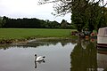
 Swans on the canal, Cosgrove - geograph.org.uk - 4889840.jpg 2,048 × 1,536; 951 KB
-
 Tall hedge field boundary - geograph.org.uk - 2953143.jpg 640 × 427; 101 KB
-
 The Barley Mow - geograph.org.uk - 4509394.jpg 1,296 × 972; 204 KB
-
 The Barley Mow Pub, Cosgrove (geograph 1694236).jpg 2,048 × 1,536; 559 KB
-
 The Barley Mow, Cosgrove - geograph.org.uk - 5387855.jpg 5,202 × 3,465; 2.78 MB
-
-
 The Great Ouse from the iron aqueduct - geograph.org.uk - 3841142.jpg 1,600 × 1,067; 370 KB
-
 The Iron Trunk Aqueduct - geograph.org.uk - 4746258.jpg 800 × 642; 150 KB
-
 The Iron Trunk Aqueduct - geograph.org.uk - 4746266.jpg 800 × 600; 132 KB
-
 The Iron Trunk Aqueduct - geograph.org.uk - 4746277.jpg 800 × 595; 146 KB
-
 The last working boats^ - geograph.org.uk - 6430969.jpg 1,024 × 653; 110 KB
-
 The Navigation Inn, Thrupp Wharf - geograph.org.uk - 6323698.jpg 1,280 × 851; 235 KB
-
 The Navigation sign - geograph.org.uk - 5071642.jpg 3,596 × 2,700; 1.53 MB
-
 The Old Brewery, Cosgrove - geograph.org.uk - 5387851.jpg 5,202 × 3,465; 3.74 MB
-
 The path to Furtho - geograph.org.uk - 2960934.jpg 640 × 427; 90 KB
-
 Thrupp Wharf - geograph.org.uk - 2953054.jpg 640 × 427; 48 KB
-
 Thrupp Wharf - geograph.org.uk - 4112221.jpg 1,024 × 683; 222 KB
-
 Thrupps Wharf, Grand Union canal - geograph.org.uk - 5387914.jpg 5,202 × 3,465; 3.29 MB
-
 Tiny tunnel under the Grand Union canal - geograph.org.uk - 2821871.jpg 1,200 × 1,600; 572 KB
-
 Towpath along the Grand Union - geograph.org.uk - 2953164.jpg 640 × 427; 78 KB
-

-
 View from canal bridge - geograph.org.uk - 1038967.jpg 640 × 471; 73 KB
-
 View over the fields to Hanslope - geograph.org.uk - 1038947.jpg 640 × 480; 44 KB
-
 Watching the world go by - geograph.org.uk - 4112186.jpg 974 × 1,024; 539 KB
-
 Winter moorings - geograph.org.uk - 1575423.jpg 640 × 480; 114 KB
-
 Wire bargee at Cosgrove - geograph.org.uk - 4889827.jpg 2,048 × 1,536; 1.04 MB
-
 Wire bargee by the Cosgrove winding hole - geograph.org.uk - 5642408.jpg 1,600 × 1,067; 676 KB
-
 Wolverton Iron Trunk Aqueduct - geograph.org.uk - 4110279.jpg 1,024 × 683; 244 KB
-
 Wolverton Iron Trunk Aqueduct - geograph.org.uk - 4110286.jpg 1,024 × 768; 408 KB
-
 Woodland path towards Rectory Farm - geograph.org.uk - 2949770.jpg 480 × 640; 163 KB
-
 Yardley Road (geograph 2679101).jpg 640 × 480; 65 KB
-
 Yardley Road - geograph.org.uk - 5071651.jpg 3,294 × 2,472; 1.67 MB
-
 Yardley Road junction - geograph.org.uk - 5071627.jpg 4,000 × 3,000; 3.03 MB
-
 Yardley Road, Cosgrove - geograph.org.uk - 5387857.jpg 4,332 × 3,054; 2.61 MB
-
 Pedestrian Tunnel, Cosgrove - geograph.org.uk - 531245.jpg 429 × 640; 84 KB
-
 Thrupp Wharf - geograph.org.uk - 570175.jpg 640 × 427; 64 KB


.jpg)


_-_geograph.org.uk_-_4210445.jpg)


.jpg)


.jpg)


