Category:Cornish Main Line
Jump to navigation
Jump to search
Main Wikipedia article: Cornish Main Line.
English: The railway line from Plymouth to Penzance, England.
Railway line in Cornwall, England | |||||
| Upload media | |||||
| Instance of | |||||
|---|---|---|---|---|---|
| Part of |
| ||||
| Location | Cornwall, South West England, England | ||||
| Connects with | |||||
| Owned by | |||||
| Operator | |||||
| Has part(s) |
| ||||
| Date of official opening |
| ||||
| Terminus | |||||
| |||||
Subcategories
This category has the following 52 subcategories, out of 52 total.
B
C
- Camborne railway station (32 F)
D
- Devonport railway station (29 F)
- Devonport Tunnel (2 F)
- Dockyard railway station (13 F)
G
H
- Hayle railway station (15 F)
K
- Keyham railway station (7 F)
- Keyham Viaduct (2 F)
L
- Liskeard Viaduct (9 F)
- Long Rock Level Crossing (14 F)
M
- Marazion railway station (11 F)
P
R
- Redruth railway station (79 F)
- Redruth Tunnel (5 F)
- Roskear Junction (4 F)
S
- St Germans railway station (45 F)
- Saltash railway station (58 F)
T
V
- Bolitho Viaduct (10 F)
- Angarrack viaduct (5 F)
- Carvedras viaduct (11 F)
- Coombe viaduct, Saltash (17 F)
- Cornwall Loop Viaduct (10 F)
- Fal viaduct (4 F)
- Forder viaduct (38 F)
- Gover Viaduct (13 F)
- Hayle viaduct (19 F)
- Moorswater viaduct (23 F)
- Penadlake Viaduct (2 F)
- Penwithers Viaduct (3 F)
- Redruth viaduct (20 F)
- St Austell viaduct (18 F)
- St Germans viaduct (27 F)
- Truro viaduct (7 F)
- Weston Mill Viaduct (4 F)
Media in category "Cornish Main Line"
The following 90 files are in this category, out of 90 total.
-
Cornish Main Line.png 2,600 × 1,595; 1.19 MB
-
AngharrackRailwayViaductCornwallUK.jpg 2,000 × 1,368; 645 KB
-
Brea tunnel (northern side).jpg 3,456 × 4,608; 8.16 MB
-
Brea tunnel.jpg 3,456 × 4,608; 8.58 MB
-
Bridge Carrying dismantled Railway - geograph.org.uk - 344837.jpg 640 × 480; 164 KB
-
Carlyon Bridge.jpg 800 × 600; 158 KB
-
Company seal of the West Cornwall Railway.JPG 1,024 × 1,024; 492 KB
-
Cornish Main Line - geograph.org.uk - 6446380.jpg 1,024 × 681; 189 KB
-
In case of Emergency (506512465).jpg 2,000 × 2,667; 4.47 MB
-
De Lay Hay Avenue (506458416).jpg 2,000 × 2,667; 3.64 MB
-
De Lay Hay Avenue (506478020).jpg 2,000 × 1,500; 2.93 MB
-
De Lay Hay Avenue (506498799).jpg 2,000 × 1,500; 2.72 MB
-
De Lay Hay Avenue (506515303).jpg 2,000 × 1,500; 2.74 MB
-
Devonmport Road Bridge, Stoke, Plymouth (471717935).jpg 2,000 × 2,667; 4.2 MB
-
Empty tracks at Ponsandane - geograph.org.uk - 3023583.jpg 640 × 410; 66 KB
-
Expansion joint, Hayle.jpg 3,072 × 2,304; 4.6 MB
-
Field and viaduct near Menheniot (geograph 4163183).jpg 1,920 × 1,124; 633 KB
-
Footbridge over the Cornish Main Line, Chyandour, July 2021.jpg 4,032 × 3,024; 8.39 MB
-
From the Bridge - geograph.org.uk - 54521.jpg 640 × 427; 99 KB
-
Gover Railway Viaduct, St Austell, north side.jpg 6,000 × 4,000; 8.4 MB
-
Great Western Main Line - geograph.org.uk - 1571577.jpg 640 × 480; 125 KB
-
Great Western Main Line - geograph.org.uk - 1571581.jpg 640 × 480; 115 KB
-
Gwinear Road level crossing - geograph.org.uk - 196728.jpg 640 × 480; 71 KB
-
Harbour Road, Par - geograph.org.uk - 1238218.jpg 640 × 480; 99 KB
-
Largin Woods - October 2014 - panoramio (1).jpg 4,000 × 3,000; 1.72 MB
-
Main Line (506526585).jpg 2,000 × 2,667; 5.33 MB
-
Main line bridge Molesworth Road (506457839).jpg 2,000 × 1,500; 3.19 MB
-
Main Line through Stoke Village (411223843).jpg 2,000 × 2,667; 5.12 MB
-
Mainline Railway - geograph.org.uk - 148048.jpg 640 × 427; 124 KB
-
Mainline through the trees (506444574).jpg 2,000 × 2,667; 5.07 MB
-
Milltown Viaduct (geograph 2523872).jpg 1,880 × 2,816; 2.25 MB
-
Old Bridge Support - geograph.org.uk - 344883.jpg 640 × 429; 98 KB
-
Old Railway Bridge Support - geograph.org.uk - 344870.jpg 640 × 419; 124 KB
-
Par Green bridge (west side).JPG 1,366 × 910; 539 KB
-
Par Viaduct 1.JPG 2,160 × 1,440; 891 KB
-
Pillars Of Stone. - panoramio.jpg 3,648 × 2,056; 5.23 MB
-
Railway at Hallenbeagle - geograph.org.uk - 1236156.jpg 640 × 426; 93 KB
-
Railway at Newbridge - geograph.org.uk - 1287479.jpg 640 × 469; 110 KB
-
Railway Bridge - geograph.org.uk - 194421.jpg 640 × 485; 174 KB
-
Railway Bridge - geograph.org.uk - 197265.jpg 640 × 427; 123 KB
-
Railway bridge from footbridge - geograph.org.uk - 1418517.jpg 640 × 480; 84 KB
-
Railway bridge sign, Station Road,. Scorrier, Cornwall - March 2024.jpg 4,608 × 3,456; 4.01 MB
-
Railway Bridge, Shillingham, near Saltash - geograph.org.uk - 89293.jpg 640 × 427; 221 KB
-
Railway bridge, Station Road,. Scorrier, Cornwall - March 2024.jpg 4,409 × 2,879; 2.15 MB
-
Railway bridges, Trenance Road - geograph.org.uk - 1313426.jpg 480 × 640; 93 KB
-
Railway crossing at Hallenbeagle - geograph.org.uk - 1236120.jpg 640 × 426; 86 KB
-
Railway embankment and bare winter trees - geograph.org.uk - 1307361.jpg 640 × 426; 110 KB
-
Railway line by Garfield Terrace - geograph.org.uk - 448700.jpg 640 × 427; 103 KB
-
Railway line near Charlestown - geograph.org.uk - 1240087.jpg 640 × 480; 91 KB
-
Railway line near Rospeath - geograph.org.uk - 185721.jpg 640 × 480; 149 KB
-
Railway line, Mount Charles - geograph.org.uk - 1148488.jpg 480 × 640; 100 KB
-
Railway Lines - geograph.org.uk - 342924.jpg 640 × 426; 113 KB
-
Railway mainline at Hallenbeagle - geograph.org.uk - 1236126.jpg 640 × 426; 75 KB
-
Railway outside Redruth - geograph.org.uk - 36048.jpg 640 × 480; 142 KB
-
Railway shed, Penzance, July 2021.jpg 4,032 × 3,024; 9.21 MB
-
Railway towards Penzance at Marazion, June 2021.jpg 4,032 × 3,024; 9.67 MB
-
Railway track towards Penzance - geograph.org.uk - 342865.jpg 640 × 427; 98 KB
-
Railway viaduct near Menheniot Station (geograph 2341448).jpg 640 × 480; 81 KB
-
Redundant Bridge - geograph.org.uk - 344841.jpg 640 × 480; 122 KB
-
Signal failure - geograph.org.uk - 1079872.jpg 621 × 455; 62 KB
-
South Crofty.jpg 3,024 × 4,032; 4.59 MB
-
St Austell Trenance Bridge (1859).jpg 1,024 × 683; 498 KB
-
St Austell Trenance Bridge (1899).jpg 1,024 × 768; 600 KB
-
The Cornish Mainline near Treesmill - geograph.org.uk - 143556.jpg 640 × 427; 115 KB
-
The Main Railway Line - geograph.org.uk - 171418.jpg 640 × 427; 143 KB
-
The mainline railway bridges Old Mill Lane - geograph.org.uk - 58562.jpg 640 × 480; 135 KB
-
The Railway line - geograph.org.uk - 54512.jpg 640 × 427; 145 KB
-
The West Cornwall Mainline Railway - geograph.org.uk - 357032.jpg 640 × 427; 92 KB
-
Towards the Lynher (geograph 4039765).jpg 1,920 × 1,237; 432 KB
-
Tracks through the forest - Largin Woods - October 2014 - panoramio.jpg 3,000 × 4,000; 2.17 MB
-
Truro 1859.gif 359 × 351; 14 KB
-
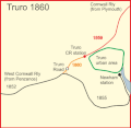
Truro 1860.gif 359 × 351; 14 KB
-
Truro 1863.gif 359 × 351; 16 KB
-
Truro road 1852 - 1863 mark 2.gif 359 × 351; 16 KB
-
Truro road 1852 - 1863.gif 359 × 351; 16 KB
-
View towards Tesco Penzance, July 2021.jpg 4,032 × 3,024; 8.28 MB
-
West Cornwall Rly 1852.gif 1,492 × 848; 58 KB
-
Wingfield (506461864).jpg 1,970 × 1,470; 3.96 MB
-
Wingfield Way bridge (506499310).jpg 1,970 × 1,473; 3.6 MB


