Category:Cornford Lane, Tunbridge Wells
Jump to navigation
Jump to search
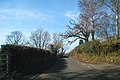
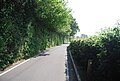
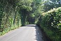
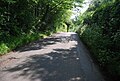
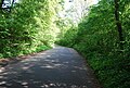
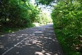
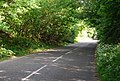
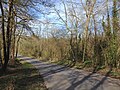
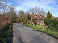
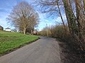
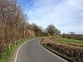
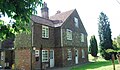
English: Cornfoot Lane is an unclassified road that runs between Halls Hole Road, Royal Tunbridge Wells, and High Street, Pembury.
Subcategories
This category has the following 2 subcategories, out of 2 total.
C
- Cornford Lane Oast, Pembury (4 F)
P
- Pepenbury, Tunbridge Wells (9 F)
Media in category "Cornford Lane, Tunbridge Wells"
The following 44 files are in this category, out of 44 total.
-
 Approaching Pepenbury Hall - geograph.org.uk - 4166532.jpg 640 × 430; 86 KB
-
 Cornford Lane - geograph.org.uk - 1181090.jpg 640 × 427; 521 KB
-
 Cornford Lane - geograph.org.uk - 4166418.jpg 640 × 430; 90 KB
-
 Cornford Lane - geograph.org.uk - 4166420.jpg 640 × 430; 87 KB
-
 Cornford Lane - geograph.org.uk - 4166423.jpg 640 × 430; 111 KB
-
 Cornford Lane - geograph.org.uk - 4166428.jpg 640 × 430; 107 KB
-
 Cornford Lane - geograph.org.uk - 4166430.jpg 640 × 430; 92 KB
-
 Cornford Lane - geograph.org.uk - 4166432.jpg 640 × 430; 95 KB
-
 Cornford Lane - geograph.org.uk - 4166511.jpg 640 × 430; 90 KB
-
 Cornford Lane - geograph.org.uk - 4166521.jpg 640 × 430; 111 KB
-
 Cornford Lane - geograph.org.uk - 4166522.jpg 640 × 430; 112 KB
-
 Cornford Lane - geograph.org.uk - 4172337.jpg 640 × 430; 116 KB
-
 Cornford Lane - geograph.org.uk - 4172345.jpg 640 × 430; 114 KB
-
 Cornford Lane - geograph.org.uk - 4172355.jpg 640 × 430; 114 KB
-
 Cornford Lane - geograph.org.uk - 5249022.jpg 640 × 426; 105 KB
-
 Cornford Lane - geograph.org.uk - 6490665.jpg 1,024 × 684; 257 KB
-
 Cornford Lane - geograph.org.uk - 6490672.jpg 1,024 × 684; 308 KB
-
 Cornford Lane - geograph.org.uk - 6490686.jpg 1,024 × 684; 202 KB
-
 Cornford Lane becomes single track - geograph.org.uk - 4166510.jpg 640 × 430; 103 KB
-
 Cornford Lane Bridge - geograph.org.uk - 4172346.jpg 640 × 430; 100 KB
-
 Cornford Lane Bridge, A21 - geograph.org.uk - 4272272.jpg 640 × 483; 86 KB
-
 Cornford Lane Bridge, A21 - geograph.org.uk - 4750290.jpg 640 × 426; 68 KB
-
 Cornford Lane Bridge, A21 - geograph.org.uk - 4847295.jpg 628 × 640; 85 KB
-
 Cornford Lane, near Pembury - geograph.org.uk - 4907553.jpg 3,264 × 2,448; 2.87 MB
-
 Cornford Lane, near Pembury - geograph.org.uk - 4907555.jpg 3,264 × 2,448; 2.37 MB
-
 Cornford Lane, near Pembury - geograph.org.uk - 4907557.jpg 3,264 × 2,448; 1.81 MB
-
 Cornford Lane, near Pembury - geograph.org.uk - 4907560.jpg 3,264 × 2,448; 2.46 MB
-
 Cornford Lane, near Pembury - geograph.org.uk - 4907562.jpg 3,264 × 2,448; 3.48 MB
-
 Cornford Lane, near Tunbridge Wells - geograph.org.uk - 4907570.jpg 3,264 × 2,448; 2.66 MB
-
 Cornford Lane, Pepenbury - geograph.org.uk - 4166539.jpg 640 × 430; 82 KB
-
 Cottage by Cornford Lane - geograph.org.uk - 4172334.jpg 640 × 371; 73 KB
-
 Cottage on Cornford Lane - geograph.org.uk - 4166427.jpg 640 × 395; 113 KB
-
 Footpath off Cornford Lane - geograph.org.uk - 4166431.jpg 640 × 430; 138 KB
-
 Gate off Cornford Lane - geograph.org.uk - 4166525.jpg 640 × 430; 98 KB
-
 Hall's Hole Rd, Cornford Lane junction - geograph.org.uk - 4166322.jpg 640 × 430; 104 KB
-
 House near Pepenbury - geograph.org.uk - 2893635.jpg 4,000 × 3,000; 2.54 MB
-
 House on Cornford Lane - geograph.org.uk - 4166338.jpg 640 × 430; 87 KB
-
 House on Cornford Lane - geograph.org.uk - 4172333.jpg 640 × 430; 105 KB
-
 House, Cornford Lane - geograph.org.uk - 4166429.jpg 640 × 430; 79 KB
-
 Passing point on Cornford Lane - geograph.org.uk - 1610601.jpg 640 × 427; 117 KB
-
 Single track - geograph.org.uk - 4166513.jpg 640 × 430; 114 KB
-
 Single track, Cornford Lane - geograph.org.uk - 4172360.jpg 640 × 430; 111 KB
-

-
 View from Cornford Lane - geograph.org.uk - 3073054.jpg 640 × 480; 96 KB


