Category:Copdock Mill Interchange
Jump to navigation
Jump to search
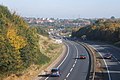
English: The Copdock Mill Interchange is a junction in the civil parishes of Copdock and Washbrook and Pinewood, in the Babergh district, in the county of Suffolk, England.
road junction in Copdock and Washbrook and Pinewood, Babergh, Suffolk, England  | |||||
| Upload media | |||||
| Instance of | |||||
|---|---|---|---|---|---|
| Location |
| ||||
| |||||
Media in category "Copdock Mill Interchange"
The following 19 files are in this category, out of 19 total.
-
 A12 Ipswich Road, Copdock - geograph.org.uk - 4116460.jpg 2,685 × 2,070; 744 KB
-
 A12 Ipswich Road, Copdock - geograph.org.uk - 4116531.jpg 1,638 × 2,088; 399 KB
-
-
 A12, approaching Copdock Interchange - geograph.org.uk - 3885662.jpg 640 × 351; 35 KB
-
 A12, approaching Junction 33 - geograph.org.uk - 4250452.jpg 640 × 430; 34 KB
-
 A12, Junction 33 - geograph.org.uk - 4250457.jpg 640 × 400; 38 KB
-
 A1214 Approaching Copdock Interchange - geograph.org.uk - 3858618.jpg 640 × 480; 260 KB
-
 A14 seen from the A12 - geograph.org.uk - 2677919.jpg 640 × 430; 63 KB
-
 A14 slip road, Copdock - geograph.org.uk - 4116638.jpg 2,242 × 1,848; 575 KB
-
 A14, westbound, - geograph.org.uk - 4121009.jpg 640 × 430; 56 KB
-
 Copdock Interchange - geograph.org.uk - 3262657.jpg 640 × 430; 56 KB
-
 Copdock Interchange Roundabout - geograph.org.uk - 3073779.jpg 3,072 × 2,304; 1.35 MB
-
 Copdock Interchange Roundabout - geograph.org.uk - 4116491.jpg 2,487 × 1,997; 627 KB
-
 Copdock Interchange, A14 - geograph.org.uk - 4121011.jpg 640 × 430; 58 KB
-
 On Copdock Interchange Roundabout - geograph.org.uk - 4117599.jpg 2,746 × 2,097; 694 KB
-
 Slip road off A14 - geograph.org.uk - 4212229.jpg 640 × 480; 69 KB
-
 Tesco Extra Copdock ^ Copdock Interchange - geograph.org.uk - 3515873.jpg 3,072 × 2,304; 1.32 MB
-
 West Ipswich from the air - geograph.org.uk - 3367272.jpg 640 × 410; 110 KB
-
 Westbound slip road from A14 to A12 - geograph.org.uk - 4057609.jpg 1,536 × 1,152; 786 KB


