Category:Cootehill
Jump to navigation
Jump to search
Čeština: Cootehill ( ir. Muinchille) je město v severovýchodní části Irska, v kraji Cavan. V roce 2006 zde žilo 1 892 obyvatel.
English: Cootehill, known before the Plantation of Ulster as Munnilly , is a rapidly-expanding market town in County Cavan, Ireland.
Français : Cootehill (Muinchille en irlandais) est une ville du comté de Cavan en République d'Irlande.
Nederlands: Cootehill is een plaats in het Ierse graafschap County Cavan. De plaats telt 1.822 inwoners.
Slovenčina: Cootehill ( ír. Muinchille) je mesto v severovýchodnej časti Írska, v grófstve Cavan. Žije tu 1 892 obyvateľov (2006).
Svenska: Cootehill är en liten handelsort i grevskapet Cavan i Republiken Irland. Den har 1 243 invånare (2006) på en yta av 1,82 km². Hela tätorten, inklusive områden utanför samhällets administrativa gräns, har 1 892 invånare (2006). Orten är känd för att vara födelseplatsen för ärkesbiskopen John Charles McQuaid år 1895.
town in County Cavan, Ireland  | |||||
| Upload media | |||||
| Instance of | |||||
|---|---|---|---|---|---|
| Location | County Cavan, Ulster, Ireland | ||||
| Population |
| ||||
| Area |
| ||||
| Elevation above sea level |
| ||||
 | |||||
Subcategories
This category has the following 10 subcategories, out of 10 total.
A
B
- Bellamont House (3 F)
C
- Cootehill Court House (2 F)
- Cootehill Masonic Hall (3 F)
- Cootehill railway station (1 F)
D
F
- Freame Mount (2 F)
P
- Presbyterian Church, Cootehill (11 F)
S
Media in category "Cootehill"
The following 180 files are in this category, out of 180 total.
-
 A minor left-hand tributary of the Annalee River - geograph.org.uk - 3152949.jpg 768 × 1,024; 301 KB
-
 A small right hand tributary of the Annalee - geograph.org.uk - 3786129.jpg 1,024 × 768; 350 KB
-
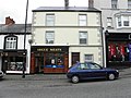
 A Smith, Cootehill - geograph.org.uk - 3056216.jpg 640 × 480; 47 KB
-
-
 Abandoned farmstead at Killyrue - geograph.org.uk - 3785762.jpg 1,024 × 768; 298 KB
-
 Ague Meats, Cootehill - geograph.org.uk - 3055288.jpg 640 × 480; 55 KB
-
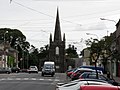 All Saints, Market Street, Cootehill - geograph.org.uk - 2487359.jpg 1,024 × 766; 155 KB
-
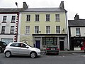
 Allied Irish Bank, Cootehill - geograph.org.uk - 3055992.jpg 640 × 480; 48 KB
-
 An entrenched tributary of the Annalee - geograph.org.uk - 3152977.jpg 1,024 × 768; 173 KB
-
 An Posts Sorting Office at Cootehill (geograph 3142200).jpg 1,024 × 768; 183 KB
-
 Antonios, Cootehill - geograph.org.uk - 3056215.jpg 640 × 480; 53 KB
-
 Approaching the R191 improvements stockyard - geograph.org.uk - 3173003.jpg 1,024 × 766; 111 KB
-
 Bank of Ireland, Cootehill - geograph.org.uk - 3056017.jpg 640 × 480; 54 KB
-
 Bannons, Cootehill - geograph.org.uk - 3055360.jpg 640 × 480; 54 KB
-
 Barbers in Bridge Street, Cootehill - geograph.org.uk - 3089436.jpg 1,024 × 610; 132 KB
-
 Bellamont Arms, Cootehill - geograph.org.uk - 3056012.jpg 640 × 480; 56 KB
-

-
 Blessings, Cootehill - geograph.org.uk - 3055483.jpg 640 × 480; 47 KB
-

-
 Bogland adjoining Killyrue Cross Roads - geograph.org.uk - 3785796.jpg 1,024 × 768; 210 KB
-
 Bogland alongside the R191 at Killarue - geograph.org.uk - 3150544.jpg 1,024 × 768; 227 KB
-
 Bogland east of the R191 at Killyrue - geograph.org.uk - 3785756.jpg 1,024 × 768; 209 KB
-
 Boyle Sports, Cootehill - geograph.org.uk - 3055256.jpg 640 × 480; 49 KB
-
 Boyle, Cootehill - geograph.org.uk - 3055290.jpg 640 × 480; 53 KB
-
 Bridge over the Dromore River, near Cootehill - geograph.org.uk - 2641419.jpg 1,024 × 597; 210 KB
-
 Bridge St Barbers, Cootehill - geograph.org.uk - 3056242.jpg 640 × 480; 51 KB
-
 Bridge Street, Cootehill - geograph.org.uk - 2639478.jpg 1,024 × 632; 90 KB
-
 Building for sale, Cootehill - geograph.org.uk - 3056199.jpg 640 × 480; 46 KB
-
 Business premises in Market Street, Cootehill - geograph.org.uk - 3142300.jpg 1,024 × 768; 165 KB
-
-
 Cavan Road, Cootehill - geograph.org.uk - 3053236.jpg 640 × 480; 44 KB
-
 Cavan Road, Cootehill - geograph.org.uk - 3054029.jpg 640 × 480; 47 KB
-
 Cavan Street, Cootehill - geograph.org.uk - 3056027.jpg 640 × 480; 47 KB
-
 Cavan Street, Cootehill - geograph.org.uk - 3056036.jpg 640 × 480; 44 KB
-
 Celise's Hair Studio, Cootehill - geograph.org.uk - 3056034.jpg 640 × 480; 42 KB
-
 Church Street, Cootehill - geograph.org.uk - 3094234.jpg 1,024 × 602; 101 KB
-

-
 Classic Style, Cootehill - geograph.org.uk - 3056254.jpg 640 × 480; 55 KB
-
 Cootehill - New Bridge - 20180806185903.jpg 4,608 × 3,456; 5.88 MB
-

-
 Cootehill Credit Union - geograph.org.uk - 3055496.jpg 640 × 480; 58 KB
-
 Cootehill Fire Station - geograph.org.uk - 1731405.jpg 3,587 × 2,656; 3.22 MB
-
 Cootehill Medical Centre - geograph.org.uk - 3053240.jpg 640 × 480; 44 KB
-
 Cootehill viewed from the east - geograph.org.uk - 1614535.jpg 640 × 480; 196 KB
-
 Cootehill, Co. Cavan - geograph.org.uk - 623986.jpg 640 × 480; 71 KB
-
 Cootehill.jpg 640 × 480; 71 KB
-
 Creator- H. Allison & Co. Photographers (6045396699).jpg 800 × 618; 238 KB
-
 Crosbie ^ Graham - Evolve, Cootehill - geograph.org.uk - 3055499.jpg 640 × 480; 53 KB
-
 Cutting Edge, Cootehill - geograph.org.uk - 3056180.jpg 640 × 480; 48 KB
-
 Dicey's, Cootehill - geograph.org.uk - 3056194.jpg 640 × 480; 45 KB
-

-
 Disused farm cottage at Killyrue - geograph.org.uk - 3785765.jpg 1,024 × 768; 271 KB
-
 Donohue - Expert, Cootehill - geograph.org.uk - 3055474.jpg 640 × 480; 55 KB
-
-
 Drive leading to a disused farmhouse at Killyrue - geograph.org.uk - 3785815.jpg 1,024 × 768; 350 KB
-
 Drumgoon Bridge over the Annalee River - geograph.org.uk - 3785911.jpg 1,024 × 768; 283 KB
-
 Drumlin east of the Old Cootehill road - geograph.org.uk - 3151270.jpg 1,024 × 768; 209 KB
-

-
 Drumlins south of the Killyrue Road - geograph.org.uk - 3786739.jpg 1,024 × 768; 156 KB
-
 Dry site settlement at Drumgoon - geograph.org.uk - 3786774.jpg 1,024 × 767; 144 KB
-
 E ^ M Stores, Cootehill - geograph.org.uk - 3056011.jpg 640 × 480; 57 KB
-
 Empty premises, Cootehill - geograph.org.uk - 3056209.jpg 640 × 480; 46 KB
-

-
 Escape Beauty Salon, Cootehill - geograph.org.uk - 3055369.jpg 640 × 480; 51 KB
-
 Factory at Killatee, near Cootehill - geograph.org.uk - 3083310.jpg 1,024 × 768; 205 KB
-
 Famine memorial Cootehill.jpg 1,024 × 768; 1.02 MB
-

-
 Farmland north of the Killyrue Road - geograph.org.uk - 3786732.jpg 1,024 × 768; 220 KB
-
 Farmstead on the Killarue Road - geograph.org.uk - 3083368.jpg 1,024 × 768; 187 KB
-
 Forestry plantation east of the Drumgill Road - geograph.org.uk - 3156344.jpg 1,024 × 768; 225 KB
-

-
 Garda station, Cootehill - geograph.org.uk - 3055995.jpg 640 × 480; 47 KB
-
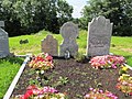
 Graves at Drumgoon Cemetery - geograph.org.uk - 3151237.jpg 1,024 × 768; 279 KB
-
 Graves in the ancient grave yard at Drumgoon - geograph.org.uk - 3151251.jpg 1,024 × 562; 179 KB
-
 Greenans, Cootehill - geograph.org.uk - 3055999.jpg 640 × 480; 51 KB
-
 Hannigans, Cootehill - geograph.org.uk - 3055488.jpg 640 × 480; 48 KB
-
 Harry's Butchers, Cootehill - geograph.org.uk - 3056022.jpg 640 × 480; 54 KB
-

-
 Hugh O'Reilly GAA Memorial Park - geograph.org.uk - 3056202.jpg 640 × 480; 43 KB
-
 Hugh O'Reilly GAA Memorial Park at Cootehill - geograph.org.uk - 3785088.jpg 1,024 × 579; 91 KB
-
 Inter-drumlin wetland east of the R191 - geograph.org.uk - 3150597.jpg 1,024 × 768; 224 KB
-
 Kenny Connollys, Cootehill - geograph.org.uk - 3056222.jpg 640 × 480; 46 KB
-
 Killatee Road just east of Killyrue Cross Roads - geograph.org.uk - 3785801.jpg 1,024 × 768; 255 KB
-

-
 Kung Fu - McCrystal's, Cootehill - geograph.org.uk - 3055340.jpg 640 × 480; 62 KB
-
 Kung Fu, Cootehill - geograph.org.uk - 3055293.jpg 640 × 480; 56 KB
-
 Library, Cootehill - geograph.org.uk - 3056238.jpg 640 × 480; 44 KB
-
 Market Street Cootehill.jpg 1,024 × 768; 312 KB
-
 Market Street, Cootehill - geograph.org.uk - 2487348.jpg 1,024 × 764; 182 KB
-
 Market Street, Cootehill - geograph.org.uk - 3055299.jpg 640 × 480; 51 KB
-
 Market Street, Cootehill - geograph.org.uk - 3055991.jpg 640 × 480; 47 KB
-
 Market Street, Cootehill - geograph.org.uk - 3142293.jpg 1,024 × 641; 123 KB
-

-
-
 McCrystal's Pharmacy, Cootehill - geograph.org.uk - 3055343.jpg 640 × 480; 63 KB
-

-
 Methodist Church, Cootehill - geograph.org.uk - 3055518.jpg 640 × 480; 96 KB
-
 Minor junction on the Degnavanty road - geograph.org.uk - 3152960.jpg 1,024 × 768; 159 KB
-

-

-

-
 MJ's Newsagents, Cootehill - geograph.org.uk - 3056019.jpg 640 × 480; 56 KB
-
 Modern house alongside the R191 at Killyrue - geograph.org.uk - 3785770.jpg 1,024 × 768; 157 KB
-
 Monaghan Road, Cootehill, Co. Cavan - geograph.org.uk - 623975.jpg 640 × 480; 57 KB
-

-
 Ms Diva, Cootehill - geograph.org.uk - 3056211.jpg 640 × 480; 48 KB
-
 Mullens Bar, Cootehill - geograph.org.uk - 3055495.jpg 640 × 480; 57 KB
-
 New house overlooking the Annalee flood plain - geograph.org.uk - 3172991.jpg 1,024 × 731; 112 KB
-
 New Line, Cootehill - geograph.org.uk - 3141430.jpg 640 × 480; 53 KB
-

-
-
 O'Donnell's, Cootehill - geograph.org.uk - 3055282.jpg 640 × 480; 57 KB
-
 O'Reilly, Solicitors, Cootehill - geograph.org.uk - 3056001.jpg 640 × 480; 51 KB
-

-

-
 Pasture land at Drumgoon - geograph.org.uk - 3150620.jpg 1,024 × 768; 198 KB
-

-

-
 R188 road near Cootehill, Co. Cavan - geograph.org.uk - 623948.jpg 640 × 480; 119 KB
-
 R190, Cootehill - geograph.org.uk - 3141424.jpg 640 × 480; 60 KB
-
 R191, Annaghard - geograph.org.uk - 3141459.jpg 640 × 480; 65 KB
-
-
 River name plate at Drumgoon Bridge - geograph.org.uk - 3785849.jpg 1,024 × 768; 326 KB
-
 Riverside Farmhouse Cootehill.jpg 1,024 × 768; 699 KB
-
 Scoil Chuimsitheach Aodain Naofa, Cootehill - geograph.org.uk - 2638613.jpg 1,024 × 688; 98 KB
-
 Sean's Diner, Cootehill - geograph.org.uk - 3055359.jpg 640 × 480; 56 KB
-
 Sharp bend in the Killyrue Road - geograph.org.uk - 3786746.jpg 1,024 × 768; 244 KB
-
 Shields Bookmakers, Cootehill - geograph.org.uk - 3055351.jpg 640 × 480; 57 KB
-

-
 Silver dollar, Cootehill - geograph.org.uk - 3056200.jpg 640 × 480; 43 KB
-
-
-
 Supervalu - Cootehill Post Office - geograph.org.uk - 3055364.jpg 640 × 480; 50 KB
-

-
 The Annalee immediately below Drumgoon Bridge - geograph.org.uk - 3785938.jpg 1,024 × 768; 271 KB
-
 The Annalee River above Drumgoon Bridge - geograph.org.uk - 3785936.jpg 1,024 × 768; 262 KB
-
 The Avenue - geograph.org.uk - 941811.jpg 446 × 640; 104 KB
-
 The Bannon Family Plot at Drumgoon - geograph.org.uk - 3151242.jpg 1,024 × 768; 354 KB
-

-
 The Drumgoon Bridge on the R191 - geograph.org.uk - 2639430.jpg 1,024 × 767; 186 KB
-

-
 The floodplain of the Annalee River - geograph.org.uk - 3152876.jpg 1,024 × 768; 218 KB
-
 The junction with the new spur of the R191 - geograph.org.uk - 3152864.jpg 1,024 × 768; 263 KB
-
 The Killarue Furniture Store - geograph.org.uk - 3083358.jpg 1,024 × 768; 175 KB
-

-
 The Livestock Mart at Cootehill - geograph.org.uk - 3093997.jpg 1,024 × 643; 102 KB
-
 The Mall Restaurant, Cootehill - geograph.org.uk - 3056002.jpg 640 × 480; 54 KB
-

-
 The north-bound R191 at Drumgoon Bridge - geograph.org.uk - 3785843.jpg 1,024 × 767; 187 KB
-
 The northern end of Market Street, Cootehill - geograph.org.uk - 2639496.jpg 1,024 × 580; 133 KB
-
-
 The old cemetery at Drumgoon - geograph.org.uk - 3056833.jpg 1,024 × 768; 314 KB
-

-
 The R191 north of the Killyrue Cross Roads - geograph.org.uk - 3785792.jpg 1,024 × 768; 148 KB
-
 The R191 south of Cootehill - geograph.org.uk - 2639449.jpg 1,024 × 768; 204 KB
-
 The southern end of Market Street, Cootehill - geograph.org.uk - 2487368.jpg 1,024 × 576; 131 KB
-
 The Ulster Bank, Cootehill - geograph.org.uk - 3142195.jpg 1,024 × 768; 171 KB
-
 The view west from Drumgoon Grave Yard - geograph.org.uk - 3151230.jpg 1,024 × 768; 331 KB
-
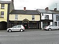
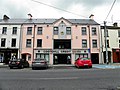
 The White Horse Hotel, Market Street, Cootehill - geograph.org.uk - 3142342.jpg 1,024 × 592; 112 KB
-
 Ulster Bank, Cootehill - geograph.org.uk - 3056015.jpg 640 × 480; 55 KB
-

-
 Vacant building, Cootehill - geograph.org.uk - 3056032.jpg 640 × 480; 49 KB
-
 Vacant premises, Cootehill - geograph.org.uk - 3056016.jpg 640 × 480; 53 KB
-
 Valley bottom powerlines in Degnavanty TD - geograph.org.uk - 3787128.jpg 1,024 × 768; 181 KB
-

-

-
 View due east along the Degnavanty road - geograph.org.uk - 3152986.jpg 1,024 × 768; 201 KB
-
 View eastwards along Killyrue Road - geograph.org.uk - 3786735.jpg 1,024 × 768; 261 KB
-

-
-

-
-
-
-

-
 View west towards the cross roads with the R191 - geograph.org.uk - 3150554.jpg 1,024 × 769; 212 KB
-
 Wetland in the Annalee Valley - geograph.org.uk - 3152884.jpg 1,024 × 768; 243 KB
-

-
 White Horse Hotel, Cootehill - geograph.org.uk - 3055990.jpg 640 × 480; 43 KB
-
 Zam Zam, Cootehill - geograph.org.uk - 3056219.jpg 640 × 480; 50 KB


.jpg)


_-_geograph.org.uk_-_3786761.jpg)


.jpg)


_-_geograph.org.uk_-_3786758.jpg)


_-_geograph.org.uk_-_1611615.jpg)


_road_at_Killarue_-_geograph.org.uk_-_3083349.jpg)


