Category:Cooling, Kent
Jump to navigation
Jump to search
village and civil parish in Kent, England  | |||||
| Upload media | |||||
| Instance of | |||||
|---|---|---|---|---|---|
| Location | Medway, Kent, South East England, England | ||||
| Population |
| ||||
| Different from | |||||
| Said to be the same as | Cooling (Wikimedia duplicated page, civil parish) | ||||
 | |||||
Subcategories
This category has the following 4 subcategories, out of 4 total.
Media in category "Cooling, Kent"
The following 200 files are in this category, out of 350 total.
(previous page) (next page)-
 'Pip's graves' in Cooling Churchyard - geograph.org.uk - 4973614.jpg 4,608 × 3,456; 3.43 MB
-
 'Pip's graves' in Cooling Churchyard - geograph.org.uk - 5161075.jpg 4,608 × 3,456; 3.35 MB
-
 'Pip's graves' in Cooling Churchyard - geograph.org.uk - 5161086.jpg 4,608 × 3,456; 3.33 MB
-
 'Pip's graves' in Cooling Churchyard - geograph.org.uk - 5560885.jpg 4,000 × 3,000; 4.88 MB
-
 'Pip's graves' in Cooling Churchyard - geograph.org.uk - 5560886.jpg 4,000 × 3,000; 4.56 MB
-
 A shelterbelt by Main Rd - geograph.org.uk - 2823907.jpg 640 × 430; 88 KB
-
 An autumnal looking orchard - geograph.org.uk - 2823898.jpg 640 × 430; 83 KB
-
 An autumnal orchard - geograph.org.uk - 2823904.jpg 640 × 430; 91 KB
-
 Autumnal orchard - geograph.org.uk - 2816022.jpg 640 × 430; 78 KB
-
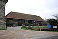
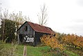
 Barn at Cooling Castle - geograph.org.uk - 3549159.jpg 4,000 × 3,000; 3.88 MB
-
 Barns at Bromhey Farm - geograph.org.uk - 1363527.jpg 640 × 480; 75 KB
-
 Before the horizon, Cooling - geograph.org.uk - 1052689.jpg 640 × 480; 36 KB
-
 Berry Court Wood - geograph.org.uk - 2849485.jpg 640 × 430; 110 KB
-
 Brick built Barn, Marshgate - geograph.org.uk - 2823924.jpg 640 × 430; 71 KB
-
 Bridge over the Hundred of Hoo Railway south of Cooling - geograph.org.uk - 4973187.jpg 4,608 × 3,456; 3.4 MB
-
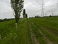
 Bridleway to New Barn Farm - geograph.org.uk - 4973122.jpg 4,608 × 3,456; 3.37 MB
-
 Bridleway to New Barn Farm - geograph.org.uk - 4973142.jpg 4,608 × 3,456; 3.39 MB
-
 Bridleway to New Barn Farm - geograph.org.uk - 4973149.jpg 4,608 × 3,456; 3.39 MB
-
 Bridleway to Wybournes Farm - geograph.org.uk - 4973134.jpg 4,608 × 3,456; 3.39 MB
-
 Broken Stile near Barn - geograph.org.uk - 1130058.jpg 640 × 481; 110 KB
-
 Buckland Fleet in Buckland Marshes - geograph.org.uk - 1116642.jpg 640 × 481; 74 KB
-
 Buckland Fleet in Whalebone Marshes - geograph.org.uk - 1116637.jpg 640 × 481; 98 KB
-
 Buckland Marshes - geograph.org.uk - 245694.jpg 640 × 483; 104 KB
-
 Car port, Marshgate - geograph.org.uk - 2823931.jpg 640 × 430; 46 KB
-
 Cartshed, Marshgate - geograph.org.uk - 2823929.jpg 640 × 430; 45 KB
-
 Childs Farm - geograph.org.uk - 2816039.jpg 640 × 430; 43 KB
-
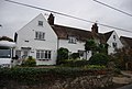
 Childs Farmhouse - geograph.org.uk - 2816036.jpg 640 × 430; 55 KB
-
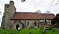
 Church of St James - geograph.org.uk - 2829021.jpg 640 × 430; 111 KB
-
 Church of St James - geograph.org.uk - 2829033.jpg 430 × 640; 98 KB
-
 Church of St James, Cooling - geograph.org.uk - 2829040.jpg 640 × 430; 90 KB
-
 Church of St James, Cooling - geograph.org.uk - 2829045.jpg 640 × 430; 98 KB
-
 Church of St James, Cooling - geograph.org.uk - 3065232.jpg 640 × 427; 127 KB
-
 Church view - geograph.org.uk - 2829004.jpg 640 × 430; 66 KB
-
 Cliffe Marshes - geograph.org.uk - 2290724.jpg 640 × 430; 33 KB
-
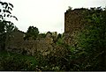
 Cooling Castle - geograph.org.uk - 2829078.jpg 640 × 439; 76 KB
-
 Cooling Castle - geograph.org.uk - 2829103.jpg 640 × 430; 79 KB
-
 Cooling Castle - geograph.org.uk - 2833405.jpg 640 × 430; 98 KB
-
 Cooling Castle - geograph.org.uk - 3069220.jpg 640 × 427; 150 KB
-
 Cooling Castle - geograph.org.uk - 3069224.jpg 640 × 427; 107 KB
-
 Cooling Castle - geograph.org.uk - 3069228.jpg 640 × 427; 114 KB
-
 Cooling Castle - geograph.org.uk - 4957408.jpg 3,264 × 2,448; 2.12 MB
-
 Cooling Castle - geograph.org.uk - 5749258.jpg 1,600 × 1,067; 400 KB
-
 Cooling Castle - geograph.org.uk - 6069236.jpg 1,024 × 768; 212 KB
-
 Cooling Castle - Inner Ward - geograph.org.uk - 2292949.jpg 640 × 430; 99 KB
-
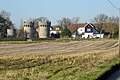
 Cooling Castle Barn - geograph.org.uk - 2292632.jpg 640 × 430; 57 KB
-
 Cooling Castle Barn - geograph.org.uk - 2833401.jpg 640 × 430; 64 KB
-
 Cooling Castle Cottage - geograph.org.uk - 2292954.jpg 640 × 430; 49 KB
-
 Cooling Castle Cottage - geograph.org.uk - 2833404.jpg 640 × 430; 64 KB
-
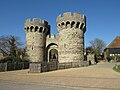
 Cooling Castle Entrance - geograph.org.uk - 2209812.jpg 1,092 × 798; 470 KB
-
 Cooling Castle Entrance - geograph.org.uk - 2209816.jpg 1,103 × 766; 582 KB
-
 Cooling Castle entrance and barn - geograph.org.uk - 3064730.jpg 640 × 280; 72 KB
-
 Cooling Castle from Cooling Road - geograph.org.uk - 3988123.jpg 913 × 684; 194 KB
-
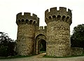
 Cooling Castle Gatehouse - geograph.org.uk - 2292628.jpg 640 × 430; 70 KB
-
 Cooling Castle Gatehouse - geograph.org.uk - 2833399.jpg 640 × 430; 83 KB
-
 Cooling Castle gatehouse - geograph.org.uk - 5324812.jpg 640 × 427; 92 KB
-
 Cooling Castle gatehouse - geograph.org.uk - 6069877.jpg 1,024 × 684; 335 KB
-
 Cooling Castle Gatehouse, Cooling Road - geograph.org.uk - 5316561.jpg 480 × 640; 108 KB
-

-
 Cooling Castle grounds, Cooling Road - geograph.org.uk - 5316555.jpg 640 × 454; 127 KB
-
 Cooling Castle Ruins - geograph.org.uk - 2209820.jpg 1,164 × 794; 396 KB
-
 Cooling Castle Ruins - geograph.org.uk - 2209822.jpg 1,166 × 793; 578 KB
-
 Cooling Castle, from the south - geograph.org.uk - 2347538.jpg 1,024 × 768; 159 KB
-
 Cooling church - geograph.org.uk - 3840159.jpg 640 × 480; 123 KB
-
 Cooling Churchyard, Kent - geograph.org.uk - 3916184.jpg 800 × 441; 83 KB
-
 Cooling Cottage - geograph.org.uk - 2829106.jpg 640 × 430; 37 KB
-
 Cooling Court - geograph.org.uk - 1067816.jpg 640 × 481; 103 KB
-
 Cooling Court - geograph.org.uk - 3556668.jpg 4,000 × 3,000; 4.09 MB
-
 Cooling Court - geograph.org.uk - 4973193.jpg 4,608 × 3,456; 3.41 MB
-
 Cooling Court, near Cooling - geograph.org.uk - 4957358.jpg 3,264 × 2,448; 2.33 MB
-
 Cooling Court, near Cooling - geograph.org.uk - 4957374.jpg 3,264 × 2,448; 1.85 MB
-
 Cooling Court, near Cooling - geograph.org.uk - 4957381.jpg 3,264 × 2,448; 2.07 MB
-
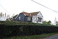
 Cooling House - geograph.org.uk - 2827836.jpg 640 × 430; 60 KB
-
 Cooling House - geograph.org.uk - 2827842.jpg 640 × 430; 57 KB
-
 Cooling Lodge - geograph.org.uk - 1160433.jpg 640 × 481; 78 KB
-
 Cooling Marshes - geograph.org.uk - 1116640.jpg 640 × 481; 61 KB
-
 Cooling Marshes - geograph.org.uk - 2842732.jpg 640 × 435; 63 KB
-
 Cooling Rd - geograph.org.uk - 2292636.jpg 640 × 430; 51 KB
-
 Cooling Road - geograph.org.uk - 3064755.jpg 640 × 480; 93 KB
-
 Cooling Road at Lipwell Hill - geograph.org.uk - 3556801.jpg 4,000 × 3,000; 4.19 MB
-
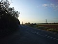 Cooling Road, Cooling - geograph.org.uk - 1002306.jpg 640 × 480; 41 KB
-
 Cooling Road, Cooling - geograph.org.uk - 4957397.jpg 3,264 × 2,448; 1.44 MB
-
 Cooling Road, Cooling - geograph.org.uk - 5316565.jpg 492 × 640; 71 KB
-
 Cooling Road, Cooling - geograph.org.uk - 6069226.jpg 1,024 × 768; 237 KB
-
 Cooling Road, near Cooling - geograph.org.uk - 6069507.jpg 1,024 × 768; 140 KB
-
 Cooling Street, Spendiff - geograph.org.uk - 4956274.jpg 3,264 × 2,448; 1.82 MB
-
 Cooling Street, Spendiff - geograph.org.uk - 4957341.jpg 3,264 × 2,448; 1.85 MB
-
 Cooling Village Sign - geograph.org.uk - 1160435.jpg 481 × 640; 96 KB
-
 Cooling Village sign - geograph.org.uk - 2827845.jpg 516 × 640; 114 KB
-
 Cooling Village Sign - geograph.org.uk - 4957464.jpg 2,448 × 3,264; 2.36 MB
-
 Cooling Village Sign - geograph.org.uk - 4957522.jpg 3,264 × 2,448; 2.09 MB
-
 Cooling, Church of St. James - geograph.org.uk - 4948014.jpg 3,573 × 2,237; 7.07 MB
-
 Cooling, Church of St. James - geograph.org.uk - 4948015.jpg 3,646 × 2,399; 5.67 MB
-

-

-

-
 Cooling, Church of St. James, Rare c14th benches 1 - geograph.org.uk - 4948017.jpg 3,678 × 2,455; 4.83 MB
-
 Cooling, Church of St. James, Rare c14th benches 2 - geograph.org.uk - 4948020.jpg 3,772 × 2,424; 3.91 MB
-
 Cooling, Church of St. James, Rare c14th benches 3 - geograph.org.uk - 4948024.jpg 3,678 × 2,456; 5.15 MB
-
 Cooling, Church of St. James, Southern aspect - geograph.org.uk - 4948016.jpg 4,399 × 2,561; 7.66 MB
-

-

-

-

-

-

-

-

-
 Cooling, Kent - geograph.org.uk - 999579.jpg 640 × 480; 62 KB
-
 Cooling, the village sign - geograph.org.uk - 2342644.jpg 767 × 1,024; 149 KB
-
 Coppiced tree - geograph.org.uk - 2849483.jpg 640 × 430; 130 KB
-
 Country road, take me home...... - geograph.org.uk - 1000599.jpg 640 × 480; 38 KB
-
 Cows by the old hut - geograph.org.uk - 4952034.jpg 4,000 × 3,000; 2.65 MB
-
 Cropland by Main Rd - geograph.org.uk - 2823932.jpg 640 × 430; 57 KB
-
 Cropland by Main Rd - geograph.org.uk - 2829069.jpg 640 × 430; 57 KB
-
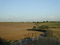
 Cropland south of Main Rd - geograph.org.uk - 2823912.jpg 640 × 430; 67 KB
-
 Defunct Light - geograph.org.uk - 168998.jpg 640 × 426; 97 KB
-
-
 Ditch, Cooling - geograph.org.uk - 3840155.jpg 640 × 480; 114 KB
-
 Ditch, RSPB Reserve - geograph.org.uk - 2800179.jpg 640 × 430; 109 KB
-
 Dressage ring by Lipwell Hill - geograph.org.uk - 2816009.jpg 640 × 355; 48 KB
-
 Eastborough Farm - geograph.org.uk - 3556727.jpg 4,000 × 3,000; 4.14 MB
-
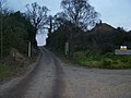
 Entering Cooling on Lipwell Hill - geograph.org.uk - 2816015.jpg 640 × 430; 88 KB
-
-

-
 Ernie Hemsley Viewpoint - geograph.org.uk - 1160390.jpg 640 × 481; 81 KB
-
 Farm building in an orchard - geograph.org.uk - 2823902.jpg 640 × 430; 77 KB
-
 Farm buildings, Marshgate - geograph.org.uk - 2823922.jpg 640 × 430; 49 KB
-
 Farm out-building at Marshgate Farm, Cooling - geograph.org.uk - 2943406.jpg 1,024 × 769; 177 KB
-
 Farm pond, Marshgate - geograph.org.uk - 2823918.jpg 640 × 430; 77 KB
-
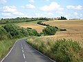
 Farmland by Cooling Rd - geograph.org.uk - 2815999.jpg 640 × 430; 32 KB
-
 Farmland by Cooling Rd - geograph.org.uk - 2833410.jpg 640 × 430; 59 KB
-
 Farmland by Lipwell Hill - geograph.org.uk - 2816004.jpg 640 × 430; 45 KB
-
 Farmland north of Cooling - geograph.org.uk - 1364066.jpg 640 × 480; 52 KB
-
 Farmland North of the Road - geograph.org.uk - 4952441.jpg 1,600 × 1,191; 564 KB
-
 Farmland south of Cooling Castle - geograph.org.uk - 2833402.jpg 640 × 430; 46 KB
-
 Farmland south of Lipwell Hill - geograph.org.uk - 2816007.jpg 640 × 430; 36 KB
-
 Farmland, Cooling - geograph.org.uk - 2828998.jpg 640 × 430; 47 KB
-
 Farmyard, Bromhey Farm - geograph.org.uk - 5749297.jpg 1,600 × 1,067; 387 KB
-
 Fence on Sea Wall - geograph.org.uk - 1130026.jpg 640 × 481; 120 KB
-
 Field at Cooling.jpg 3,888 × 5,184; 5.47 MB
-
 Field track off Main Road - geograph.org.uk - 3069194.jpg 640 × 427; 113 KB
-
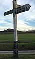
 Finger Post, Main Road, Cooling - geograph.org.uk - 4957395.jpg 2,448 × 3,264; 2.98 MB
-
 Fixing the Footpath - geograph.org.uk - 4951894.jpg 4,000 × 3,000; 5.7 MB
-
 Flowers and Table, St James Church, Cooling - geograph.org.uk - 3065206.jpg 2,304 × 3,072; 2.07 MB
-
 Footbridge, Saxon Shore Way - geograph.org.uk - 2797386.jpg 640 × 430; 105 KB
-
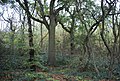
 Footpath along Great Chattenden Wood - geograph.org.uk - 2849486.jpg 640 × 430; 140 KB
-
 Footpath off Main Rd, Cooling - geograph.org.uk - 2827832.jpg 640 × 430; 77 KB
-
 Footpath to Berry Court Wood - geograph.org.uk - 3065165.jpg 3,072 × 2,304; 2.23 MB
-
 Footpath towards Spendiff - geograph.org.uk - 5119053.jpg 640 × 480; 175 KB
-
 Former chapel at Spendiff - geograph.org.uk - 3559361.jpg 1,024 × 763; 191 KB
-
 Former Wesleyan chapel at Spendiff - geograph.org.uk - 3556647.jpg 4,000 × 3,000; 4.19 MB
-
 Former Wesleyan Chapel, Spendiff - geograph.org.uk - 4957289.jpg 3,264 × 2,448; 2.06 MB
-
 Fruit Trees at Bromhey Farm - geograph.org.uk - 4952060.jpg 1,600 × 1,200; 533 KB
-
 Fruit trees in bloom - geograph.org.uk - 5749291.jpg 1,600 × 1,067; 344 KB
-
 Garden by Main Road - geograph.org.uk - 3065227.jpg 640 × 427; 142 KB
-
 Gatehouse to Cooling Castle across the fields - geograph.org.uk - 3556711.jpg 4,000 × 3,000; 3.84 MB
-
 Gatehouse, Cooling Castle - geograph.org.uk - 2833398.jpg 640 × 428; 79 KB
-
 Hay at Eastborough Farm - geograph.org.uk - 3556731.jpg 4,000 × 3,000; 4.09 MB
-
 Improvements to the Saxon Shore Way - geograph.org.uk - 4951914.jpg 4,000 × 3,000; 4.77 MB
-
 In Berry Court Wood - geograph.org.uk - 2849480.jpg 640 × 430; 127 KB
-
 Interior of St James Church, Cooling - geograph.org.uk - 4973619.jpg 4,608 × 3,456; 3.32 MB
-
 Kiln House - geograph.org.uk - 3067738.jpg 640 × 427; 138 KB
-
 Kissing gate, Saxon Shore Way - geograph.org.uk - 2292602.jpg 640 × 430; 52 KB
-
 Lane near Spendiff Farm - geograph.org.uk - 3556617.jpg 4,000 × 3,000; 4.15 MB
-
 Lane north of Cooling Court Farm - geograph.org.uk - 5324838.jpg 640 × 427; 123 KB
-
 Lane past Spendiff Farm - geograph.org.uk - 3067757.jpg 640 × 427; 73 KB
-
 Large fallow field near Cooling - geograph.org.uk - 2292956.jpg 640 × 430; 61 KB
-
 Lipwell Hill - geograph.org.uk - 2816000.jpg 640 × 430; 44 KB
-
 Lipwell Hill - geograph.org.uk - 2816005.jpg 640 × 430; 49 KB
-
 Lipwell Hill - geograph.org.uk - 2816018.jpg 640 × 430; 77 KB
-
 Lipwell Hill - geograph.org.uk - 2816025.jpg 640 × 430; 67 KB
-
 Lipwell Hill and Cooling Road - geograph.org.uk - 6069981.jpg 1,024 × 684; 253 KB
-

-
 Lipwell Hill, near Cooling - geograph.org.uk - 4957505.jpg 3,264 × 2,448; 2.02 MB
-
 Lipwell Hill, near Cooling - geograph.org.uk - 6069519.jpg 1,024 × 768; 163 KB
-
 Main Rd - geograph.org.uk - 2816033.jpg 640 × 430; 65 KB
-
 Main Rd - geograph.org.uk - 2823896.jpg 640 × 430; 72 KB
-
 Main Rd to Cooling - geograph.org.uk - 2823891.jpg 640 × 430; 67 KB
-
 Main Rd, Cooling - geograph.org.uk - 2823940.jpg 640 × 430; 81 KB
-
 Main Road - geograph.org.uk - 3065230.jpg 640 × 427; 86 KB
-
 Main Road Cooling - geograph.org.uk - 1364097.jpg 640 × 480; 62 KB
-
 Main Road, Cooling - geograph.org.uk - 1403391.jpg 640 × 480; 82 KB
-
 Main Road, Cooling - geograph.org.uk - 1403400.jpg 640 × 480; 79 KB
-
 Main Road, Cooling - geograph.org.uk - 2842707.jpg 640 × 435; 53 KB
-
 Main Road, Cooling - geograph.org.uk - 3246039.jpg 4,000 × 3,000; 4.29 MB
-
 Main Road, Cooling - geograph.org.uk - 4957438.jpg 3,264 × 2,448; 1.57 MB
-
 Main Road, Cooling - geograph.org.uk - 4957470.jpg 3,264 × 2,448; 1.96 MB
-
 Main Road, Cooling - geograph.org.uk - 4957475.jpg 3,264 × 2,448; 1.76 MB
-
 Main Road, Cooling - geograph.org.uk - 4957486.jpg 3,264 × 2,448; 2.07 MB
-
 Main Road, Cooling - geograph.org.uk - 4957499.jpg 3,264 × 2,448; 1.62 MB
-
 Main Road, Cooling - geograph.org.uk - 6069243.jpg 1,024 × 768; 161 KB
-
 Main Road, Cooling - geograph.org.uk - 6069253.jpg 1,024 × 768; 206 KB
-
 Main Road, Cooling - geograph.org.uk - 6069256.jpg 1,024 × 768; 169 KB
-
 Main Road, Cooling - geograph.org.uk - 6069262.jpg 1,024 × 768; 115 KB
-
 Main Road, Cooling - geograph.org.uk - 6069268.jpg 1,024 × 768; 165 KB
-
 Main Road, Cooling - geograph.org.uk - 6069970.jpg 1,024 × 684; 277 KB
-
 Main Road, near Cooling - geograph.org.uk - 6069272.jpg 1,024 × 768; 138 KB
-
 Mallow in the road verge near Spendiff Farm - geograph.org.uk - 3556624.jpg 4,000 × 3,000; 4.45 MB
-
 Marshes north of Cooling - geograph.org.uk - 3049070.jpg 1,600 × 1,066; 405 KB
-
 Marshgate Farm - geograph.org.uk - 2823938.jpg 640 × 430; 52 KB


