Category:Conjunto Histórico Paseo de Pereda y Calle Castelar
Jump to navigation
Jump to search
This is a category about a historical area listed in the Spanish heritage register of Bienes de Interés Cultural under the reference RI-53-0000329. |
| Object location | | View all coordinates using: OpenStreetMap |
|---|
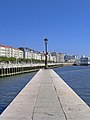
public park located in the city of Santander, Spain  | |||||
| Upload media | |||||
| Instance of | |||||
|---|---|---|---|---|---|
| Part of | |||||
| Location | Santander, Cantabria, Spain | ||||
| Heritage designation |
| ||||
| Date of official opening |
| ||||
 | |||||
Media in category "Conjunto Histórico Paseo de Pereda y Calle Castelar"
The following 20 files are in this category, out of 20 total.
-
 1917-04-28 IBÉRICA 03.jpg 2,457 × 1,872; 1.63 MB
-
 Atardecer en el Paseo Pereda.jpg 2,816 × 2,112; 2.41 MB
-
 Atardecer en la Calle Castelar.jpg 2,816 × 2,112; 2.04 MB
-
 Banco de Santander 1.JPG 4,051 × 2,699; 5.26 MB
-
 Bike-repair-station-Santander-2023.jpg 4,600 × 8,000; 9.87 MB
-
 Cantabria. Santander. Palacete del Embarcadero. Paseo de Pereda street. Spain (2745634363).jpg 8,016 × 1,920; 13.65 MB
-
 Cantabria. Santander. Palacete del Embarcadero. Paseo de Pereda. Spain (2745625131).jpg 3,072 × 2,304; 3.97 MB
-
 Cantabria. Santander. Paseo de Pereda street. Building. Spain (2746475240).jpg 1,944 × 2,592; 4.33 MB
-
 Cantabria. Santander. Paseo de Pereda street. Spain (2745608657).jpg 3,072 × 4,096; 8.78 MB
-
 Cantabria. Santander. Paseo de Pereda street. Spain (2746448432).jpg 3,072 × 2,304; 5.36 MB
-
 Conjunto Histórico Paseo de Pereda y Calle de Castelar.jpg 3,872 × 2,592; 4.38 MB
-
 Palacete del Embarcadero. Santander.jpg 8,016 × 1,920; 14.62 MB
-
 Paseo de Pereda, Santander.JPG 2,736 × 3,648; 4.18 MB
-
 Paseo Pereda - Santander.jpg 800 × 1,280; 1.12 MB
-
 Paseo pereda 18.jpg 3,648 × 2,736; 2.79 MB
-
 Paseo pereda 19.jpg 3,648 × 2,736; 2.8 MB
-
 Paseo pereda 29.jpg 3,648 × 2,736; 2.86 MB
-
 Paseo pereda 30.jpg 3,648 × 2,736; 2.82 MB
-
 Paseo Pereda de Santander.jpg 2,816 × 2,112; 3.06 MB
-
 Santander, balcones.jpg 4,144 × 2,764; 7.71 MB


.jpg)
.jpg)
.jpg)
.jpg)


.jpg)