Category:Condorrat
Jump to navigation
Jump to search
village in North Lanarkshire, Scotland, UK  | |||||
| Upload media | |||||
| Instance of | |||||
|---|---|---|---|---|---|
| Location |
| ||||
 | |||||
Subcategories
This category has the following 2 subcategories, out of 2 total.
M
- Main Road, Condorrat (6 F)
N
- North Road Bridge (6 F)
Media in category "Condorrat"
The following 17 files are in this category, out of 17 total.
-
 B802 - geograph.org.uk - 2239797.jpg 640 × 480; 111 KB
-
 Bridge Over the Railway - geograph.org.uk - 1951494.jpg 922 × 692; 244 KB
-
 Chappleton Road over the Luggie bridge - geograph.org.uk - 1538427.jpg 640 × 480; 111 KB
-
 Condorrat in the town Of Cumbernauld - geograph.org.uk - 1261772.jpg 640 × 437; 75 KB
-
 Condorrat Library - geograph.org.uk - 1748270.jpg 968 × 648; 110 KB
-
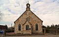 Condorrat Parish Church - geograph.org.uk - 1748134.jpg 1,076 × 685; 172 KB
-
 Condorrat, Moss Water - geograph.org.uk - 2379605.jpg 1,024 × 768; 215 KB
-
 Condorrat, Moss Water - geograph.org.uk - 2379609.jpg 1,024 × 768; 239 KB
-
 Dalshannon.jpg 2,090 × 881; 972 KB
-
 Earthworks at Westfield - geograph.org.uk - 1498025.jpg 640 × 480; 128 KB
-
 Farm Track to South Myvot - geograph.org.uk - 2040845.jpg 974 × 720; 210 KB
-
 Footbridge in the fields - geograph.org.uk - 1801593.jpg 800 × 600; 134 KB
-
 Footbridge over Luggie Water - geograph.org.uk - 1801599.jpg 800 × 600; 226 KB
-
 Sepa monitoring station, Luggie Water - geograph.org.uk - 1801368.jpg 800 × 600; 196 KB
-

-
 Summerhill - geograph.org.uk - 2239686.jpg 640 × 480; 82 KB
-
 View across Condorrat and Balloch - geograph.org.uk - 3042384.jpg 640 × 480; 98 KB


