Category:Compton Verney
Jump to navigation
Jump to search
English: Compton Verney is a manor and parish in the county of Warwickshire, England.
parish in the county of Warwickshire, England .jpg) | |||||
| Upload media | |||||
| Instance of | |||||
|---|---|---|---|---|---|
| Location | Stratford-on-Avon, Warwickshire, West Midlands, England | ||||
| Population |
| ||||
| Area |
| ||||
 | |||||
Subcategories
This category has the following 3 subcategories, out of 3 total.
C
- Compton Verney Icehouse (4 F)
Media in category "Compton Verney"
The following 105 files are in this category, out of 105 total.
-
 "Nature's Art Box" at Compton Verney - geograph.org.uk - 5801283.jpg 640 × 480; 369 KB
-
 "The Clearing" at Compton Verney - geograph.org.uk - 5801266.jpg 640 × 480; 329 KB
-
 "The Clearing" at Compton Verney - geograph.org.uk - 5801271.jpg 640 × 480; 363 KB
-
 "Untitled Boulder" - geograph.org.uk - 5801296.jpg 640 × 480; 289 KB
-
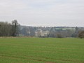 A distant view of Compton Verney - geograph.org.uk - 100974.jpg 640 × 480; 55 KB
-
 A sleeping swan - geograph.org.uk - 5845469.jpg 1,024 × 683; 132 KB
-
 An Art House^ - geograph.org.uk - 2588926.jpg 1,024 × 768; 225 KB
-
-
 Banisters Meadow Farm - geograph.org.uk - 2119526.jpg 2,000 × 1,500; 188 KB
-
 Basal inscriptions, Compton Verney obelisk - geograph.org.uk - 2645141.jpg 1,024 × 1,280; 1.89 MB
-
 Bridleway by Poolfield Lower Pool - geograph.org.uk - 1855528.jpg 2,000 × 1,496; 191 KB
-
 Bridleway marker at edge of Poolfield Upper Pool - geograph.org.uk - 1855593.jpg 2,000 × 1,506; 182 KB
-

-
 Bridleway near Bishop's Gorse Farm - geograph.org.uk - 2115835.jpg 1,500 × 2,000; 380 KB
-
 Bridleway to Bishop's Gorse Farm by Poolfield Upper Pool - geograph.org.uk - 1855578.jpg 2,000 × 1,496; 184 KB
-
 Bridleway to Home Farm - geograph.org.uk - 4932103.jpg 4,000 × 3,000; 2.99 MB
-
 Bridleway to Lighthorne Road near Poolfield Cottages - geograph.org.uk - 1855567.jpg 2,000 × 1,493; 155 KB
-
 Bridleway, Compton Verney - geograph.org.uk - 5228578.jpg 4,000 × 3,000; 3.19 MB
-
 Bridleway, Compton Verney Park - geograph.org.uk - 6465489.jpg 1,024 × 723; 185 KB
-
 Cedar of Lebanon - geograph.org.uk - 5801247.jpg 480 × 640; 353 KB
-
 Compton Hill, Compton Verney - geograph.org.uk - 1654950.jpg 640 × 427; 76 KB
-
 Compton Verney - geograph.org.uk - 5801311.jpg 640 × 480; 248 KB
-
 Compton Verney - geograph.org.uk - 5861271.jpg 1,024 × 615; 138 KB
-
 Compton Verney 4 (7622661384).jpg 2,252 × 3,140; 4.55 MB
-
 Compton Verney Lake - geograph.org.uk - 3932741.jpg 1,024 × 768; 183 KB
-
 Compton Verney Lodge - geograph.org.uk - 1936215.jpg 640 × 480; 95 KB
-
 Compton Verney parkland - geograph.org.uk - 6151552.jpg 1,024 × 614; 230 KB
-
 Conifers at Compton Verney car park - geograph.org.uk - 2499569.jpg 480 × 640; 105 KB
-
 Cottages at Red House corner - geograph.org.uk - 99343.jpg 640 × 480; 81 KB
-
 Country lane in the snow - geograph.org.uk - 1650848.jpg 421 × 640; 99 KB
-
 Derry Cottage, Compton Verney - geograph.org.uk - 1936275.jpg 640 × 480; 62 KB
-
 Driveway and bridleway to Poolfield Cottages - geograph.org.uk - 1855557.jpg 2,000 × 1,495; 190 KB
-
 Driveway to Hillfields - geograph.org.uk - 1650859.jpg 640 × 423; 72 KB
-
 Driveway to Poolfield Cottages - geograph.org.uk - 1934232.jpg 640 × 480; 99 KB
-
 Driveway to Three Gates House - geograph.org.uk - 108008.jpg 640 × 480; 102 KB
-
 Dryclose Coppice - geograph.org.uk - 2495487.jpg 640 × 480; 84 KB
-
 Dryclose Coppice - geograph.org.uk - 4163233.jpg 2,592 × 1,944; 1.81 MB
-

-
 Entrance to Compton Verney House - geograph.org.uk - 5059933.jpg 3,917 × 2,802; 2.92 MB
-
 Entrance to Lodge Farm - geograph.org.uk - 1654756.jpg 640 × 399; 46 KB
-
 Farmland near Compton Verney - geograph.org.uk - 4163264.jpg 2,592 × 1,944; 1.89 MB
-
 Farmland near Lighthorne - geograph.org.uk - 4163268.jpg 2,592 × 1,944; 1.83 MB
-
 Field near Lighthorne Rough - geograph.org.uk - 1933983.jpg 640 × 480; 116 KB
-
 Fields near Compton Verney - geograph.org.uk - 2495483.jpg 640 × 480; 56 KB
-
 Fields near Lighthorne Rough - geograph.org.uk - 1933976.jpg 640 × 480; 75 KB
-
 Fields near Lighthorne Rough - geograph.org.uk - 1934025.jpg 640 × 480; 113 KB
-
 Foggy road - geograph.org.uk - 5633450.jpg 6,032 × 4,014; 2.91 MB
-
 Footpath, Compton Verney Park - geograph.org.uk - 6465492.jpg 1,024 × 768; 225 KB
-
 Formal bridge at Compton Verney - geograph.org.uk - 1936285.jpg 640 × 480; 98 KB
-
-
 Fosse Way near Moreton Paddox - geograph.org.uk - 2079449.jpg 640 × 480; 70 KB
-
 Fox Cub in the Rough - geograph.org.uk - 2713543.jpg 2,848 × 2,034; 1.13 MB
-
 Hillfields Lodge - geograph.org.uk - 1934215.jpg 640 × 480; 137 KB
-
 Horse bridge on bridleway by Poolfield Upper Pool - geograph.org.uk - 1855519.jpg 2,000 × 1,491; 200 KB
-
 Kineton Road across Hillfields - geograph.org.uk - 819675.jpg 640 × 480; 47 KB
-
 Landseer, Victoria, Princess Royal, with Eos.jpg 1,672 × 1,284; 556 KB
-
 Lighthorne Road - geograph.org.uk - 4932594.jpg 4,000 × 3,000; 2.91 MB
-
 Lighthorne Road in the snow - geograph.org.uk - 1650871.jpg 640 × 427; 62 KB
-
 Lodge Farm, near Compton Verney - geograph.org.uk - 1934245.jpg 640 × 480; 104 KB
-
 Lone tree on Lighthorne Road - geograph.org.uk - 6465497.jpg 1,024 × 768; 224 KB
-
 Lonesome tree - geograph.org.uk - 6581240.jpg 1,600 × 1,200; 400 KB
-
 Lonesome tree - geograph.org.uk - 6581249.jpg 1,600 × 1,200; 398 KB
-
 Memorial bust of Sir Grenville Verney - geograph.org.uk - 5845560.jpg 683 × 1,024; 135 KB
-
 Memorial bust, Sir Greville Verney - geograph.org.uk - 5845554.jpg 683 × 1,024; 134 KB
-
 Minor road heading east, Three Gates - geograph.org.uk - 3396115.jpg 640 × 480; 116 KB
-
 New Fence and Trees - geograph.org.uk - 4944071.jpg 1,600 × 1,200; 512 KB
-
 Obelisk, Compton Verney - geograph.org.uk - 2645134.jpg 428 × 640; 113 KB
-

-

-
 Old Town Meadow at Compton Verney - geograph.org.uk - 5801343.jpg 640 × 480; 233 KB
-
 Plantation near Bishop's Gorse Farm - geograph.org.uk - 2119500.jpg 2,000 × 1,500; 372 KB
-
 Plantation near Bishop's Gorse Farm - geograph.org.uk - 2125982.jpg 2,000 × 1,500; 479 KB
-
 Poolfield Lower Pool - geograph.org.uk - 1855542.jpg 2,000 × 1,500; 211 KB
-
 Poolfield Upper Pool - geograph.org.uk - 1855606.jpg 2,000 × 1,497; 242 KB
-
 Private road to Home Farm - geograph.org.uk - 6465485.jpg 1,024 × 768; 209 KB
-
 Protected Field - geograph.org.uk - 2495457.jpg 640 × 480; 105 KB
-
 Restoring the ice house - geograph.org.uk - 1490089.jpg 640 × 428; 103 KB
-
 Road and Bridleway at Home Farm - geograph.org.uk - 4932331.jpg 4,000 × 3,000; 2.93 MB
-
 Road to Kineton - geograph.org.uk - 819665.jpg 640 × 480; 69 KB
-
 Road towards Lighthorne Rough - geograph.org.uk - 5228562.jpg 1,600 × 1,251; 333 KB
-
 Sheep in the valley - geograph.org.uk - 4932346.jpg 1,600 × 1,039; 390 KB
-
 The approach to Bowshot roundabout - geograph.org.uk - 1936257.jpg 640 × 480; 95 KB
-
 The Horse is a Noble Animal - geograph.org.uk - 2471136.jpg 640 × 480; 79 KB
-
 The lake - geograph.org.uk - 1497774.jpg 428 × 640; 48 KB
-
 The trees from the rough - geograph.org.uk - 2713536.jpg 2,816 × 2,112; 1.07 MB
-
 The way to Compton Verney - geograph.org.uk - 2804103.jpg 800 × 600; 84 KB
-

-
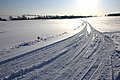
 Track into Lighthorne Rough in the snow - geograph.org.uk - 1650839.jpg 640 × 427; 130 KB
-
 Trees hiding something - geograph.org.uk - 4932372.jpg 4,000 × 3,000; 2.83 MB
-
 Upper end of the Lake at Compton Verney - geograph.org.uk - 5801337.jpg 640 × 480; 253 KB
-
 Vehicle Proving Ground - geograph.org.uk - 6600698.jpg 1,024 × 684; 44 KB
-
 Wellesbourne Road at the junction with Fosse Way - geograph.org.uk - 6078067.jpg 1,857 × 1,226; 1.39 MB
-
 Young trees at Compton Verney - geograph.org.uk - 1497763.jpg 640 × 428; 57 KB
-
 Bridleway to Compton Verney - geograph.org.uk - 106260.jpg 640 × 480; 87 KB
-
 Cottages at Three Gates - geograph.org.uk - 106270.jpg 640 × 480; 62 KB
-
 Farmland to the East of Compton Verney - geograph.org.uk - 180847.jpg 640 × 480; 119 KB
-
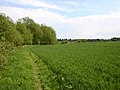
 Footpath and Dryclose Coppice - geograph.org.uk - 106262.jpg 640 × 480; 101 KB
-
 Kineton Road, Compton Verney - geograph.org.uk - 108001.jpg 640 × 480; 43 KB
-
 Lodge Farm - geograph.org.uk - 108004.jpg 640 × 480; 36 KB
-
 Lodge Farm - geograph.org.uk - 99377.jpg 640 × 480; 73 KB
-
 Pittern Hill reservoir. - geograph.org.uk - 107980.jpg 640 × 480; 42 KB
-
 The Glebe House - geograph.org.uk - 106265.jpg 640 × 480; 67 KB
-
 The Red House - geograph.org.uk - 100969.jpg 640 × 480; 130 KB
-
 Trig point on Pittern Hill - geograph.org.uk - 100963.jpg 640 × 480; 59 KB
-
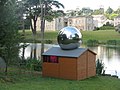
 ‘Untitled Boulder’ by John Frankland, Compton Verney - geograph.org.uk - 6088263.jpg 1,024 × 614; 1.02 MB


.jpg)


