Category:Compton Dundon
Jump to navigation
Jump to search
English: Compton Dundon is a village and civil parish in Somerset, England, situated beside King's Sedge Moor and the Polden Hills, north of Somerton in the South Somerset district. The village has a population of 710. The parish includes the hamlet of Littleton.
village and civil parish in Somerset, United Kingdom  | |||||
| Upload media | |||||
| Instance of | |||||
|---|---|---|---|---|---|
| Location | South Somerset, Somerset, South West England, England | ||||
| Population |
| ||||
 | |||||
Subcategories
This category has the following 3 subcategories, out of 3 total.
A
- Admiral Hood Monument (11 F)
K
- King's Sedgemoor (6 F)
Media in category "Compton Dundon"
The following 200 files are in this category, out of 249 total.
(previous page) (next page)-
 A bad benchmark on St Andrew's church - geograph.org.uk - 6521703.jpg 3,296 × 2,472; 1.93 MB
-
 A colourful wait - geograph.org.uk - 6523697.jpg 3,296 × 2,472; 1.84 MB
-
 A concrete trough on Lollover Hill - geograph.org.uk - 6522388.jpg 3,296 × 2,472; 1.9 MB
-
 A corner of St Andrew - geograph.org.uk - 6524626.jpg 3,296 × 2,472; 1.94 MB
-
 A crosier to keep the flock in - geograph.org.uk - 6522679.jpg 2,472 × 3,296; 3.05 MB
-
 A deep ditch crossed - geograph.org.uk - 6522652.jpg 3,296 × 2,472; 1.82 MB
-
 A face by the rain pipes - geograph.org.uk - 6524624.jpg 2,472 × 3,296; 1.71 MB
-
 A few tithe details - geograph.org.uk - 6522428.jpg 2,472 × 3,296; 1.7 MB
-
 A ghostly tree - geograph.org.uk - 6521772.jpg 3,296 × 2,472; 1.85 MB
-
 A horse and rider on Mead Run - geograph.org.uk - 6522647.jpg 3,296 × 2,472; 1.89 MB
-
 A Lane concrete product - geograph.org.uk - 6522384.jpg 3,296 × 2,472; 1.96 MB
-
 A memorial beir (sic) - geograph.org.uk - 6522685.jpg 3,296 × 2,472; 1.84 MB
-
 A quiet rest overlooking Goose Lane - geograph.org.uk - 6524651.jpg 2,472 × 3,296; 1.8 MB
-
 A rickety wooden door - geograph.org.uk - 6522642.jpg 3,296 × 2,472; 1.87 MB
-
 A short distance - geograph.org.uk - 6522446.jpg 3,296 × 2,472; 1.81 MB
-
 A sloping graveyard - geograph.org.uk - 6524632.jpg 3,296 × 2,472; 1.88 MB
-
 A splash of colour in Butleigh Wood - geograph.org.uk - 5607622.jpg 1,280 × 1,600; 833 KB
-
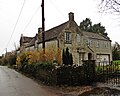
 A thatched farmhouse - geograph.org.uk - 6521782.jpg 3,296 × 2,472; 1.88 MB
-
 A tyre wash - geograph.org.uk - 6521777.jpg 3,296 × 2,472; 1.92 MB
-
 An up and over gate - geograph.org.uk - 6521173.jpg 2,472 × 3,296; 1.76 MB
-
 Anthills and scrub on Lollover Hill - geograph.org.uk - 5357795.jpg 1,600 × 1,200; 361 KB
-
 Autumn colours in the strip of woodland near Westfield - geograph.org.uk - 5607654.jpg 1,600 × 1,332; 830 KB
-
 B3151 Entering Compton Dundon - geograph.org.uk - 2010604.jpg 640 × 480; 213 KB
-
 Barn near Decoy Farm - geograph.org.uk - 6622971.jpg 1,024 × 683; 192 KB
-
 Bartlett's Farm, Dundon - geograph.org.uk - 6521700.jpg 3,296 × 2,472; 2.03 MB
-
 Bartletts Farm - geograph.org.uk - 5305866.jpg 1,024 × 720; 211 KB
-
 Beacon Cottage - geograph.org.uk - 5306538.jpg 1,024 × 812; 198 KB
-
 Benchmark on Bartlett's Farm - geograph.org.uk - 6521697.jpg 3,296 × 2,472; 1.94 MB
-
 Beside the River Cary - geograph.org.uk - 6622316.jpg 1,024 × 683; 189 KB
-
 Beside the River Cary under a grey sky - geograph.org.uk - 6622317.jpg 1,024 × 683; 189 KB
-
 Branching out on a wall - geograph.org.uk - 6522672.jpg 3,296 × 2,472; 1.84 MB
-
 Bridleway from Hayes Lane - geograph.org.uk - 5357766.jpg 1,600 × 1,191; 257 KB
-
 Bridleway to West Hill - geograph.org.uk - 5305044.jpg 1,024 × 785; 218 KB
-
 Car park on Combe Hill - geograph.org.uk - 5375988.jpg 1,024 × 768; 229 KB
-
 Carved Seat above Compton Dundon - geograph.org.uk - 892237.jpg 480 × 640; 136 KB
-
 Castlebrook Inn, Compton Dundon - geograph.org.uk - 2167516.jpg 640 × 480; 171 KB
-
 Collard Hill - geograph.org.uk - 1934560.jpg 480 × 640; 111 KB
-
 Collard Hill - geograph.org.uk - 1934568.jpg 640 × 480; 342 KB
-
 Collard Hill - geograph.org.uk - 1934576.jpg 640 × 480; 392 KB
-
 Combe Hill - geograph.org.uk - 4440465.jpg 800 × 533; 265 KB
-
 Combe Hill - geograph.org.uk - 4441544.jpg 800 × 533; 298 KB
-
 Combe Hollow - geograph.org.uk - 4693958.jpg 2,304 × 3,456; 2.15 MB
-
 Combe Hollow Lane - geograph.org.uk - 4441560.jpg 800 × 533; 324 KB
-
 Compton Dundon bus shelter - geograph.org.uk - 6523704.jpg 3,296 × 2,472; 2.63 MB
-
 Compton Dundon C.C. pavilion - geograph.org.uk - 6521144.jpg 3,296 × 2,472; 1.83 MB
-
 Compton Dundon cross - geograph.org.uk - 6523721.jpg 2,472 × 3,296; 1.81 MB
-
 Compton Dundon tithe barn - geograph.org.uk - 6522425.jpg 3,296 × 2,472; 1.98 MB
-
 Compton Dundon village hall - geograph.org.uk - 6523852.jpg 3,296 × 2,472; 1.86 MB
-
 Compton Street - geograph.org.uk - 5306555.jpg 1,024 × 763; 183 KB
-
 Compton Street - geograph.org.uk - 5306673.jpg 1,024 × 806; 202 KB
-
 Compton Street - geograph.org.uk - 6522622.jpg 3,296 × 2,472; 1.8 MB
-
 Corrugated iron barn on Hayes Lane - geograph.org.uk - 5305465.jpg 1,024 × 760; 136 KB
-
 Cottage on Hayes Road - geograph.org.uk - 5306523.jpg 1,024 × 768; 161 KB
-
 Cottage, Behind Town - geograph.org.uk - 5469216.jpg 1,024 × 758; 166 KB
-
 Cottages at Dundon seen across field - geograph.org.uk - 6622993.jpg 1,024 × 683; 159 KB
-
 Cottages in Peak Lane - geograph.org.uk - 6622974.jpg 1,024 × 683; 242 KB
-
 Cricket pavilion, Compton Dundon CC - geograph.org.uk - 5305827.jpg 1,024 × 803; 251 KB
-
 Cyclist pulling in to a layby - geograph.org.uk - 4100135.jpg 640 × 480; 187 KB
-

-
 Drain on Street Moor - geograph.org.uk - 5986192.jpg 1,600 × 1,200; 563 KB
-
 Drainage right across the road - geograph.org.uk - 6522624.jpg 3,296 × 2,472; 1.84 MB
-
 Drove on Compton Dundon Moor - geograph.org.uk - 5305853.jpg 1,024 × 743; 201 KB
-
 Dundon and Lollover Hill - geograph.org.uk - 4665803.jpg 3,456 × 2,304; 5.09 MB
-
 Dundon Beacon - geograph.org.uk - 4664705.jpg 3,456 × 2,304; 3.83 MB
-
 Dundon Beacon - geograph.org.uk - 5305074.jpg 1,024 × 768; 310 KB
-
 Dundon Beacon and Decoy Farm - geograph.org.uk - 4693975.jpg 3,456 × 2,304; 2.07 MB
-
 Dundon Beacon from Decoy Lane - geograph.org.uk - 6521779.jpg 3,296 × 2,472; 1.96 MB
-
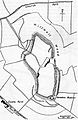 Dundon Camp Somerset Map.jpg 600 × 920; 92 KB
-
 Dundon church and Lollover Hill - geograph.org.uk - 4664710.jpg 3,456 × 2,304; 1.78 MB
-
 Dundon Hill - geograph.org.uk - 4416162.jpg 3,072 × 2,304; 3.13 MB
-
 Dundon Hill - geograph.org.uk - 4693980.jpg 3,456 × 2,304; 3.89 MB
-
 Dundon Hill from Lollover Hill - geograph.org.uk - 6521746.jpg 3,296 × 2,472; 1.99 MB
-
 Dundon Hill from Walton Hill - geograph.org.uk - 5607680.jpg 1,600 × 800; 576 KB
-
 Eighteen Feet Rhyne - geograph.org.uk - 5375709.jpg 1,024 × 768; 159 KB
-
 Enough hazards to go to church - geograph.org.uk - 6522676.jpg 3,296 × 2,472; 1.83 MB
-
 Entering Compton Dundon - geograph.org.uk - 6522440.jpg 3,296 × 2,472; 1.91 MB
-
 Farm buildings by Hurst Drove - geograph.org.uk - 5986323.jpg 1,600 × 1,200; 439 KB
-
 Farm crossing on Eighteen Feet Rhyne - geograph.org.uk - 5375712.jpg 1,024 × 768; 187 KB
-
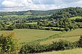
 Field and Gilling Down - geograph.org.uk - 5397822.jpg 1,600 × 1,200; 492 KB
-
 Field by Hayes Lane - geograph.org.uk - 5357756.jpg 1,600 × 1,172; 399 KB
-
 Fields and hedgerows - geograph.org.uk - 231009.jpg 640 × 480; 97 KB
-
 Fields by Hayes Lane - geograph.org.uk - 5357760.jpg 1,600 × 1,088; 241 KB
-
 Footbridge across the River Cary - geograph.org.uk - 6622315.jpg 1,024 × 683; 261 KB
-
 Footbridge Over the River Cary - geograph.org.uk - 1010688.jpg 640 × 428; 116 KB
-
 Footpath around Dundon Hill - geograph.org.uk - 5397820.jpg 1,600 × 1,200; 517 KB
-
 Footpath from Hurst - geograph.org.uk - 5357801.jpg 1,600 × 1,200; 422 KB
-
 Footpath On Dundon Hill - geograph.org.uk - 4416174.jpg 3,072 × 2,304; 2.73 MB
-
 Footpath through Lower Hayes Farm - geograph.org.uk - 5357740.jpg 1,600 × 1,266; 471 KB
-
 Footpath to Lollover Hill - geograph.org.uk - 5357788.jpg 1,600 × 1,200; 846 KB
-
 Garden ^ Play Area - geograph.org.uk - 2167518.jpg 640 × 480; 123 KB
-
 Gilling Down - geograph.org.uk - 4692929.jpg 3,456 × 2,304; 1.36 MB
-
 Gilling Down - geograph.org.uk - 4693380.jpg 3,456 × 2,304; 1.44 MB
-
 Gilling Down and Compton Dundon - geograph.org.uk - 4693990.jpg 3,456 × 2,304; 1.93 MB
-
 Gilling Down, Polden Hills - geograph.org.uk - 5618956.jpg 5,184 × 2,920; 5.59 MB
-
 Half way up Lollover Hill - geograph.org.uk - 6522381.jpg 3,296 × 2,472; 1.97 MB
-
 Ham Lane Pumping Station - geograph.org.uk - 6522657.jpg 3,296 × 2,472; 1.82 MB
-
 Hayes Farm - geograph.org.uk - 5305868.jpg 1,024 × 755; 285 KB
-
 Hayes Lane - geograph.org.uk - 5357758.jpg 1,600 × 1,225; 455 KB
-
 Hayes Lane - geograph.org.uk - 5357761.jpg 1,600 × 1,204; 446 KB
-
 Hayes Lane - geograph.org.uk - 6622968.jpg 1,024 × 683; 231 KB
-
 Hayes lane leaving Dundon - geograph.org.uk - 5357770.jpg 1,600 × 1,177; 462 KB
-
 Hayes Road - geograph.org.uk - 5305844.jpg 1,024 × 785; 227 KB
-
 Heading down Goose Lane - geograph.org.uk - 6524634.jpg 3,296 × 2,472; 1.89 MB
-
 Herding the cattle at Compton Dundon - geograph.org.uk - 5469203.jpg 1,024 × 768; 307 KB
-
 Home of Groworganic - geograph.org.uk - 5306506.jpg 1,024 × 741; 148 KB
-
 Horse paddock and Dundon Hill - geograph.org.uk - 5397824.jpg 1,600 × 1,200; 500 KB
-
 House at Middle Hayes - geograph.org.uk - 5305476.jpg 1,024 × 799; 148 KB
-
 House on Peak Lane - geograph.org.uk - 5305455.jpg 1,024 × 829; 206 KB
-

-
 Ivythorn Hill, Street - geograph.org.uk - 81344.jpg 640 × 480; 95 KB
-
 Ixodes ricinus (7009684725).jpg 5,184 × 3,456; 4.63 MB
-
 Large Blue, Collard Hill - geograph.org.uk - 1934619.jpg 640 × 480; 116 KB
-
 Littleton - geograph.org.uk - 4693970.jpg 3,456 × 2,304; 1.93 MB
-
 Lollover Cottage, Dundon - geograph.org.uk - 5305712.jpg 1,024 × 768; 186 KB
-
 Lollover Hill - geograph.org.uk - 4416137.jpg 3,072 × 2,304; 2.87 MB
-
 Lollover Hill from the south - geograph.org.uk - 4665792.jpg 3,456 × 2,304; 1.25 MB
-
 Lollover Lane - geograph.org.uk - 6521761.jpg 3,296 × 2,472; 1.84 MB
-
 Looking north-northeast along Compton Street - geograph.org.uk - 4944618.jpg 3,264 × 2,448; 2.16 MB
-

-
 Looking towards Dundon Beacon from Collard Hill. - geograph.org.uk - 2267037.jpg 1,024 × 615; 209 KB
-

-

-
 Looking up towards Hood Monument - geograph.org.uk - 5306676.jpg 1,024 × 770; 184 KB
-
 Lovell's Plantation - geograph.org.uk - 4440389.jpg 800 × 533; 340 KB
-
 Maize stubble near Lower Hayes Farm - geograph.org.uk - 5357744.jpg 1,600 × 1,096; 383 KB
-
 Manor House, Littleton - geograph.org.uk - 5305041.jpg 1,024 × 816; 204 KB
-
 Marshall's Elm Farm, near Street - geograph.org.uk - 2398278.jpg 3,296 × 2,472; 1.86 MB
-
 Meadway Hall and Post Office, Compton Dundon - geograph.org.uk - 5306545.jpg 1,024 × 686; 108 KB
-
 Meadway Hall on a summer's evening - geograph.org.uk - 1432227.jpg 640 × 344; 92 KB
-
 Meadway Hall, Compton Dundon - geograph.org.uk - 81378.jpg 640 × 480; 76 KB
-
 Missing a bit - geograph.org.uk - 6522417.jpg 2,472 × 3,296; 1.67 MB
-
 Mixed woodland on New Hill - geograph.org.uk - 4693961.jpg 2,304 × 3,456; 3.88 MB
-
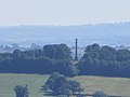 Monument on a hill - geograph.org.uk - 3580104.jpg 1,024 × 768; 63 KB
-
 Nearly at Ham Lane - geograph.org.uk - 6522406.jpg 3,296 × 2,472; 1.84 MB
-
 Notice board on Peak Lane - geograph.org.uk - 6521768.jpg 3,296 × 2,472; 1.82 MB
-
 Older than the church - geograph.org.uk - 6524628.jpg 2,472 × 3,296; 1.84 MB
-
 On Lollover Hill - geograph.org.uk - 3027683.jpg 640 × 480; 382 KB
-

-
 On top of Lollover - geograph.org.uk - 6521725.jpg 3,296 × 2,472; 1.93 MB
-
 Open air fun by the hall - geograph.org.uk - 6523854.jpg 3,296 × 2,472; 1.92 MB
-
 Order in St Andrew's yard - geograph.org.uk - 6524635.jpg 3,296 × 2,472; 1.85 MB
-
 Outside a garage - geograph.org.uk - 6522638.jpg 3,296 × 2,472; 1.82 MB
-
 Parking on Moor Close, Dundon - geograph.org.uk - 5357768.jpg 1,600 × 1,175; 506 KB
-
 Patchy crops below Lollover Hill - geograph.org.uk - 6521750.jpg 3,296 × 2,472; 1.84 MB
-
 Path back down to Dundon - geograph.org.uk - 6521753.jpg 3,296 × 2,472; 1.89 MB
-
 Path by Butleigh Monument - geograph.org.uk - 4440428.jpg 800 × 533; 295 KB
-
 Path from Dundon to Lollover Hill - geograph.org.uk - 4664714.jpg 3,456 × 2,304; 2.51 MB
-
 Path off Peak Lane - geograph.org.uk - 6522664.jpg 2,472 × 3,296; 3.32 MB
-
 Path to Decoy Farm - geograph.org.uk - 6521775.jpg 2,472 × 3,296; 1.84 MB
-
 Path to Lollover Hill - geograph.org.uk - 4664712.jpg 3,456 × 2,304; 3.09 MB
-
 Path under repair - use the road - geograph.org.uk - 6521763.jpg 2,472 × 3,296; 1.78 MB
-
 Path, Combe Hill - geograph.org.uk - 4440458.jpg 800 × 533; 311 KB
-
 Path, Combe Hill - geograph.org.uk - 4441535.jpg 800 × 533; 294 KB
-
 Path, Windmill Hill - geograph.org.uk - 4440438.jpg 800 × 533; 352 KB
-
 Paved to Ham Lane - geograph.org.uk - 6522397.jpg 2,472 × 3,296; 1.76 MB
-
 Peak Lane, Dundon - geograph.org.uk - 5357777.jpg 1,600 × 1,232; 545 KB
-
 Picnic area on Combe Hill above Compton Dundon, Polden Hills - geograph.org.uk - 5618958.jpg 5,184 × 2,920; 5.06 MB
-
 Ploughing near Compton Dundon - geograph.org.uk - 1500239.jpg 640 × 480; 121 KB
-
 Ponies on Collard Hill. - geograph.org.uk - 2267045.jpg 1,024 × 681; 117 KB
-
 Rare breed Sheep - geograph.org.uk - 2267025.jpg 1,024 × 818; 360 KB
-
 Red Lake Farm, Littleton - geograph.org.uk - 2113313.jpg 640 × 480; 189 KB
-
 Redland Farm - geograph.org.uk - 4693963.jpg 3,456 × 2,304; 3.82 MB
-
 Redland Farm - geograph.org.uk - 5305057.jpg 1,024 × 783; 213 KB
-
 Reynald's Way - geograph.org.uk - 4440400.jpg 800 × 533; 294 KB
-
 Reynald's Way - geograph.org.uk - 5375999.jpg 1,024 × 804; 293 KB
-
 Ride, Windmill Hill - geograph.org.uk - 4440418.jpg 800 × 533; 270 KB
-
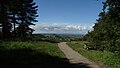
 Road to Compton Dundon, Windmill Hill - geograph.org.uk - 5607650.jpg 1,600 × 1,200; 890 KB
-
 Roadside strip, Westfield - geograph.org.uk - 4440396.jpg 800 × 533; 344 KB
-
 Row of houses at Redlands - geograph.org.uk - 5469110.jpg 1,024 × 802; 143 KB
-
 Russian doll barn - geograph.org.uk - 6521771.jpg 3,296 × 2,401; 2.77 MB
-
 Save lifes^ - geograph.org.uk - 6522645.jpg 3,296 × 2,472; 1.69 MB
-
 School Lane, Dundon - geograph.org.uk - 5305825.jpg 1,024 × 796; 197 KB
-
 Soggy field, south of Hayes Lane - geograph.org.uk - 5305477.jpg 1,024 × 768; 184 KB
-
 Some work being done on Hayes Farm - geograph.org.uk - 6521153.jpg 3,296 × 2,472; 2.01 MB
-
 St Andrew's tower, Dundon - geograph.org.uk - 6521704.jpg 2,472 × 3,296; 1.88 MB
-
 Street Rhyne - geograph.org.uk - 5986184.jpg 1,600 × 1,200; 456 KB
-
 Street Youth Hostel - geograph.org.uk - 13570.jpg 640 × 480; 70 KB
-
 Taking in a Somerset view - geograph.org.uk - 6521733.jpg 3,296 × 2,472; 1.83 MB
-
 Thatched cottage at Dundon - geograph.org.uk - 4665788.jpg 3,456 × 2,304; 1.7 MB
-
 Thatched Cottage, Compton Dundon - geograph.org.uk - 192902.jpg 640 × 480; 70 KB
-
 Thatched cottage, Dundon - geograph.org.uk - 5305456.jpg 1,024 × 768; 182 KB
-
 Thatched cottages, Dundon - geograph.org.uk - 5305822.jpg 1,024 × 774; 151 KB
-
 Thatching on Peak Lane - geograph.org.uk - 6524612.jpg 3,296 × 2,472; 1.9 MB
-
 The B3151 at Marshall's Elm on a rainy day - geograph.org.uk - 2398294.jpg 3,296 × 2,472; 1.91 MB
-
 The B3151 near Compton Dundon - geograph.org.uk - 840336.jpg 640 × 480; 73 KB
-
 The Castlebrook Inn - geograph.org.uk - 5306559.jpg 1,024 × 716; 145 KB
-
 The Castlebrook Inn, Castlebrook - geograph.org.uk - 6522436.jpg 3,296 × 2,472; 1.88 MB
-
 The flank of Dundon Hill - geograph.org.uk - 6521785.jpg 3,296 × 2,472; 1.87 MB
-
 The gate is earthed, isn't it^ - geograph.org.uk - 6521194.jpg 3,296 × 2,472; 1.87 MB
-
 The Hood Monument on Windmill Hill. - geograph.org.uk - 2267008.jpg 1,024 × 681; 127 KB
-
 The northern slopes of Dundon Hill - geograph.org.uk - 6522413.jpg 3,296 × 2,472; 1.96 MB
-
 The Old Tavern - geograph.org.uk - 6523850.jpg 3,296 × 2,472; 1.94 MB
-
 The old windmill across the Levels - geograph.org.uk - 6523683.jpg 3,296 × 2,472; 1.82 MB
-
 The path near Bartlett's Farm - geograph.org.uk - 6521163.jpg 3,296 × 2,472; 1.87 MB
-
 The slopes around Bartlett's Farm - geograph.org.uk - 6521169.jpg 3,296 × 2,472; 1.99 MB
-
 The south side of Hayes Lane - geograph.org.uk - 6521769.jpg 3,296 × 2,472; 1.84 MB
-
 The trig point beckons - geograph.org.uk - 6521200.jpg 3,296 × 2,472; 1.98 MB
-
 The two pinnacles of Compton Dundon - geograph.org.uk - 6523739.jpg 3,296 × 2,472; 1.87 MB
-
 The village hall is also the Post Office - geograph.org.uk - 6523853.jpg 3,296 × 2,472; 1.91 MB
-
 The war memorial in St Andrew's church - geograph.org.uk - 6522682.jpg 3,296 × 2,472; 1.79 MB


_-_geograph.org.uk_-_6522685.jpg)


.jpg)


