Category:Compton Abdale
Jump to navigation
Jump to search
village in Gloucestershire, UK  | |||||
| Upload media | |||||
| Instance of | |||||
|---|---|---|---|---|---|
| Location | Cotswold, Gloucestershire, South West England, England | ||||
| Population |
| ||||
 | |||||
Subcategories
This category has the following 2 subcategories, out of 2 total.
C
- Compton Abdale War Memorial (4 F)
Media in category "Compton Abdale"
The following 79 files are in this category, out of 79 total.
-

-
-
 A40 at Salt Way junction - geograph.org.uk - 2511729.jpg 640 × 480; 62 KB
-
 A40 at the Compton Abdale crossroads - geograph.org.uk - 2511725.jpg 640 × 480; 58 KB
-
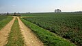
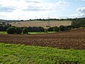
 Arable land, Compton Abdale - geograph.org.uk - 3773061.jpg 1,024 × 680; 210 KB
-
 Bluebells at Cassey Compton - geograph.org.uk - 4644102.jpg 1,920 × 2,564; 1.08 MB
-
 Bridleway at Cassey Compton - geograph.org.uk - 4644074.jpg 1,920 × 1,440; 823 KB
-
 Bridleway meeting the White Way - geograph.org.uk - 4644440.jpg 1,920 × 1,362; 828 KB
-
 Bridleway to Yanworth - geograph.org.uk - 4644447.jpg 1,920 × 1,295; 783 KB
-
 Bridleway to Yanworth - geograph.org.uk - 4644487.jpg 1,920 × 1,440; 839 KB
-
 Bridleway to Yanworth - geograph.org.uk - 4644592.jpg 1,920 × 1,440; 727 KB
-
 Bridleway to Yanworth - geograph.org.uk - 4644694.jpg 1,920 × 1,069; 524 KB
-
 Buildings at Manor Farm north of Compton Abdale - geograph.org.uk - 4013356.jpg 1,600 × 1,064; 522 KB
-
 Compton Abdale - geograph.org.uk - 53350.jpg 640 × 507; 65 KB
-
 Compton Abdale crossroads - geograph.org.uk - 3579859.jpg 1,024 × 768; 134 KB
-
 Compton Abdale stream - geograph.org.uk - 4644078.jpg 1,920 × 1,440; 668 KB
-
 Compton Abdale valley - geograph.org.uk - 4644307.jpg 1,920 × 1,440; 865 KB
-
 Compton Abdale valley - geograph.org.uk - 4644353.jpg 1,920 × 980; 653 KB
-
 Compton Abdale.jpg 640 × 480; 112 KB
-
 Corn mill, Compton Abdale (geograph 7390838).jpg 3,604 × 2,422; 1.42 MB
-
 Cotswold , The A40 - geograph.org.uk - 6113364.jpg 6,000 × 4,000; 3.12 MB
-
 Cotswold , The A40 - geograph.org.uk - 6113368.jpg 6,000 × 4,000; 2.7 MB
-
 Deep snow - geograph.org.uk - 5215994.jpg 720 × 467; 41 KB
-
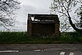 Derelict bus shelter on the A40 - geograph.org.uk - 4013362.jpg 1,600 × 1,064; 791 KB
-
 Drinking trough, Compton Abdale - geograph.org.uk - 885825.jpg 426 × 640; 132 KB
-
 Drystone wall and small dry valley - geograph.org.uk - 5214209.jpg 1,024 × 768; 189 KB
-
 Electricity pylons above Cassey Compton - geograph.org.uk - 5511154.jpg 1,024 × 768; 191 KB
-
 Entering Compton Abdale - geograph.org.uk - 2808195.jpg 800 × 600; 142 KB
-
 Farmland above Compton Abdale - geograph.org.uk - 5515610.jpg 1,024 × 683; 263 KB
-
 Farmland above Compton Abdale - geograph.org.uk - 882458.jpg 640 × 426; 110 KB
-
 Fields at Compton Grove - geograph.org.uk - 3535237.jpg 2,592 × 1,944; 1.54 MB
-
 Footpath through a barley field - geograph.org.uk - 3014424.jpg 1,024 × 680; 194 KB
-
 Hillside by the White Way - geograph.org.uk - 4644196.jpg 2,034 × 1,570; 807 KB
-
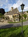
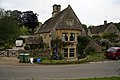
 House in Compton Abdale - geograph.org.uk - 5515753.jpg 1,024 × 768; 385 KB
-
 House in Compton Abdale - geograph.org.uk - 5515771.jpg 768 × 1,024; 251 KB
-
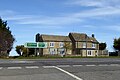 Houses at junction on A40 - geograph.org.uk - 5324756.jpg 640 × 428; 96 KB
-
 Logs by the bridleway to Yanworth - geograph.org.uk - 4644494.jpg 1,920 × 1,440; 1.21 MB
-
 Manor Farmhouse, Compton Abdale - geograph.org.uk - 3535232.jpg 2,592 × 1,944; 1.64 MB
-
 Manor Farmhouse, Compton Abdale - geograph.org.uk - 4013292.jpg 1,600 × 1,064; 678 KB
-
 Manor Farmhouse, Compton Abdale - geograph.org.uk - 5324732.jpg 640 × 480; 158 KB
-
 Mapped oak north of Yanworth Wood - geograph.org.uk - 4419836.jpg 1,920 × 1,311; 708 KB
-
 Phonebox in Compton Abdale - geograph.org.uk - 2863943.jpg 4,752 × 3,168; 3.27 MB
-
 Pylons - geograph.org.uk - 293921.jpg 480 × 640; 94 KB
-
 Pylons crossing Cotswold farmland - geograph.org.uk - 5515596.jpg 1,024 × 768; 277 KB
-
 River Coln - geograph.org.uk - 5324684.jpg 640 × 480; 146 KB
-
 Road and valley near Compton Abdale - geograph.org.uk - 5214211.jpg 1,024 × 768; 204 KB
-
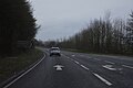
 Road from Shipton joins the A40 - geograph.org.uk - 1610569.jpg 640 × 480; 112 KB
-
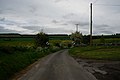
 Road leading to Compton Abdale - geograph.org.uk - 4013275.jpg 1,600 × 1,064; 594 KB
-
 Road leading to the A40 - geograph.org.uk - 4013321.jpg 1,600 × 1,064; 375 KB
-
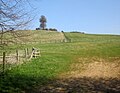
 Shed, gate, footpath sign - geograph.org.uk - 5120699.jpg 1,024 × 768; 212 KB
-
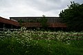
 Smallhope Farm, Compton Abdale - geograph.org.uk - 4644326.jpg 3,648 × 2,736; 1.51 MB
-
 The A40 approaching Compton Abdale crossroads - geograph.org.uk - 3576329.jpg 1,600 × 1,200; 523 KB
-
 The Compton Abdale crossroads on the A40 - geograph.org.uk - 3576335.jpg 1,600 × 1,200; 746 KB
-
 The Compton Business ^ Craft Centre - geograph.org.uk - 2808203.jpg 800 × 600; 137 KB
-
 The former A40 - geograph.org.uk - 3014421.jpg 1,024 × 680; 204 KB
-
 The hills north east of Cassey Compton - geograph.org.uk - 2844629.jpg 3,264 × 2,448; 2.53 MB
-
 The lane to Compton Abdale - geograph.org.uk - 3535146.jpg 2,592 × 1,944; 1.23 MB
-
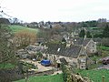
 The village of Compton Abdale - geograph.org.uk - 4013289.jpg 1,600 × 1,064; 748 KB
-

-
 Turn hard left for Shipton - geograph.org.uk - 3579838.jpg 1,024 × 768; 113 KB
-
 Turning for Shipton off A40 - geograph.org.uk - 3579844.jpg 1,024 × 768; 230 KB
-
 View north from White Way - geograph.org.uk - 5324722.jpg 640 × 480; 138 KB
-
 View north-west from White Way - geograph.org.uk - 5324705.jpg 640 × 480; 110 KB
-
 Wall, tree and pylons south of Compton Abdale - geograph.org.uk - 4419805.jpg 1,920 × 1,298; 745 KB
-
 War memorial at Compton Abdale - geograph.org.uk - 2863952.jpg 4,752 × 3,168; 3.5 MB
-
 Way to Compton Abdale - Gloucestershire - geograph.org.uk - 6074988.jpg 1,024 × 672; 174 KB
-
 Wheat growing above Compton Abdale - geograph.org.uk - 885989.jpg 640 × 426; 112 KB
-
 White Way above Cassey Compton - geograph.org.uk - 4644188.jpg 1,920 × 1,381; 709 KB
-
 White Way above Cassey Compton - geograph.org.uk - 4644208.jpg 1,920 × 1,267; 642 KB
-
 White Way above Compton Abdale - geograph.org.uk - 4644434.jpg 1,920 × 1,349; 539 KB
-
 White Way to Compton Abdale - geograph.org.uk - 4644289.jpg 1,920 × 1,358; 750 KB
-
 Brook below Compton Grove - geograph.org.uk - 290709.jpg 640 × 480; 80 KB
-
 Cassey Compton - geograph.org.uk - 1515589.jpg 640 × 470; 50 KB
-
 Disused quarry - geograph.org.uk - 293917.jpg 640 × 480; 110 KB
-
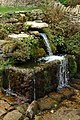
 Drain (looking up-stream) - geograph.org.uk - 293909.jpg 480 × 640; 133 KB
-
 Drain - geograph.org.uk - 293906.jpg 640 × 480; 157 KB
-
 Field boundary - geograph.org.uk - 293925.jpg 640 × 480; 100 KB
-
 Near Compton Grove - geograph.org.uk - 290699.jpg 640 × 480; 140 KB
-
 The Salt Way - geograph.org.uk - 293448.jpg 640 × 427; 69 KB


.jpg)


_-_geograph.org.uk_-_293909.jpg)


