Category:Complexe socio-sportif de Feillens
Jump to navigation
Jump to search
| Object location | | View all coordinates using: OpenStreetMap |
|---|
Media in category "Complexe socio-sportif de Feillens"
The following 5 files are in this category, out of 5 total.
-
 Gymnase Feillens 1.jpg 5,184 × 3,456; 6.51 MB
-
 Gymnase Feillens 2.jpg 5,184 × 3,456; 7.07 MB
-
 Gymnase Feillens 3.jpg 5,184 × 3,456; 6.58 MB
-
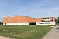
 Gymnase Tennis Intercommunal - Feillens (FR01) - 2024-09-28 - 1.jpg 4,032 × 3,024; 2.79 MB
-
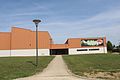
 Gymnase Tennis Intercommunal - Feillens (FR01) - 2024-09-28 - 2.jpg 4,032 × 3,024; 2.31 MB


_-_2024-09-28_-_1.jpg)
_-_2024-09-28_-_2.jpg)