Category:Combe Valley Countryside Park, Bexhill-on-Sea
Jump to navigation
Jump to search
 .jpg) | |||||
| Upload media | |||||
| Instance of | |||||
|---|---|---|---|---|---|
| Location | |||||
| Has part(s) | |||||
| Inception |
| ||||
| Area |
| ||||
| official website | |||||
 | |||||
Subcategories
This category has the following 3 subcategories, out of 3 total.
C
G
Media in category "Combe Valley Countryside Park, Bexhill-on-Sea"
The following 200 files are in this category, out of 236 total.
(previous page) (next page)-
 1066 Bexhill Walk, Distance Marker.jpg 3,019 × 3,427; 1.12 MB
-
 1066 Bexhill Walk, Marker Post.jpg 3,110 × 3,110; 1.06 MB
-
 1066 Country Walk - Bexhill Link - geograph.org.uk - 1357246.jpg 640 × 480; 77 KB
-
 1066 Country Walk - Bexhill Link - geograph.org.uk - 1357459.jpg 480 × 640; 142 KB
-
 1066 Country Walk - Bexhill Link - geograph.org.uk - 1357554.jpg 640 × 480; 102 KB
-
 1066 Country Walk - geograph.org.uk - 3301161.jpg 640 × 206; 42 KB
-
 1066 Country Walk - geograph.org.uk - 3301163.jpg 640 × 320; 57 KB
-
 1066 Country Walk - geograph.org.uk - 3821902.jpg 640 × 427; 86 KB
-
 1066 Country Walk - geograph.org.uk - 3828459.jpg 640 × 427; 108 KB
-
 1066 Country Walk - geograph.org.uk - 4101572.jpg 1,024 × 683; 249 KB
-
 1066 Country Walk and Field - geograph.org.uk - 934832.jpg 640 × 424; 92 KB
-
 1066 Country Walk approaching Crowhurst - geograph.org.uk - 3828439.jpg 640 × 427; 133 KB
-
-
-

-
 1066 Country Walk south of Combe Haven - geograph.org.uk - 1578214.jpg 640 × 430; 134 KB
-

-
 A field of winter wheat - geograph.org.uk - 1578288.jpg 640 × 430; 141 KB
-
 BB43 Boundary Stone, Combe Valley.jpg 3,458 × 2,594; 1.99 MB
-
 BB44 Boundary Stone, Combe Valley (2).jpg 4,608 × 3,456; 4.68 MB
-
 BB44 Boundary Stone, Combe Valley.jpg 4,608 × 3,456; 3.8 MB
-
 BB45 Boundary Stone, Combe Valley.jpg 4,608 × 3,456; 3.33 MB
-
 BB56 Boundary Stone, Combe Valley.jpg 4,608 × 3,456; 2.84 MB
-
 Bird watching at Pebsham Marsh - geograph.org.uk - 5317487.jpg 954 × 701; 368 KB
-
 Boardwalk, Combe Haven - geograph.org.uk - 1360280.jpg 480 × 640; 101 KB
-
 Bridge near Acton's Farm - geograph.org.uk - 5307894.jpg 4,000 × 3,000; 3 MB
-
 Bridges over the Combe Haven - geograph.org.uk - 1578206.jpg 640 × 430; 124 KB
-
 Bridleway from Acton's Farm - geograph.org.uk - 4457619.jpg 2,400 × 1,600; 1.92 MB
-
 Broom (Cytisus scoparius) Pebsham. (3501238748).jpg 2,095 × 2,511; 1.03 MB
-
 CHI Boundary Stone, Bulverhythe.jpg 4,608 × 3,456; 3.48 MB
-
 CHP and BB56 Boundary Stone, Combe Valley.jpg 2,911 × 2,183; 1.6 MB
-
 CHP Boundary Stone, Combe Valley.jpg 3,953 × 2,965; 2.89 MB
-
 Combe Haven - geograph.org.uk - 1357465.jpg 640 × 480; 100 KB
-
 Combe Haven - geograph.org.uk - 1357481.jpg 640 × 480; 102 KB
-
 Combe Haven - geograph.org.uk - 1357520.jpg 640 × 480; 94 KB
-
 Combe Haven - geograph.org.uk - 1357537.jpg 480 × 640; 95 KB
-
 Combe Haven - geograph.org.uk - 1358902.jpg 640 × 480; 91 KB
-
 Combe Haven - geograph.org.uk - 1358943.jpg 480 × 640; 80 KB
-
 Combe Haven - geograph.org.uk - 3301290.jpg 640 × 427; 88 KB
-
 Combe Haven Bulverhythe East Sussex - geograph.org.uk - 167789.jpg 640 × 480; 146 KB
-
 Combe Haven Holiday Park, St Leonards on Sea - geograph.org.uk - 5536663.jpg 2,193 × 1,542; 936 KB
-
 Combe Valley Countryside Park - geograph.org.uk - 4769537.jpg 9,000 × 2,208; 7.37 MB
-
 Combe Valley Countryside Park - geograph.org.uk - 4769544.jpg 5,184 × 3,456; 7.45 MB
-
 Combe Valley Countryside Park - geograph.org.uk - 4769551.jpg 4,000 × 3,000; 3.47 MB
-
 Combe Valley Countryside Park - geograph.org.uk - 4769552.jpg 7,933 × 2,952; 7.13 MB
-
 Combe Valley Countryside Park - geograph.org.uk - 4769554.jpg 4,000 × 3,000; 3.66 MB
-
 Combe Valley Countryside Park map board (2024).jpg 4,000 × 3,000; 2.52 MB
-
 Combe Valley Countryside Park sign - geograph.org.uk - 3304470.jpg 640 × 427; 71 KB
-
 Combe Valley Countryside Park, Bexhill (2).jpg 4,537 × 2,552; 1.32 MB
-
 Combe Valley Countryside Park, Bexhill (3).jpg 4,608 × 2,592; 1.12 MB
-
 Combe Valley Countryside Park, Bexhill (360 aerial panorama).jpg 10,240 × 5,120; 4.1 MB
-
 Combe Valley Countryside Park, Bexhill (360 panorama) (2).jpg 5,760 × 2,880; 9.54 MB
-
 Combe Valley Countryside Park, Bexhill (360 panorama).jpg 5,760 × 2,880; 8.05 MB
-
 Combe Valley Countryside Park, Bexhill.jpg 4,608 × 2,592; 1.04 MB
-
 Combe Valley Countryside Park, Glyne Gap, Bexhill.jpg 4,608 × 2,592; 2.53 MB
-
 Combe Valley Discovery Centre, Freshfields, St Leonards (2024).jpg 4,000 × 3,000; 1.57 MB
-
 Combe Valley Discovery Centre, Freshfields, St Leonards (aerial).jpg 4,000 × 3,000; 5.18 MB
-
 Combe Valley Discovery Centre, Freshfields, St Leonards.jpg 4,366 × 2,456; 1.82 MB
-
 Combe Valley, Pebsham - geograph.org.uk - 5217647.jpg 2,040 × 1,492; 693 KB
-
 Combe Wood - geograph.org.uk - 1358813.jpg 640 × 480; 79 KB
-
 Common Toadflax (Linaria vulgaris) (3191524795).jpg 1,600 × 1,200; 723 KB
-
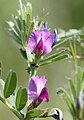
 Common Vetch (Vicia sativa) Pebsham. (3500415033).jpg 1,839 × 1,958; 660 KB
-
 Common vetch (Vicia sativa).jpg 1,904 × 2,723; 971 KB
-
 Countryside adjacent to Railway - geograph.org.uk - 863628.jpg 640 × 424; 60 KB
-
 Countryside Park - geograph.org.uk - 4455902.jpg 2,400 × 1,800; 1.66 MB
-
 Countryside Park - geograph.org.uk - 4455904.jpg 2,400 × 1,800; 1.67 MB
-
 Countryside Park - geograph.org.uk - 4455908.jpg 2,400 × 1,600; 2.91 MB
-
 Countryside Park - geograph.org.uk - 4457407.jpg 2,400 × 1,800; 2.17 MB
-
 Countryside Park - geograph.org.uk - 4457413.jpg 2,400 × 1,800; 1.75 MB
-
 Countryside Park - geograph.org.uk - 4457594.jpg 2,400 × 1,600; 2.47 MB
-
 Countryside Park - geograph.org.uk - 4457595.jpg 3,000 × 1,160; 1.49 MB
-
 Cows at Buckholt Farm - geograph.org.uk - 4455860.jpg 800 × 245; 54 KB
-
 Defibrillator, Combe Valley Discovery Centre.jpg 4,000 × 3,000; 1.45 MB
-
 Dismantled Bexhill to Crowhurst railway - geograph.org.uk - 1578258.jpg 640 × 430; 211 KB
-

-
 Ditch across Bulverhythe Recreation Ground - geograph.org.uk - 5536640.jpg 2,751 × 2,050; 2.02 MB
-
 Ditch at Combe Haven - geograph.org.uk - 3304460.jpg 427 × 640; 88 KB
-
 Drainage Channel - geograph.org.uk - 934788.jpg 640 × 424; 69 KB
-
 Drainage Marker, Combe Haven - geograph.org.uk - 1360249.jpg 480 × 640; 158 KB
-
 Electricity Pylons near Crowhurst - geograph.org.uk - 1357441.jpg 640 × 480; 82 KB
-
 Empty car park at Bulverhythe Recreation Ground - geograph.org.uk - 5536618.jpg 2,743 × 1,995; 1.35 MB
-
 Equestrian ford, Bexhill to Hastings Greenway, Bexhill.jpg 4,608 × 3,456; 2.64 MB
-
 Farmland Nr Pebsham East Sussex - geograph.org.uk - 167846.jpg 640 × 480; 149 KB
-
 Field by the 1066 Country Walk - geograph.org.uk - 1578245.jpg 640 × 430; 76 KB
-
 Field near Little Worsham Farm - geograph.org.uk - 934804.jpg 640 × 424; 82 KB
-
 Field near Pebsham Landfill Site - geograph.org.uk - 1358880.jpg 640 × 480; 94 KB
-
 Fields at Combe Haven - geograph.org.uk - 3301859.jpg 8,544 × 2,300; 7.7 MB
-
 Fields by 1066 Country Walk - geograph.org.uk - 3301165.jpg 640 × 427; 69 KB
-
 Flooded field - geograph.org.uk - 3300568.jpg 640 × 427; 94 KB
-
 Flooded field - geograph.org.uk - 3300570.jpg 640 × 427; 93 KB
-
 Flooded fields - geograph.org.uk - 3296026.jpg 8,550 × 1,888; 7.76 MB
-
 Flooded fields - geograph.org.uk - 3300555.jpg 640 × 427; 66 KB
-
 Flooded fields - geograph.org.uk - 3300557.jpg 640 × 339; 62 KB
-
 Flooded fields - geograph.org.uk - 3300558.jpg 640 × 427; 73 KB
-
 Flooded fields - geograph.org.uk - 3300566.jpg 640 × 303; 57 KB
-
 Flooded fields by Watermill Stream - geograph.org.uk - 3296046.jpg 640 × 263; 43 KB
-
 Flooded fields south of Adam's Farm - geograph.org.uk - 3300571.jpg 640 × 427; 58 KB
-
 Floodplain of the Combe Haven - geograph.org.uk - 1578212.jpg 640 × 430; 117 KB
-
 Footbridge on the 1066 Country Walk - geograph.org.uk - 1577518.jpg 640 × 430; 159 KB
-
 Footbridge over Combe Haven - geograph.org.uk - 1358916.jpg 480 × 640; 100 KB
-
 Footbridges at Combe Valley Countryside Park - geograph.org.uk - 4455898.jpg 2,400 × 1,600; 2.57 MB
-
 Footbridges at Combe Valley Countryside Park - geograph.org.uk - 4455901.jpg 2,133 × 1,600; 1.37 MB
-
 Footbridges, Combe Haven - geograph.org.uk - 1357545.jpg 480 × 640; 98 KB
-
 Footpath across Combe Haven - geograph.org.uk - 3828574.jpg 640 × 640; 167 KB
-
 Footpath across Combe Haven - geograph.org.uk - 3828587.jpg 8,587 × 2,800; 7.75 MB
-
 Footpath and track to Acton's Farm - geograph.org.uk - 3303505.jpg 640 × 427; 83 KB
-
 Footpath and track to Acton's Farm - geograph.org.uk - 3303513.jpg 427 × 640; 69 KB
-
 Footpath between Pebsham and Bulverhythe - geograph.org.uk - 1579076.jpg 640 × 430; 110 KB
-
 Footpath Nr Pebsham East Sussex - geograph.org.uk - 167843.jpg 640 × 480; 150 KB
-
 Footpath through wood, Worsham, Bexhill-on-Sea.jpg 4,608 × 2,592; 1.66 MB
-
 Footpath to Combe Haven (1) - geograph.org.uk - 1358855.jpg 480 × 640; 115 KB
-
 Footpath to Combe Haven (2) - geograph.org.uk - 1358866.jpg 480 × 640; 143 KB
-
 Footpath to Combe Haven (3) - geograph.org.uk - 1358873.jpg 480 × 640; 145 KB
-
 Footpath to Combe Haven (4) - geograph.org.uk - 1358887.jpg 640 × 480; 88 KB
-
 Footpath to Combe Haven (5) - geograph.org.uk - 1358908.jpg 640 × 480; 92 KB
-
 Footpath to Combe Haven (6) - geograph.org.uk - 1358912.jpg 640 × 480; 120 KB
-
 Footpath to Filsham - geograph.org.uk - 1358946.jpg 480 × 640; 173 KB
-
 Footpath to Worsham and Bulverhythe - geograph.org.uk - 1362990.jpg 640 × 480; 102 KB
-
 Footpath to Wrestwood Road - geograph.org.uk - 3303560.jpg 640 × 427; 119 KB
-
 Footpath, Combe Haven - geograph.org.uk - 1360265.jpg 480 × 640; 116 KB
-
 Former Crowhurst to Bexhill Railway - geograph.org.uk - 1358796.jpg 480 × 640; 128 KB
-
 Former railway - geograph.org.uk - 3301943.jpg 427 × 640; 146 KB
-
 Former railway bridge - geograph.org.uk - 4101582.jpg 1,024 × 768; 355 KB
-
 Galley Hill Pumping Station - geograph.org.uk - 4271648.jpg 640 × 430; 51 KB
-
 Galley Hill Pumping Station - geograph.org.uk - 4271649.jpg 640 × 430; 61 KB
-

-
 Gulls on the Pebsham tip - geograph.org.uk - 5477217.jpg 2,224 × 1,648; 1.08 MB
-

-

-
 Historic boundary post by the Combe Haven river - geograph.org.uk - 2823131.jpg 3,648 × 2,736; 7.55 MB
-
 Horses in field - geograph.org.uk - 934793.jpg 640 × 424; 69 KB
-

-
 Lake near Pebsham Farm - geograph.org.uk - 1578868.jpg 640 × 430; 151 KB
-
 Lake near Pebsham Farm - geograph.org.uk - 1578872.jpg 640 × 430; 123 KB
-
 Lesser Periwinkle (Vinca minor) (3409491687).jpg 1,945 × 1,962; 675 KB
-
 Looking towards Worsham Farm - geograph.org.uk - 1578679.jpg 640 × 430; 111 KB
-
 Looking west from Railway crossing - geograph.org.uk - 863554.jpg 640 × 424; 125 KB
-
 Marsh Wood - geograph.org.uk - 1360275.jpg 640 × 480; 87 KB
-
 Monkham Wood - geograph.org.uk - 1360256.jpg 640 × 480; 90 KB
-
 Mount Pebsham. (6148056096).jpg 3,396 × 2,100; 1.06 MB
-
 New bridge to Acton's Farm - geograph.org.uk - 3823280.jpg 640 × 268; 68 KB
-
 New footbridge on '1066 Country Walk' - geograph.org.uk - 2050951.jpg 640 × 480; 130 KB
-
 New link road crossing point - geograph.org.uk - 3824576.jpg 1,024 × 346; 127 KB
-
 New link road crossing point - geograph.org.uk - 3824577.jpg 640 × 427; 93 KB
-
 New link road under construction - geograph.org.uk - 3824578.jpg 640 × 239; 53 KB
-
 New link road under construction - geograph.org.uk - 3824579.jpg 640 × 427; 71 KB
-
 New pond - geograph.org.uk - 4455868.jpg 10,000 × 2,145; 5.35 MB
-
 Old Pumping Station, Combe Haven, Crowhurst.jpg 4,608 × 3,456; 3.12 MB
-
 Old railway bridge - geograph.org.uk - 3303541.jpg 427 × 640; 122 KB
-
 Old railway bridge - geograph.org.uk - 4101585.jpg 1,024 × 768; 331 KB
-
 Old railway bridge - geograph.org.uk - 4101589.jpg 1,024 × 768; 346 KB
-

-
 Old railway line - geograph.org.uk - 3303537.jpg 427 × 640; 146 KB
-
 Old railway line - geograph.org.uk - 4101583.jpg 683 × 1,024; 275 KB
-
 Old railway line through Sidley - geograph.org.uk - 3303535.jpg 640 × 427; 86 KB
-
 Path of dismantled Railway - geograph.org.uk - 934797.jpg 640 × 424; 135 KB
-
 Path through Combe Valley Countryside Park - geograph.org.uk - 5307892.jpg 4,000 × 3,000; 3.46 MB
-
 Path to Combe Valley Countryside Park - geograph.org.uk - 5307889.jpg 4,000 × 3,000; 5.72 MB
-
 Pebsham Aerodrome, Hastings, E.Sussex. early 1950s. (6009628898).jpg 800 × 470; 311 KB
-
 Pebsham Conservation Area - geograph.org.uk - 1578948.jpg 640 × 430; 61 KB
-
 Pebsham Conservation Area - geograph.org.uk - 1578952.jpg 640 × 430; 90 KB
-
 Pebsham Conservation Area - geograph.org.uk - 1579085.jpg 640 × 430; 76 KB
-
 Pebsham Farm - geograph.org.uk - 1578877.jpg 640 × 430; 115 KB
-
 Pebsham Landfill Site - geograph.org.uk - 1358938.jpg 640 × 480; 84 KB
-
 Pebsham Landfill Site - geograph.org.uk - 1578889.jpg 640 × 430; 122 KB
-
 Pebsham Lane - geograph.org.uk - 1579125.jpg 640 × 430; 111 KB
-
 Pebsham Lane at junction of Freshfield Road - geograph.org.uk - 5317557.jpg 1,001 × 751; 303 KB
-
 Pebsham Marsh - geograph.org.uk - 5317932.jpg 1,024 × 768; 284 KB
-
 Pebsham Water Treatment Works - geograph.org.uk - 1578799.jpg 640 × 430; 160 KB
-
 Pebsham Wood - geograph.org.uk - 1358858.jpg 480 × 640; 120 KB
-
 Pebsham Wood - geograph.org.uk - 1578734.jpg 640 × 430; 129 KB
-
 Pebsham Wood - geograph.org.uk - 1578782.jpg 640 × 430; 121 KB
-
 Pond by Combe Valley - geograph.org.uk - 4769556.jpg 4,000 × 3,000; 3.25 MB
-
 Prunus spinosa (3415351926).jpg 1,400 × 1,310; 454 KB
-
 Rabbit by the old Bexhill West Branch Line - geograph.org.uk - 4101590.jpg 1,024 × 1,024; 322 KB
-
 Railway arch in Pebsham Woods - geograph.org.uk - 1726097.jpg 1,440 × 1,080; 1.92 MB
-

-
 Reedbeds, Combe Valley SSSI.jpg 4,608 × 2,592; 962 KB
-
 Reeds, Pebsham Conservation Area - geograph.org.uk - 1579113.jpg 640 × 430; 71 KB
-
 Reeds, Pebsham Conservation Area - geograph.org.uk - 1579119.jpg 640 × 430; 57 KB
-
 Road construction works - geograph.org.uk - 3300552.jpg 10,067 × 2,200; 7.02 MB
-
 Round Acre Wood in spring 2009 - geograph.org.uk - 1726087.jpg 1,600 × 1,200; 562 KB
-
 Sallow (Salix caprea) male.jpg 2,557 × 2,355; 1.08 MB
-
 Silverweed (Potentilla anserina) Pebsham. (3549783540).jpg 3,155 × 2,579; 1.28 MB
-
 Site of Crowhurst Viaduct - geograph.org.uk - 1357509.jpg 480 × 640; 91 KB
-

-

-

-
 Small woodland north of Pebsham - geograph.org.uk - 1578818.jpg 640 × 430; 117 KB
-
 Snow covered field at Combe Haven - geograph.org.uk - 3304464.jpg 640 × 427; 99 KB
-
 Snowberry (Symphoricarpus albus) (3830483811).jpg 1,348 × 1,594; 421 KB
-
 Sophie's Play Space.jpg 4,608 × 2,592; 1.87 MB
-
 Spear Thistle (Cirsium vulgare) X (4752364236).jpg 1,704 × 2,402; 900 KB
-
 Spinney, Pebsham Conservation Area - geograph.org.uk - 1578966.jpg 640 × 430; 69 KB
-
 Stile on the 1066 Country Walk - geograph.org.uk - 1578221.jpg 640 × 430; 136 KB
-
 Stile, near Footpath 47, Bexhill.jpg 4,608 × 3,456; 2.76 MB
-
 Stormy clouds, Combe Valley Countryside Park, Bexhill.jpg 4,608 × 3,456; 2.77 MB
-
 Stream in the Pebsham Conservation Area - geograph.org.uk - 1578956.jpg 640 × 430; 101 KB
-
 Temporary pool, Bulverhythe Recreation Ground - geograph.org.uk - 5536612.jpg 2,816 × 2,112; 1.98 MB
-
 The Combe Haven - downstream - geograph.org.uk - 1578209.jpg 640 × 430; 121 KB


.jpg)


_Pebsham._(3501238748).jpg)


.jpg)

.jpg)
.jpg)
.jpg)
_(2).jpg)
.jpg)

.jpg)
.jpg)


_(3191524795).jpg)
_Pebsham._(3500415033).jpg)
.jpg)


_-_geograph.org.uk_-_1358855.jpg)
_-_geograph.org.uk_-_1358866.jpg)
_-_geograph.org.uk_-_1358873.jpg)
_-_geograph.org.uk_-_1358887.jpg)
_-_geograph.org.uk_-_1358908.jpg)
_-_geograph.org.uk_-_1358912.jpg)


_(3409491687).jpg)


.jpg)


.jpg)


.jpg)


_male.jpg)
_Pebsham._(3549783540).jpg)


_(3830483811).jpg)

_X_(4752364236).jpg)


