Category:Combe, Oxfordshire
Jump to navigation
Jump to search
village and civil parish in West Oxfordshire, England  | |||||
| Upload media | |||||
| Instance of | |||||
|---|---|---|---|---|---|
| Location | West Oxfordshire, Oxfordshire, South East England, England | ||||
| Located in or next to body of water | |||||
| Population |
| ||||
| official website | |||||
 | |||||
English: Combe is a village and civil parish about 5 miles (8 km) northeast of Witney in Oxfordshire. The ecclesiastical parish is called Combe Longa
Subcategories
This category has the following 7 subcategories, out of 7 total.
Media in category "Combe, Oxfordshire"
The following 152 files are in this category, out of 152 total.
-
 'Mayfield', West End - geograph.org.uk - 4848525.jpg 1,024 × 683; 191 KB
-
 'Red Gables' from the east - geograph.org.uk - 4846240.jpg 1,024 × 683; 237 KB
-
 'Red Gables', Stonesfield Road - geograph.org.uk - 4846244.jpg 1,024 × 683; 219 KB
-
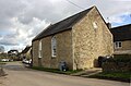 'The Old Chapel', Church Walk - geograph.org.uk - 4848998.jpg 1,024 × 675; 164 KB
-
 'The Yellow House', Akeman Street - geograph.org.uk - 4846233.jpg 1,024 × 683; 239 KB
-
 A field of cherry tomatoes - geograph.org.uk - 4791054.jpg 6,000 × 4,000; 4.83 MB
-
 A field of peas near Stonesfield - geograph.org.uk - 4791049.jpg 6,000 × 4,000; 5.38 MB
-
 A field yet to be harvested near Stonesfield - geograph.org.uk - 4790210.jpg 6,000 × 4,000; 5.41 MB
-
 Akeman Street - geograph.org.uk - 2772074.jpg 640 × 480; 85 KB
-
 Akeman Street - geograph.org.uk - 3364223.jpg 640 × 427; 200 KB
-
 Akeman Street - geograph.org.uk - 6392560.jpg 800 × 450; 114 KB
-
 Akeman Street at the junction of Woodstock Road - geograph.org.uk - 6278261.jpg 1,804 × 1,202; 1.31 MB
-
 Akeman Street, Combe - geograph.org.uk - 6278257.jpg 1,890 × 1,234; 1.49 MB
-
 Akeman Street, Combe - geograph.org.uk - 6278259.jpg 1,920 × 1,280; 1.34 MB
-
 Approaching Blenheim Park - geograph.org.uk - 3364232.jpg 640 × 426; 169 KB
-
 Benchmark (partly hidden) on Combe Lodge - geograph.org.uk - 4849235.jpg 683 × 1,024; 199 KB
-
 Benchmark on 'The Old Chapel' - geograph.org.uk - 4848621.jpg 683 × 1,024; 315 KB
-
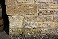
 Benchmark on Akeman Street culvert - geograph.org.uk - 4847133.jpg 1,024 × 683; 235 KB
-
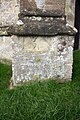 Benchmark on buttress of St Lawrence's Church - geograph.org.uk - 4849195.jpg 683 × 1,024; 276 KB
-
 Benchmark on Combe Methodist Chapel - geograph.org.uk - 4849213.jpg 683 × 1,024; 257 KB
-
 Benchmark on Combe Primary School - geograph.org.uk - 4848539.jpg 1,024 × 683; 277 KB
-
 Benchmark on farm building at Peagles View - geograph.org.uk - 4849016.jpg 683 × 1,024; 259 KB
-
 Benchmark on railway bridge 71m 40ch OWW - geograph.org.uk - 4848502.jpg 666 × 1,024; 306 KB
-
 Blenheim Estate boundary wall - geograph.org.uk - 4791057.jpg 6,000 × 4,000; 5.44 MB
-
 Bolton's Lane - geograph.org.uk - 5578521.jpg 6,000 × 4,000; 7 MB
-
 Bolton's Lane - geograph.org.uk - 5578537.jpg 6,000 × 4,000; 4.87 MB
-
 Bolton's Lane, Combe - geograph.org.uk - 6704689.jpg 1,920 × 1,280; 1.18 MB
-
 Bolton's Lane, looking south - geograph.org.uk - 5645063.jpg 5,202 × 3,465; 2.8 MB
-
 Bolton's Lane, near Bolton's Farm - geograph.org.uk - 5645073.jpg 5,202 × 3,465; 3.66 MB
-
 Boltons Lane near Combe - geograph.org.uk - 1481860.jpg 640 × 403; 87 KB
-
 Bridge over River Evenlode NW of Long Hanborough - geograph.org.uk - 4848343.jpg 1,024 × 683; 300 KB
-
 Bridge over the River Evenlode - geograph.org.uk - 1478269.jpg 640 × 427; 89 KB
-
 Bridge over the River Evenlode - geograph.org.uk - 1878879.jpg 640 × 480; 100 KB
-
 Bridge Over the River Evenlode - geograph.org.uk - 5157727.jpg 4,000 × 2,666; 7.01 MB
-
 Buildings of Park Farm, Blenheim Park - geograph.org.uk - 442384.jpg 640 × 480; 123 KB
-
 Bus Shelter at Combe Station - geograph.org.uk - 5572348.jpg 3,888 × 2,592; 4.73 MB
-
 The Cock Inn at Combe - geograph.org.uk - 1478287.jpg 640 × 427; 64 KB
-
 Combe Church of England Primary School - geograph.org.uk - 4848572.jpg 1,024 × 678; 176 KB
-
 Combe Green - geograph.org.uk - 6278255.jpg 1,902 × 1,252; 1.67 MB
-
 Combe Green - geograph.org.uk - 6278256.jpg 1,886 × 1,226; 1.53 MB
-
 Combe Lodge Gate - geograph.org.uk - 7152.jpg 640 × 480; 109 KB
-
 Combe Methodist Chapel and Pre-School, Park Road - geograph.org.uk - 4849225.jpg 1,024 × 683; 169 KB
-
 Combe Road railway bridge - geograph.org.uk - 4848510.jpg 1,024 × 683; 229 KB
-
 Combe sawmills from the station - geograph.org.uk - 5645051.jpg 4,589 × 3,104; 2.51 MB
-
 Combe station - geograph.org.uk - 1872687.jpg 3,648 × 2,736; 2.08 MB
-
 Combe station path - geograph.org.uk - 5645053.jpg 5,202 × 3,465; 3.48 MB
-
 Combe village green - geograph.org.uk - 1018059.jpg 640 × 426; 137 KB
-
 Combe village green - geograph.org.uk - 1748848.jpg 640 × 480; 105 KB
-
 Combe village hall - geograph.org.uk - 6278254.jpg 1,920 × 1,280; 1.13 MB
-
 Combe, Oxfordshire 01.jpg 4,128 × 3,096; 6.66 MB
-
 Combe, Oxfordshire 02.jpg 4,128 × 3,096; 4.71 MB
-
 Combe, Oxfordshire 03.jpg 4,128 × 3,096; 5.54 MB
-
 Combe, Oxfordshire 04.jpg 4,128 × 3,096; 6.17 MB
-
 Combe, Oxfordshire 05.jpg 4,128 × 3,096; 6.63 MB
-
 Combe, Oxfordshire 06.jpg 4,128 × 3,096; 5.88 MB
-
 Combe, Oxfordshire 07.jpg 4,128 × 3,096; 4.84 MB
-
 Combe, Oxfordshire 08.jpg 4,128 × 3,096; 4.04 MB
-
 Combe, Oxfordshire 09.jpg 4,128 × 3,096; 6.51 MB
-
 Combe, Oxfordshire 10.jpg 4,128 × 3,096; 5.43 MB
-
 Combe, Oxfordshire 11.jpg 4,128 × 3,096; 6.95 MB
-
 Combe, Oxfordshire 12.jpg 4,128 × 3,096; 9.55 MB
-
 Combetree.JPG 3,072 × 2,304; 2.89 MB
-

-
 Drive heading to Combe - geograph.org.uk - 2772169.jpg 640 × 480; 62 KB
-

-
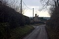
 Entering Combe on the Stonesfield Road - geograph.org.uk - 2984885.jpg 1,876 × 2,821; 1.24 MB
-
 Entrance to Blenheim Park at Combe Lodge - geograph.org.uk - 4849242.jpg 1,024 × 683; 200 KB
-
 Farm buildings at 'Peagles View', Park Road - geograph.org.uk - 4849025.jpg 1,024 × 683; 155 KB
-
 Farmland north of Park Road - geograph.org.uk - 5471549.jpg 3,888 × 2,592; 1.61 MB
-
 Farmland off Akeman Street - geograph.org.uk - 3364216.jpg 640 × 427; 196 KB
-
 Field below Wedgehook Wood - geograph.org.uk - 5578532.jpg 6,000 × 4,000; 5.81 MB
-
 Field by Akeman Street, Combe - geograph.org.uk - 6278260.jpg 1,280 × 1,920; 1.42 MB
-
 Field by Park Road, Combe - geograph.org.uk - 6704692.jpg 1,880 × 1,218; 1.62 MB
-
 Field by Park Road, Combe - geograph.org.uk - 6704693.jpg 1,886 × 1,228; 1.42 MB
-
 Field entrance by Akeman Street, Combe - geograph.org.uk - 6278258.jpg 1,920 × 1,280; 1.32 MB
-
 Field in Combe - geograph.org.uk - 1481823.jpg 640 × 427; 87 KB
-
 Field near Combe - geograph.org.uk - 5578535.jpg 6,000 × 4,000; 5.67 MB
-
 Flat Landscape near Stonesfield - geograph.org.uk - 6657344.jpg 5,184 × 3,456; 2.24 MB
-
 Footpath from Boltons Farm to Combe, Oxfordshire.jpg 4,128 × 3,096; 5.62 MB
-
 Footpath nearing Bolton's Lane - geograph.org.uk - 2772009.jpg 640 × 480; 90 KB
-
 Footpath to Combe from Bolton's Lane - geograph.org.uk - 5645076.jpg 5,202 × 3,465; 3.48 MB
-
 Footpath to East End - geograph.org.uk - 5471529.jpg 3,888 × 2,592; 1.73 MB
-
 Footpath to East End from Bolton's Lane - geograph.org.uk - 5645080.jpg 5,202 × 3,465; 3.17 MB
-
 Former park exit - geograph.org.uk - 3364237.jpg 640 × 427; 237 KB
-
 Gate at Combe Lodge - geograph.org.uk - 5645442.jpg 5,202 × 3,465; 4.06 MB
-
 Gravestones as partial barrier - geograph.org.uk - 2831574.jpg 640 × 480; 113 KB
-
 Grintleyhill Bridge - geograph.org.uk - 6444195.jpg 1,200 × 806; 1.48 MB
-

-
 Harvested field near Stonesfield - geograph.org.uk - 4790202.jpg 6,000 × 4,000; 5.51 MB
-
 Hedgerow by East End near Combe - geograph.org.uk - 1481846.jpg 640 × 427; 104 KB
-
 Hendy Curzon sign - geograph.org.uk - 5645068.jpg 5,202 × 3,465; 5.46 MB
-
 House on the edge of Notoaks Wood - geograph.org.uk - 2984866.jpg 2,000 × 3,008; 2.36 MB
-
 Junction of Akeman Street with Woodstock Road - geograph.org.uk - 4846535.jpg 1,024 × 683; 164 KB
-

-
 Junction of Park Road and Bolton's Lane - geograph.org.uk - 4849039.jpg 1,024 × 683; 185 KB
-
 Junction on Shakespeare's Way - geograph.org.uk - 3364214.jpg 640 × 427; 203 KB
-
 Land at Littleworth Farm - geograph.org.uk - 3364227.jpg 640 × 427; 185 KB
-
 Lane towards Robin Hill at Combe station - geograph.org.uk - 5645041.jpg 5,202 × 3,465; 3.25 MB
-
 Littleworth Farm - geograph.org.uk - 3364217.jpg 640 × 427; 178 KB
-
 Littleworth Farm - geograph.org.uk - 4791051.jpg 6,000 × 4,000; 4.22 MB
-
 Looking down minor road towards Combe Station - geograph.org.uk - 4848523.jpg 1,024 × 683; 179 KB
-
 North bank of the Evenlode - geograph.org.uk - 6661017.jpg 1,600 × 1,142; 786 KB
-
 Notoaks Wood - geograph.org.uk - 2772089.jpg 640 × 480; 105 KB
-
 Other Buildings at Combe Mill - geograph.org.uk - 1950194.jpg 3,648 × 2,736; 2.68 MB
-
 Parallel lines - geograph.org.uk - 1882292.jpg 3,648 × 2,736; 2.15 MB
-
 Park Farm, Blenheim - geograph.org.uk - 442369.jpg 640 × 552; 119 KB
-
 Park Road in Combe - geograph.org.uk - 1481842.jpg 640 × 427; 94 KB
-
 Park Road, Combe - geograph.org.uk - 6704690.jpg 1,824 × 1,114; 1.33 MB
-
 Park Road, Combe - geograph.org.uk - 6704691.jpg 1,884 × 1,224; 1.23 MB
-
 Path off Park Road, Combe - geograph.org.uk - 6704694.jpg 1,920 × 1,280; 1.61 MB
-
 Postbox on East Lane - geograph.org.uk - 5645439.jpg 5,202 × 3,465; 3.43 MB
-
 Potato field near Limbeck Farm - geograph.org.uk - 4790193.jpg 6,000 × 4,000; 4.92 MB
-
 RAF Brize Norton - geograph.org.uk - 4676126.jpg 3,264 × 2,448; 4.55 MB
-
 Railway bridge over Swan Lane - geograph.org.uk - 5645031.jpg 5,202 × 3,465; 3.58 MB
-
 River Evenlode - geograph.org.uk - 6118357.jpg 3,456 × 2,592; 4.58 MB
-
 River Evenlode - geograph.org.uk - 6118359.jpg 2,592 × 3,456; 4.18 MB
-
 River Evenlode, Stonesfield - geograph.org.uk - 2038764.jpg 640 × 427; 112 KB
-

-
 Road Junction Near Combe Mill - geograph.org.uk - 5157733.jpg 4,000 × 2,666; 7.61 MB
-
 Road past Limbeck Farm - geograph.org.uk - 3364181.jpg 640 × 427; 200 KB
-
 Road to the Sawmills off Swan Lane - geograph.org.uk - 5645027.jpg 5,202 × 3,465; 3.18 MB
-
 Shallows on the Evenlode - geograph.org.uk - 1950764.jpg 3,648 × 2,736; 2.63 MB
-
 Signpost at Park Road - geograph.org.uk - 5645435.jpg 5,202 × 3,465; 4.72 MB
-
 Solitary tree (in winter) - geograph.org.uk - 5645059.jpg 5,202 × 3,465; 4 MB
-
 Solitary tree near Combe Station - geograph.org.uk - 5578539.jpg 6,000 × 4,000; 4.23 MB
-
 Stagecoach Oxford S3 in Combe (6172700865).jpg 3,648 × 2,056; 1,017 KB
-
 Stagecoach Oxford S3 in Combe (6173227204).jpg 3,648 × 2,056; 1.01 MB
-
 Straight but not Roman - geograph.org.uk - 6657339.jpg 5,184 × 3,456; 6.2 MB
-
 Stubble field near Littleworth Farm - geograph.org.uk - 1013123.jpg 640 × 426; 100 KB
-
 Swan Lane bridge over River Evenlode - geograph.org.uk - 5645013.jpg 5,202 × 3,465; 4.11 MB
-
 The Cock Inn, Combe - geograph.org.uk - 1018071.jpg 640 × 426; 111 KB
-
 The Cotswold Line at Combe - geograph.org.uk - 1950737.jpg 3,376 × 2,736; 2.32 MB
-

-
 The Evenlode at Combe Mill - geograph.org.uk - 1950206.jpg 3,648 × 2,736; 2.51 MB
-
 The Evenlode Valley South of Combe - geograph.org.uk - 1950230.jpg 3,648 × 2,736; 2.34 MB
-
 The railway bridge by Combe Station - geograph.org.uk - 1481866.jpg 640 × 419; 86 KB
-

-
 The road from Stonesfield to Wootton - geograph.org.uk - 4294168.jpg 2,592 × 1,944; 1.85 MB
-
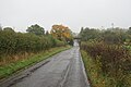
 The road into Stonesfield from Combe - geograph.org.uk - 4846494.jpg 1,024 × 683; 219 KB
-
 The Saturday match, Combe - geograph.org.uk - 1017144.jpg 640 × 426; 88 KB
-
 The Wychwood Way at Bolton's Lane - geograph.org.uk - 5471525.jpg 3,888 × 2,592; 1.53 MB
-
 The Wychwood Way, Combe - geograph.org.uk - 1019924.jpg 640 × 426; 110 KB
-
 The Yard at Combe Mill - geograph.org.uk - 1950185.jpg 3,144 × 2,380; 2.17 MB
-
 Three "Ways" - geograph.org.uk - 2984847.jpg 2,000 × 3,008; 1.81 MB
-
 Track into Wedgehook Wood - geograph.org.uk - 5578524.jpg 6,000 × 4,000; 7.68 MB
-
 Village green at Combe - geograph.org.uk - 1872804.jpg 3,648 × 2,736; 2.12 MB
-
 Village green in Combe - geograph.org.uk - 1018064.jpg 640 × 426; 121 KB
-
 Warning, edge of sign.jpg 737 × 800; 168 KB
-
 Woodstock Road near Stonesfield - geograph.org.uk - 6278262.jpg 1,872 × 1,204; 1.27 MB
-
 Wychwood Way bridge over the Evenlode - geograph.org.uk - 2831590.jpg 640 × 480; 125 KB
-
 Wychwood Way crosses Akeman Street - geograph.org.uk - 4847109.jpg 1,024 × 683; 160 KB
-
 Wychwood Way footpath marker.jpg 3,096 × 4,128; 5.04 MB


_on_Combe_Lodge_-_geograph.org.uk_-_4849235.jpg)


_-_geograph.org.uk_-_1748836.jpg)


_-_geograph.org.uk_-_5645059.jpg)

.jpg)
.jpg)


