Category:Colorado State Highway 348
Jump to navigation
Jump to search
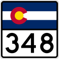
 | number: | (three hundred fourty-eight) |
|---|---|---|
| State highways in Colorado: | 330 · 340 · 347 · 348 · 368 |
state highway in Montrose and Delta counties in Colorado, United States  | |||||
| Upload media | |||||
| Instance of | |||||
|---|---|---|---|---|---|
| Location |
| ||||
| Transport network | |||||
| Connects with | |||||
| Owned by | |||||
| Maintained by | |||||
| Length |
| ||||
| Terminus | |||||
| |||||
English: Media related to Colorado State Highway 348, a 17.06-mile (27.46 km) state highway in Montrose and Delta counties in Colorado, United States, that connects U.S. Route 50 (US 50) southeast of Olathe with US 50 in Delta.
Subcategories
This category has only the following subcategory.
Media in category "Colorado State Highway 348"
The following 3 files are in this category, out of 3 total.
-
 Colorado 348 wide.svg 751 × 601; 4 KB
-
 Colorado 348.svg 601 × 601; 9 KB
-
 Colorado State Highway 348 Map.svg 1,028 × 609; 364 KB
