Category:Colonsay
Jump to navigation
Jump to search
island in the Inner Hebrides of Scotland, located north of Islay and south of Mull   | |||||
| Upload media | |||||
| Pronunciation audio | |||||
|---|---|---|---|---|---|
| Instance of | |||||
| Part of | |||||
| Location |
| ||||
| Located in or next to body of water | |||||
| Width |
| ||||
| Length |
| ||||
| Population |
| ||||
| Area |
| ||||
 | |||||
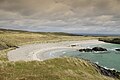
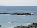
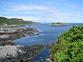
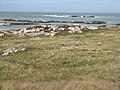
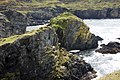
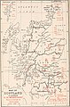
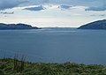
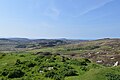
Colonsay is an island of the Inner Hebrides, Scotland. Most of it is designated as sites of Special Scientific Interest.

Subcategories
This category has the following 16 subcategories, out of 16 total.
- Animals of Colonsay (6 F)
- Maps of Colonsay (12 F)
- Plants of Colonsay (6 F)
C
F
M
- Machair, Colonsay (7 F)
S
- The Strand, Colonsay (10 F)
Media in category "Colonsay"
The following 46 files are in this category, out of 46 total.
-
 Allt na h-Uamha Mhòire - geograph.org.uk - 990054.jpg 640 × 480; 94 KB
-
 Beinn nan Caorach, Colonsay - geograph.org.uk - 85246.jpg 480 × 640; 121 KB
-
 Cable Bay, Colonsay - geograph.org.uk - 2414325.jpg 640 × 426; 126 KB
-
 Cairn south-east of Mala Bholsa - geograph.org.uk - 1635648.jpg 640 × 360; 64 KB
-
 Calmac Ferry Lord of the Isles at Colonsay (Scalasaig) (6141141009).jpg 853 × 1,280; 1,010 KB
-
 Colonsay Harbour (Scalasaig) (6141140979).jpg 1,280 × 853; 1.52 MB
-
 Colonsay Harbour (Scalasaig) (6141140997).jpg 2,048 × 1,161; 2.78 MB
-
 Colonsay Harbour (Scalasaig) (6141987924).jpg 2,048 × 1,228; 3.01 MB
-
-
 Eilean Dubh - geograph.org.uk - 1855946.jpg 640 × 480; 57 KB
-
 Eilean Dubh - geograph.org.uk - 2413365.jpg 640 × 426; 117 KB
-
 Eilean Dubh - geograph.org.uk - 4647074.jpg 1,600 × 1,200; 482 KB
-
 Eilean Muhgaig - geograph.org.uk - 1854809.jpg 640 × 480; 51 KB
-
 Eilean nam Ban - geograph.org.uk - 1855952.jpg 640 × 480; 68 KB
-
 Eilean Olmsa - geograph.org.uk - 4678447.jpg 1,600 × 1,200; 333 KB
-
 End of the Ardskenish peninsula, Colonsay - geograph.org.uk - 5441290.jpg 1,600 × 900; 528 KB
-

-
 Isle of Colonsay, Kiloran Bay - geograph.org.uk - 3286411.jpg 640 × 481; 55 KB
-

-
 Looking into Port Olmsa - geograph.org.uk - 5337903.jpg 1,600 × 1,080; 169 KB
-
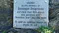 Memorial to Italian PoW's and others - geograph.org.uk - 1568043.jpg 640 × 360; 90 KB
-
 MV Lord of the Isles About to Offload at Colonsay (7045349537).jpg 1,000 × 1,126; 1.4 MB
-
 Na Dubh-sgeireagan - geograph.org.uk - 4164053.jpg 640 × 480; 345 KB
-
 Port a' Mhuilinn - geograph.org.uk - 4678277.jpg 1,600 × 1,200; 540 KB
-
 Port Ban - geograph.org.uk - 4530607.jpg 640 × 427; 143 KB
-
 Port Mòr, Kilchattan - geograph.org.uk - 3979035.jpg 3,264 × 2,448; 5.27 MB
-
 Saint Kilda Banner Alternative.jpg 6,016 × 859; 2.51 MB
-
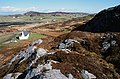
 Scalasaig from Dùn Eibhinn.jpg 604 × 453; 37 KB
-
 Sea cliffs and gully near Rubha A'Mhail - geograph.org.uk - 934903.jpg 640 × 452; 108 KB
-
 Sea Cliffs at Uragaig - geograph.org.uk - 2414354.jpg 640 × 426; 194 KB
-
 The Annals of Scottish natural history (1892-1911) (17791832674).jpg 1,932 × 2,928; 1.08 MB
-
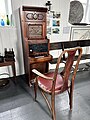 The Colonsay Telephone Exchange.jpg 3,024 × 4,032; 4.04 MB
-
-
 Tying Up The Lord of the Isles (6770276013).jpg 1,280 × 910; 1.1 MB
-

-
 Views from Dùn Eibhinn 01.jpg 6,016 × 4,000; 8.61 MB
-
 Views from Dùn Eibhinn 02.jpg 6,016 × 4,000; 11.32 MB
-
 Views from Dùn Eibhinn 03.jpg 6,016 × 4,000; 11.23 MB
-
 Views from Dùn Eibhinn 04.jpg 6,016 × 4,000; 10.47 MB
-
 Views from Dùn Eibhinn 05.jpg 6,016 × 4,000; 12.94 MB
-
 Views from Dùn Eibhinn 06.jpg 6,016 × 4,000; 9.65 MB
-
 Views from Dùn Eibhinn 07.jpg 6,016 × 4,000; 12.8 MB
-
 Views from Dùn Eibhinn 08.jpg 6,016 × 4,000; 12.07 MB
-
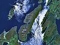 Wfm jura landsat.jpg 1,280 × 948; 328 KB
-
 Garta Ghoban Cottage at Port Mor - geograph.org.uk - 760808.jpg 640 × 424; 132 KB
-
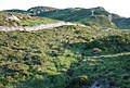 Moorland wall - geograph.org.uk - 466451.jpg 640 × 430; 95 KB


_(6141141009).jpg)
_(6141140979).jpg)
_(6141140997).jpg)
_(6141987924).jpg)


.jpg)


_(17791832674).jpg)


.jpg)


