Category:Coln St. Dennis
Jump to navigation
Jump to search
village in the United Kingdom .jpg) | |||||
| Upload media | |||||
| Instance of | |||||
|---|---|---|---|---|---|
| Location | Cotswold, Gloucestershire, South West England, England | ||||
| Population |
| ||||
| official website | |||||
 | |||||
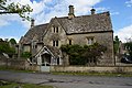
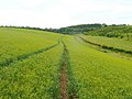
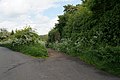
English: Coln St. Dennis is a village and civil parish on the River Coln in Gloucestershire about northeast of Cirencester. The parish includes the village of Coln Rogers and the hamlets of Calcot, Fossebridge and Winson. The Fosse Way Roman road, which is now the A429 trunk road, forms the wesetrn boundary of the parish.

Subcategories
This category has the following 3 subcategories, out of 3 total.
Media in category "Coln St. Dennis"
The following 118 files are in this category, out of 118 total.
-
 A Wayside Cottage - geograph.org.uk - 5548791.jpg 2,399 × 1,599; 787 KB
-
 Agricultural buildings, Calcot - geograph.org.uk - 6602611.jpg 4,608 × 3,456; 5.97 MB
-

-
 Arable field east of the Fosse Way - geograph.org.uk - 3773058.jpg 1,024 × 680; 238 KB
-
 Arable land near Calcot - geograph.org.uk - 3772160.jpg 1,024 × 680; 218 KB
-
 Barn on Fosscross Lane - geograph.org.uk - 3104495.jpg 640 × 480; 93 KB
-
 Belt of trees by Fosse Way - geograph.org.uk - 4959225.jpg 1,600 × 1,282; 867 KB
-
 Black Barns Cottage and farm buildings, Fosscross Lane - geograph.org.uk - 6599737.jpg 4,608 × 3,456; 7.2 MB
-
 Bridleway from Calcot to Coln Rogers - geograph.org.uk - 2532982.jpg 640 × 435; 266 KB
-
 Brook Cottage, Fossebridge - geograph.org.uk - 5509090.jpg 1,346 × 1,795; 1.24 MB
-
 Buildings at Coln Rogers - geograph.org.uk - 4027178.jpg 1,600 × 1,064; 638 KB
-
 Buildings at Parkway Farm - geograph.org.uk - 2599656.jpg 640 × 480; 73 KB
-
 Calcot crossroads (geograph 2530944).jpg 640 × 382; 211 KB
-
 Car towing gypsy caravan on Salt Way - geograph.org.uk - 6557070.jpg 4,608 × 3,456; 7.58 MB
-
 Centre of Coln St Dennis - geograph.org.uk - 3165147.jpg 3,519 × 2,599; 1.83 MB
-
 Coln Rogers, dry stone wall and field gate - geograph.org.uk - 3641735.jpg 1,024 × 1,024; 1.36 MB
-
 Coln St. Dennis. - geograph.org.uk - 1093184.jpg 640 × 427; 72 KB
-
 Colnpen Copse - geograph.org.uk - 3104610.jpg 640 × 480; 68 KB
-
 Cottages in Calcot - geograph.org.uk - 6602606.jpg 4,608 × 3,456; 7.53 MB
-
 Country lane near Coln Rogers - geograph.org.uk - 6599725.jpg 3,000 × 2,250; 6.24 MB
-
 Countryside near Coln Rogers - geograph.org.uk - 3056684.jpg 640 × 480; 44 KB
-
 Crossroads on Foss Cross Lane - geograph.org.uk - 1392549.jpg 640 × 488; 52 KB
-
 Crossroads on Road to Northleach - geograph.org.uk - 5327744.jpg 640 × 480; 115 KB
-
 Cyclists passing entrance to Calcot Peak Farm - geograph.org.uk - 6557085.jpg 4,608 × 3,456; 7.28 MB
-
 Driveway to Cilldara Stud - geograph.org.uk - 2599603.jpg 640 × 480; 97 KB
-
 Dry stone walls at Coln Rogers - geograph.org.uk - 3163852.jpg 3,648 × 2,736; 1.78 MB
-
 Dry Valley - geograph.org.uk - 2599290.jpg 640 × 480; 72 KB
-
 Dry valley in the Cotswolds - geograph.org.uk - 5770169.jpg 1,024 × 680; 192 KB
-
 Entering Coln Rogers - geograph.org.uk - 3640421.jpg 1,200 × 900; 1.53 MB
-
 Entering Coln St Dennis - geograph.org.uk - 4027191.jpg 1,600 × 1,064; 600 KB
-
 Entrance to Colnpen - geograph.org.uk - 2531834.jpg 640 × 429; 230 KB
-
 Far Peak Business Park - geograph.org.uk - 2599676.jpg 640 × 480; 100 KB
-
 Farm track at turning to Calcot Peak Barn - geograph.org.uk - 6557888.jpg 4,608 × 3,456; 5.68 MB
-
 Farm track east of Foss Cross - geograph.org.uk - 2527985.jpg 800 × 600; 387 KB
-
 Farmland near Hollow Fosse Farm - geograph.org.uk - 2532727.jpg 640 × 421; 244 KB
-
 Farmland near the Fosse Way - geograph.org.uk - 2599308.jpg 640 × 480; 86 KB
-
 Farmland north of Fosscross Lane - geograph.org.uk - 5769222.jpg 1,024 × 680; 300 KB
-
 Farmland off Fosscross Lane - geograph.org.uk - 2532995.jpg 640 × 427; 205 KB
-
 Field at Colnpen Barn - geograph.org.uk - 3104532.jpg 640 × 480; 45 KB
-
 Fieldedge bridleway to Coln St Dennis - geograph.org.uk - 5595951.jpg 4,000 × 3,000; 4.15 MB
-
 Footpath and fuel pipeline - geograph.org.uk - 3773055.jpg 1,024 × 680; 258 KB
-
 Foss Cross - geograph.org.uk - 2649150.jpg 640 × 480; 50 KB
-
 Foss Way at Foss Cross - geograph.org.uk - 2052224.jpg 640 × 480; 46 KB
-
 Fosse Bridge - geograph.org.uk - 2599612.jpg 640 × 480; 92 KB
-
 Fosse Cottage, Fossebridge - geograph.org.uk - 5509082.jpg 1,795 × 1,346; 1.12 MB
-
 Fosse Way at Hollow Fosse Farm - geograph.org.uk - 2530907.jpg 640 × 427; 206 KB
-
 Fosse Way near Hollow Fosse farm - geograph.org.uk - 2052219.jpg 640 × 480; 58 KB
-
 Fosse Way near Stowell - geograph.org.uk - 2052236.jpg 640 × 480; 72 KB
-

-
 Fossebridge houses (1) (geograph 6382202).jpg 3,997 × 2,998; 2.86 MB
-
 Fossebridge houses (2) - geograph.org.uk - 6382204.jpg 3,639 × 2,729; 2.55 MB
-
 Glebe House, Coln Rogers - geograph.org.uk - 5330581.jpg 640 × 480; 124 KB
-
 Harvested field near Colnpen - geograph.org.uk - 2549526.jpg 800 × 600; 400 KB
-
 Horses in field, Coln Rogers - geograph.org.uk - 6599688.jpg 4,608 × 3,456; 6.03 MB
-
 House at Coln St. Dennis - geograph.org.uk - 3201717.jpg 640 × 425; 206 KB
-
 Houses at Winson Mill - geograph.org.uk - 4027155.jpg 1,600 × 1,064; 733 KB
-
 Houses in Coln Rogers - geograph.org.uk - 4027158.jpg 1,600 × 1,064; 603 KB
-
 Houses in Coln St Dennis (geograph 4027221).jpg 1,600 × 1,064; 783 KB
-
 Junction of roads at Long Barrow - geograph.org.uk - 5595955.jpg 4,000 × 3,000; 3.58 MB
-
 Junction on the Fosse Way - geograph.org.uk - 2052240.jpg 640 × 480; 44 KB
-

-
 Land west of Colnpen - geograph.org.uk - 2530902.jpg 640 × 427; 216 KB
-
 Lane leading to Fosse Bridge - geograph.org.uk - 4027224.jpg 1,600 × 1,064; 660 KB
-
 Linseed crop - geograph.org.uk - 2529691.jpg 800 × 600; 406 KB
-
 Lodge gates - geograph.org.uk - 4249066.jpg 2,048 × 1,536; 1.57 MB
-
 Looking down into Coln St. Dennis. - geograph.org.uk - 1093113.jpg 640 × 427; 38 KB
-
 Lower Farm - geograph.org.uk - 3201724.jpg 640 × 411; 231 KB
-
 Lower Farm - geograph.org.uk - 3201726.jpg 640 × 423; 230 KB
-
 Lower Farm Coln Rogers - geograph.org.uk - 3163842.jpg 3,648 × 2,736; 3.01 MB
-
 Milestone - geograph.org.uk - 4547073.jpg 480 × 640; 142 KB
-
 Mower engineers by Fosse Way - geograph.org.uk - 4959226.jpg 1,600 × 1,200; 772 KB
-
 Ordnance Survey Pivot - geograph.org.uk - 4547077.jpg 480 × 640; 118 KB
-
 OS flush bracket 1697, Fossebridge - geograph.org.uk - 5517608.jpg 1,224 × 1,632; 1.14 MB
-
 Pasture near Fosse Bridge - geograph.org.uk - 2533030.jpg 640 × 427; 210 KB
-
 Pastures to the east of Fosse Bridge - geograph.org.uk - 2533038.jpg 800 × 600; 386 KB
-
 Path leading to Calcot - geograph.org.uk - 4027186.jpg 1,600 × 1,064; 636 KB
-
 Path to Coln Rogers church - geograph.org.uk - 5330926.jpg 640 × 480; 181 KB
-
 Peggotty Cottage, Fossebridge - geograph.org.uk - 5509088.jpg 1,795 × 1,346; 1.24 MB
-
 Post at the Hare and Hounds - geograph.org.uk - 2599342.jpg 640 × 480; 64 KB
-
 Potlickers Lane - geograph.org.uk - 2533062.jpg 800 × 600; 400 KB
-
 Red phone box - geograph.org.uk - 5324382.jpg 640 × 480; 169 KB
-
 River Coln - geograph.org.uk - 5330929.jpg 640 × 480; 183 KB
-
 River Coln at Coln Rogers - geograph.org.uk - 3163848.jpg 3,648 × 2,736; 2.5 MB
-
 River Coln downstream from bridge at Coln St Dennis - geograph.org.uk - 3163950.jpg 3,648 × 2,736; 2.94 MB
-
 River Coln floods meadow at Calcot - geograph.org.uk - 1621304.jpg 640 × 428; 51 KB
-
 River Coln, Coln Rogers - geograph.org.uk - 5330571.jpg 640 × 480; 126 KB
-
 River Coln, Coln Rogers - geograph.org.uk - 5330575.jpg 640 × 480; 196 KB
-
 Road from Calcot to Long Barrow - geograph.org.uk - 5595996.jpg 4,000 × 3,000; 2.67 MB
-
 Road from Calcot to Long Barrow being crossed by a footpath - geograph.org.uk - 5595972.jpg 4,000 × 3,000; 3.01 MB
-
 Road junction off Fosse Way to Coln St Dennis - geograph.org.uk - 4959229.jpg 1,600 × 1,200; 727 KB
-
 Road junction. - geograph.org.uk - 1093311.jpg 640 × 427; 73 KB
-
 Road leading to Fosse Bridge - geograph.org.uk - 4027233.jpg 1,600 × 1,064; 772 KB
-
 Sign at entrance to Potlicker's Lane - geograph.org.uk - 6599709.jpg 4,608 × 3,456; 6.59 MB
-
 Speed on the Fosse Way - geograph.org.uk - 293437.jpg 640 × 427; 57 KB
-
 Splash jumps - geograph.org.uk - 2530952.jpg 640 × 429; 231 KB
-
 Stone wall and Camp Wood by Fosse Way - geograph.org.uk - 4959227.jpg 1,600 × 1,197; 764 KB
-
 Telephone box, Coln Rogers - geograph.org.uk - 5330566.jpg 640 × 480; 187 KB
-
 The A429 near Fosse Bridge - geograph.org.uk - 4027263.jpg 1,600 × 1,064; 699 KB
-
 The Coln at Calcot - geograph.org.uk - 2533046.jpg 800 × 600; 424 KB
-
 The eastern carpark of the Fossebridge Inn - geograph.org.uk - 5509091.jpg 2,122 × 1,591; 1.28 MB
-
 The Fosse Way in Fossebridge - geograph.org.uk - 5839039.jpg 2,700 × 2,025; 506 KB
-
 The Fosse Way passing Fossebridge - geograph.org.uk - 5839038.jpg 2,700 × 2,025; 748 KB
-
 The road peters out at Calcot - geograph.org.uk - 2549552.jpg 800 × 600; 388 KB
-
 The war memorial, Coln St Dennis - geograph.org.uk - 4027219.jpg 1,064 × 1,600; 832 KB
-
 Towards Barnsley Wold - geograph.org.uk - 2532719.jpg 640 × 409; 204 KB
-
 Towards Colnpen Copse - geograph.org.uk - 2527943.jpg 800 × 600; 410 KB
-
 Towards Colnpen Copse - geograph.org.uk - 2532702.jpg 640 × 496; 298 KB
-
 Track leading out of The Warren - geograph.org.uk - 2822278.jpg 2,848 × 2,136; 1.41 MB
-
 Unnamed Lane joins A429 north of Fosse Bridge - geograph.org.uk - 3165173.jpg 3,392 × 2,579; 2.07 MB
-
 Unnamed Lane north of Pindrup Farm - geograph.org.uk - 3165160.jpg 3,648 × 2,736; 2.82 MB
-
 Unnamed lane parallels the River Coln - geograph.org.uk - 3163858.jpg 3,524 × 2,469; 1.99 MB
-
 Valley of River Coln - geograph.org.uk - 5330923.jpg 640 × 480; 126 KB
-
 Victorian post box at Coln St Dennis - geograph.org.uk - 4027227.jpg 1,064 × 1,600; 852 KB
-
 View down over The Warren - geograph.org.uk - 2822588.jpg 2,848 × 2,073; 1.44 MB
-
 View from Potlicker's Lane - geograph.org.uk - 2532952.jpg 640 × 402; 243 KB
-
 Waterlogged Field - geograph.org.uk - 3061295.jpg 640 × 480; 51 KB
-
 Winson Lane - geograph.org.uk - 2549563.jpg 800 × 600; 416 KB
-
 Winston Mill - geograph.org.uk - 3162918.jpg 3,648 × 2,736; 2.63 MB


.jpg)


_(geograph_6382202).jpg)
_-_geograph.org.uk_-_6382204.jpg)


