Category:Colliston
Jump to navigation
Jump to search
English: Colliston is a roadside hamlet in Angus, Scotland that is north of Arbroath, in the parish of St Vigeans.
village in Angus, Scotland, UK  | |||||
| Upload media | |||||
| Instance of | |||||
|---|---|---|---|---|---|
| Location |
| ||||
 | |||||
Subcategories
This category has the following 5 subcategories, out of 5 total.
C
- Colliston Castle (6 F)
- Colliston Parish Church (1 F)
L
- Letham Grange House (2 F)
Media in category "Colliston"
The following 24 files are in this category, out of 24 total.
-
 Arbroath to Forfar Crossroads - geograph.org.uk - 85486.jpg 640 × 480; 81 KB
-
 Colliston Inn - geograph.org.uk - 5421900.jpg 640 × 427; 250 KB
-
 Colliston Parish Kirk - geograph.org.uk - 5421895.jpg 640 × 427; 288 KB
-
 Colliston Primary School - geograph.org.uk - 5421902.jpg 640 × 427; 352 KB
-
 Colliston Village Hall - geograph.org.uk - 5421905.jpg 640 × 427; 304 KB
-

-
 Denside Farm - geograph.org.uk - 111600.jpg 640 × 475; 51 KB
-
-
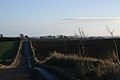
 Farmland at the side of the A933 - geograph.org.uk - 133184.jpg 640 × 424; 69 KB
-
 Empty reservoir near Colliston - geograph.org.uk - 65633.jpg 640 × 475; 121 KB
-
 Heading south from Loanhead of Colliston - geograph.org.uk - 228185.jpg 640 × 480; 116 KB
-
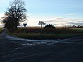
 Left for Letham or right for Friockheim - geograph.org.uk - 85484.jpg 640 × 480; 109 KB
-
 Left for Peebles and Mains of Letham - geograph.org.uk - 85918.jpg 640 × 480; 97 KB
-
 Millfield Feus - geograph.org.uk - 85481.jpg 640 × 480; 105 KB
-
 Old Airfield at RM Condor - geograph.org.uk - 111591.jpg 640 × 475; 54 KB
-

-

-
 Sunset - geograph.org.uk - 273198.jpg 640 × 480; 55 KB
-
 Tattie Sheds at Parkhill Farm - geograph.org.uk - 111619.jpg 640 × 475; 60 KB
-
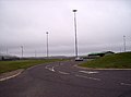 The new entrance to RM Condor - geograph.org.uk - 65650.jpg 640 × 475; 44 KB
-
 The road towards Kirkton from the A933 - geograph.org.uk - 65666.jpg 640 × 475; 51 KB
-

-
 West Mains of Colliston - geograph.org.uk - 182857.jpg 640 × 481; 72 KB
-
 West Mill of Colliston - geograph.org.uk - 228184.jpg 640 × 480; 75 KB


