Category:Collingbourne Kingston
Jump to navigation
Jump to search
village and civil parish in Wiltshire, United Kingdom  | |||||
| Upload media | |||||
| Instance of | |||||
|---|---|---|---|---|---|
| Location | Wiltshire, South West England, England | ||||
| official website | |||||
 | |||||
English: Collingbourne Kingston is a village and civil parish in the English county of Wiltshire in England. It is one of several villages on the River Bourne, which is a seasonal river usually dry in summer.
Nederlands: Collingbourne Kingston is een dorp (village) en civil parish in de unitary authority Wiltshire, in het Engelse graafschap Wiltshire. De civil parish telt
Subcategories
This category has the following 2 subcategories, out of 2 total.
C
Media in category "Collingbourne Kingston"
The following 200 files are in this category, out of 208 total.
(previous page) (next page)-

-
 A338 at Aughton - geograph.org.uk - 6128699.jpg 3,822 × 2,600; 4.45 MB
-

-
 A338 heading north - geograph.org.uk - 5910153.jpg 1,024 × 684; 188 KB
-
 A338 heading north - geograph.org.uk - 5910163.jpg 1,024 × 684; 339 KB
-
 A338 in Collingbourne Kingston - geograph.org.uk - 4233088.jpg 640 × 480; 68 KB
-
 A338 Marlborough Road - geograph.org.uk - 5910186.jpg 1,024 × 684; 251 KB
-
 A338 Marlborough Road, Collingbourne Kingston - geograph.org.uk - 5910180.jpg 1,024 × 684; 252 KB
-
 A338 north of Aughton - geograph.org.uk - 4233081.jpg 640 × 480; 33 KB
-
 A338, Aughton - geograph.org.uk - 2321861.jpg 640 × 480; 73 KB
-
 A338, Collingbourne Kingston - geograph.org.uk - 2321774.jpg 640 × 481; 80 KB
-
 Approaching Aughton - geograph.org.uk - 274253.jpg 640 × 480; 115 KB
-
 Aughton, A338 - geograph.org.uk - 1405210.jpg 640 × 480; 98 KB
-
 Aughton, barn - geograph.org.uk - 5244704.jpg 1,024 × 768; 222 KB
-
 Aughton, barn - geograph.org.uk - 5244735.jpg 1,024 × 768; 151 KB
-
 Aughton, bus shelter - geograph.org.uk - 5244788.jpg 1,024 × 749; 187 KB
-
 Aughton, byway - geograph.org.uk - 5244715.jpg 1,024 × 768; 288 KB
-
 Aughton, byway - geograph.org.uk - 5244726.jpg 1,024 × 768; 229 KB
-
 Aughton, byway - geograph.org.uk - 5244745.jpg 1,024 × 768; 236 KB
-
 Aughton, byway - geograph.org.uk - 5244763.jpg 1,024 × 768; 187 KB
-
 Aughton, byway junction - geograph.org.uk - 5244707.jpg 1,024 × 768; 208 KB
-
 Aughton, copse - geograph.org.uk - 5244719.jpg 1,024 × 768; 334 KB
-
 Aughton, maize patch - geograph.org.uk - 5244692.jpg 1,024 × 768; 222 KB
-
 Aughton, paddocks - geograph.org.uk - 5244794.jpg 1,024 × 768; 234 KB
-
 Aughton, silos - geograph.org.uk - 5244769.jpg 1,024 × 768; 194 KB
-
 Bench mark on milestone, Aughton - geograph.org.uk - 2321851.jpg 640 × 480; 102 KB
-
 Between a maize field and a plantation - geograph.org.uk - 4163770.jpg 1,024 × 768; 155 KB
-
 Brunton, Collingbourne Kingston - geograph.org.uk - 6090802.jpg 1,024 × 768; 283 KB
-
 By-way north of Everleigh - geograph.org.uk - 6256514.jpg 2,592 × 1,944; 2.3 MB
-

-

-
 Byway by a maize field - geograph.org.uk - 4163764.jpg 1,024 × 768; 128 KB
-
 Byway, Crow Down - geograph.org.uk - 396078.jpg 640 × 480; 117 KB
-
 Byway, Crow Down - geograph.org.uk - 396143.jpg 640 × 480; 164 KB
-
 Colingbourne Kingston - Manor Farm B&B (geograph 2628485).jpg 800 × 575; 106 KB
-
 Colingbourne Kingston, Carthouse at the Manor Farm Wiltshire 1364548 20230817 0024.jpg 4,416 × 2,992; 16.37 MB
-
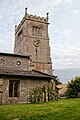
 Colingbourne Kingston, Church of St Mary Wiltshire 1285324 20230816 0664.jpg 6,502 × 4,335; 21.99 MB
-
 Colingbourne Kingston, Church of St Mary Wiltshire 1285324 20230817 0021.jpg 8,256 × 5,504; 48.48 MB
-
 Colingbourne Kingston, Church of St Mary Wiltshire 1285324 20230817 0022.jpg 4,603 × 6,903; 25.68 MB
-
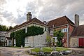 Colingbourne Kingston, Manor Farmhouse Wiltshire 1035971 20230816 0662.jpg 7,344 × 4,897; 31.53 MB
-
 Colingbourne Kingston, Manor Farmhouse Wiltshire 1035971 20230816 0663.jpg 7,467 × 4,978; 41.03 MB
-
 Colingbourne Kingston, The Manor Farmhouse Wiltshire 1035971 20230817 0023.jpg 7,792 × 5,195; 38.38 MB
-
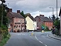
 Collingbourne Kingston - - geograph.org.uk - 2628540.jpg 800 × 600; 121 KB
-
 Collingbourne Kingston - Barleycorn Inn - geograph.org.uk - 2612798.jpg 800 × 600; 108 KB
-
 Collingbourne Kingston - Barleycorn Inn - geograph.org.uk - 2612807.jpg 800 × 600; 120 KB
-
 Collingbourne Kingston - geograph.org.uk - 2628550.jpg 800 × 600; 116 KB
-
 Collingbourne Kingston - geograph.org.uk - 274258.jpg 640 × 480; 107 KB
-
-

-

-
 Collingbourne Kingston - The Old Bakery - geograph.org.uk - 2628560.jpg 800 × 600; 104 KB
-
 Collingbourne Kingston - Village Cross (geograph 2612717).jpg 600 × 800; 231 KB
-
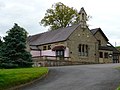
 Collingbourne Kingston - Village Hall (geograph 2612757).jpg 800 × 600; 116 KB
-
 Collingbourne Kingston - Village Hall (geograph 2612766).jpg 800 × 600; 103 KB
-
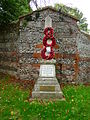 Collingbourne Kingston - War Memorial (geograph 2612779).jpg 600 × 800; 218 KB
-
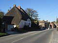
 Collingbourne Kingston Village from A338 (geograph 3433279).jpg 640 × 440; 65 KB
-
 Collingbourne Kingston Village Hall - geograph.org.uk - 5244146.jpg 1,024 × 768; 221 KB
-
 Collingbourne Kingston, Barleycorn Inn - geograph.org.uk - 5244384.jpg 1,024 × 756; 143 KB
-
 Collingbourne Kingston, barn - geograph.org.uk - 5244423.jpg 1,024 × 769; 158 KB
-
 Collingbourne Kingston, barn - geograph.org.uk - 5244426.jpg 1,024 × 769; 142 KB
-
 Collingbourne Kingston, bird feeder - geograph.org.uk - 5244447.jpg 1,024 × 768; 267 KB
-
 Collingbourne Kingston, byway - geograph.org.uk - 5244424.jpg 1,024 × 768; 177 KB
-
 Collingbourne Kingston, byway - geograph.org.uk - 5244450.jpg 1,024 × 768; 139 KB
-
 Collingbourne Kingston, cattle shed - geograph.org.uk - 5244421.jpg 1,024 × 768; 148 KB
-
 Collingbourne Kingston, clamp - geograph.org.uk - 5244454.jpg 1,024 × 766; 243 KB
-
 Collingbourne Kingston, farm road - geograph.org.uk - 5244422.jpg 1,024 × 768; 192 KB
-
 Collingbourne Kingston, gate - geograph.org.uk - 5244501.jpg 1,024 × 768; 213 KB
-
 Collingbourne Kingston, Mill Drove - geograph.org.uk - 5244416.jpg 1,024 × 768; 158 KB
-
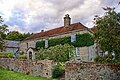
 Collingbourne Kingston, Parsonage Farm - geograph.org.uk - 5244418.jpg 1,024 × 768; 187 KB
-

-
 Collingbourne Kingston, St. Mary's - geograph.org.uk - 5244377.jpg 1,024 × 768; 150 KB
-
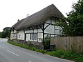
 Collingbourne Kingston, thatched cottages - geograph.org.uk - 5244393.jpg 1,024 × 768; 140 KB
-
-
 Copse, Thornhill Down - geograph.org.uk - 396294.jpg 640 × 480; 153 KB
-
 Corner of field near Summer Down - geograph.org.uk - 4705922.jpg 640 × 427; 88 KB
-
 Cow Down, Collingbourne Kingston - geograph.org.uk - 2223356.jpg 640 × 480; 145 KB
-

-
 East side of Fair Mile Clumps - geograph.org.uk - 6393394.jpg 1,024 × 768; 413 KB
-
 Entrance to Collingbourne Kingston - geograph.org.uk - 4582409.jpg 640 × 480; 47 KB
-
 Entrance to track on Fairmile Down - geograph.org.uk - 5754588.jpg 640 × 427; 73 KB
-
 Everleigh, byway - geograph.org.uk - 5244504.jpg 1,024 × 768; 152 KB
-
 Everleigh, byway - geograph.org.uk - 5244507.jpg 1,024 × 768; 152 KB
-
 Everleigh, byway junction - geograph.org.uk - 5244687.jpg 1,024 × 768; 174 KB
-
 Everleigh, former turnpike road - geograph.org.uk - 5244518.jpg 1,024 × 768; 229 KB
-
 Everleigh, former turnpike road - geograph.org.uk - 5244554.jpg 1,024 × 768; 227 KB
-
 Everleigh, former turnpike road - geograph.org.uk - 5244675.jpg 1,024 × 768; 265 KB
-
 Everleigh, Hogdown Copse - geograph.org.uk - 5244559.jpg 1,024 × 768; 347 KB
-
 Everleigh, junction - geograph.org.uk - 5244514.jpg 1,024 × 768; 141 KB
-
 Everleigh, Summer Down Farm - geograph.org.uk - 5244512.jpg 1,024 × 769; 125 KB
-
 Fair Mile - geograph.org.uk - 6393369.jpg 1,024 × 684; 223 KB
-
 Fair Mile - geograph.org.uk - 6393388.jpg 1,024 × 768; 306 KB
-
 Fair Mile past farm road to Ash Tree Drier - geograph.org.uk - 6393378.jpg 1,024 × 684; 226 KB
-
 Fairmile Down, Collingbourne Kingston - geograph.org.uk - 1561751.jpg 640 × 480; 163 KB
-
 Farm track and Fair Mile Clumps - geograph.org.uk - 6393384.jpg 1,024 × 684; 395 KB
-
-

-

-
 Farmland east of Collingbourne Kingston - geograph.org.uk - 1596014.jpg 640 × 480; 214 KB
-

-
 Farmland, Aughton - geograph.org.uk - 274252.jpg 640 × 480; 124 KB
-
 Farmland, Collingbourne Kingston - geograph.org.uk - 1561737.jpg 640 × 480; 136 KB
-
 Farmland, Collingbourne Kingston - geograph.org.uk - 1561766.jpg 640 × 480; 144 KB
-
 Farmland, Collingbourne Kingston - geograph.org.uk - 2223372.jpg 640 × 480; 118 KB
-
 Farmland, Collingbourne Kingston - geograph.org.uk - 2915320.jpg 640 × 480; 155 KB
-
 Farmland, Collingbourne Kingston - geograph.org.uk - 2915324.jpg 640 × 480; 202 KB
-
 Farmland, Collingbourne Kingston - geograph.org.uk - 2915332.jpg 640 × 480; 169 KB
-
 Farmland, Collingbourne Kingston - geograph.org.uk - 2915351.jpg 640 × 480; 156 KB
-
 Farmland, Collingbourne Kingston - geograph.org.uk - 2921246.jpg 640 × 480; 139 KB
-
 Farmland, Collingbourne Kingston - geograph.org.uk - 2921251.jpg 640 × 480; 152 KB
-
 Farmland, Collingbourne Kingston - geograph.org.uk - 6090799.jpg 1,024 × 768; 259 KB
-
 Farmland, Collingbourne Kingston - geograph.org.uk - 6090821.jpg 1,024 × 768; 252 KB
-
 Farmland, Collingbourne Kingston - geograph.org.uk - 6123831.jpg 1,024 × 768; 205 KB
-
 Farmland, Milton Lilbourne - geograph.org.uk - 6123825.jpg 1,024 × 768; 193 KB
-
 Field and fence north of Brokenway Copse - geograph.org.uk - 6099408.jpg 1,024 × 683; 229 KB
-
 Field and lane towards Tinkerbarn - geograph.org.uk - 6099411.jpg 1,024 × 683; 176 KB
-
 Field edge towards Cow Down - geograph.org.uk - 6099413.jpg 1,024 × 683; 248 KB
-

-

-
 Firemark, The Old Bakery - geograph.org.uk - 2321833.jpg 480 × 640; 90 KB
-
 Footpath at Scot's Poor - geograph.org.uk - 6250076.jpg 1,024 × 683; 277 KB
-
 Gated public byway - geograph.org.uk - 6393372.jpg 1,024 × 768; 348 KB
-
 Gated track off Fair Mile - geograph.org.uk - 6393366.jpg 1,024 × 768; 308 KB
-
 Green Lane near Easton, Salisbury Plain - Flowing Two Track - panoramio.jpg 3,264 × 2,448; 1.79 MB
-
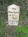 Milestone, Aughton - geograph.org.uk - 2321844.jpg 481 × 640; 95 KB
-
 Milestone, Collingbourne Kingston - geograph.org.uk - 2321795.jpg 480 × 640; 87 KB
-
 Private road to Ash Tree Drier - geograph.org.uk - 4393121.jpg 640 × 428; 80 KB
-
 Road towards Hungerford - geograph.org.uk - 4393083.jpg 640 × 428; 101 KB
-

-
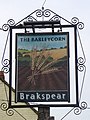 Sign for the Barleycorn Inn - geograph.org.uk - 2256700.jpg 480 × 640; 91 KB
-
 Stream near Brunton - geograph.org.uk - 2956391.jpg 640 × 480; 85 KB
-

-
 Thatched cottages at Brunton - geograph.org.uk - 2956398.jpg 640 × 480; 68 KB
-

-
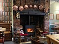 The Barleycorn Inn fire place.jpg 2,048 × 1,536; 2.47 MB
-

-

-
 The Barleycorn, Collingbourne Kingston - geograph.org.uk - 1497049.jpg 640 × 480; 124 KB
-
 The edge of Southgrove Copse - geograph.org.uk - 417963.jpg 640 × 480; 130 KB
-

-
 The Old Marlborough Road - geograph.org.uk - 6177636.jpg 1,024 × 754; 206 KB
-
 The Orange Way in Wiltshire (308) - geograph.org.uk - 3443325.jpg 800 × 600; 72 KB
-
 The Orange Way in Wiltshire (309) - geograph.org.uk - 3443339.jpg 800 × 600; 121 KB
-
 The Orange Way in Wiltshire (310) - geograph.org.uk - 3443343.jpg 800 × 600; 86 KB
-
 The Orange Way in Wiltshire (311) - geograph.org.uk - 3443350.jpg 800 × 546; 103 KB
-
 The Orange Way in Wiltshire (312) - geograph.org.uk - 3443353.jpg 800 × 600; 111 KB
-
 The Orange Way in Wiltshire (313) - geograph.org.uk - 3443365.jpg 800 × 600; 140 KB
-
 The Orange Way in Wiltshire (314) - geograph.org.uk - 3443369.jpg 800 × 600; 144 KB
-
 The Orange Way in Wiltshire (315) - geograph.org.uk - 3443377.jpg 800 × 600; 99 KB
-
 The Orange Way in Wiltshire (316) - geograph.org.uk - 3443383.jpg 4,320 × 3,240; 4.69 MB
-
 The Orange Way in Wiltshire (317) - geograph.org.uk - 3443390.jpg 800 × 600; 141 KB
-
 The Orange Way in Wiltshire (318) - geograph.org.uk - 3443401.jpg 800 × 600; 145 KB
-
 The Orange Way in Wiltshire (319) - geograph.org.uk - 3443406.jpg 800 × 600; 101 KB
-
 The Orange Way in Wiltshire (320) - geograph.org.uk - 3443412.jpg 800 × 600; 97 KB
-
 The Orange Way in Wiltshire (321) - geograph.org.uk - 3443425.jpg 800 × 600; 102 KB
-
 The Orange Way in Wiltshire (322) - geograph.org.uk - 3443429.jpg 800 × 467; 101 KB
-
 The Orange Way in Wiltshire (324) - geograph.org.uk - 3443476.jpg 800 × 563; 93 KB
-
 The Orange Way in Wiltshire (325) - geograph.org.uk - 3443479.jpg 800 × 600; 164 KB
-
 The Orange Way in Wiltshire (326) - geograph.org.uk - 3443486.jpg 600 × 800; 206 KB
-
 The Orange Way in Wiltshire (327) - geograph.org.uk - 3443491.jpg 800 × 600; 111 KB
-
 The Orange Way in Wiltshire (328) - geograph.org.uk - 3443500.jpg 800 × 600; 135 KB
-
 The Orange Way in Wiltshire (329) - geograph.org.uk - 3443501.jpg 800 × 600; 184 KB
-
 The Orange Way in Wiltshire (330) - geograph.org.uk - 3443504.jpg 800 × 600; 224 KB
-
 The Orange Way in Wiltshire (331) - geograph.org.uk - 3443530.jpg 800 × 600; 111 KB
-

-

-
 Track east from Tinkerbarn - geograph.org.uk - 6099416.jpg 1,024 × 683; 191 KB
-

-
 Tree and small covered reservoir - geograph.org.uk - 4393103.jpg 640 × 480; 92 KB
-
 Tree belt east of Fair Mile - geograph.org.uk - 6393380.jpg 1,024 × 768; 336 KB
-
 Tree clump on Fairmile Down - geograph.org.uk - 6393377.jpg 1,024 × 768; 380 KB
-
 Tree shadows in lane near Brokenway Copse - geograph.org.uk - 6099405.jpg 1,024 × 683; 255 KB
-
 View across Summer Down - geograph.org.uk - 4705927.jpg 640 × 427; 84 KB
-
 View towards Fairmile Clumps - geograph.org.uk - 4163795.jpg 1,024 × 768; 117 KB
-
 View up field north of Brokenway Copse - geograph.org.uk - 6099407.jpg 1,024 × 683; 198 KB
-
 Water trough east of Tinkerbarn - geograph.org.uk - 6099420.jpg 1,024 × 683; 270 KB
-
 Wexcombe Down from the south-west - geograph.org.uk - 4190112.jpg 4,608 × 3,456; 4.64 MB
-
 Wide gates - geograph.org.uk - 4163776.jpg 1,024 × 768; 161 KB
-

-
 Aughton Down - geograph.org.uk - 391194.jpg 640 × 480; 133 KB
-
 Bales, Aughton Down - geograph.org.uk - 396170.jpg 640 × 480; 151 KB
-
 Between the Collingbournes - geograph.org.uk - 274259.jpg 640 × 480; 129 KB
-
 Byway above Collingbourne Kingston - geograph.org.uk - 396195.jpg 640 × 480; 139 KB
-
 Byway approaching Gammon's Farm - geograph.org.uk - 274298.jpg 640 × 478; 137 KB
-
 Byway at Hill Barn - geograph.org.uk - 395543.jpg 640 × 480; 142 KB
-
 Collingbourne Kingston Village Hall - geograph.org.uk - 1405254.jpg 640 × 480; 70 KB
-
 Covered Reservoir - geograph.org.uk - 775278.jpg 640 × 427; 58 KB
-
 Crow Down - geograph.org.uk - 391132.jpg 640 × 480; 162 KB
-
 Crow Down - geograph.org.uk - 396481.jpg 640 × 480; 108 KB
-
 Crowdown Clump - geograph.org.uk - 396045.jpg 640 × 480; 136 KB
-
 Crown on the cottage - geograph.org.uk - 773928.jpg 640 × 427; 44 KB
-
 Fairmile Down - geograph.org.uk - 274239.jpg 640 × 480; 90 KB
-
 Farmland near Collingbourne Kingston - geograph.org.uk - 274241.jpg 640 × 480; 86 KB
-
 Farmland near Collingbourne Kingston - geograph.org.uk - 274249.jpg 640 × 480; 137 KB
-
 Farmland near Collingbourne Kingston - geograph.org.uk - 274250.jpg 640 × 480; 126 KB
-
 Farmland near Collingbourne Kingston - geograph.org.uk - 274251.jpg 640 × 480; 119 KB
-
 Farmland, Crow Down - geograph.org.uk - 396092.jpg 640 × 480; 156 KB
-
 Farmland, Easton Royal - geograph.org.uk - 395545.jpg 640 × 480; 113 KB
-
 Farmland, Grafton - geograph.org.uk - 417966.jpg 640 × 480; 129 KB
-
 Farmland, Grafton - geograph.org.uk - 417969.jpg 640 × 480; 139 KB
-
 Farmland, Grafton - geograph.org.uk - 419999.jpg 640 × 480; 158 KB


.jpg)


.jpg)
.jpg)
.jpg)
.jpg)
.jpg)


_-_geograph.org.uk_-_3443325.jpg)
_-_geograph.org.uk_-_3443339.jpg)
_-_geograph.org.uk_-_3443343.jpg)
_-_geograph.org.uk_-_3443350.jpg)
_-_geograph.org.uk_-_3443353.jpg)
_-_geograph.org.uk_-_3443365.jpg)
_-_geograph.org.uk_-_3443369.jpg)
_-_geograph.org.uk_-_3443377.jpg)
_-_geograph.org.uk_-_3443383.jpg)
_-_geograph.org.uk_-_3443390.jpg)
_-_geograph.org.uk_-_3443401.jpg)
_-_geograph.org.uk_-_3443406.jpg)
_-_geograph.org.uk_-_3443412.jpg)
_-_geograph.org.uk_-_3443425.jpg)
_-_geograph.org.uk_-_3443429.jpg)
_-_geograph.org.uk_-_3443476.jpg)
_-_geograph.org.uk_-_3443479.jpg)
_-_geograph.org.uk_-_3443486.jpg)
_-_geograph.org.uk_-_3443491.jpg)
_-_geograph.org.uk_-_3443500.jpg)
_-_geograph.org.uk_-_3443501.jpg)
_-_geograph.org.uk_-_3443504.jpg)
_-_geograph.org.uk_-_3443530.jpg)


