Category:Collingbourne Ducis
Jump to navigation
Jump to search
village in United Kingdom Nov2006.jpg) | |||||
| Upload media | |||||
| Instance of | |||||
|---|---|---|---|---|---|
| Location | Wiltshire, South West England, England | ||||
| Population |
| ||||
| official website | |||||
 | |||||
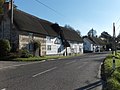
English: Collingbourne Ducis is a small village and civil parish on Salisbury Plain in the English county of Wiltshire in England. It is one of several villages on the River Bourne, which is a seasonal river usually dry in summer.
Nederlands: Collingbourne Ducis is een dorp (village) en civil parish in de unitary authority Wiltshire, in het Engelse graafschap Wiltshire. De civil parish telt
Subcategories
This category has the following 2 subcategories, out of 2 total.
C
Media in category "Collingbourne Ducis"
The following 200 files are in this category, out of 259 total.
(previous page) (next page)-
 A338 approaching a tank crossing - geograph.org.uk - 4233095.jpg 640 × 481; 31 KB
-
 A338 approaching junction with A342 - geograph.org.uk - 3702271.jpg 2,038 × 1,188; 1.28 MB
-
 A338 at Collingbourne Ducis boundary - geograph.org.uk - 4233091.jpg 640 × 481; 81 KB
-
 A338 High Street, Collingbourne Ducis - geograph.org.uk - 5910192.jpg 1,024 × 684; 247 KB
-
 A338 High Street, Collingbourne Ducis - geograph.org.uk - 5910296.jpg 1,024 × 684; 249 KB
-
 A338 near Glebe Barn - geograph.org.uk - 4233094.jpg 640 × 480; 40 KB
-
 A342 near Leckford Bridge - geograph.org.uk - 4705946.jpg 640 × 427; 83 KB
-
 A342 near Leckford Bridge - geograph.org.uk - 5522647.jpg 4,704 × 1,808; 3.75 MB
-
 A342 towards Andover - geograph.org.uk - 5710784.jpg 640 × 428; 94 KB
-
 A342 towards Andover - geograph.org.uk - 5710790.jpg 640 × 428; 76 KB
-
 A342 towards Andover - geograph.org.uk - 5710792.jpg 640 × 428; 96 KB
-
 A342 towards Andover - geograph.org.uk - 5710796.jpg 640 × 428; 73 KB
-
 A342 towards Andover - geograph.org.uk - 5710800.jpg 640 × 428; 75 KB
-
 A342 towards Upavon - geograph.org.uk - 5522900.jpg 4,000 × 3,000; 4.09 MB
-
 A342, A346 junction - geograph.org.uk - 1497048.jpg 640 × 480; 60 KB
-
 A346 A342 Junction - geograph.org.uk - 6128711.jpg 4,000 × 3,000; 4.89 MB
-
 A346 at Shaw Hill - geograph.org.uk - 3918250.jpg 640 × 522; 52 KB
-
 A346 at Shaw Hill - geograph.org.uk - 6128706.jpg 4,000 × 3,000; 5.2 MB
-
 A346 Collingbourne Ducis - geograph.org.uk - 6128704.jpg 3,438 × 2,404; 2.95 MB
-
 Alleyway to the school - geograph.org.uk - 773968.jpg 427 × 640; 114 KB
-
 Andover 8 miles - geograph.org.uk - 772913.jpg 640 × 427; 66 KB
-
 Andover Road, Ludgershall - geograph.org.uk - 96877.jpg 640 × 480; 86 KB
-
 Back of the farm - geograph.org.uk - 774028.jpg 640 × 427; 96 KB
-
 Barns, Wick Down - geograph.org.uk - 274282.jpg 640 × 480; 136 KB
-
 Beech Woods - Rag Copse - Nov 2012 - panoramio.jpg 3,000 × 4,000; 6.38 MB
-
 Beech woods, late afternoon - Nov 2012 - panoramio.jpg 4,000 × 3,000; 5.9 MB
-
 Bench Mark, St Andrew's Church - geograph.org.uk - 2254111.jpg 480 × 640; 68 KB
-

-
 Bends out of Collingbourne Ducis - geograph.org.uk - 3918253.jpg 640 × 483; 49 KB
-
 Beside Rag Copse - Nov 2012 - panoramio.jpg 4,000 × 3,000; 5.75 MB
-
 Brace of pheasants - geograph.org.uk - 773956.jpg 640 × 427; 66 KB
-
 Bridleway - Nov 2012 - panoramio.jpg 4,000 × 3,000; 4.43 MB
-
 Bridleway, Collingbourne Ducis - geograph.org.uk - 2256615.jpg 640 × 480; 73 KB
-
 Byway, Collingbourne Ducis - geograph.org.uk - 2256618.jpg 640 × 480; 99 KB
-
 Coldridge Wood - geograph.org.uk - 287214.jpg 640 × 478; 168 KB
-
 Coldridge Wood, Collingbourne Ducis - geograph.org.uk - 6090737.jpg 1,024 × 768; 360 KB
-

-

-
 Collingbourne Ducis - Houses - geograph.org.uk - 1149131.jpg 640 × 480; 79 KB
-

-
 Collingbourne Ducis - The River Bourne - geograph.org.uk - 1149147.jpg 640 × 480; 100 KB
-
 Collingbourne Ducis - The Shears Inn - geograph.org.uk - 2612656.jpg 800 × 600; 113 KB
-
 Collingbourne Ducis - The Shears Inn - geograph.org.uk - 2612690.jpg 800 × 600; 112 KB
-

-
 Collingbourne Ducis ... former P.O. (3866698143).jpg 2,761 × 2,056; 3.6 MB
-
 Collingbourne Ducis A338.jpg 2,048 × 1,536; 1.38 MB
-
 Collingbourne Ducis, Cadley Road - geograph.org.uk - 1405387.jpg 640 × 480; 108 KB
-

-

-
 Collingbourne Ducis, milestone - geograph.org.uk - 1756596.jpg 640 × 480; 83 KB
-
 Collingbourne Ducis, Mill Lane - geograph.org.uk - 1405464.jpg 640 × 480; 127 KB
-

-

-

-
 Collingbourne Ducis, Tipple Inn (geograph 6294640).jpg 1,024 × 769; 166 KB
-
 Collingbourne station site geograph-3294934-by-Ben-Brooksbank.jpg 2,395 × 1,504; 3.37 MB
-
 Collingbourne Wood - geograph.org.uk - 274289.jpg 640 × 478; 128 KB
-
 Collingbourne Wood - geograph.org.uk - 420085.jpg 640 × 480; 194 KB
-
 Collingbourne Woods - geograph.org.uk - 695024.jpg 640 × 480; 193 KB
-
 CollingbourneDucis(AndrewSmith)Nov2006.jpg 640 × 478; 122 KB
-

-
 Copse, Wick Down - geograph.org.uk - 274278.jpg 640 × 478; 109 KB
-
 Cottages at the junction - geograph.org.uk - 773028.jpg 640 × 427; 77 KB
-
 Course of old railway - geograph.org.uk - 4392918.jpg 640 × 480; 93 KB
-
 Court Farm, Collingbourne Ducis - geograph.org.uk - 5394332.jpg 1,024 × 768; 259 KB
-
 Cow Down, Wiltshire - geograph.org.uk - 6548271.jpg 1,024 × 657; 138 KB
-
 Crown Cottage - geograph.org.uk - 773889.jpg 640 × 427; 59 KB
-
 Dark trees, late afternoon - Nov 2012 - panoramio.jpg 4,000 × 3,000; 4.74 MB
-
 Detail, St Andrew's Church - geograph.org.uk - 2254160.jpg 479 × 640; 75 KB
-
 Downland - Collingbourne - Nov 2012 - panoramio.jpg 4,000 × 3,000; 4.96 MB
-
 Downland beyond top of Rag Copse - Nov 2012 - panoramio.jpg 4,000 × 3,000; 5.14 MB
-
 Downland, Collingbourne Ducis - geograph.org.uk - 2915317.jpg 640 × 480; 121 KB
-
 Downland, Collingbourne Ducis - geograph.org.uk - 2915340.jpg 640 × 480; 143 KB
-
 Entrance to Collingbourne Ducis - geograph.org.uk - 4582402.jpg 640 × 465; 75 KB
-

-
 Evening light - Nov 2012 - panoramio (1).jpg 4,000 × 3,000; 4.39 MB
-
 Evening light - Nov 2012 - panoramio.jpg 3,000 × 4,000; 4.95 MB
-
 Evening light to the south-west - Nov 2012 - panoramio.jpg 4,000 × 3,000; 5.07 MB
-
 Everleigh Road - geograph.org.uk - 6638656.jpg 800 × 533; 177 KB
-
 Everleigh to Collingbourne Ducis road - geograph.org.uk - 396443.jpg 640 × 480; 140 KB
-
 Farmland below Wick Down - geograph.org.uk - 274276.jpg 640 × 478; 93 KB
-
 Farmland near Collingbourne Ducis - geograph.org.uk - 6393272.jpg 1,024 × 768; 306 KB
-
 Farmland near Collingbourne Ducis - geograph.org.uk - 6393277.jpg 1,024 × 768; 365 KB
-
 Farmland north of Tidworth - geograph.org.uk - 1864241.jpg 640 × 480; 72 KB
-
 Farmland, Aughton - geograph.org.uk - 274252.jpg 640 × 480; 124 KB
-
 Farmland, Collingbourne Ducis - geograph.org.uk - 2223351.jpg 640 × 480; 129 KB
-
 Farmland, Collingbourne Ducis - geograph.org.uk - 2915353.jpg 640 × 480; 127 KB
-
 Farmland, Collingbourne Ducis - geograph.org.uk - 6090784.jpg 1,024 × 768; 240 KB
-
 Farmland, Collingbourne Ducis - geograph.org.uk - 6123953.jpg 1,024 × 768; 226 KB
-
 Farmland, Collingbourne Kingston - geograph.org.uk - 2223372.jpg 640 × 480; 118 KB
-
 Farmland, Ludgershall - geograph.org.uk - 6090762.jpg 1,024 × 768; 270 KB
-
 Field, Shaw Hill - geograph.org.uk - 6393226.jpg 1,024 × 768; 369 KB
-
 Fields beyond Rag Copse - Nov 2012 - panoramio.jpg 4,000 × 3,000; 4.62 MB
-
 Fields near Leckford Bridge - geograph.org.uk - 5522648.jpg 4,626 × 1,864; 3 MB
-

-
 Font, St Andrew's Church - geograph.org.uk - 2254149.jpg 480 × 640; 80 KB
-
 Gate - Rag Copse - Nov 2012 - panoramio.jpg 3,000 × 4,000; 3.76 MB
-
 Gate way - Rag Copse - Nov 2012 - panoramio.jpg 3,000 × 4,000; 4.74 MB
-
 Glebe Barn - geograph.org.uk - 3732549.jpg 800 × 450; 214 KB
-
 High Street, Collingbourne Ducis - geograph.org.uk - 4233092.jpg 640 × 481; 75 KB
-
 Horse in the field - geograph.org.uk - 774003.jpg 640 × 427; 65 KB
-
 Houses in Cadley Road - geograph.org.uk - 5388977.jpg 1,024 × 768; 207 KB
-

-

-
 Industrial estate - geograph.org.uk - 772054.jpg 640 × 427; 70 KB
-

-

-

-

-

-

-

-
 Joyce's Copse - geograph.org.uk - 274284.jpg 640 × 478; 223 KB
-
 Knoll Plantation - geograph.org.uk - 4392923.jpg 640 × 480; 134 KB
-
 Lane near Rag Copse - Nov 2012 - panoramio.jpg 3,000 × 4,000; 6.21 MB
-
 Late afternoon - Rag Copse - Nov 2012 - panoramio.jpg 4,000 × 3,000; 4.91 MB
-
 Leckford Bottom, Wiltshire - geograph.org.uk - 6637907.jpg 1,024 × 544; 110 KB
-
 Lone horse - geograph.org.uk - 774015.jpg 640 × 427; 68 KB
-
 Lone tree - Nov 2012 - panoramio.jpg 4,000 × 3,000; 3.59 MB
-
 Looking north(ish) from Sidbury Hill - geograph.org.uk - 3192064.jpg 1,200 × 779; 536 KB
-
 Looking south - Nov 2012 - panoramio.jpg 4,000 × 3,000; 3.5 MB
-
 Looking south along Ludgershall Road (A346) - geograph.org.uk - 4464881.jpg 3,264 × 2,448; 1.96 MB
-
 Memorial plaque, St Andrew's Church - geograph.org.uk - 2254152.jpg 381 × 640; 74 KB
-
 Mount Orleans Farm - geograph.org.uk - 274268.jpg 640 × 478; 116 KB
-
 New school - geograph.org.uk - 772013.jpg 640 × 427; 45 KB
-
 North end of Collingbourne Woods - Nov 2012 - panoramio.jpg 4,000 × 3,000; 4.55 MB
-
 North Tidworth - Bridleway - geograph.org.uk - 1866352.jpg 640 × 480; 122 KB
-
 North Tidworth - Bridleway - geograph.org.uk - 1868139.jpg 640 × 480; 135 KB
-
 North Tidworth - Farmland - geograph.org.uk - 1866383.jpg 640 × 480; 79 KB
-
 North Tidworth - Field Edge - geograph.org.uk - 1866490.jpg 640 × 480; 85 KB
-
 North Tidworth - Pennings Plantation - geograph.org.uk - 1866509.jpg 640 × 480; 147 KB
-
 North Tidworth - Scrubland - geograph.org.uk - 1866404.jpg 640 × 480; 109 KB
-
 North Tidworth - Track - geograph.org.uk - 1866443.jpg 640 × 480; 72 KB
-
 Northbound A338 at A342 junction - geograph.org.uk - 5910304.jpg 1,024 × 684; 165 KB
-

-
 Old pub - geograph.org.uk - 774033.jpg 640 × 427; 56 KB
-
 Oxdown Copse - geograph.org.uk - 420063.jpg 480 × 640; 210 KB
-
 Parachute drop over Salisbury Plain - geograph.org.uk - 5394311.jpg 1,024 × 768; 92 KB
-
 Path to the hall - geograph.org.uk - 774010.jpg 640 × 427; 65 KB
-
 Ploughed hillside with power line - geograph.org.uk - 6393268.jpg 1,024 × 768; 327 KB
-
 Post Box, Collingbourne Ducis - geograph.org.uk - 2256694.jpg 480 × 640; 70 KB
-
 Prancley Rows - geograph.org.uk - 274291.jpg 640 × 478; 173 KB
-
 Pylons near Wexcombe - geograph.org.uk - 433568.jpg 640 × 480; 98 KB
-
 River Bourne - geograph.org.uk - 773917.jpg 427 × 640; 76 KB
-
 River by the cottage - geograph.org.uk - 773904.jpg 427 × 640; 79 KB
-
 River through the fence - geograph.org.uk - 772031.jpg 640 × 427; 111 KB
-
 River under the road - geograph.org.uk - 772040.jpg 640 × 427; 122 KB
-
 Road ahead - geograph.org.uk - 773978.jpg 427 × 640; 98 KB
-
 Road and farmland, Collingbourne Ducis - geograph.org.uk - 6124022.jpg 1,024 × 768; 231 KB
-
 Road junction - geograph.org.uk - 4582368.jpg 640 × 441; 49 KB
-
 Road towards Hungerford - geograph.org.uk - 6393219.jpg 1,024 × 684; 263 KB
-
 Road, Lynden Down - geograph.org.uk - 4393067.jpg 640 × 480; 198 KB
-
 Run your own pub, The Shears Inn, near Cadley - geograph.org.uk - 5804233.jpg 1,024 × 813; 206 KB
-
 Salisbury this way - geograph.org.uk - 772923.jpg 640 × 427; 75 KB
-
 School Entrance - geograph.org.uk - 772019.jpg 640 × 427; 52 KB
-
 School on the hill - geograph.org.uk - 773845.jpg 640 × 427; 72 KB
-
 Seat by the war memorial - geograph.org.uk - 4214744.jpg 640 × 480; 137 KB
-
 Shaw Cross - geograph.org.uk - 2627869.jpg 3,406 × 2,366; 1.81 MB
-
 Sidbury Hill - geograph.org.uk - 4454183.jpg 3,264 × 2,448; 1.93 MB
-
 Sign for the Shears Inn - geograph.org.uk - 2256626.jpg 480 × 640; 90 KB
-

-

-

-
 Snail Down - geograph.org.uk - 5387938.jpg 1,024 × 768; 165 KB
-
 Snowdrops, St Andrew's Church - geograph.org.uk - 2254131.jpg 480 × 640; 112 KB
-

-

-

-

-

-

-

-

-
 St Andrew, Collingbourne Ducis, font - geograph.org.uk - 4215496.jpg 480 × 640; 56 KB
-

-

-

-

-

-

-

-

-

-

-

-

-

-
 Stable block^ - geograph.org.uk - 772952.jpg 640 × 427; 79 KB
-
 Stream at Collingbourne Ducis - geograph.org.uk - 1864238.jpg 640 × 480; 106 KB
-
 Sunton - geograph.org.uk - 274262.jpg 640 × 480; 118 KB
-
 Tank crossing CC over A338 - geograph.org.uk - 5910318.jpg 1,024 × 648; 145 KB
-
 Tank in the road^ - geograph.org.uk - 5752707.jpg 640 × 427; 43 KB
-

-
 Thatched cottages - geograph.org.uk - 772046.jpg 640 × 427; 66 KB
-
 Thatched cottages - geograph.org.uk - 773865.jpg 640 × 427; 74 KB
-
 Thatched cottages across the field - geograph.org.uk - 773018.jpg 640 × 427; 45 KB
-

-

-
 Thatched cottages, Sunton - geograph.org.uk - 2956570.jpg 640 × 480; 101 KB
-
 The A338 - geograph.org.uk - 274260.jpg 640 × 480; 165 KB


.jpg)


.jpg)


Nov2006.jpg)
,_Snail_Down,_Salisbury_Plain_-_geograph.org.uk_-_5442659.jpg)


.jpg)


_-_geograph.org.uk_-_4215507.jpg)
_-_geograph.org.uk_-_4215508.jpg)
_-_geograph.org.uk_-_4215510.jpg)
_-_geograph.org.uk_-_4215511.jpg)
_-_geograph.org.uk_-_4216096.jpg)
_-_geograph.org.uk_-_4216097.jpg)
_-_geograph.org.uk_-_4216098.jpg)


_from_Sidbury_Hill_-_geograph.org.uk_-_3192064.jpg)

_-_geograph.org.uk_-_4464881.jpg)


_-_geograph.org.uk_-_5442585.jpg)
_-_geograph.org.uk_-_5442624.jpg)


_-_geograph.org.uk_-_4216088.jpg)
_-_geograph.org.uk_-_4216094.jpg)
_-_geograph.org.uk_-_4216099.jpg)
_-_geograph.org.uk_-_4216101.jpg)


_-_geograph.org.uk_-_4215501.jpg)
_-_geograph.org.uk_-_4215502.jpg)
_-_geograph.org.uk_-_4215503.jpg)

_-_geograph.org.uk_-_4216078.jpg)


